Overview
|
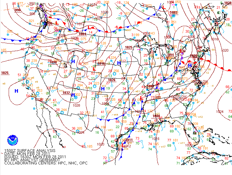
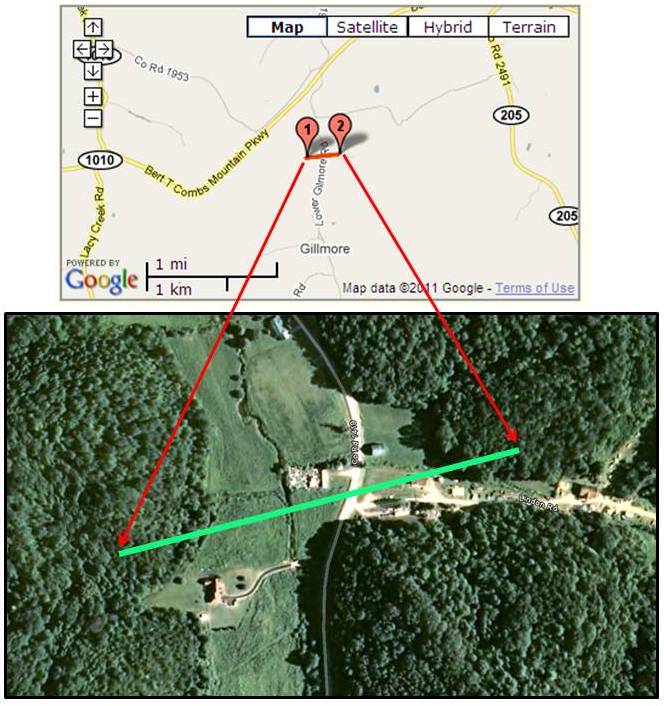
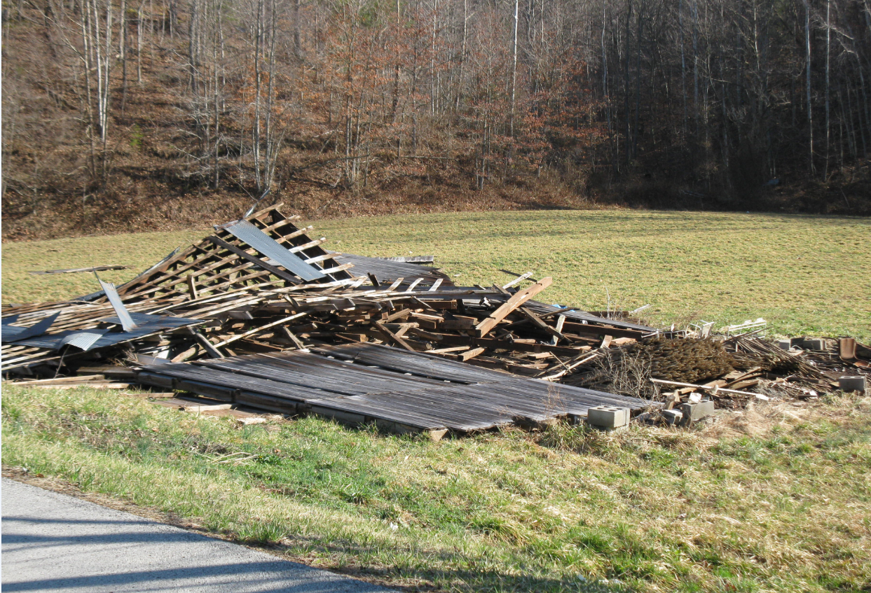
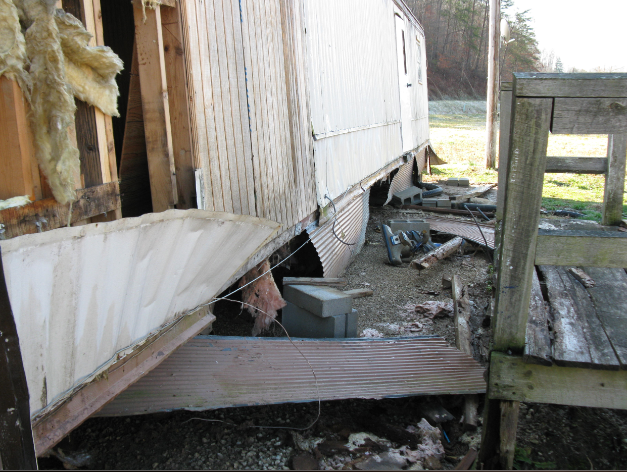
An early season severe weather outbreak occurred across eastern KY on February 28th. The first storms began moving across the area around 6am on Monday. The final warnings were issued around 915 am. The primary mode of severe weather was lines of strong to severe storms with bowing segments and embedded supercell structures. Most of the events were straight line wind damage, with a few reports of large hail and one confirmed short lived tornado that occurred in Wolfe county. An EF-1 tornado was confirmed to have touched down 1 mile north of Gilmore. The tornado's track was one quarter of a mile long and 100 yards wide. Numerous trees were snapped and scattered along the tornado's path. One mobile home had its roof blow off and was also pushed about 5 feet off of its foundation. One barn was destroyed. Two other mobile homes had roof and siding damage. One outbuilding used as a sawmill was also destroyed. |
 |
Tornado damage survey results, tornado track, and damage photographs
| DATE: FEBRUARY 28TH 2011 TIME: TOUCHDOWN AROUND 737 AM EST EF-SCALE: EF-1 ESTIMATED MAX WINDS: 90 MPH PATH LENGTH: 0.25 OF A MILE PATH WIDTH: 100 YARDS |
 |
|
 |
Media use of NWS Web News Stories is encouraged! Please acknowledge the NWS as the source of any news information accessed from this site. |
|


 Follow us on YouTube