The major storm system created as Hurricane Sandy merged with a strengthening upper level disturbance brought wide ranging and severe impacts to the eastern United States between Sunday October 28th and Wednesday October 31st. Record storm surge, damaging hurricane force winds, inland flooding and blizzard conditions were all reported with the storm.

East Kentucky wasn't spared impacts from the system. Nearly continuous rain fell over the far eastern part of the Kentucky beginning as early as Saturday October 27th. The rain began to change over to a heavy, wet snow as early as the afternoon hours of Sunday October 28th when snow first began accumulating on top of Black Mountain at around 4000 ft. elevation. The snow levels then lowered gradually over the next 24 hours, with 4" of snow reported at 2800 ft. elevation near Dorton in Pike County by the late afternoon hours on Monday October 29th. The snow then made it down to the valleys of east Kentucky during the overnight hours Monday night and Tuesday morning. The snow then quickly changed back to rain on Tuesday below 2000 ft. elevation, but remained as snow above 2000 ft. through Wednesday morning October 31st.
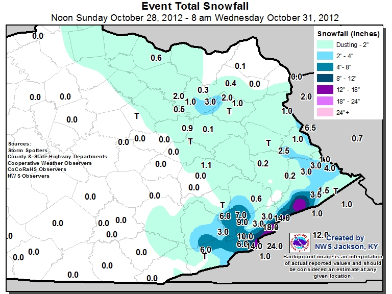
Snowfall accumulations were highly variable across east Kentucky, ranging from nothing up to 18". Most lower elevation locations below 1500 ft. elevation received light accumulations, however a few lower elevation locations such as around Morehead and near the Virginia border received as much as 3" of snow. Amounts quickly escalated above 1500 ft. however with 12 to 18" reported above 2000 ft. elevation. The highest report received was from a trained weather spotter at 2400 ft. elevation on Pine Mountain in Letcher County with 18" of snow. The maps below show the snowfall totals received for the storm and a table is included below listing reports of over 6" of snow received by NWS Jackson.
 |
 |
| Snowfall Totals across East Kentucky (click on map to enlarge) |
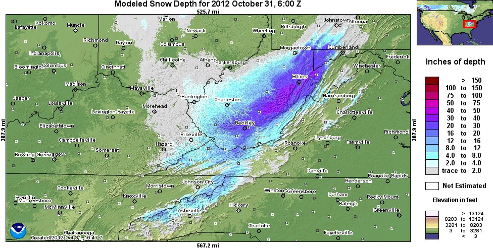
Regional Analysis of Snowfall Totals courtesy of the National Operational Hydrologic Remote Sensing Center (click on map to enlarge) |
**************SNOWFALL REPORTS GREATER THAN 6 INCHES************* INCHES LOCATION ST COUNTY TIME DAY ------ ----------------------- -- -------------- ----------- 18.0 WHITESBURG 4SE KY LETCHER 1000 PM TUE 14.0 PAYNE GAP KY LETCHER 0915 AM TUE 14.0 3 S LYNCH KY HARLAN 0800 AM WED 10.2 KINGDOM COME S.P. KY HARLAN 0800 AM WED 9.0 1 NW ELKO KY LETCHER 1012 AM TUE 7.0 4 SE VICCO KY LETCHER 0845 AM TUE 6.0 3 S BENHAM KY HARLAN 0830 AM TUE 6.0 5 N HARLAN KY HARLAN 0659 AM TUE 6.0 VIPER KY PERRY 1200 PM TUE |
While snowfall accumulations were generally light in the valleys, the heavy, wet snow on the ridges downed trees and power lines. On Tuesday morning, it was estimated that around 10,000 east Kentucky residents were without power. Also, travel across the higher terrain was very difficult Monday night and Tuesday with near impassable conditions reported at times on Hwy 23 over Pound Gap and on Hwy 160 crossing Black Mountain.
The storm system also dumped heavy amounts of precipitation across the region. Luckily, dry antecedant conditions and the prolonged nature of the precipitation allowed everything to runoff without creating any flood problems.

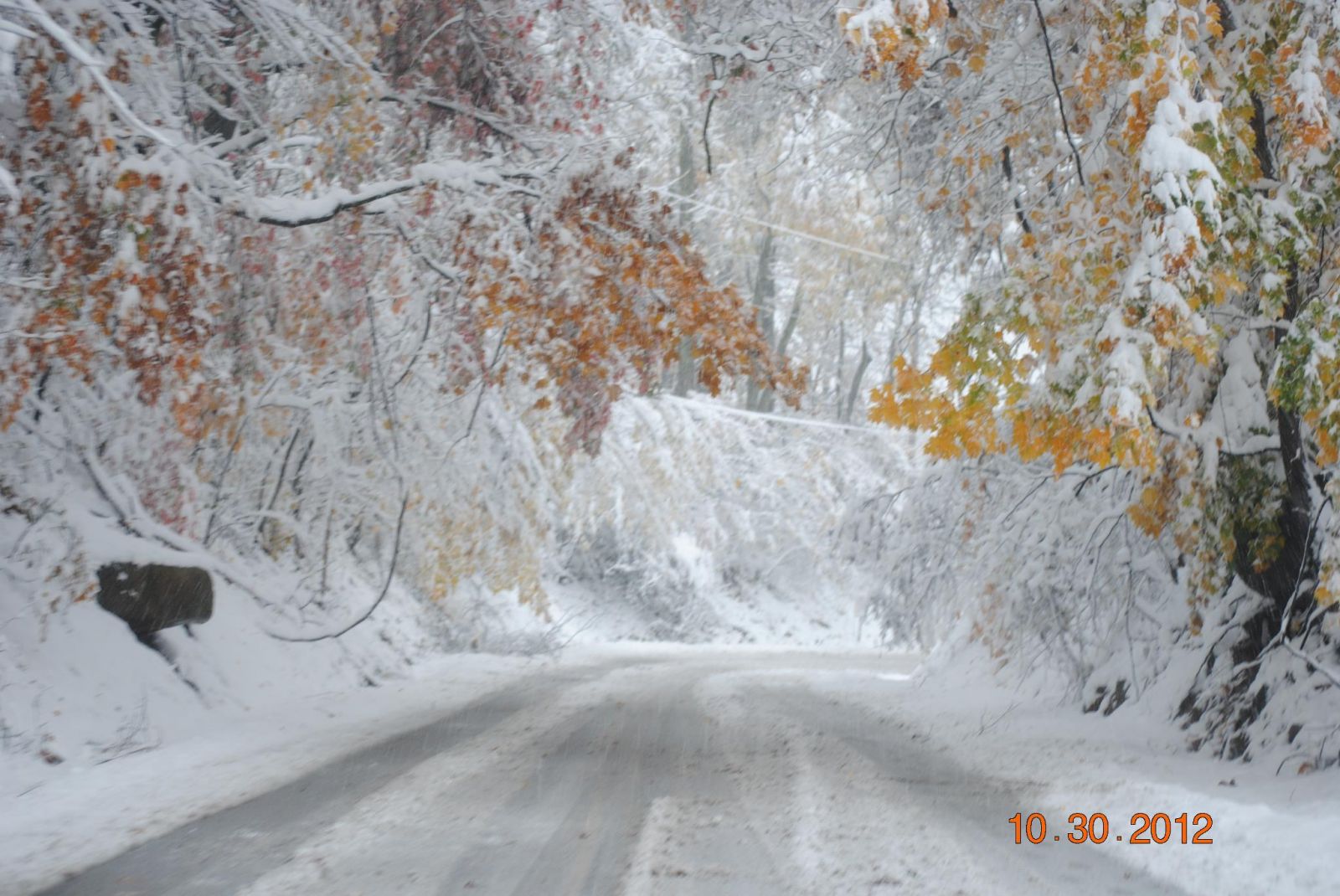
Below are a few pictures of the event sent to us at NWS Jackson, KY or captured from various social media sources. Click on the images to enlarge.
 |
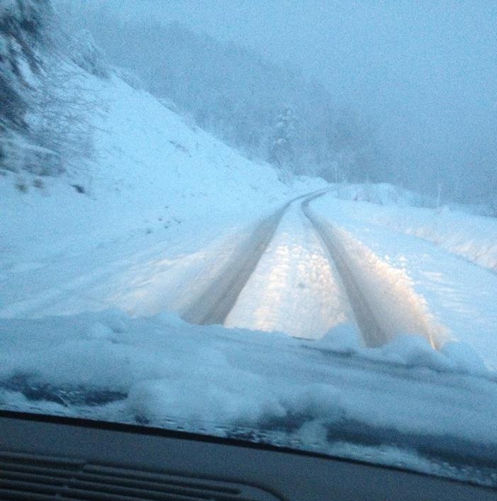 |
 |
| Black Mtn Sunday Afternoon (courtesy Twitter User TAnnaLuu) | Big Black Mtn (from WLEX Facebook page courtesy of Harlan County Sheriff's Office) | Pine Mountain (from WYMT facebook page taken by Brandon Meyer) |
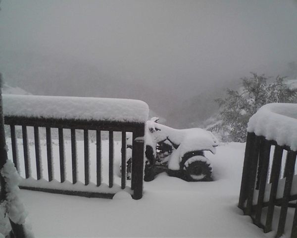 |
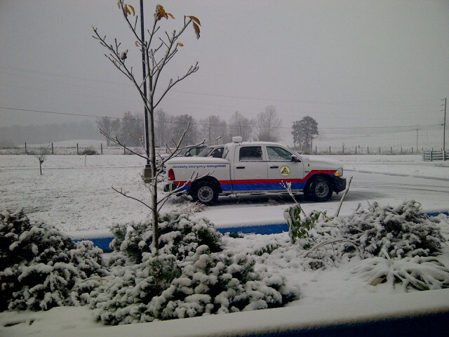 |
| Near Hazard (courtesy Chris Bailey WKYT) | Morehead (courtesy Larry Dixon KYEM) |


 Follow us on YouTube