Read the Hazardous Weather Outlook (click to read)
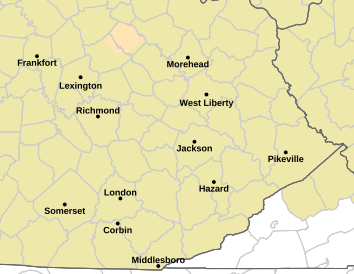
000 FLUS43 KJKL 190714 HWOJKL Hazardous Weather Outlook National Weather Service Jackson KY 314 AM EDT Fri Apr 19 2024 KYZ044-050>052-058>060-068-069-079-080-083>088-104-106>120-200715- Fleming-Montgomery-Bath-Rowan-Estill-Powell-Menifee-Rockcastle- Jackson-Pulaski-Laurel-Wayne-McCreary-Whitley-Knox-Bell-Harlan- Elliott-Morgan-Johnson-Wolfe-Magoffin-Floyd-Lee-Breathitt-Knott- Owsley-Perry-Clay-Leslie-Letcher-Martin-Pike- Including the cities of Flemingsburg, Camargo, Jeffersonville, Mount Sterling, Owingsville, Morehead, Irvine, Ravenna, Clay City, Stanton, Frenchburg, Brodhead, Mount Vernon, McKee, Annville, Burnside, Somerset, London, Monticello, Stearns, Whitley City, Corbin, Williamsburg, Barbourville, Middlesboro, Pineville, Cumberland, Harlan, Sandy Hook, West Liberty, Paintsville, Campton, Salyersville, Prestonsburg, Wheelwright, Beattyville, Jackson, Hindman, Pippa Passes, Booneville, Hazard, Manchester, Hyden, Jenkins, Whitesburg, Inez, Coal Run, Elkhorn City, Pikeville, and South Williamson 314 AM EDT Fri Apr 19 2024 This Hazardous Weather Outlook is for a portion of eastern Kentucky. .DAY ONE...Today and tonight. Thunderstorms are possible through this afternoon, and may possibly linger into this evening near the Virginia border. Storms could produce gusty winds, small hail, and brief downpours. .DAYS TWO THROUGH SEVEN...Saturday through Thursday. Frost is possible in many locations early Monday morning. Thunderstorms are possible in some locations Tuesday night. .SPOTTER INFORMATION STATEMENT... Spotter activation is not expected at this time. $$ JKL
Read the Area Forecast Discussion (click to read)
000 FXUS63 KJKL 191122 AFDJKL AREA FORECAST DISCUSSION National Weather Service Jackson KY 722 AM EDT Fri Apr 19 2024 .KEY MESSAGES... - A cold front will pass through the area today, bringing showers/thunderstorms for most if not all locations. - Cooler and more seasonable temperatures will arrive behind the cold front and carry through the first part of next week. - Frost will be possible in some sheltered valley locations Sunday morning, but is expected to become widespread Monday morning, especially through the valleys. - Another cold front is forecast for late Tuesday through Wednesday morning, bringing another round of rain along with a possible thunderstorm. && .UPDATE... Issued at 714 AM EDT FRI APR 19 2024 Made minor tweaks to PoPs and Sky grids, as well as blending in latest observations to the NDFD forecast grids. If present trends continue the late morning update might be able to clear north and west areas from any thunderstorm mention behind the current showers and thunderstorms moving across eastern Kentucky. && .SHORT TERM...(Today through Saturday) Issued at 321 AM EDT FRI APR 19 2024 Shortwave disturbance within zonal flow continues to fire off early morning shower and thunderstorm activity, with additional convective activity through the mid- and late morning periods before cold frontal passage during the afternoon hours today. A Marginal Risk for an isolated severe storm or two exists with the primary threat being gusty winds, with small hail a lesser threat. Even though the cold front passes in the afternoon, low clouds and low-level moisture will linger ahead of a secondary cold frontal passage tonight that will be the leading edge of a much cooler and drier air mass into the region along with a slight increase in northwest winds. Dry and stable conditions will occur Saturday, with high clouds arriving in the late afternoon and early evening ahead of the next system arriving from the west. Temperatures today will begin a decreasing trend as increased clouds and precipitation along with a cold frontal passage brings cooler weather into the region, with highs in the upper 60s to mid-70s, which is close to normal for this time of year. With low-level moisture and clouds lingering along the highest terrain of southeast Kentucky for much if not all of tonight, lows will fall only slightly below normal with lower to mid 40s, with perhaps some upper 30s in sheltered valleys that can clear out especially in northeastern parts of our CWA. Despite sunny to mostly sunny skies Saturday, high temperatures will be around 4 to 8 degrees below normal with highs in the lower to mid 60s within a cold advection regime. .LONG TERM...(Saturday night through Thursday) Issued at 256 AM EDT FRI APR 19 2024 The period begins with the are the base of a flattened trough, with zonal flow, that`ll slowly eject off to the east through the overnight Saturday into Sunday. At the surface, high pressure will continue to nudge into the region allowing for dry weather for first part of the period. However, the area will be on the backside of an exiting trough and cold front with CAA occurring through the early part of next week. Surface high pressure, coupled with clear skies and CAA, areas of near freezing temperatures and frost chances will increase Sunday night and again Monday night. Temperatures will be on the cooler side to start the period but as an upper-level wave moves across Canada, upper-level flow will back to the southwest allowing for temperatures to gradually warm through the middle of next week. As the associated surface wave moves across the Great Lakes, a cold front extending southwest through the Ohio Valley will gradually approach the area for the middle of next week. Showers and thunderstorms are expected along and head of the front but with frontal timing expected to be late Tuesday night and into the day Wednesday, severe thunderstorms chances look to be limited. Ahead of the front, temperatures are forecast to climb back into the 70s before cold frontal passage lowers them back into the mid-60s for the remainder of the week. Model confidence begins to degrade toward the end of the period as model solutions deviate on how to handle a system for the end of the period; therefore, opted to stick with the NBM. && .AVIATION...(For the 12Z TAFS through 12Z Saturday morning) ISSUED AT 721 AM EDT FRI APR 19 2024 VFR conditions with embedded MVFR/IFR conditions in areas of showers and thunderstorms will quickly give way to deteriorating ceilings to widespread low MVFR to IFR in its wake ahead of a cold frontal passage this afternoon. However, it will take a secondary cold frontal passage late tonight to usher in a drier air mass and help to clear skies. Therefore, expect the low-MVFR and IFR cigs to be slow to improve until late afternoon or the evening, with considerable uncertainty as to when VFR conditions return tonight. Outside of thunderstorms, expect light southwest winds becoming northwesterly at 10 kts or less this afternoon with the frontal passage. && .JKL WATCHES/WARNINGS/ADVISORIES... NONE. && $$ UPDATE...CMC SHORT TERM...CMC LONG TERM...VORST AVIATION...CMC |
||||||||||||||


 Follow us on YouTube