| February 11-12, 2010 Snow |
click on map for larger image
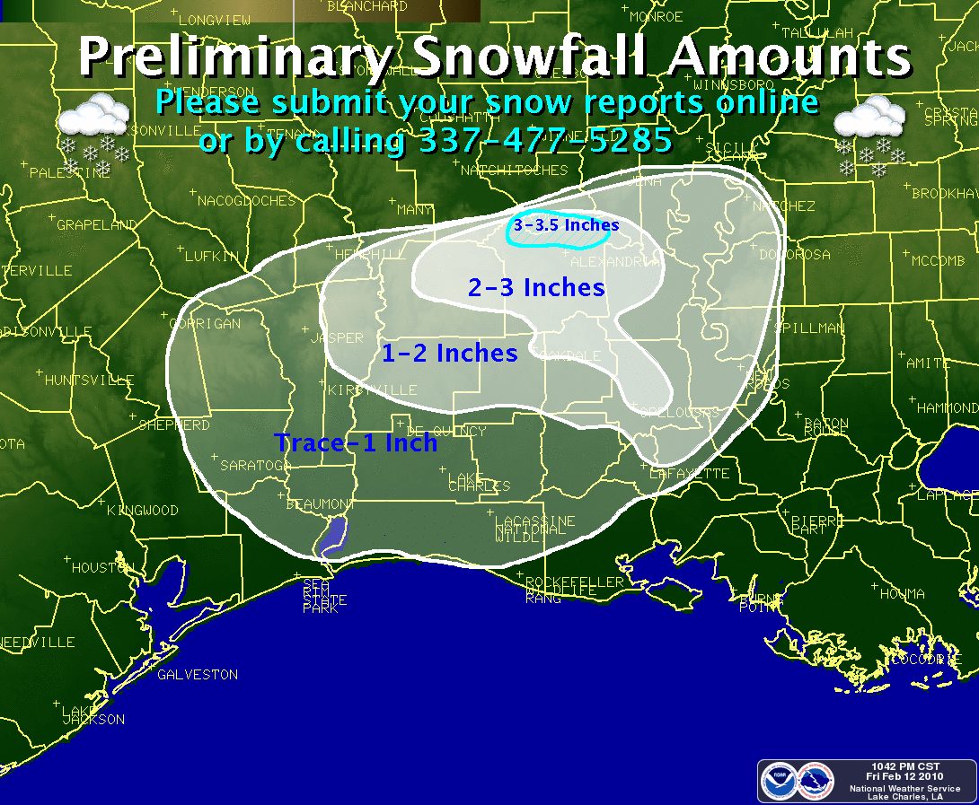
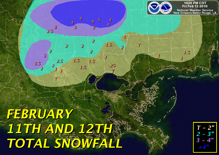
A powerful upper level low moved across Texas and Louisiana from Thursday, February 11, 2010 into Friday, February 12, 2010. Widespread rain developed ahead of the system and spread across southeast Texas and southwest Louisiana during the day on Thursday. Although temperatures remained above in the mid to upper 30s across the area, temperatures aloft were below freezing and began to support a mix of rain, sleet, and snow across the Lakes Region of Southeast Texas and in Central Louisiana by early Thursday evening. This wintry mix continued until after midnight on Friday morning when a changeover to all snow occurred from northern Newton County into Central Louisiana. As the upper level low moved from east Texas across Louisiana during the morning hours on Friday, a change to all snow spread southward to the Interstate 10 corridor, and even as far southward as the Highway 14 corridor in parts of Acadiana.
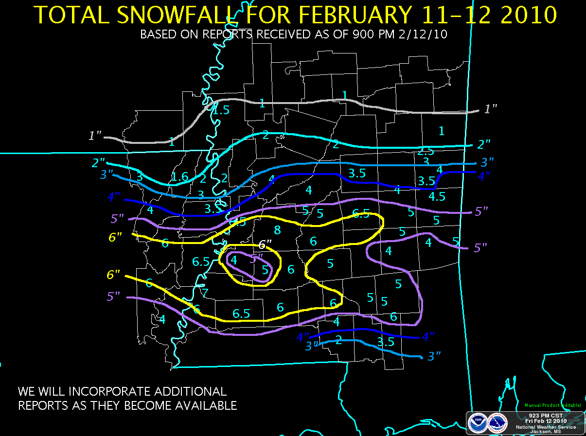
Snow fell across nearly all of Southeast Texas away from the immediate coast, with snow reported as far south as Port Arthur. However, little or no snow accumulation was seen south of the Highway 190 corridor, with amounts ranging from a trace up to 1 inch in portions of northern Jasper and northern Newton Counties. Across Louisiana, snow fell for over 12 hours across portions of central Louisiana, where accumulations of 1 to 4 inches were seen. Further to the south, snow only fell for a few hours and accumulations were much less, ranging from 1 to 2 inches along the Highway 190 corridor to a half inch or less along Interstate 10. Snow was reported as far south as Cameron and Abbeville.
This was the second measurable snow across Southeast Texas and Southwest Louisiana during the 2009/2010 Winter Season, something not seen in this region of the country since 1973. Lafayette tied their record of two measurable snowfalls in one winter season previously set in 1973, and Alexandria set a daily snowfall record for February 11, 2010 with 0.5 inches measured.
|
2/11/10 to 2/12/10 Snow Reports |
|||
| TEXAS | LOUISIANA | ||
| Burkeville | 1.0" | Alexandria (Int'l Airport) | 3.5" |
| Newton | 0.8" | Ball | 3.5" |
| Beaumont | T | Big Island | 3.5" |
| Buna | T | Pineville | 3.5" |
| Fred | T | Boyce | 3" |
| Jasper | T | 4 NE Marksville | 3" |
| Kirbyville | T | Alexandria (Downtown) | 2" |
| Kountze | T | Leesville | 2" |
| Orange | T | Marksville | 2" |
| Port Arthur | T | Oakdale | 2" |
| Woodville | T | Opelousas | 2" |
| Woodworth | 2" | ||
| Fort Polk | 1.6" | ||
| Eunice | 1.5" | ||
| Alexandria (911 Center) | 1" | ||
| De Ridder | 1" | ||
| Elmer | 1" | ||
| Rosepine | 1" | ||
| Scott | 1" | ||
| Washington | 1" | ||
| Whiteville | 1" | ||
| Breaux Bridge | 0.5" | ||
| Butte La Rose | 0.5" | ||
| Hathaway | 0.5" | ||
| Lafayette (KLFY-TV) | 0.4" | ||
| Church Point | 0.3" | ||
| Abbeville | T | ||
| Cameron | T | ||
| Crowley | T | ||
| Jennings | T | ||
| Click here for a list of all Local Snow Reports | |||
|
2/11/10 to 2/12/10 Snow Maps |
||
|
|
|
|
|
|
|
|
|
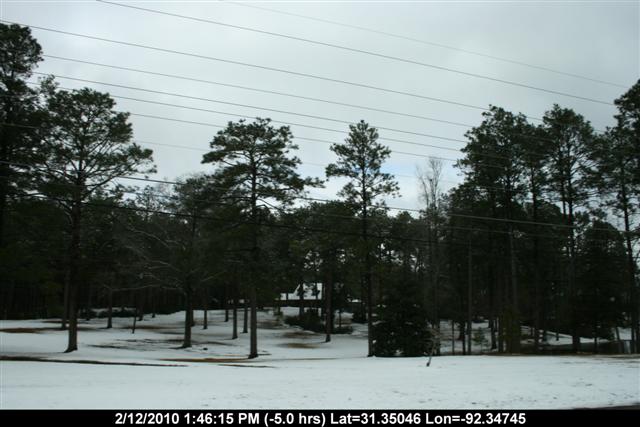
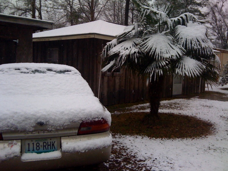
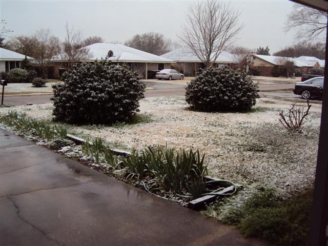
2/11/10 to 2/12/10 Snow Pictures |
||
|
|
|
|
|
|
|
|


 Follow us on YouTube