| December 27 2014 TORNADOES |
| Local Storm Reports |
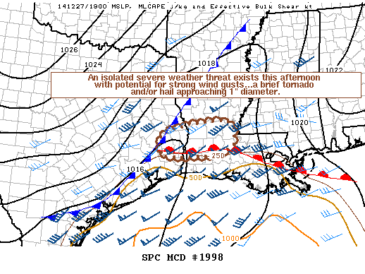
| SPC Storm Reports for December 27 2014 Preliminary Tyler County Report Preliminary Jasper County Report |
Event Summary
Conditions became favorable for a long lived strong to severe storm to track along the intersection of a warm front and cold front (triple point low) across southeast Texas andwestern Louisiana. This storm produced at least two tornadoes in Tyler and JasperCounties.
| Location | Start/ End Time |
Event Type | Fatalities/ Injuries |
Path Length | Path Width |
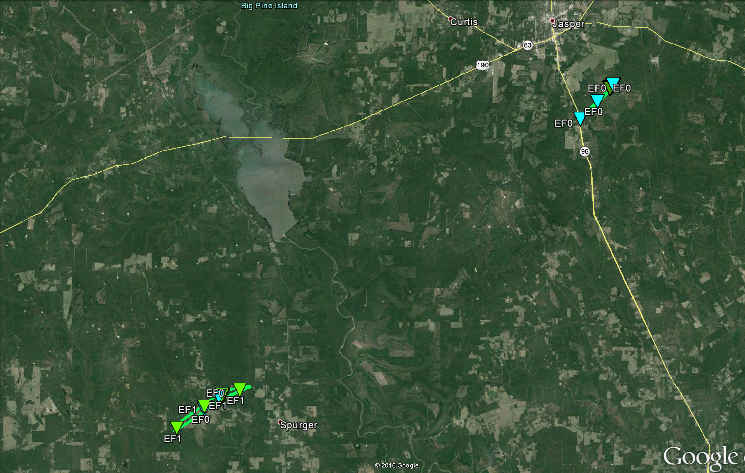
| Tyler County 4 W Spurger to 2 NW Spurger |
2:00 pm - |
EF-1 Tornado |
none | 4 miles | 50 yards |
| Jasper County 4 SSE Jasper to 4 SE Jasper |
2:35 pm - 2:39 pm |
EF-1 Tornado |
none | 2 miles | 150 yards |
Map of the Surveyed Damage
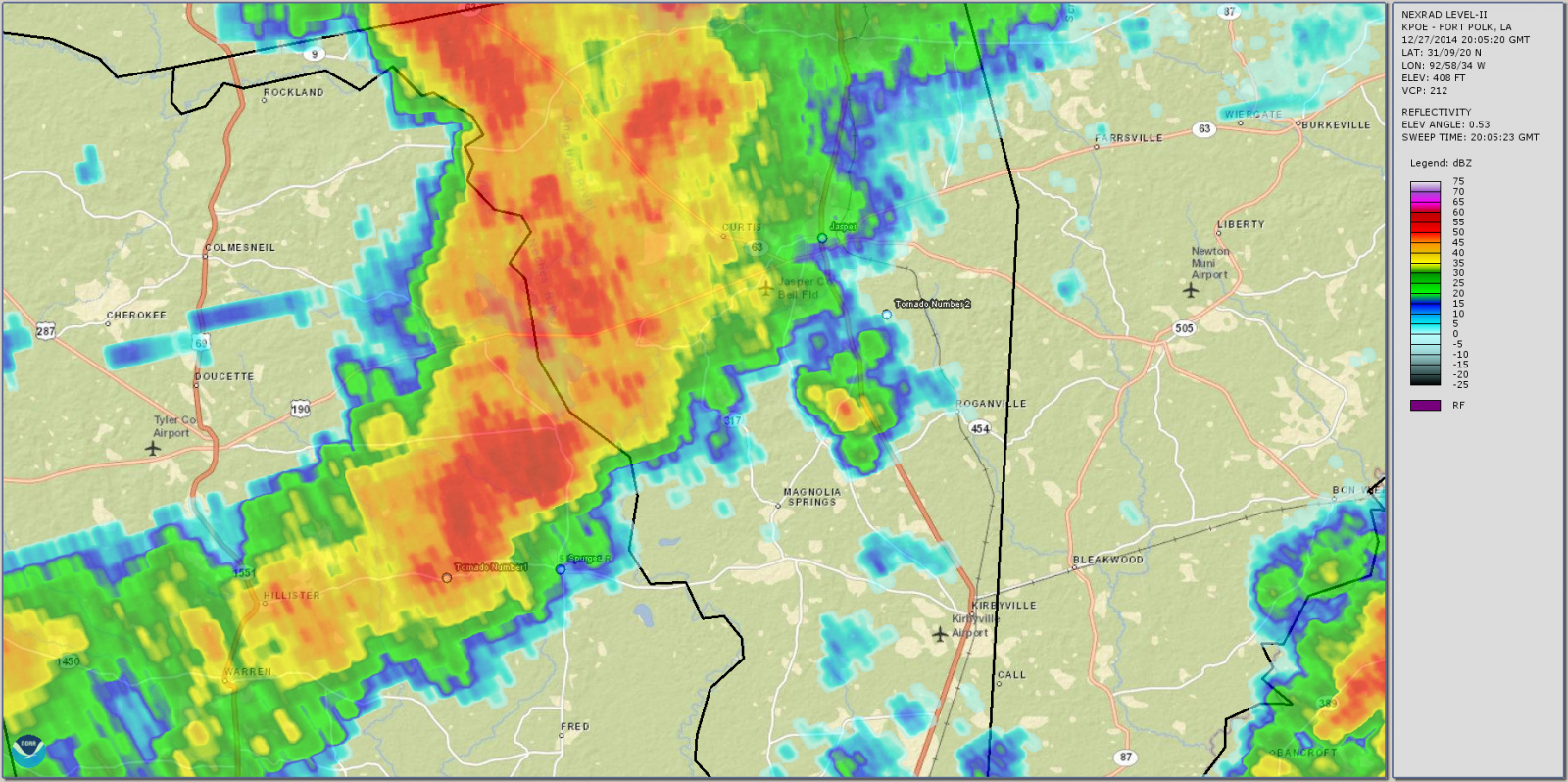
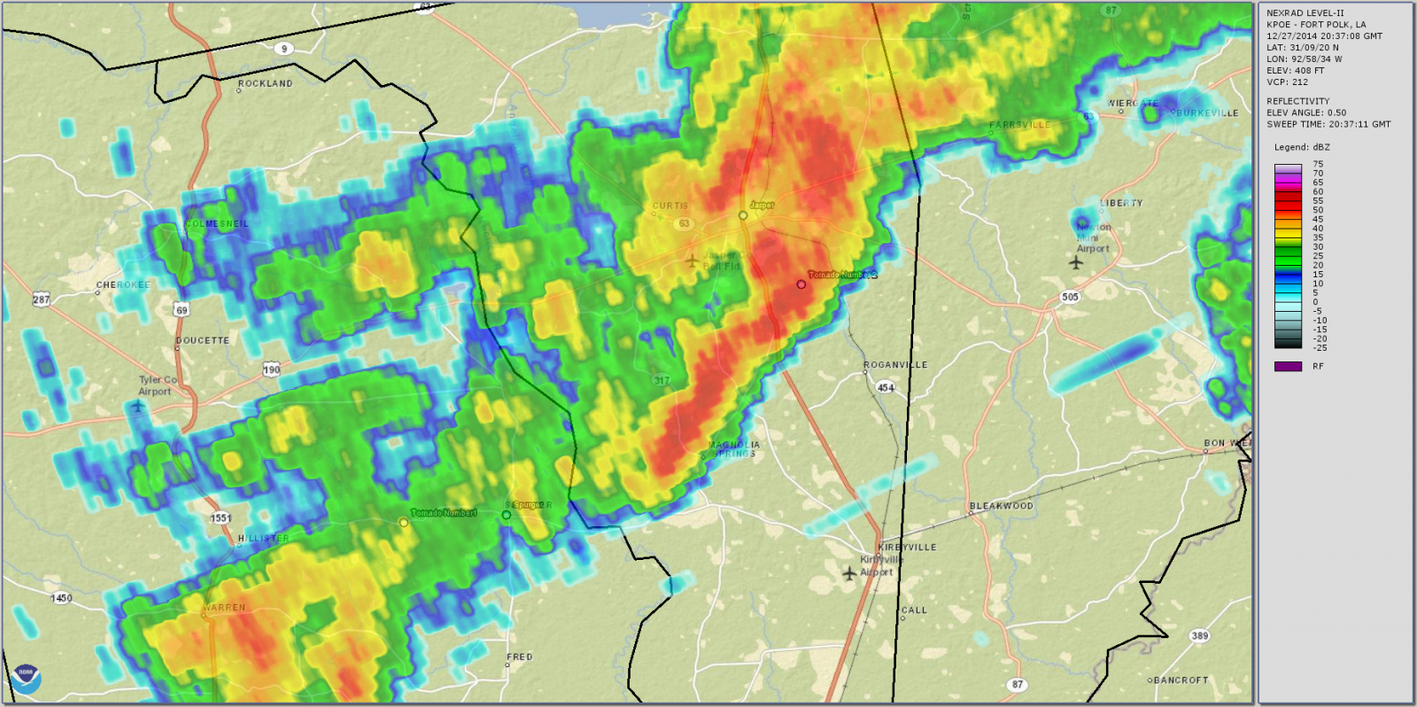
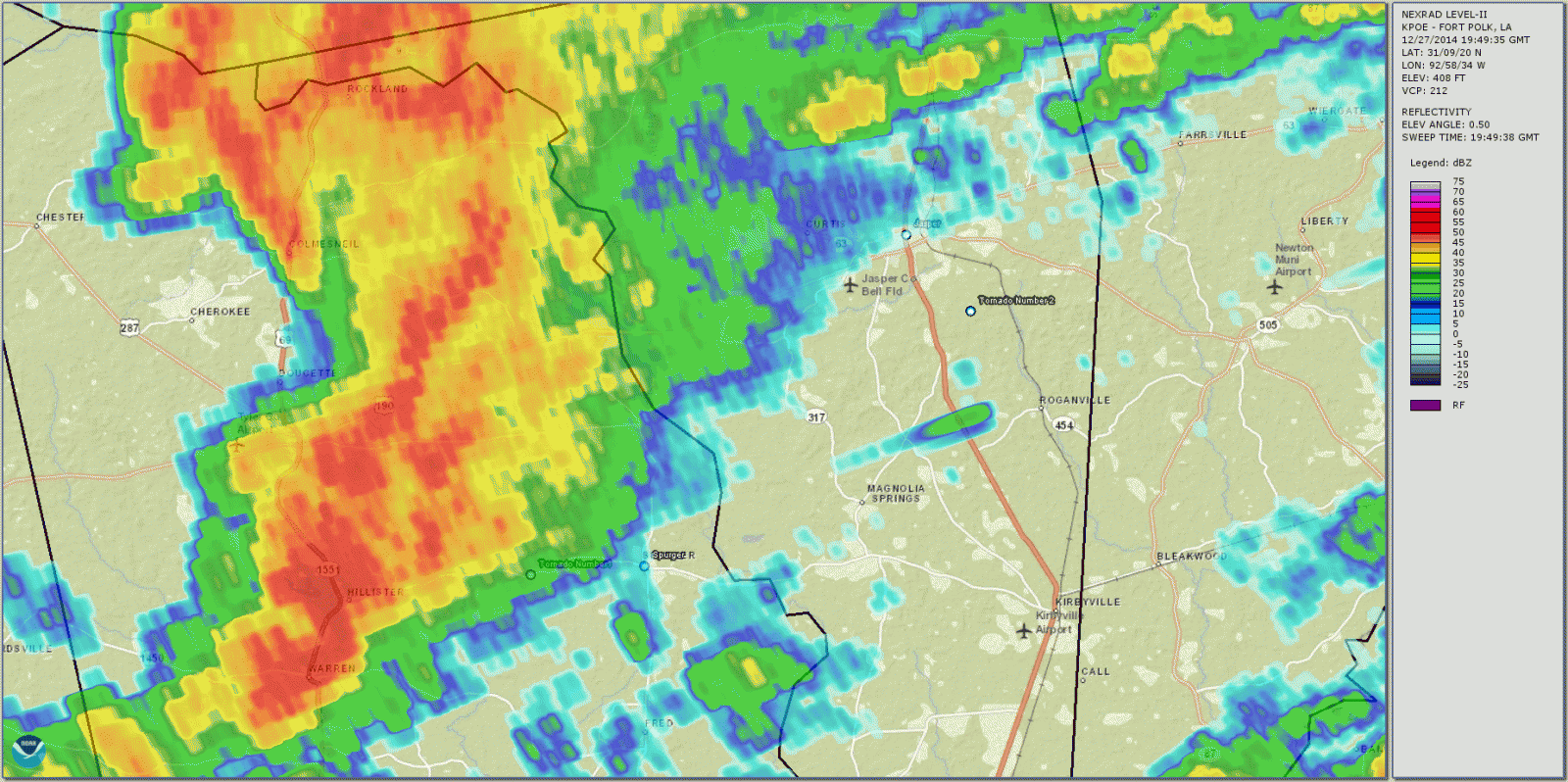
Radar Imagery
|
Radar image near the time of the tornado in Tyler County at 2:05 PM. (Click for a larger image) |
Radar image near the time of the tornado in Jasper County at 2:37 PM. (Click for a larger image) |
Radar animation of the storm progression from 1:49 PM to 2:42 PM. (Click for a larger image) |


 Follow us on YouTube