| Event Summary |
Meteorological Setup |
Satellite and Radar Imagery |
Storm Total Rainfall |
Timeline | Sabine River | Neches River | Calcasieu River | Red River |
Doswell et al. 1996 highlight several basic ingredients shared by all flash flood/heavy rainfall events:
These ingredients came together over the Lower Mississippi Valley and Southern Plains from 9-11 March 2016 and resulted in record rainfall and flooding across parts of Louisiana and Texas.
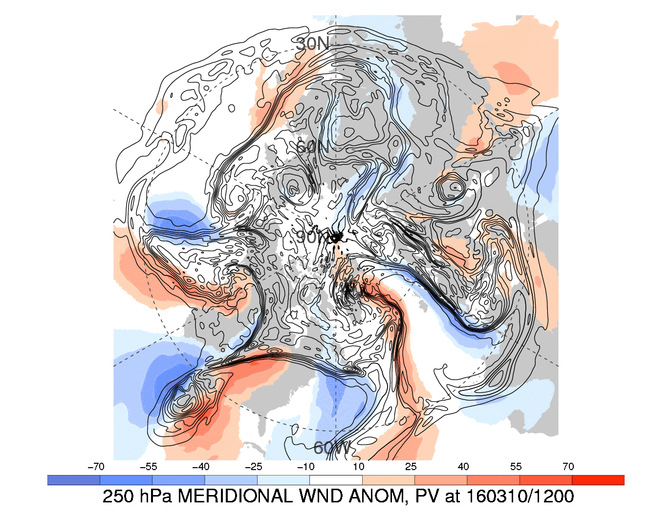
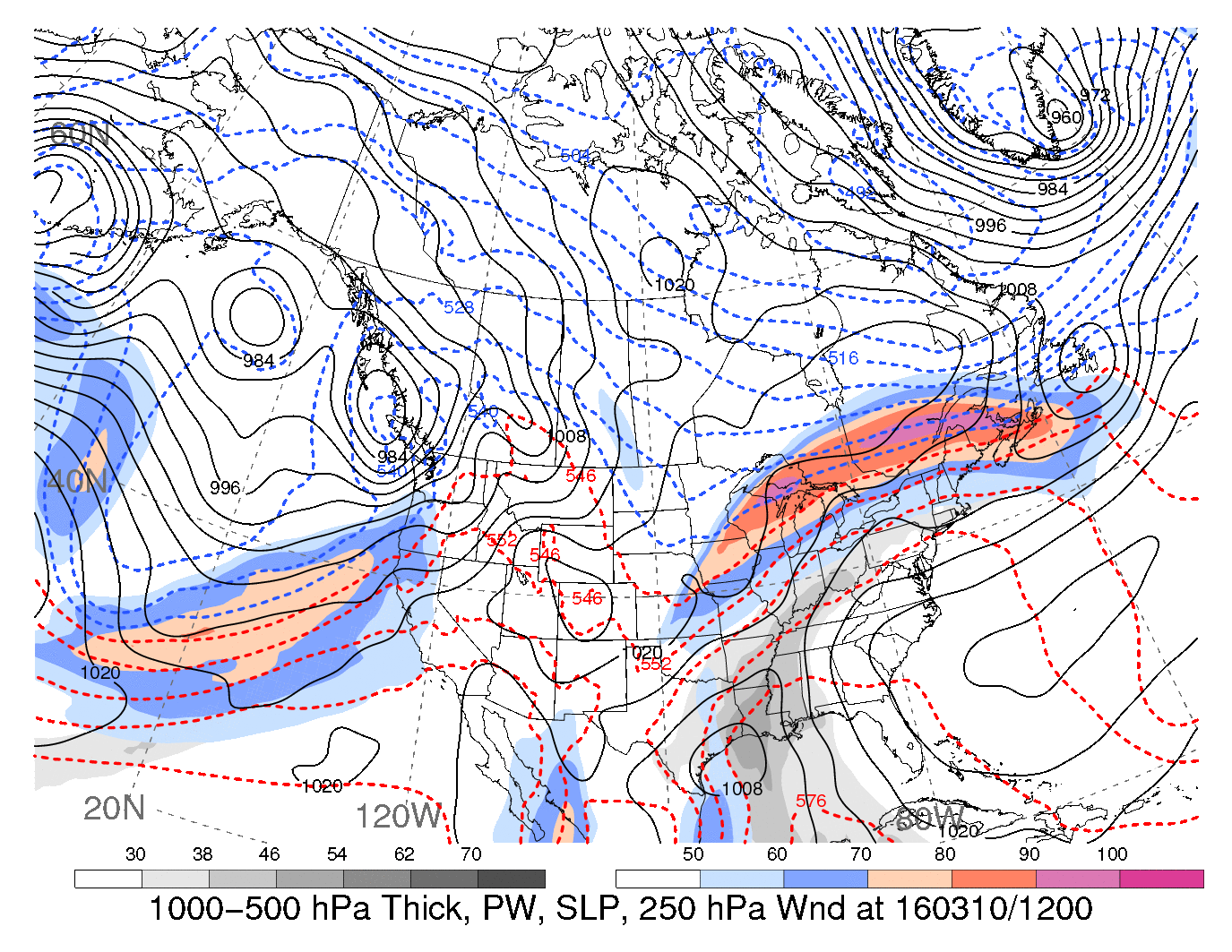
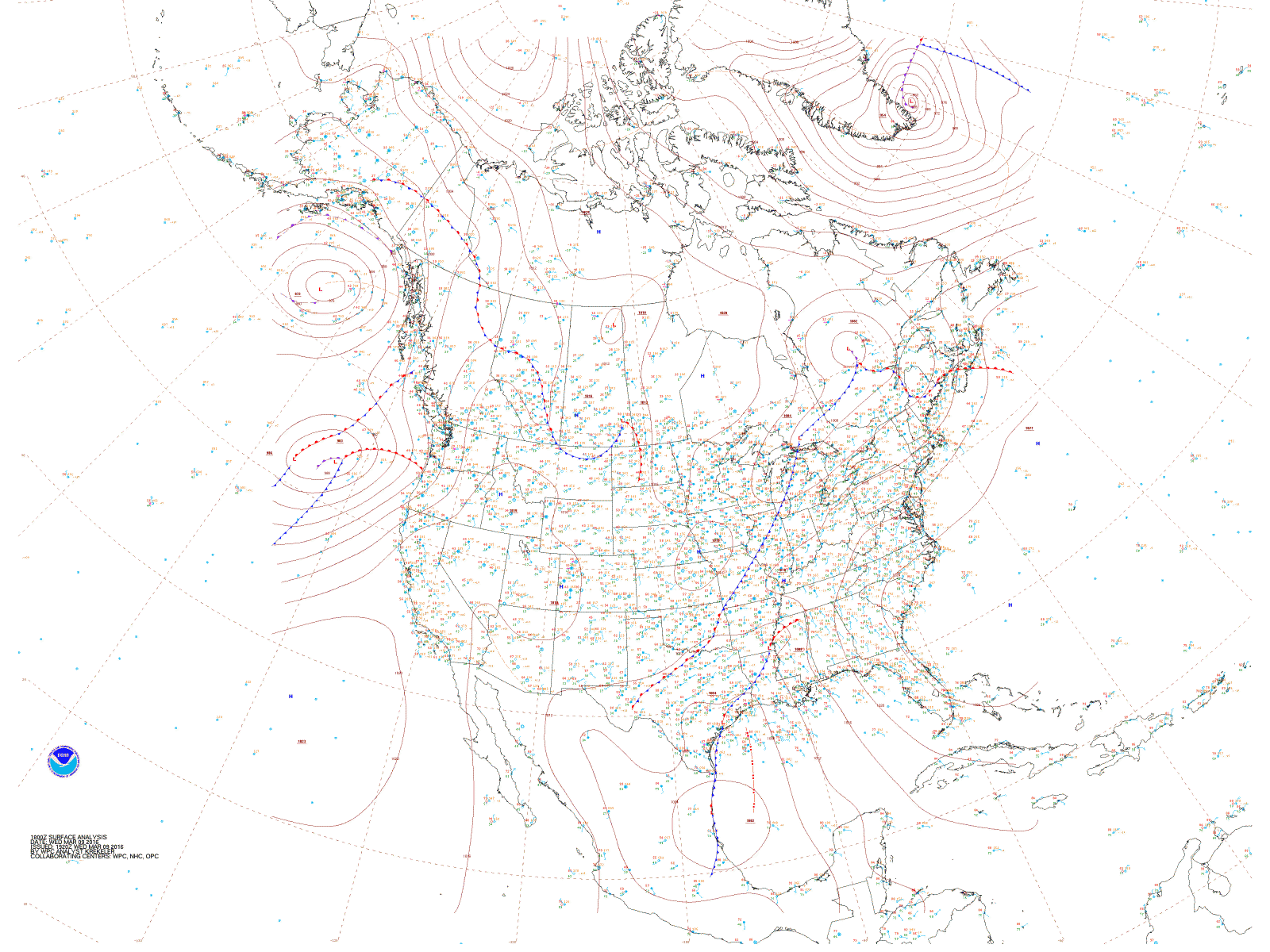
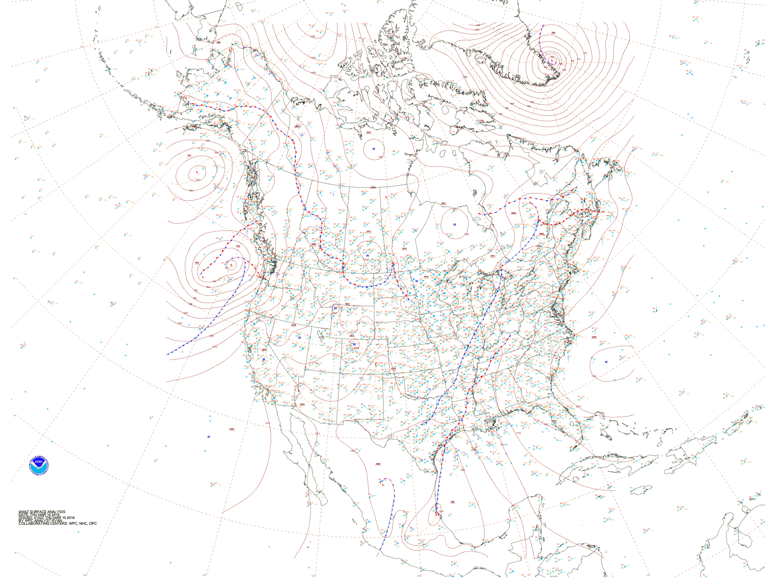
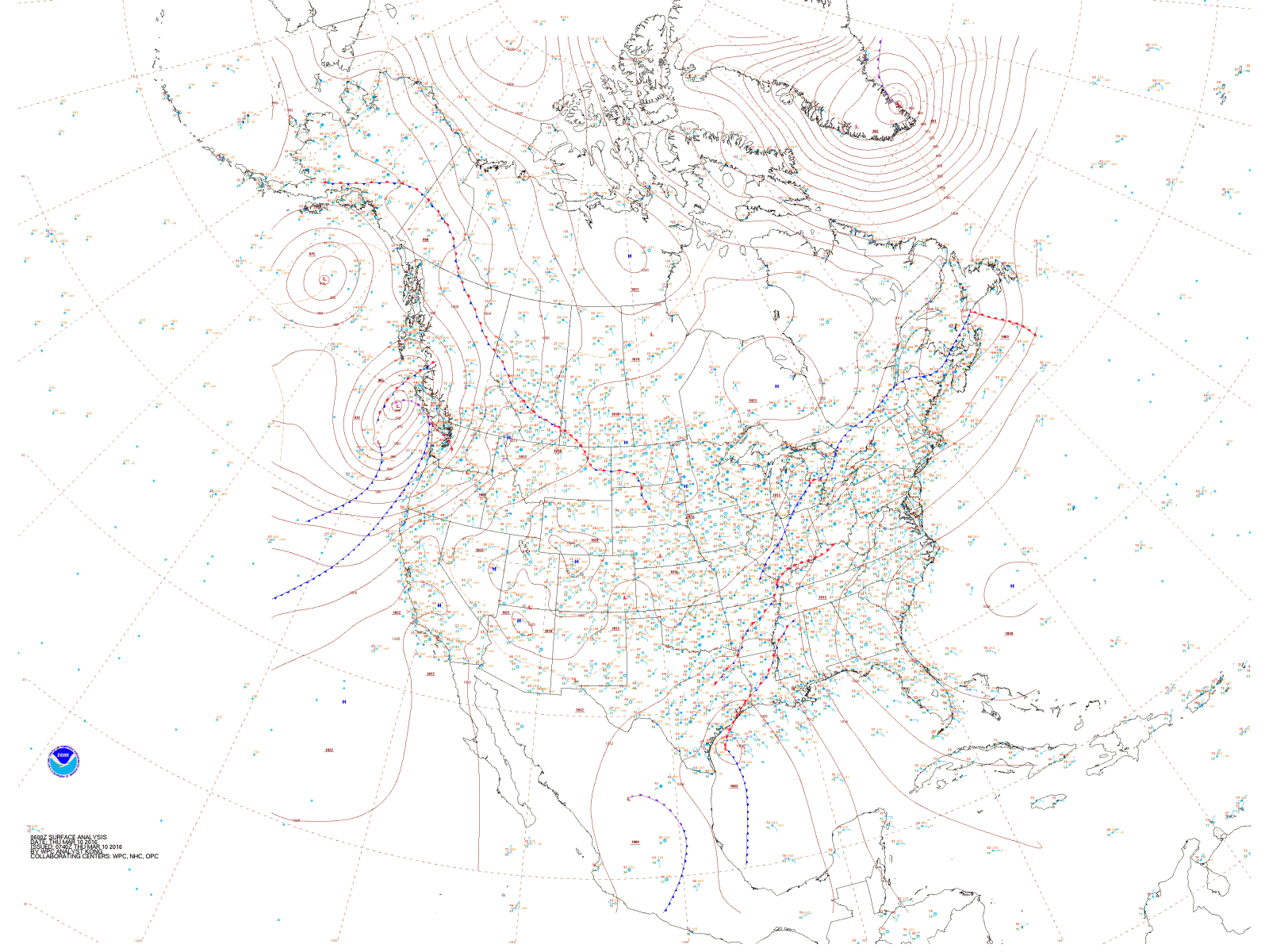
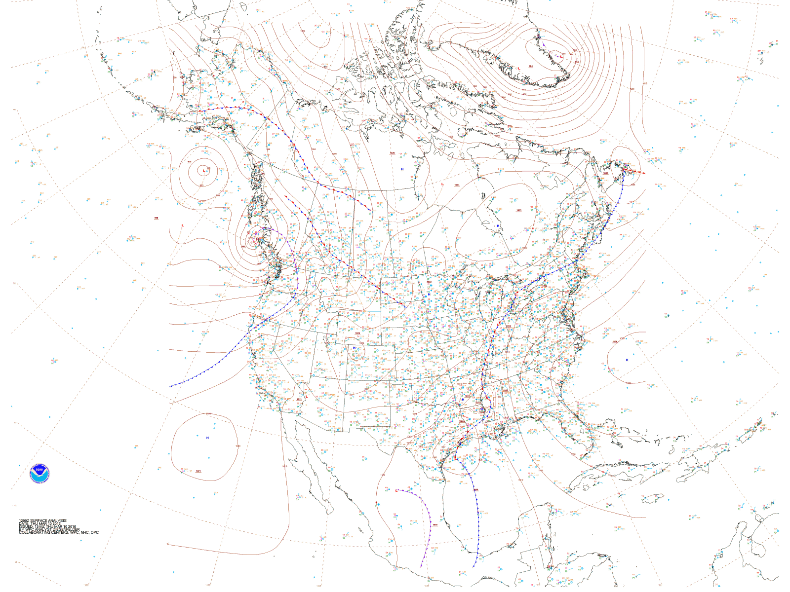
An upper level trough amplified over the southwestern United States beginning on 7 March 2016. By 9 March, this resulted in the development of an anomalously strong upper level low over Mexico characterized by 500-hPa height anomalies greater than -5 sigma. Downstream of the upper level low, anomalous southerly flow located resulted in deep layer moisture being transported from the tropics to the Gulf Coast. By 12Z 10 March, an airmass characterized by precipitable water (PW) values in excess of 1.50" (38 mm) extended from the Gulf Coast north-northeastward into the Ohio River Valley.
 |
 |
|
10 March 2016 GFS Analysis of 250 hPa Wind Anomalies (shaded) and Potential Vorticity (contoured). Image by Heather Archambault. |
10 March 2016 GFS Analysis of 250 hPa Winds (color shading), Precipitable Water (gray shading), 1000-500 hPa thickness (color contours) and sea-level pressure (contours). Image by Heather Archambault. |
The local upper air sounding from 12Z on 10 March recorded a PW of 2.15" (54.6 mm) over SW Louisiana. Per the Storm Prediction Center's sounding climatology, this PW was an all time maximum for the month of March with records going back to 1948. The tall, skinny CAPE profile and a warm cloud layer depth of nearly 13,000 feet indicated an atmosphere favorable for convection capable of high precipitation efficiency. Additionally, the relatively uniform southerly winds sampled indicated the potential for training convection.
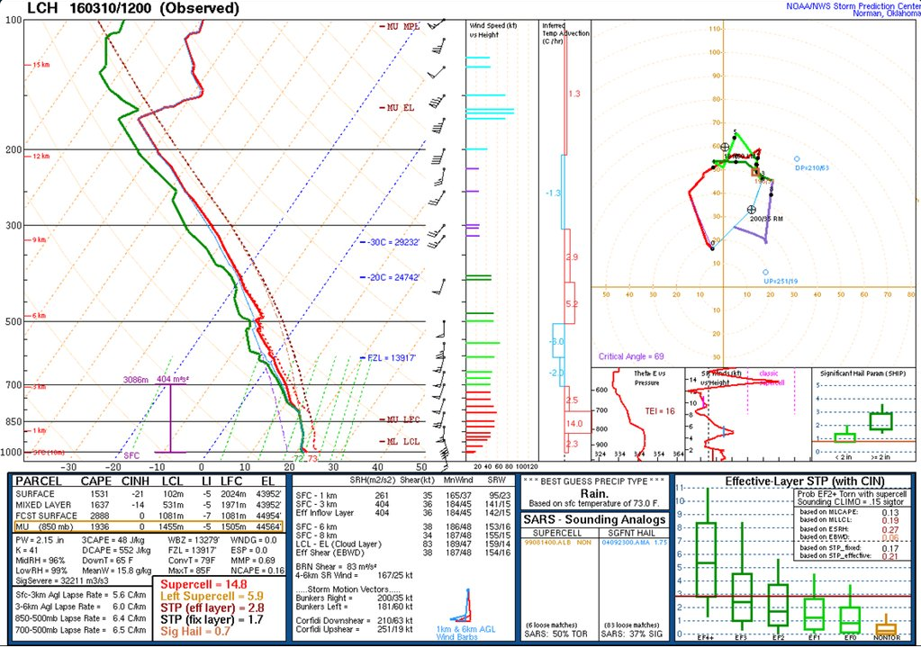
March 10th Lake Charles Morning Sounding

Lake Charles Sounding Climatology
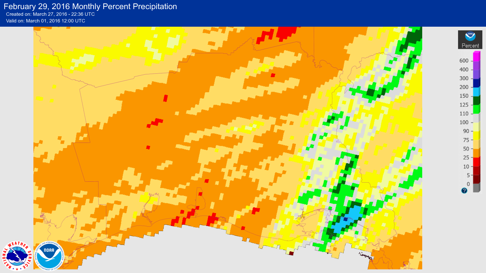
As surface low pressure moved to the southeast on 9 March, the associated cold front slowed and transitioned to a stationary front. This resulted in prolonged forcing for the development of training storms extending from northwestern Louisiana into southeast Texas. While precipitation across most of this area was below normal in February, the soil quickly became saturated due to the training convection. Much of the 10 + inches of rainfall was converted to runoff which produced flash flooding and river flooding.
|
|
|
|


 Follow us on YouTube