Overview
|
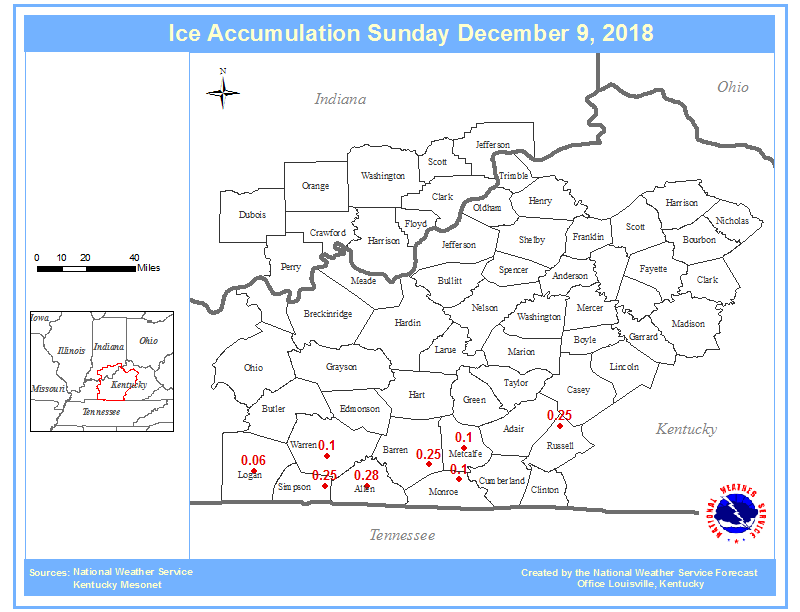
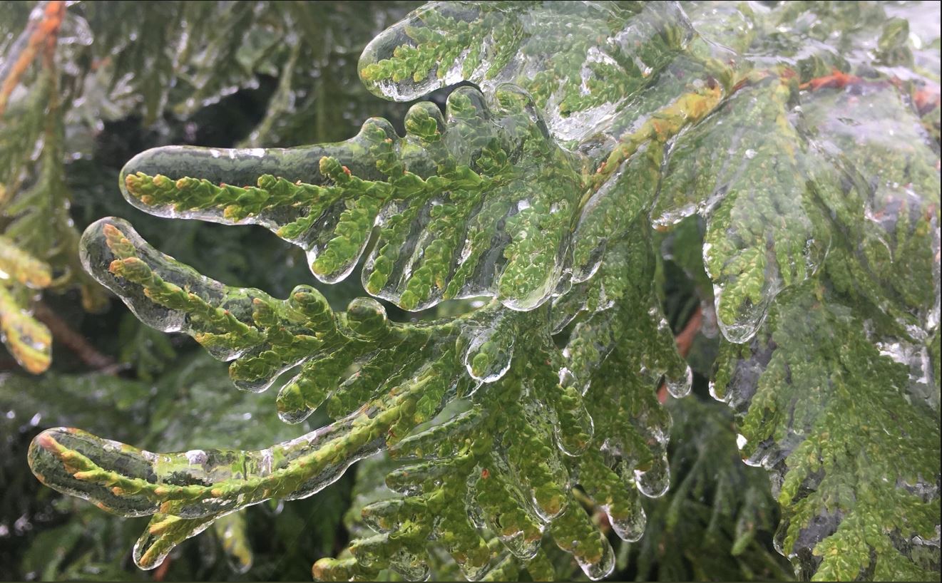
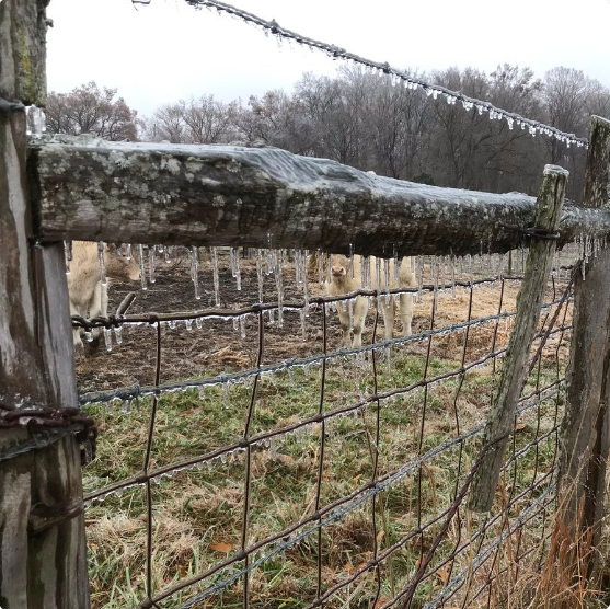
A storm system moving east through the Gulf states brought wintry precipitation to southern Kentucky December 8-9, 2018. Many locations over southern Kentucky experienced a wintry mix with the predominant precipitation type being freezing rain during the evening of the 8th and continuing into the morning of the 9th. By sunrise many locations saw 0.1"-0.25" of ice accumulation on elevated surfaces such as trees and powerlines. Some power outages occurred as well (around 2,000-3,000 without power during the peak of the event). Temperatures warmed above freezing by around Noon in southern Kentucky causing most of the ice to melt. |
|
Ice
 |
Photos
 |
 |
 |
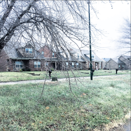 |
| Southern Bowling Green, KY Courtesy of Megan Schargorodski |
Southern Bowling Green, KY Courtesy of Megan Schargorodski |
Southern Bowling Green, KY Courtesy of Megan Schargorodski |
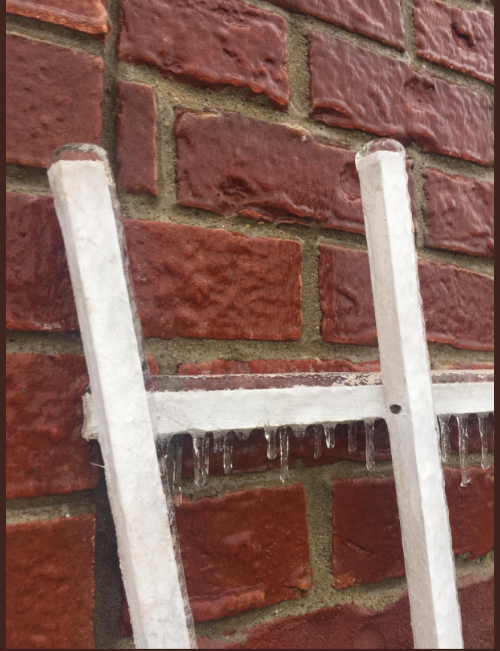
Southern Bowling Green, KY Courtesy of WxOrNotBG |
 |
 |
 |
 |
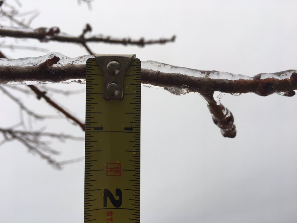
| Southern Bowling Green, KY Courtesy of WxOrNotBG |
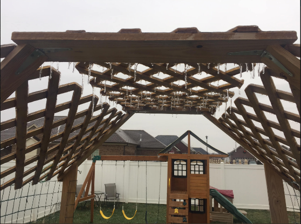
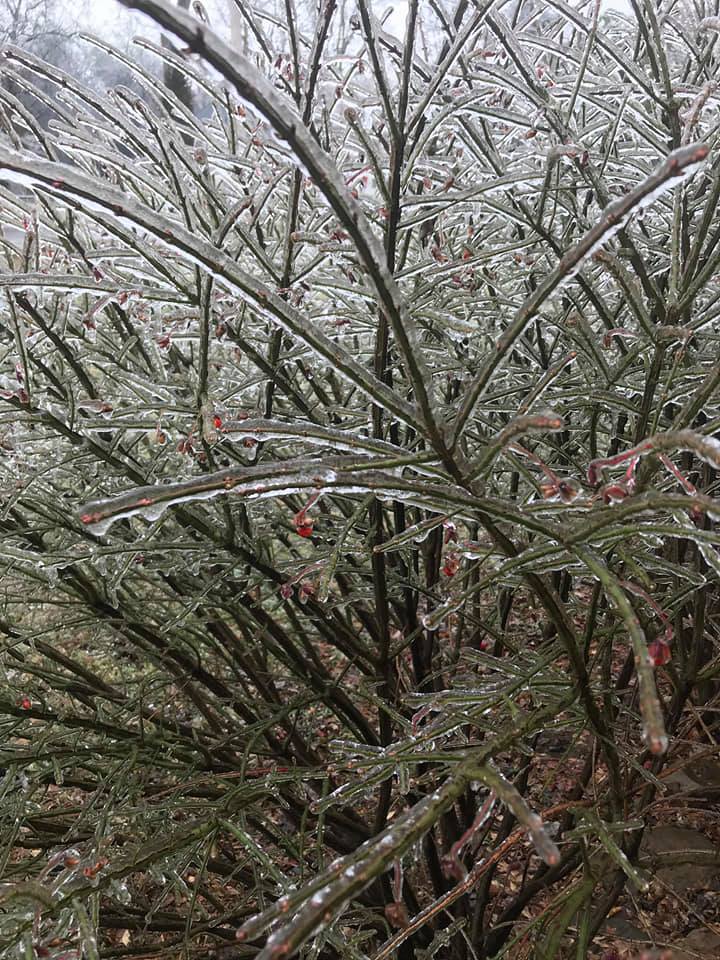
Franklin, KY Courtesy of Shannon Hoffman |
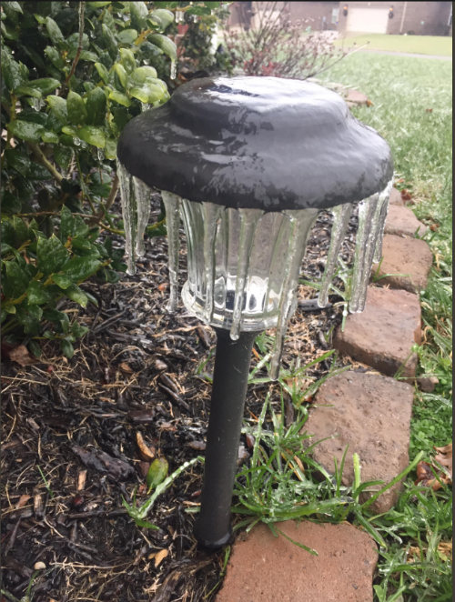
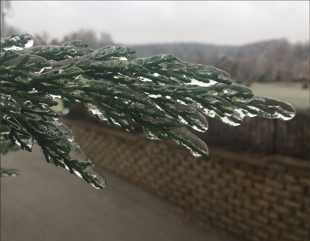
Scottsville, KY Courtesy of Jeremy Byrn |
Scottsville, KY Courtesy of Jeremy Byrn |
Storm Reports
...FREEZING RAIN REPORTS (ICE ACCUMULATION)...

LOCATION                     AMOUNT    TIME/DATE       LAT/LON

...KENTUCKY...

...ALLEN COUNTY...
SCOTTSVILLE                  0.28 IN   1130 AM 12/09   36.75N/86.20W
SCOTTSVILLE                  0.20 IN   0925 AM 12/09   36.75N/86.20W


...BARREN COUNTY...
TEMPLE HILL                  0.25 IN   1212 PM 12/09   36.88N/85.83W

...LOGAN COUNTY...
1 E RUSSELLVILLE             0.06 IN   0819 AM 12/09   36.84N/86.87W


...METCALFE COUNTY...
EDMONTON                     0.10 IN   0645 AM 12/09   36.98N/85.62W

...MONROE COUNTY...
1 ENE ROCKBRIDGE             0.10 IN   0800 AM 12/09   36.79N/85.65W

...RUSSELL COUNTY...
5 NNE RUSSELL SPRINGS        0.25 IN   1000 AM 12/09   37.11N/85.05W

...SIMPSON COUNTY...
GOLD CITY                    0.25 IN   0815 AM 12/09   36.75N/86.45W

...WARREN COUNTY...
3 S BOWLING GREEN            0.10 IN   0839 AM 12/09   36.93N/86.44W
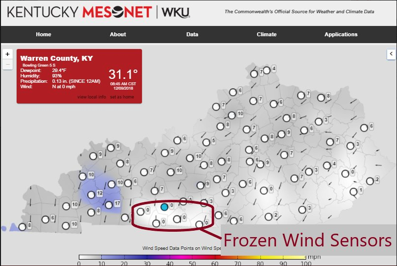
KY Mesonet
 |
 |
Media use of NWS Web News Stories is encouraged! Please acknowledge the NWS as the source of any news information accessed from this site. |
|


 Weather Story
 Weather Map
 Local Radar
 Follow us on YouTube