
Severe Weather Outlook Later Tonight Read More >
Louisville, KY
Weather Forecast Office
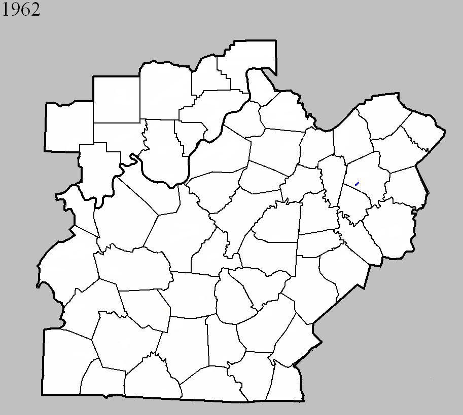
March 21, 1962
Counties: Fayette
F-scale: F1
Deaths: 0
Injuries: 0
Path width:
Path length: 1/3 of a mile
Time: 9:00am
Grazulis narrative: At Blueberry Hill, two barns were "blown up and flattened" by a tornado that touched down south of Lexington.
Noted discrepancies: SPC and NCDC list this as an F1, Grazulis calls it an F2. SPC gives a path width of 10 yards, NCDC 30 yards, Grazulis nothing. Grazulis lists it at 10:00am.
Current Hazards
Hazardous Weather Outlook
Storm Prediction Center
Submit a Storm Report
Advisory/Warning Criteria
Radar
Fort Knox
Evansville
Fort Campbell
Nashville
Jackson
Wilmington
Latest Forecasts
1-Stop Severe Forecast
1-Stop Winter Forecast
1-Stop Drought
Event Ready
El Nino and La Nina
Climate Prediction
Central U.S. Weather Stories
Nationwide Weather Stories
Aviation
Spot Request
Air Quality
Fire Weather
Recreation Forecasts
Past Weather
1-Stop Climate
Climate Graphs
CoCoRaHS
Daily Temp/Precip Maps
Local Climate Pages
Past Derby/Oaks/Thunder Weather
Tornado History
Football Weather
Local Information
About the NWS
Forecast Discussion
Decision Support Page
Hazardous Weather Outlook
2024 Eclipse
Spotter Training
Regional Weather Map
Text Products
Science and Technology
Outreach
LMK Warning Area
About Our Office
Station History
Local Climate Page
Tornado Machine Plans
Items of Interest
Weather Enterprise Resources
US Dept of Commerce
National Oceanic and Atmospheric Administration
National Weather Service
Louisville, KY
6201 Theiler Lane
Louisville, KY 40229-1476
502-969-8842
Comments? Questions? Please Contact Us.


 Weather Story
 Weather Map
 Local Radar
 Follow us on YouTube