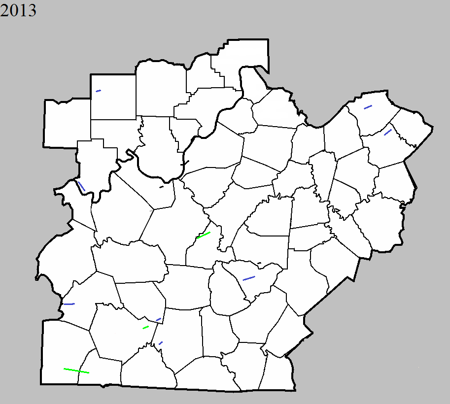
January 30, 2013
County: Orange
EF-Scale: EF1
Deaths: 0
Injuries: 0
Path width: 75 yards
Path length: 0.23 mile
Time: 1:47am EST
Notes: Several trees were toppled in a forest on the southwest portion of the path. The tornado then affected a residence, badly damaging the roof and throwing the porch of the house several yards to the northeast. Several small twigs were driven through the siding of the home.
January 30, 2013
County: Meade
EF-Scale: EF0
Deaths: 0
Injuries: 0
Path width: 200 yards
Path length: 1 mile
Time: 4:05am EST
Notes: This tornado touched down in a grove of trees near the end of Kurtz Drive. The tornado traveled to the northeast and damaged homes on Kurtz Drive and at the intersection of Thornhill Drive and Gaines Road. Continuing to the northeast, at a home east of Gaines Road the owner reported that the water was evacuated out of all four toilets in the building as the tornado passed by. At the home next door the front door was pulling away from the building. Residents reported a loud roar. The tornado continued northeast through some woods and lifted after damaging a small shed off of Tom Cain Road.
January 30, 2013
County: Harrison IN, Jefferson KY
EF-Scale: EF0
Deaths: 0
Injuries: 0
Path width: 325 yards
Path length: 2.8 miles
Time: 4:17am EST
Notes: An NWS survey team has confirmed an EF-0 tornado touch down east of Elizabeth in Harrison County, Indiana. Four homes and two barns were damaged along Highway 111. The porch of one home was lifted and thrown 30 feet. The walls of one of the barns collapsed in multiple directions. Trees were down in this location as well. The track of the tornado extended to the Ohio River and into Jefferson County, Kentucky. Northwest of Valley Station many softwood trees were damaged, a pine tree was snapped, and a trampoline was blown over.
January 30, 2013
County: Warren
EF-Scale: EF2
Deaths: 0
Injuries: 0
Path width: 250 yards
Path length: 3.3 miles
Time: 3:38am CST
Notes: Four grain bins were scattered over a quarter mile, with some debris thrown up to a half mile away. Fencing with 8" posts was torn down. A semi truck was flipped as the tornado crossed Interstate 65. Towards the end of the path a barn was destroyed and a 100 by 300 foot well-built metal outbuilding was destroyed.
January 30, 2013
County: Edmonson
EF-Scale: EF1
Deaths: 0
Injuries: 0
Path width: 100 yards
Path length: 2.7 miles
Time: 3:42am CST
Notes: The tornado touched down two separate times. Near Rocky Hill a barn was destroyed and two outbuildings lost their roofs. Cedar trees were snapped. Towards the end of the path a pole barn was destroyed and a home was unroofed on US 31W.
January 30, 2013
County: Barren
EF-Scale: EF1
Deaths: 0
Injuries: 0
Path width: 50 yards
Path length: 0.3 mile
Time: 3:49am CST
Notes: A large barn was destroyed, trees were felled, and the doors and siding were pulled off of a barn along Finney Road.
January 30, 2013
County: Marion
EF-Scale: EF0
Deaths: 0
Injuries: 2
Path width: 13 yards
Path length: 0.1 mile
Time: 5:42am EST
Notes: This tornado did damage along Calvary Road where a mobile home was destroyed and a small shed slid off its foundation. Two minor injuries occurred with this tornado.
June 10, 2013
Counties: Logan and Simpson
EF-Scale: EF2
Deaths: 0
Injuries: 4
Path width: 325 yards
Path length: 14 miles
Time: 1:40pm CDT
Notes: Touchdown occurred northwest of Adairville near the intersection of Vick Road and Route 96, where a barn sustained roof damage and another outbuilding was destroyed. EF2 damage occurred sporadically from near Route 96 to the Logan/Simpson county line. The worst damage occurred north-northeast of Adairsville where the tornado crossed Route 663. Several homes sustained extensive damage and three people were injured. A fourth person was injured on Trimble Road. The tornado entered Simpson County just north of the intersection of Conn Road and Reames Dixon Road. The tornado produced EF1 and EF0 damage in Simpson County until it lifted at Russellville-Gallatin Road at 2:09pm CDT. A total of five homes sustained extensive damage, and two homes suffered minor damage. Five grain bins were blown away, and two others collapsed. Numerous outbuildings were damaged or destroyed.
June 26, 2013
County: Perry
EF-Scale:EF1
Deaths: 0
Injuries: 0
Path width: 100 yards
Path length: 5.2 miles
Time: 8:29pm CDT
Notes: This tornado touched down southeast of Troy and moved southeast through the east side of Tell City. Several large trees were felled and there was some minor roof damage and damage to outbuildings. A large semi trailer and a few rides were blown sideways at a carnival at 10th & Watt streets.
June 26, 2013
Counties: LaRue
EF-Scale: EF2
Deaths: 0
Injuries: 0
Path width: 300 yards
Path length: 7 miles
Time: 10:25pm EDT
Notes: The tornado initially touched down near the Hardin-LaRue County line between routes 210 and 61 just north of Tonieville. From there the tornado moved northeast. On Castleman Road, just north of the intersection with Carter Brothers Road, a metal shop building had its metal sheet roof taken off and thrown downwind 150 yards. The garage doors were bent and pushed in. Insulation was everywhere. Several trees were uprooted. Here the tornado was estimated to be EF1 with a maximum wind speed of 105 mph. On Carter Brothers Road a large RV inside a metal shed was blown onto its side and the shed was destroyed. A two-story pole tobacco barn was also destroyed. Red and white oak and walnut trees were sheared off. Across the road a metal livestock building was destroyed. Here the tornado was estimated at EF2 with 115mph winds. Next, along KY 1607, not far from Salem Church Road and Dan Dunn Road, a silo was crumbled and some parts of a corn field were mashed sown. Some bradford pear trees were uprooted on Dan Dunn Road. Considerable damage occurred on parts of Slack Road. A one room schoolhouse was destroyed. A dairy farming operation lost several barns, along with some trees that were uprooted. The worst damage was at the dairy farm where winds were estimated around 135 mph, or high-end EF2. Also on Slack Road a two-story house lost its entire roof. Insulation was caked onto the entire back side of the house opposite the direction of travel of the tornado. A shed was blown down and some trees were uprooted. The winds at this location were estimated around 120 mpg (EF2). The exact end point of the tornado was difficult to determine as it went into a thickly wooded area with limited access. The tornado may have skipped a few times along its path.
November 17, 2013
County: Butler
EF-Scale: EF1
Deaths: 0
Injury: 1
Path width: 200 yards
Path length: 5.3 miles
Time: 4:10-4:16pm CST
Notes: The tornado, with 105 mph winds, touched down approximately one mile west of Huntsville on Blaine Road where some trees were uprooted. The tornado then moved eastward into Huntsville where a few homes were damaged and trees were snapped along Huntsville-Quality Road. The tornado then continued east damaging trees, homes and small outbuildings just north of Silver City-Huntsville Road. One minor injury occurred in a double-wide that lost all of its roof and a couple of walls just west of the intersection of Silver City-Huntsville Road and Panther Creek Road. Intermittent minor damage then occurred east of this intersection. Finally, the tornado did a more concentrated area of damage along Muddy Creek Road where a few more homes and trees were damaged. The tornado quickly lifted 4 miles east of Huntsville.
December 21, 2013
County: Taylor
EF-Scale: EF1
Deaths: 0
Injuries: 0
Path width: 300 yards
Path length: 6 miles
Time: 11:07pm - 11:13pm EST
Notes: This tornado touched down along Old Greensburg Road just west of the intersection of US 68 and KY 323, where it immediately destroyed small outbuildings. The tornado entered the city of Campbellsville when it crossed KY 210 and uprooted trees and damaged buildings near the intersection of Hodgenville Road and Vintage Lane. A more concentrated area of damage then occurred as the tornado crossed Saloma Road and moved roughly parallel to and just north of Upper Miller Park Road. Trees were torn down and rooftops damaged in this area. The tornado exited the city at the intersection of Eastern Drive and East Lake Drive. The final damage occurred at the intersection of US 68 and Palestine Road. At this location there was more tree and roof damage.
December 21, 2013
County: Harrison KY
EF-Scale: EF1
Deaths: 0
Injuries: 0
Path width:110 yards
Path length: 3.8 miles
Time: 11:29pm - 11:34pm EST
Notes: The NWS storm survey team found many areas of intermittent straight line wind damage around northern Harrison County, with one specific tornado path. There were many barns damaged or destroyed, power lines and power poles down or snapped, some trees snapped and uprooted, and several homes and outbuildings had roof damage. The most concentrated damage was along Dutch Chapel Road where about half a dozen large barns, garages, and outbuildings were either destroyed or sustained significant damage. In addition, two homes on Dutch Chapel Road had significant roof damage and other structural damage, with debris thrown to the north, northeast, and east southeast. Several residents on Dutch Chapel Road heard a distinct "freight train roar" and their ears popped, along with zero visibility during torrential rain when the storm struck.
December 21, 2013
County: Bourbon
EF-Scale: EF1
Deaths: 0
Injuries: 0
Path width: 125 yards
Path length: 4.8 miles
Time: 11:41pm - 11:45pm EST
Notes: The NWS storm survey team found many areas of straight line wind damage across northern Bourbon County, and one specific tornado path within the straight line wind damage. There were many barns damaged or destroyed, power lines and poles down or snapped, and many softwood and hardwood trees snapped, twisted, and uprooted. Several homes and outbuildings had roof damage. The most concentrated damage was along Colville Road, down Endicott Lane, and over to the Steele Ford Road area. In this area, several large barns, garages, and outbuildings were either destroyed or sustained significant damage, with debris thrown to the north, northeast, and east. In addition, some well anchored solid footers from a garage and barn at 201 Endicott Lane were lifted up and thrown 75 yards. Several residents reported a loud roar, their ears popped, and there was zero visibility in torrential rain when the storm struck


 Weather Story
 Weather Map
 Local Radar
 Follow us on YouTube