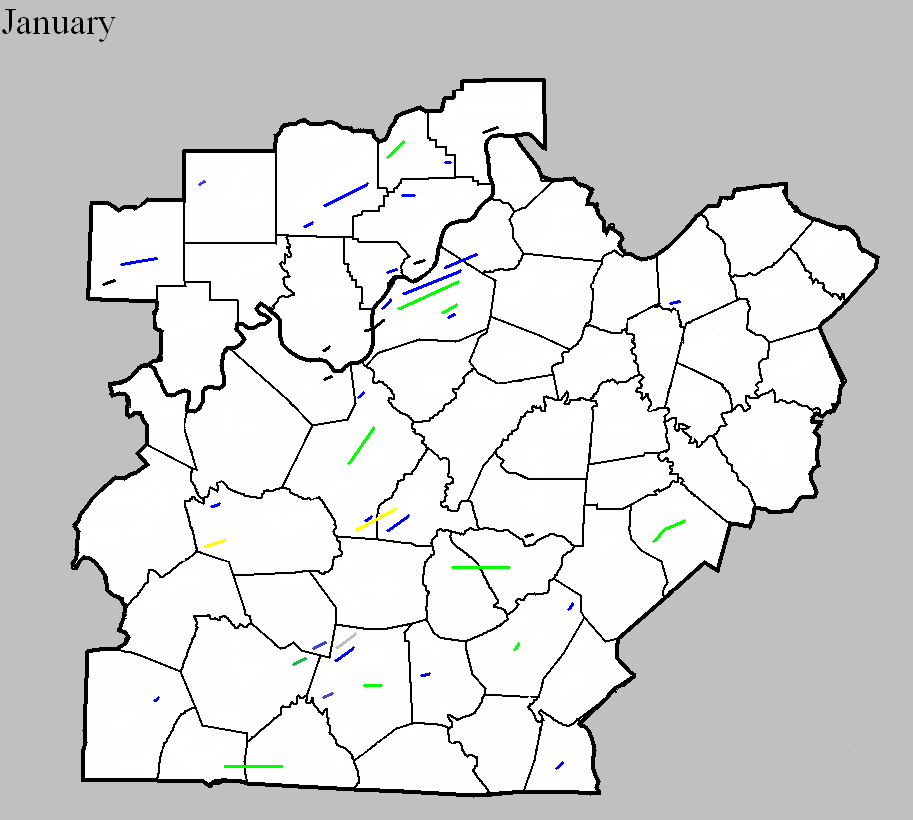

January 17, 1870
Counties: Barren
F-scale:
Deaths: 8
Injuries: 30
Path width:
Path length:
Time: 6:00am
Narrative: A tornado moved northeast from near Park City to Cave City. Fifty homes were damaged or destroyed, mostly in and near Cave City. Some of the dead were found 300 yards from where they were sleeping. The Masonic Hall and two churches were destroyed. The track may very well have continued on past Barren County.
January 19, 1928
Counties: Jefferson KY
F-scale: F2
Deaths: 0
Injuries: 17
Path width: 50 yards
Path length: 16 miles
Time: 7:20am
Narrative: This unusual January tornado touched down southwest of Shively and moved east-northeast. The tornado lifted near Anchorage after cutting a narrow path through the south suburbs of Louisville. About a hundred homes were unroofed or damaged. The first damage was to a farm on Lower Hunters Trace Road. The tornado quickly strengthened and caused quite a bit of damage in Saint Helens, just southwest of Shively. Damage was reported at Rockford Station (Rockford Lane and 18th Street Road -- now Dixie Highway). On Stewart Avenue a house lost its roof. The tornado then weakened or possibly lifted as it passed through or over Jacobs, where little damage occurred. The tornado then touched back down or strengthened as it entered Wyandotte-Oakdale. Damage was widespread along Dresden and Longfield Avenues, with damage on Longfield reported at the addresses of 812, 713, 716, and at 715 the house was "twisted." A house lost its roof at 570 Dresden Avenue, with additional damage at 550 and 552 Dresden. The tornado proceeded to the northeast across the southeastern section of Churchill Downs -- click here to see a map of how close the tornado came to the twin spires (the path of the tornado is outlined by the thick white lines). The tornado's worst damage then occurred in the 3800 block of Southern Parkway, with walls blown out of homes at the addresses of 3833, 3831, 3855, 3844, 3848, and 3850. Three brick houses were completely wrecked. The last significant damage occurred on High Street near Boxley Avenue where a house was unroofed and several cottages were damaged. Damage between this location (just east of Cardinal Stadium) and Anchorage was very light and spotty. J. L. Kendall and Grady Norton, meteorologists with the Weather Bureau, surveyed that damage and called the event, "a true tornado."
January 19, 1928
Counties: Jefferson KY
F-scale: F2
Deaths: 0
Injuries: 0
Path width: 50 yards
Path length: 4 miles
Time: 7:20am
Narrative: This tornado moved east-northeast from one mile northwest of Fern Creek, traveling parallel to the previously mentioned tornado. One barn was destroyed, and others were damaged.
January 18, 1929
Counties: Green, Taylor
F-scale: F2
Deaths: 2
Injuries: 5
Path width: 100 yards
Path length: 12 miles
Time: 4:00pm
Narrative: Moved east from near Summersville to near Campbellsville. The deaths were in a home near the county line.
January 18, 1929
Counties: Hardin, LaRue
F-scale: F3
Deaths: 1
Injuries: 5
Path width: 800 yards
Path length: 10 miles
Time: 4:00pm
Narrative: One "substantial" home and four barns were destroyed as a tornado moved northeast at Sonora. Many other buildings were damaged. This day's wind damage throughout the state of Kentucky totalled $1,000,000.
January 22, 1957
Counties: Logan
F-scale: F1
Deaths:
Injuries:
Path width:
Path length:
Time: 3:30pm
Noted discrepancies: None.
January 21, 1959
Counties: Grayson
F-scale: F3
Deaths: 3
Injuries: 5
Path width: 100 yards
Path length: 7 miles
Time: 12:30pm
Grazulis Narrative: Moved northeast in and near Neafus, Steff, Spring Lick, Goffs, Short Creek, Staff, and Caneyville. Four homes were destroyed in Neafus, and two each in Steff and Spring Lick. Ten buildings were destroyed on a farm.
Noted discrepancies: SPC, Storm Data, and NCDC list no injuries, but Grazulis lists 5. SPC gives a path width of 10 yards, NCDC 30 yards, Grazulis 100 yards.
January 11, 1963
Counties: Scott IN
F-scale: F2
Deaths: 0
Injuries: 0
Path width: 150 yards
Path length:
Time: 11:35pm
Grazulis narrative: Moved northeast from three miles north of Scottsburg. Several homes and barns were damaged or destroyed.
Noted discrepancies: SPC and NCDC rank this as an F2, Grazulis calls it an F3. SPC/NCDC begin the tornado west of Scottsburg...Grazulis starts it north of Scottsburg. SPC/NCDC stop the tornado where Grazulis starts it (Grazulis then moves it northeast for 5 miles). Storm Data says the tornado moved northeast and crossed I-65 three miles north of Scottsburg.
January 24, 1964
Counties: Grayson
F-scale: F1
Deaths:
Injuries:
Path width:
Path length:
Time: 8:16pm
Notes: Narrow swath through thick timber, evidence of rotary motion.
Noted discrepancies: SPC gives a path width of 10 yards and a path length of 1/10 of a mile...NCDC gives nothing for either. The only Kentucky event on this day in Storm Data is in Fulton County because the report for this tornado came in too late for inclusion in the publication.
January 24, 1964
Counties: Hardin
F-scale: F1
Deaths:
Injuries:
Path width:
Path length:
Time: 9:00pm
Notes: One to two miles west of Sonora a large barn with corrugated iron siding was completely torn from its foundation, with corrugated iron sheets extending about 0.25 mile across two fields. A 12" diameter oak tree was twisted off in the center of the damage path. Definite indication of rotary motion in the damage path according to the Louisville Weather Bureau surveyor. Two other barns were damaged though not destroyed.
Noted discrepancies: SPC gives a path width of 10 yards and a path length of 1/10 of a mile...NCDC gives nothing for either. The only Kentucky event on this day in Storm Data is in Fulton County because the report for this tornado came in too late for inclusion in the publication.
January 24, 1964
Counties: Hardin
F-scale: F1
Deaths:
Injuries:
Path width:
Path length:
Time: 9:45pmNotes: Manager of radio station WIEL relayed a report of considerable damage, with indications of a circular patter in the debris, at the rear of an athletic field at a dependent school.
Noted discrepancies: SPC gives a path width of 10 yards and a path length of 1/10 of a mile...NCDC gives nothing for either. The only Kentucky event on this day in Storm Data is in Fulton County because the report for this tornado came in too late for inclusion in the publication. The SPC/NCDC lat/lon pairs actually put this tornado in Meade County. There was minor tree damage in Meade County, but so far this project has been unable to find any documentation of a tornado there.
January 13, 1976
Counties: Harrison IN
F-scale: F0
Deaths:
Injuries:
Path width:
Path length:
Time: 2:50pm
Noted discrepancies: None
January 4, 1997
Counties: Clinton
F-scale: F1
Deaths: 1
Injuries: 2
Path width:
Path length:
Time: 10:55pm
Notes: Storm Data mentions damage on KY 1590 half a mile west of Albany.
January 24, 1997
Counties: Barren
F-scale: F2
Deaths:
Injuries: 2
Path width:
Path length:
Time: 5:40pm
Noted discrepancies: Storm Data lists this and the following tornado as one.
Notes: Storm Data says this tornado touched down south of Glasgow and did damage along KY 90.
January 24, 1997
Counties: Metcalfe
F-scale: F1
Deaths:
Injuries:
Path width:
Path length:
Time: 5:50pm
Noted discrepancies: Storm Data lists this and the previous tornado as one.
Notes: Storm Data says this tornado lifted at Wisdom.
January 3, 2000
Counties: Washington IN
F-scale: F1
Deaths:
Injuries:
Path width:
Path length:
Time: 1:05pm
Noted discrepancies: Storm Data puts this tornado two and a half miles north of Fredericksburg.
January 2, 2006
Counties: Hardin
F-scale: F2
Deaths: 0
Injuries: 0
Path width: 150 yards
Path length: 8 miles
Time: 2:43pm
Notes: This tornado touched down near Cecilia, blowing the roof off a barn, but only producing shingle damage on nearby residences. It did more damage when it reached Saint John Road, where it destroyed a home and some farm buildings. As the tornado continued to the northeast, it produced major roof damage to homes along Rineyville Road. Next, an office building that was under construction was lifted off of its foundation. A convenience store was destroyed along US 31W. A few more homes received minor damage before the tornado lifted near Longview.
January 2, 2006
Counties: LaRue
F-scale: F1
Deaths: 0
Injuries: 0
Path width: 175 yards
Path length: 6 miles
Time: 2:50pm
Notes: This tornado touched down near Talley in southwest LaRue County, and was intermittently on the ground until lifting just east of Tanner. Near Talley, the tornado lifted the roof off of a home. A home on Upton-Talley Road had the front porch and much of the roof removed. The tornado also did moderate damage to barns and destroyed several outbuildings, and moved a 2700 pound motorboat 220 feet. In the Oak Hill area two barns and some outbuildings were destroyed. Another barn and a home were damaged.
January 2, 2006
Counties: Adair
F-scale: F2
Deaths: 0
Injuries: 0
Path width: 200 yards
Path length: 1 mile
Time: 2:22pm Central
Notes: This tornado touched down near Columbia. It destroyed a mobile home and removed the roof from a house. Other homes and mobile homes were damaged.
January 2, 2006
Counties: Jefferson KY
F-scale: F1
Deaths: 0
Injuries: 0
Path width: 34 yards
Path length: 2 miles
Time: 3:22pm
Notes: A tornado touched down near the corner of Bramers and Campground roads. Many homes along the damage path had roof damage. A large, well constructed barn was destroyed. Numerous trees and power lines were downed, and one tree was blown onto a house. The local Moose Lodge building had significant damage. The tornado lifted around 3:27pm near the intersection of Campground Road and Ralph Avenue.
January 2, 2006
Counties: Adair
F-scale: F1
Deaths: 0
Injuries: 0
Path width: 100 yards
Path length: 1 mile
Time: 2:57pm Central
Notes: This tornado touched down in the Pellyton area. Several homes and barns in the area were damaged.
January 2, 2006
Counties: Lincoln
F-scale: F2
Deaths: 0
Injuries: 2
Path width: 200 yards
Path length: 9 miles
Time: 4:34pm
Notes: This tornado passed through western and central Lincoln County. A man received minor injuries when a barn he was in collapsed around him. An elderly woman was hospitalized with a broken collar bone and nose. She had been sucked out of her mobile home when she tried to open her front door. In all, eight mobile homes were destroyed, with most of the damage concentrated south of McKinney. At one location the tornado had embedded two by six boards firmly into the ground.
January 10, 2008
Counties: Barren
EF-scale: EF1
Deaths: 0
Injuries: 0
Path width: 350 yards
Path length: 3.1 miles
Time: 2:02pm CST to 2:06pm CST
Notes: The tornado first touched down along Millstown Road southwest of Park City. It uprooted and snapped the trunks of several large trees and did some minor roof damage to a home. The tornado was on the ground intermittently along its path to the south and east of Park City, destroying eight barns and snapping or uprooting several trees. Right before it lifted, it tore the front porch off a home and destroyed a barn.
January 29, 2008
Counties: Washington, IN
EF-scale: EF1
Deaths: 0
Injuries: 0
Path width: 200 yards
Path length: 10.7 miles
Time: 7:40pm EST to 7:50pm EST
Notes: The most intense damage occurred near the intersection of Skylight and Cauble roads, where several hardwood trees were snapped off, numerous trees were uprooted in different directions, a farm outbuilding collapsed, and metal sheeting from a well-constructed barn was thrown 200 yards into the trees downwind.
January 29, 2008
Counties: Clark, IN
EF-scale: EF1
Deaths: 1
Injuries: 0
Path width: 100 yards
Path length: 0.2 miles
Time: 7:58pm EST to 7:59pm EST
Notes: Touched down briefly just northeast of Henryville. The tornado felled trees in varying directions, one of which crashed into a mobile home killing the occupant.
January 29, 2008
Counties: Jefferson, KY
EF-scale: EF1
Deaths: 0
Injuries: 0
Path width: 100 yards
Path length: 16.4 miles
Time: 8:00pm EST to 8:13pm EST
Notes: A fast moving tornado briefly touched down four times in Louisville. The tornado was on the ground for about one and a half miles over the course of its 16 mile long skipping track. The first touchdown was in an industrial area just off Millers Lane west of Dixie Highway. The tornado stayed on the ground for one mile before lifting, heavily damaging a church on Dixie Highway, as well as uprooting and snapping several trees and damaging numerous homes. The tornado then dipped to earth again on the west side of the University of Louisville campus, breaking out many windows in a large residence hall and nearby building, and damaging several vehicles parked nearby. The next touchdown happened in Saint Matthews near the intersection of Shelbyville Road and Interstate 264, where extensive damage was suffered by many businesses and private properties. The fourth and final touchdown was in Anchorage where many trees were damaged, blown over, and uprooted, roofs were damaged, and a large outbuilding at a training school was destroyed.
January 29, 2008
Counties: Scott, IN
EF-scale: EF1
Deaths: 0
Injuries: 0
Path width: 100 yards
Path length: 1.8 miles
Time: 8:10pm EST to 8:12pm EST
Notes: Touched down just east of Lexington. The tornado snapped and uprooted trees, destroyed a mobile home, and caused roof damage to a number of homes.
January 17, 2012
County: Dubois
EF-Scale: EF0
Deaths: 0
Injuries: 0
Path width: 25 yards
Path length: 0.1 mile
Time: 9:44am EST
Notes: Touched down 2.7 miles southwest of Huntingburg. An outbuilding was destroyed and debris was scattered for a quarter mile.
January 17, 2012
County: Dubois
EF-Scale: EF1
Deaths: 0
Injuries: 0
Path width: 100 yards
Path length: 9 miles
Time: 9:54am EST
Notes: This tornado touched down three miles northeast of Huntingburg, destroying a barn and blowing several outbuildings off their foundation. The tornado skipped east-northeast for nearly 9 miles across primarily open fields. Structural damage occurred along IN-162 where over 50 feet of a 600 foot long commercial outbuilding was destroyed. One-half mile east of IN-162, numerous outbuildings were damaged and a small grain hopper was toppled. Continuing east-northeast, a roof was blown off of one barn and another barn had roof sections peeled off on St. Anthony Road West. Occasional uprooted and snapped trees occurred for an additional 5 miles before the tornado dissipated after destroying a 40 by 50 foot tool shed 1.6 miles south-southeast of Celestine.
January 17, 2012
County: Jefferson IN
EF-Scale: EF0
Deaths: 0
Injuries: 0
Path width: 60 yards
Path length: 0.3 mile
Time: 10:40am EST
Notes: An EF-0 tornado touched down at the Madison Municipal Airport. Damage was confined to IMS Lane. The tornado touched down briefly along this path and moved an at least 500 pound dumpster 35 feet southeast. It also moved a Beechcraft/King Air plane 10 degrees and the nose gear was broken. The airport operations building had a disabled awning and post. Part of a hangar`s siding came off with siding and insulation up in trees. Several trees were snapped along the narrow path. A witness saw the swirl as the tornado touched down.
January 17, 2012
County: Floyd
EF-Scale: EF1
Deaths: 0
Injuries: 0
Path width: 50 yards
Path length: 1.2 miles
Time: 11:00am EST
Notes: EF-1 tornado first touched down on East Riley Rd. in Floyds Knobs, where a garage was destroyed. The tornado continued east across the Knobs toward Binford Rd, where it took multiple trees down. The tornado crossed Paoli Pike just north of I-265 and caused roof damage at the Knob Point Apartments.
January 17, 2012
County: Clark IN
EF-Scale: EF0
Deaths: 0
Injuries: 0
Path width: 30 yards
Path length: 1.9 miles
Time: 11:06am EST
Notes: An EF-0 tornado first touched down at the Wal-Mart parking lot on the northwest corner of the Veteran`s Parkway near I-65. A vehicle was turned over on I-65, then the tornado skipped over an area before coming down again on a subdivision to the east, with damage occurring along Belmar Dr and Meadows Dr as well as at the intersection of Kingsfield St and Crown Ct. It took down several fences, with evidence of cyclonic circulation. It lifted again before coming down and taking the roof of a barn on Armstrong Rd.,where the tornado ended.
January 17, 2012
Counties: Jefferson KY, Oldham
EF-Scale: EF1
Deaths: 0
Injuries: 1
Path width: 250 yards
Path length: 8.2 miles
Time: 11:12am EST
Notes: The tornado touched down near the intersection of I-264 and Brownsboro Road. The tornado tracked northeast to near the intersection of Hurstbourne Lane and Brownsboro Road where it briefly lifted. The tornado then reformed and crossed I-265 and continued to the east-northeast through several subdivisions north and northeast of Fincastle. The tornado crossed into Oldham County, moving through Orchard Grass Hills and lifting at the northern tip of Clore Lane. Damage indicators along the path of this tornado included multiple softwood trees down, minor shingle damage to homes, a side wall downed in a large indoor tennis facility, and a barn roof collapse. An injury occurred as the tornado crossed I-265 when two semi trailers were blown over. The driver of one of the trucks was injured.
January 17, 2012
County: Jefferson KY
EF-Scale: EF-1
Deaths: 0
Injuries: 0
Path width: 90 yards
Path length: 0.2 mile
Time: 11:20am EST
Notes: An EF-1 tornado touched down just to the north of the intersection of Stony Brook Drive and Hurstbourne Parkway. The tornado traveled north-northeast along Stony Brook Drive and lifted near the intersection of Stony Brook and Laverne Drive. Numerous trees were snapped along the path. Siding and shingles were blown off of multiple houses. On Michael Edward Drive the garage door was blown in on a detached garage and the roof was lifted off and shifted a foot.
January 17, 2012
County: Scott KY
EF-Scale: EF-1
Deaths: 0
Injuries: 0
Path width: 75 yards
Path length: 0.5 mile
Time: 12:12pm EST
Notes: This tornado touched down at 338 Soards Road and moved northeast, lifting as it began to cross a small lake. A well-anchored 50x20 three bay barn was destroyed and scattered in three directions. A 20x30 barn was also destroyed, and a third small barn along the path was damaged. Numerous trees were blown down, snapped, or uprooted. Fences were torn down as well. This survey was conducted by personnel from both the NWS and emergency management from Franklin and Scott Counties.
January 17, 2012
Counties: Simpson, Allen
EF-Scale: EF-2
Deaths: 0
Injuries: 0
Path width: 150 yards
Path length: 9 miles
Time: 12:20pm CST
Notes: This tornado touched down near Hickory Flat Road just south of its intersection with Hickory Flat-Ridge Road in Simpson County where about a dozen trees were uprooted. The most significant damage occurred near the intersection of McKendree Church Road and Highway 100 where a well constructed brick house completely lost its roof. Multiple barns, garages, and outbuildings were destroyed here as well. Nearly a complete roof of one outbuilding was project 1/2 mile to the east. Another area of significant damage was at the intersection of Highway 100 and Reeder School Road (near the Simpson/Allen County line) where a house had significant roof damage and had an exterior wall blown out. A jeep in the driveway was blown into the house and a camper was blown from the driveway across the road with debris scattered through the field beyond. Damage continued east into Allen County with the last evidence of damage at Walker Chapel Road about a mile south of Highway 100.
January 30, 2013
County: Orange
EF-Scale: EF1
Deaths: 0
Injuries: 0
Path width: 75 yards
Path length: 0.23 mile
Time: 1:47am EST
Notes: Several trees were toppled in a forest on the southwest portion of the path. The tornado then affected a residence, badly damaging the roof and throwing the porch of the house several yards to the northeast. Several small twigs were driven through the siding of the home.
January 30, 2013
County: Meade
EF-Scale: EF0
Deaths: 0
Injuries: 0
Path width: 200 yards
Path length: 1 mile
Time: 4:05am EST
Notes: This tornado touched down in a grove of trees near the end of Kurtz Drive. The tornado traveled to the northeast and damaged homes on Kurtz Drive and at the intersection of Thornhill Drive and Gaines Road. Continuing to the northeast, at a home east of Gaines Road the owner reported that the water was evacuated out of all four toilets in the building as the tornado passed by. At the home next door the front door was pulling away from the building. Residents reported a loud roar. The tornado continued northeast through some woods and lifted after damaging a small shed off of Tom Cain Road.
January 30, 2013
County: Harrison IN, Jefferson KY
EF-Scale: EF0
Deaths: 0
Injuries: 0
Path width: 325 yards
Path length: 2.8 miles
Time: 4:17am EST
Notes: An NWS survey team has confirmed an EF-0 tornado touch down east of Elizabeth in Harrison County, Indiana. Four homes and two barns were damaged along Highway 111. The porch of one home was lifted and thrown 30 feet. The walls of one of the barns collapsed in multiple directions. Trees were down in this location as well. The track of the tornado extended to the Ohio River and into Jefferson County, Kentucky. Northwest of Valley Station many softwood trees were damaged, a pine tree was snapped, and a trampoline was blown over.
January 30, 2013
County: Warren
EF-Scale: EF2
Deaths: 0
Injuries: 0
Path width: 250 yards
Path length: 3.3 miles
Time: 3:38am CST
Notes: Four grain bins were scattered over a quarter mile, with some debris thrown up to a half mile away. Fencing with 8" posts was torn down. A semi truck was flipped as the tornado crossed Interstate 65. Towards the end of the path a barn was destroyed and a 100 by 300 foot well-built metal outbuilding was destroyed.
January 30, 2013
County: Edmonson
EF-Scale: EF1
Deaths: 0
Injuries: 0
Path width: 100 yards
Path length: 2.7 miles
Time: 3:42am CST
Notes: The tornado touched down two separate times. Near Rocky Hill a barn was destroyed and two outbuildings lost their roofs. Cedar trees were snapped. Towards the end of the path a pole barn was destroyed and a home was unroofed on US 31W.
January 30, 2013
County: Barren
EF-Scale: EF1
Deaths: 0
Injuries: 0
Path width: 50 yards
Path length: 0.3 mile
Time: 3:49am CST
Notes: A large barn was destroyed, trees were felled, and the doors and siding were pulled off of a barn along Finney Road.
January 30, 2013
County: Marion
EF-Scale: EF0
Deaths: 0
Injuries: 2
Path width: 13 yards
Path length: 0.1 mile
Time: 5:42am EST
Notes: This tornado did damage along Calvary Road where a mobile home was destroyed and a small shed slid off its foundation. Two minor injuries occurred with this tornado.


 Weather Story
 Weather Map
 Local Radar
 Follow us on YouTube