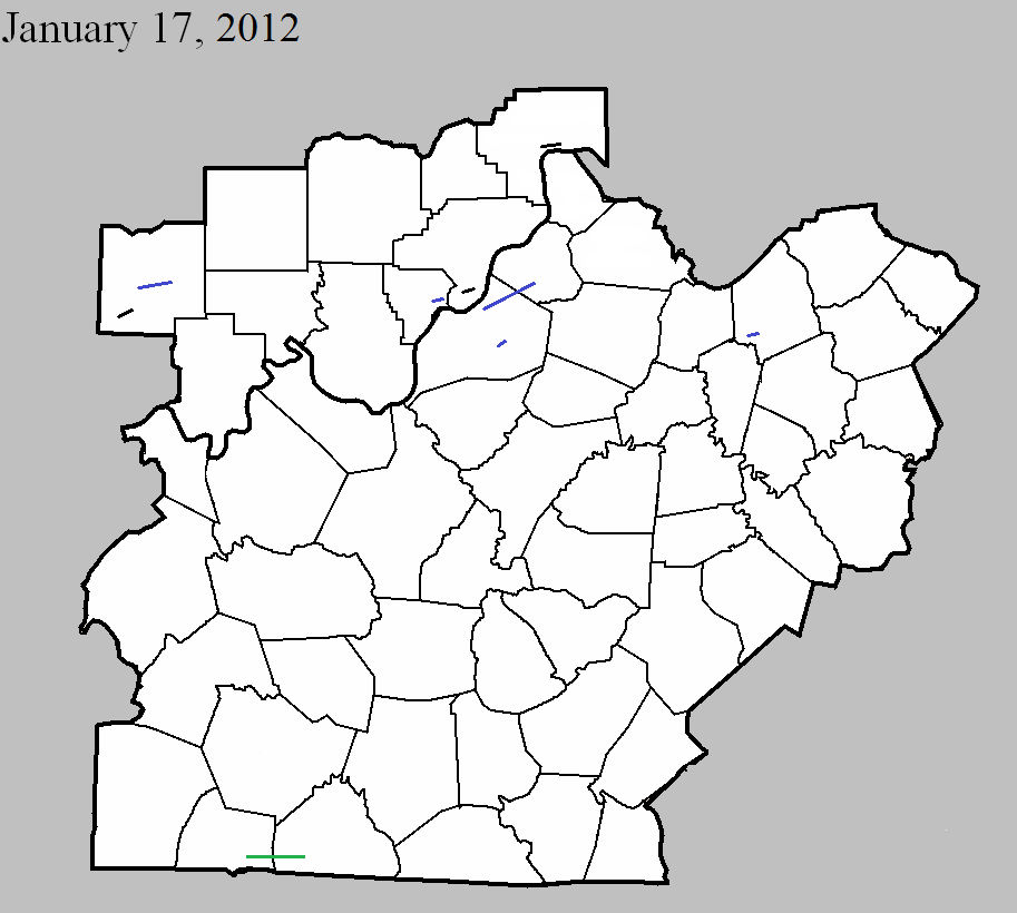
January 17, 2012
County: Dubois
EF-Scale: EF0
Deaths: 0
Injuries: 0
Path width: 25 yards
Path length: 0.1 mile
Time: 9:44am EST
Notes: Touched down 2.7 miles southwest of Huntingburg. An outbuilding was destroyed and debris was scattered for a quarter mile.
January 17, 2012
County: Dubois
EF-Scale: EF1
Deaths: 0
Injuries: 0
Path width: 100 yards
Path length: 9 miles
Time: 9:54am EST
Notes: This tornado touched down three miles northeast of Huntingburg, destroying a barn and blowing several outbuildings off their foundation. The tornado skipped east-northeast for nearly 9 miles across primarily open fields. Structural damage occurred along IN-162 where over 50 feet of a 600 foot long commercial outbuilding was destroyed. One-half mile east of IN-162, numerous outbuildings were damaged and a small grain hopper was toppled. Continuing east-northeast, a roof was blown off of one barn and another barn had roof sections peeled off on St. Anthony Road West. Occasional uprooted and snapped trees occurred for an additional 5 miles before the tornado dissipated after destroying a 40 by 50 foot tool shed 1.6 miles south-southeast of Celestine.
January 17, 2012
County: Jefferson IN
EF-Scale: EF0
Deaths: 0
Injuries: 0
Path width: 60 yards
Path length: 0.3 mile
Time: 10:40am EST
Notes: An EF-0 tornado touched down at the Madison Municipal Airport. Damage was confined to IMS Lane. The tornado touched down briefly along this path and moved an at least 500 pound dumpster 35 feet southeast. It also moved a Beechcraft/King Air plane 10 degrees and the nose gear was broken. The airport operations building had a disabled awning and post. Part of a hangar`s siding came off with siding and insulation up in trees. Several trees were snapped along the narrow path. A witness saw the swirl as the tornado touched down.
January 17, 2012
County: Floyd
EF-Scale: EF1
Deaths: 0
Injuries: 0
Path width: 50 yards
Path length: 1.2 miles
Time: 11:00am EST
Notes: EF-1 tornado first touched down on East Riley Rd. in Floyds Knobs, where a garage was destroyed. The tornado continued east across the Knobs toward Binford Rd, where it took multiple trees down. The tornado crossed Paoli Pike just north of I-265 and caused roof damage at the Knob Point Apartments.
January 17, 2012
County: Clark IN
EF-Scale: EF0
Deaths: 0
Injuries: 0
Path width: 30 yards
Path length: 1.9 miles
Time: 11:06am EST
Notes: An EF-0 tornado first touched down at the Wal-Mart parking lot on the northwest corner of the Veteran`s Parkway near I-65. A vehicle was turned over on I-65, then the tornado skipped over an area before coming down again on a subdivision to the east, with damage occurring along Belmar Dr and Meadows Dr as well as at the intersection of Kingsfield St and Crown Ct. It took down several fences, with evidence of cyclonic circulation. It lifted again before coming down and taking the roof of a barn on Armstrong Rd.,where the tornado ended.
January 17, 2012
Counties: Jefferson KY, Oldham
EF-Scale: EF1
Deaths: 0
Injuries: 1
Path width: 250 yards
Path length: 8.2 miles
Time: 11:12am EST
Notes: The tornado touched down near the intersection of I-264 and Brownsboro Road. The tornado tracked northeast to near the intersection of Hurstbourne Lane and Brownsboro Road where it briefly lifted. The tornado then reformed and crossed I-265 and continued to the east-northeast through several subdivisions north and northeast of Fincastle. The tornado crossed into Oldham County, moving through Orchard Grass Hills and lifting at the northern tip of Clore Lane. Damage indicators along the path of this tornado included multiple softwood trees down, minor shingle damage to homes, a side wall downed in a large indoor tennis facility, and a barn roof collapse. An injury occurred as the tornado crossed I-265 when two semi trailers were blown over. The driver of one of the trucks was injured.
January 17, 2012
County: Jefferson KY
EF-Scale: EF-1
Deaths: 0
Injuries: 0
Path width: 90 yards
Path length: 0.2 mile
Time: 11:20am EST
Notes: An EF-1 tornado touched down just to the north of the intersection of Stony Brook Drive and Hurstbourne Parkway. The tornado traveled north-northeast along Stony Brook Drive and lifted near the intersection of Stony Brook and Laverne Drive. Numerous trees were snapped along the path. Siding and shingles were blown off of multiple houses. On Michael Edward Drive the garage door was blown in on a detached garage and the roof was lifted off and shifted a foot.
January 17, 2012
County: Scott KY
EF-Scale: EF-1
Deaths: 0
Injuries: 0
Path width: 75 yards
Path length: 0.5 mile
Time: 12:12pm EST
Notes: This tornado touched down at 338 Soards Road and moved northeast, lifting as it began to cross a small lake. A well-anchored 50x20 three bay barn was destroyed and scattered in three directions. A 20x30 barn was also destroyed, and a third small barn along the path was damaged. Numerous trees were blown down, snapped, or uprooted. Fences were torn down as well. This survey was conducted by personnel from both the NWS and emergency management from Franklin and Scott Counties.
January 17, 2012
Counties: Simpson, Allen
EF-Scale: EF-2
Deaths: 0
Injuries: 0
Path width: 150 yards
Path length: 9 miles
Time: 12:20pm CST
Notes: This tornado touched down near Hickory Flat Road just south of its intersection with Hickory Flat-Ridge Road in Simpson County where about a dozen trees were uprooted. The most significant damage occurred near the intersection of McKendree Church Road and Highway 100 where a well constructed brick house completely lost its roof. Multiple barns, garages, and outbuildings were destroyed here as well. Nearly a complete roof of one outbuilding was project 1/2 mile to the east. Another area of significant damage was at the intersection of Highway 100 and Reeder School Road (near the Simpson/Allen County line) where a house had significant roof damage and had an exterior wall blown out. A jeep in the driveway was blown into the house and a camper was blown from the driveway across the road with debris scattered through the field beyond. Damage continued east into Allen County with the last evidence of damage at Walker Chapel Road about a mile south of Highway 100.


 Weather Story
 Weather Map
 Local Radar
 Follow us on YouTube