Overview
|
Fast Facts: A supercell thunderstorm developed over Will County, Illinois in the very early morning hours of August 17 shortly after 2 a.m. This storm would end up sustaining itself for well over an hour as it moved into northwest Indiana. The storm was substantially deep and very well organized, a combination that resulted in large hail and severe winds. While severe storms certainly can produce both, to happen concurrently in the same location is much more rare especially with hail of 1.5" and larger and winds of 70+ mph. This storm had this based on reports, degree of damage, and radar signatures. Hail and wind damage occurred from Peotone, IL in Will County to Wheatfield, IN in Jasper County. |
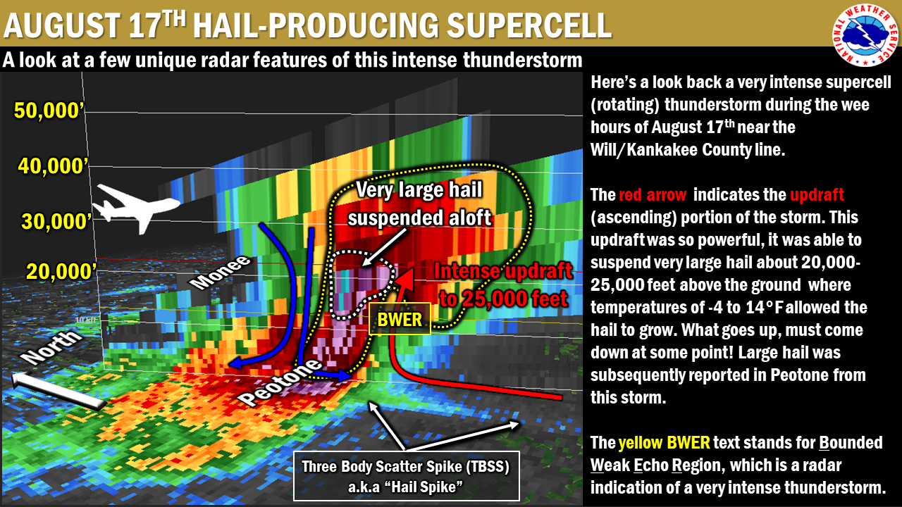 NWS Chicago radar (KLOT) cross section of the powerful thunderstorm. |
Storm Reports
PRELIMINARY LOCAL STORM REPORT
NATIONAL WEATHER SERVICE CHICAGO/ROMEOVILLE IL


..TIME...   ...EVENT...      ...CITY LOCATION...     ...LAT.LON...
..DATE...   ....MAG....      ..COUNTY LOCATION..ST.. ...SOURCE....
            ..REMARKS..

0230 AM     HAIL             PEOTONE                 41.33N 87.80W
08/17/2019  M1.50 INCH       WILL               IL   LAW ENFORCEMENT

0230 AM     TSTM WND GST     PEOTONE                 41.33N 87.80W
08/17/2019  E75.00 MPH       WILL               IL   LAW ENFORCEMENT

0236 AM     HAIL             PEOTONE                 41.33N 87.80W
08/17/2019  M1.75 INCH       WILL               IL   TRAINED SPOTTER

0236 AM     TSTM WND GST     PEOTONE                 41.33N 87.80W
08/17/2019  M63.00 MPH       WILL               IL   TRAINED SPOTTER
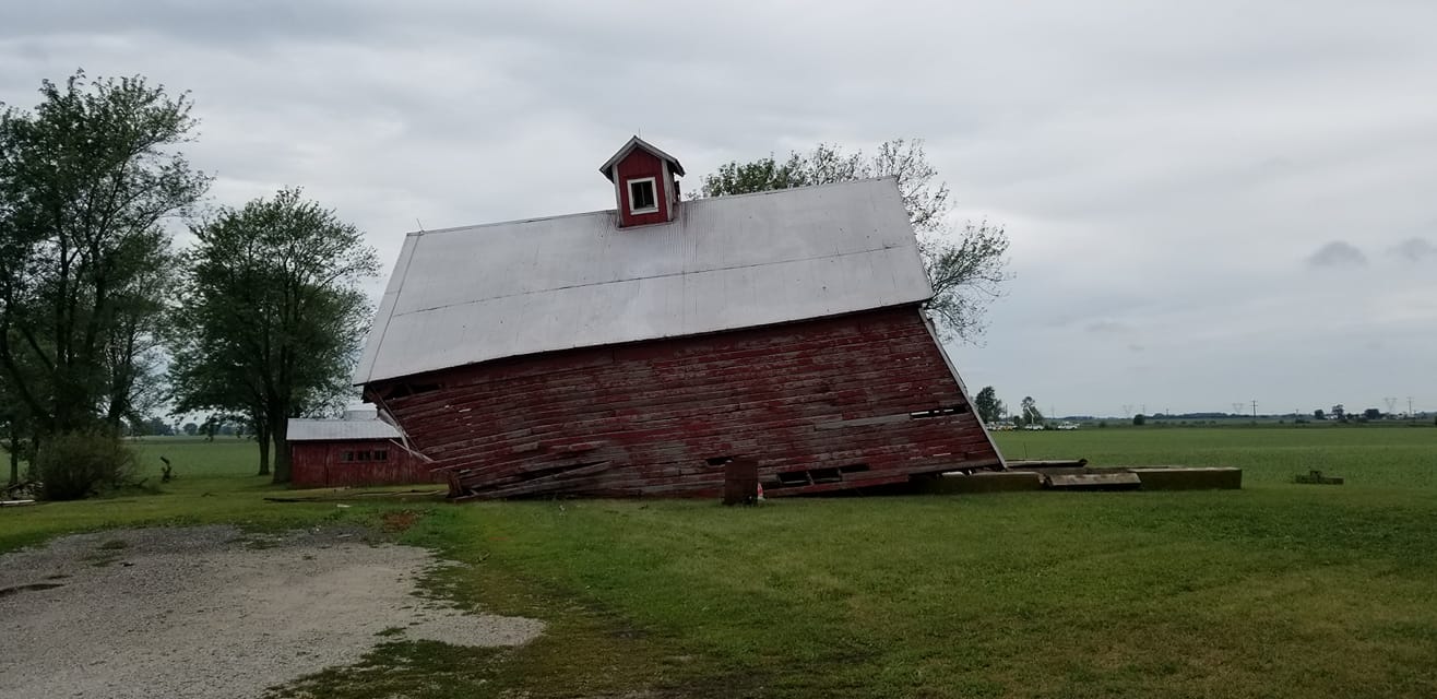
0244 AM     TSTM WND DMG     4 SW BEECHER            41.30N 87.68W
08/17/2019                   WILL               IL   PUBLIC

            FACEBOOK PHOTO OF OLD BARN BLOWN OFF OF ITS
            FOUNDATION. TIME ESTIMATED BASED ON RADAR.
0246 AM     TSTM WND DMG     3 S BEECHER             41.30N 87.63W
08/17/2019                   WILL               IL   PUBLIC

            TWITTER PHOTO OF A LARGE (LIKELY 2 FOOT
            DIAMETER) TREE LIMB DOWN IN SOLLITT. TIME
            ESTIMATED BASED ON RADAR.
0254 AM     TSTM WND DMG     GRANT PARK              41.24N 87.64W
08/17/2019                   KANKAKEE           IL   TRAINED SPOTTER

            MULTIPLE 6 INCH DIAMETER BRANCHES SNAPPED
            OFF HEALTHY TREES. 2 FOOT DIAMETER TREE
            DOWNED. REPORT RELAYED VIA HAM OPERATOR ON
            NWSCHAT.
0330 AM     TSTM WND DMG     DEMOTTE                 41.19N 87.20W
08/17/2019                   JASPER             IN   TRAINED SPOTTER

            TRAINED SPOTTER REPORTS BRANCHES DOWN AND
            ESTIMATED 60 MPH WIND GUSTS IN DEMOTTE.
0338 AM     TSTM WND DMG     1 SSE WHEATFIELD        41.17N 87.04W
08/17/2019                   JASPER             IN   PUBLIC

            FACEBOOK PHOTOS OF MULTIPLE TREES SNAPPED IN
            SEVERAL LOCATIONS NEAR WHEATFIELD. TIME
            ESTIMATED BASED ON RADAR.
Photos
 |
 |
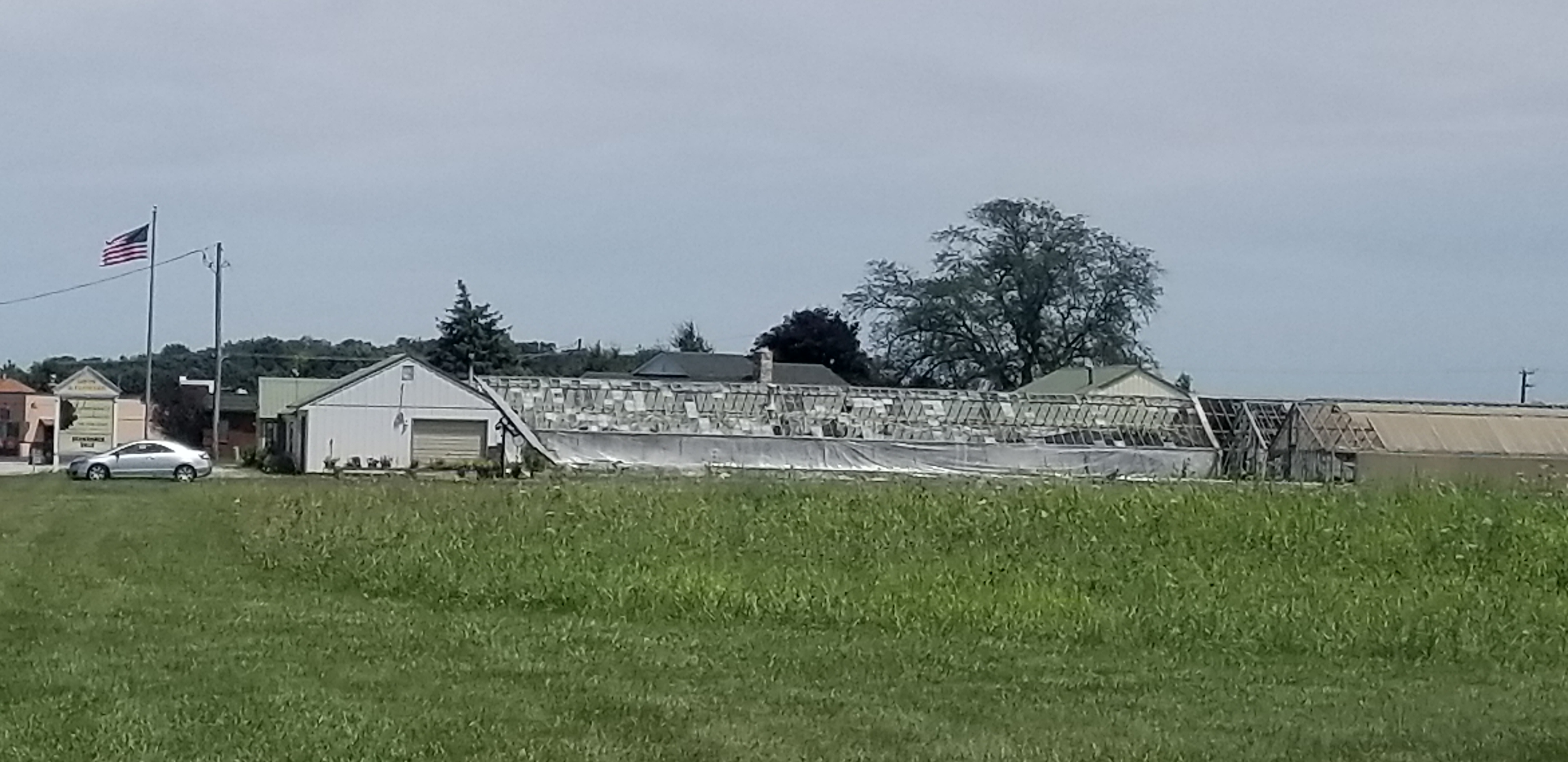
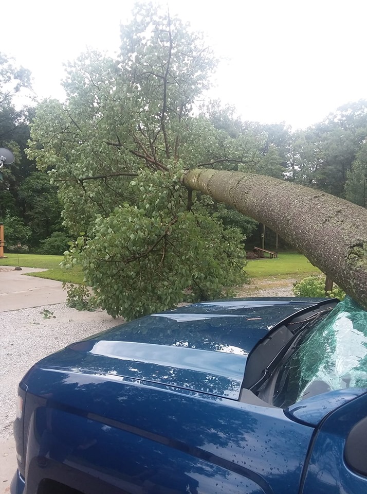
| Peotone, IL taken by Mike Shivers | Peotone, IL greenhouse damage by combination of hail and wind, taken by Patrick Pahl |
 |
 |
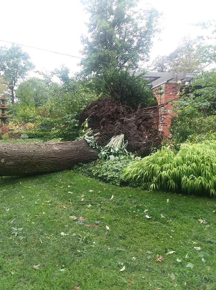 |
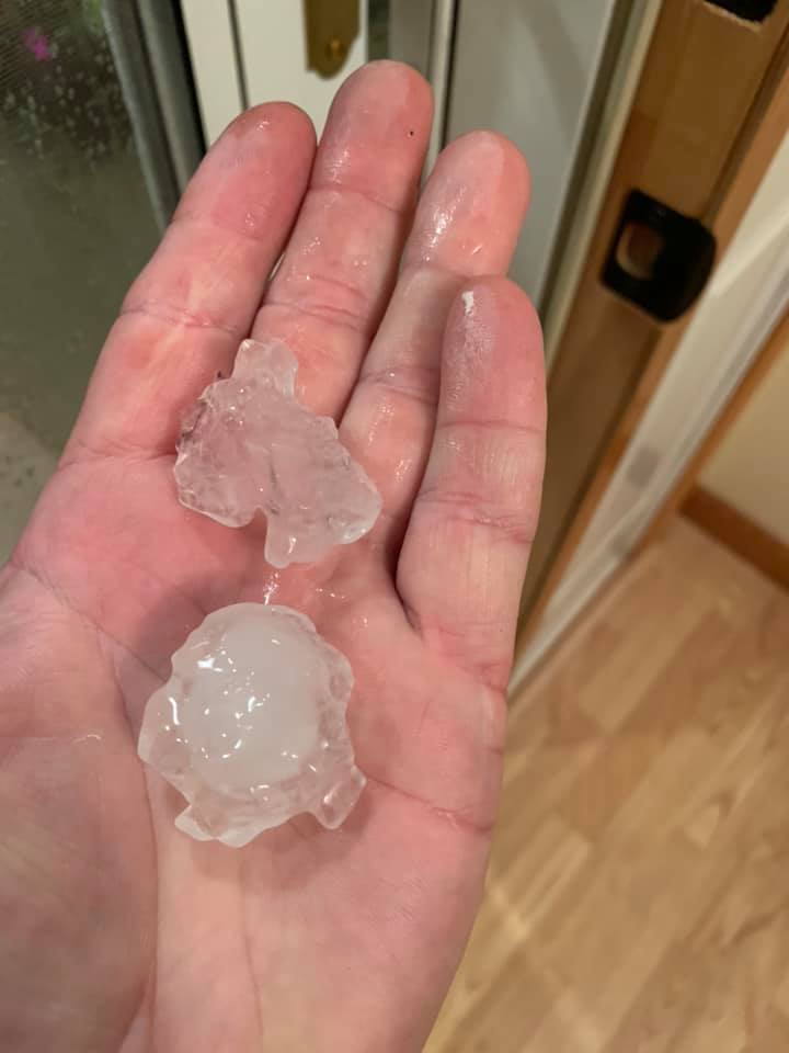
| Hail in Peotone, IL taken by Mike Shivers | Wind damage in Wheatfield, IN taken by Joshua Culley | Wind damage in Wheatfield, IN taken by Joshua Culley |
Radar
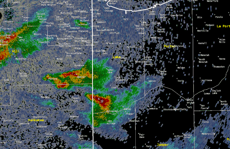 |
| Radar loop of supercell storm from 2-4 a.m. on August 17, 2019. |
 |
Media use of NWS Web News Stories is encouraged! Please acknowledge the NWS as the source of any news information accessed from this site. Additional recaps can be found on the NWS Chicago Past Events Page |
|


 Follow us on YouTube