National Weather Service personnel conducted a survey of damage as a result of severe thunderstorms that moved through Carol Stream and Glendale Heights on Saturday evening, March 31, 2007, and have concluded that a microburst was the cause of the damage. The damage occurred across an area about ½ mile long and 250 yards wide, just to the east of Schmale Road near the intersection with North Avenue.
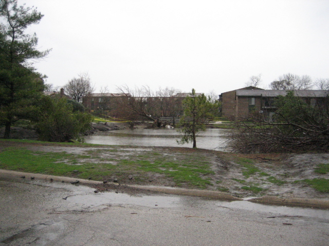
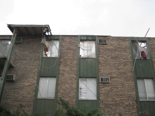
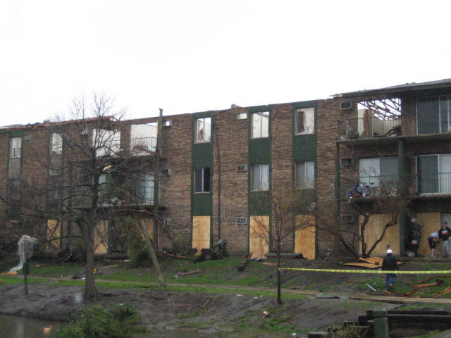
The most severe damage occurred at the Covered Bridges Apartment complex east of Schmale Road between Willow Woods Drive and Burns Street in Carol Stream at 9:49 PM CDT . Here a three story apartment building had a substantial portion of its roof entirely peeled off by winds and many windows were blown out. Two other apartment buildings lost significant portions of their roofs, while 6 other buildings sustained significant roof damage. Many large trees were uprooted around the grounds.
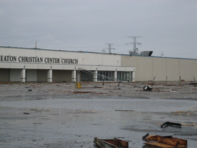
Located adjacent to and to the north of the apartment complex, the Wheaton Christian Center Church sustained significant damage to its roof. This structure was formally a large discount store. Debris from the apartments was strewn throughout the church’s parking lot and onto North Avenue . Further to the north, across North Avenue , a few large trees were uprooted or blown down. There was also significant damage to the roof at the Spraying Systems Corporation, a manufacturing company in Glendale Heights . Here a 60 by 80 foot section of the roof was peeled off on the southeast corner of the structure. There were also two or three holes about 8 to 10 feet across punched in the roof.
Located to the south of the Covered Bridges complex, there was damage to the roof façade on a medical office building located along the south side of St. Charles Road just east of Schmale Road . Further south, there were trees downed and shingles and small sections of siding peeled up from roofs at two other apartment complexes.
A microburst is a very localized, sudden and violent downward moving rush of divergent air resulting in straight line winds at the surface of the earth. Wind speeds associated with the microburst that struck Carol Stream and Glendale Heights Saturday evening are estimated to have been between 95 mph and 105 mph. There may have been additional localized acceleration of wind at the apartment complex due to funneling between the buildings located to the south and southeast of the three story building that sustained the greatest amount of damage.
Debris from the damage was consistently blown in the same direction (to the north or north-northwest) throughout the damage area, supporting the conclusion of a microburst. Trees that were blown down also fell consistently to the north or north-northwest. Debris were found in some instances more than ¼ mile away from its source (again to the north), yet another testimony to the strength of these powerful thunderstorm winds.
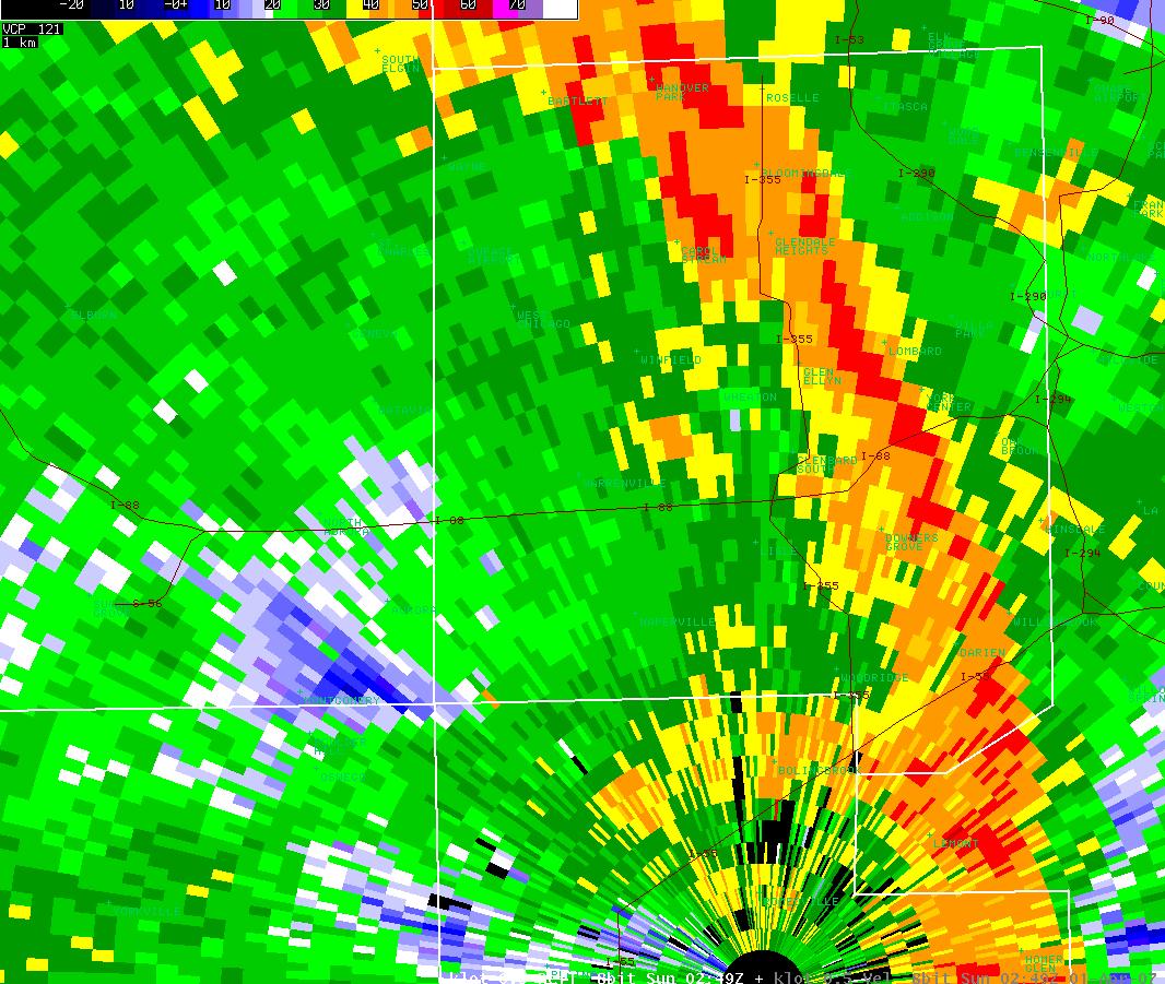
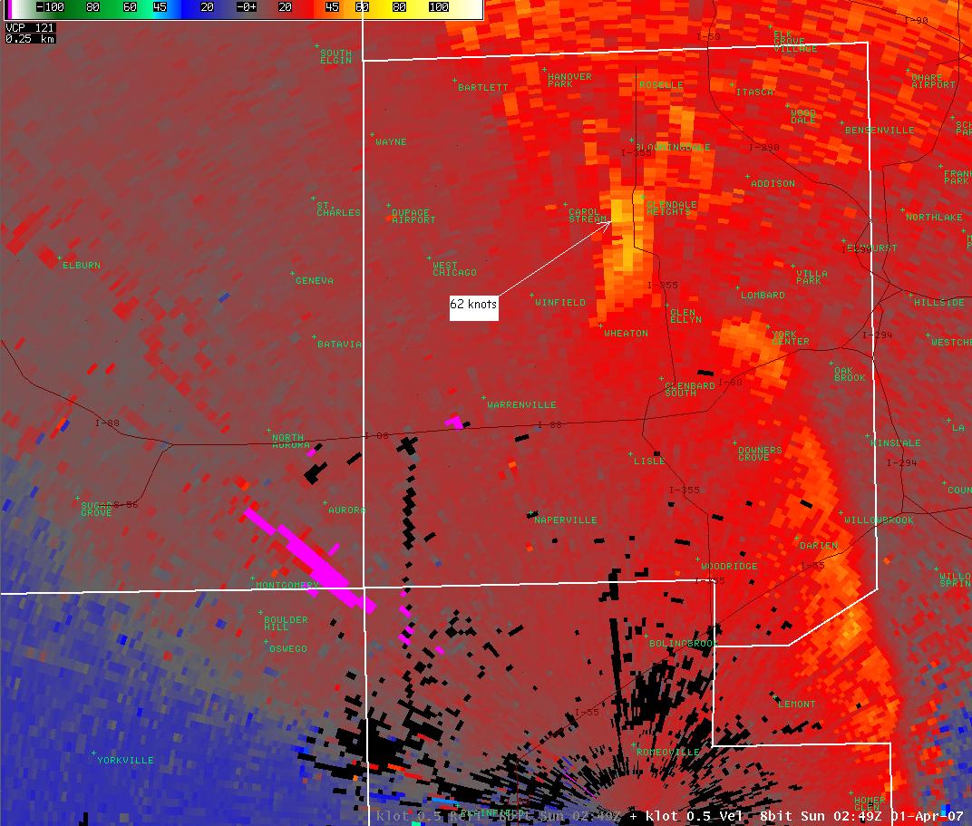
Radar reflectivity (left) and radial velocity (right) images from the NWS Chicago radar located in Romeoville, IL from 02:49 UTC (9:49 PM CDT), the time of the wind damage in Carol Stream. The reflectivity data shows the line of storms extending across DuPage County. The velocity data indicated radial wind velocities above Carol Stream of 62 knots (71 mph), at 1,100 feet above ground level. These winds were estimated to be higher closer to the ground. Warm colors indicate motion away from the radar (located at the bottom, right of center of the image) and cool colors indicate movement toward the radar.


 Follow us on YouTube