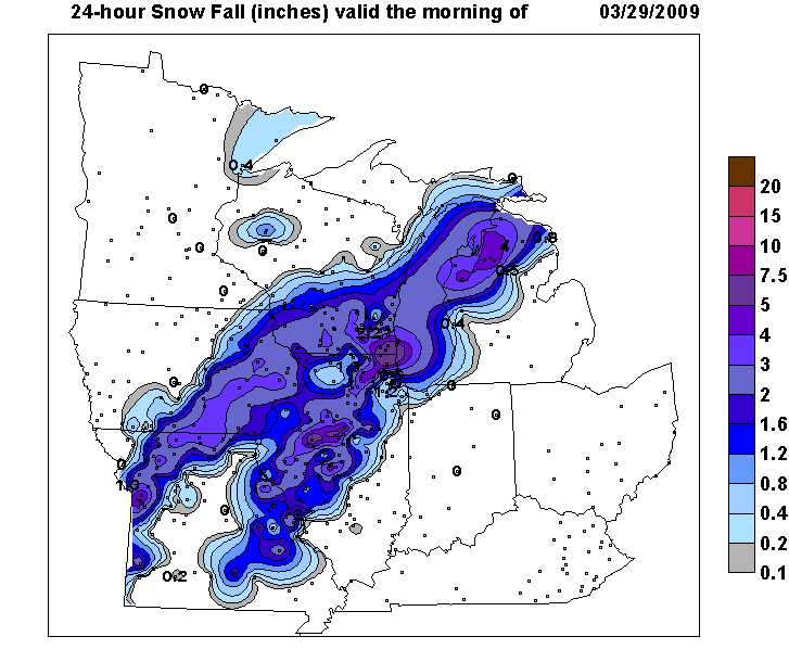
An intense low pressure system brought a wide variety of weather across northern Illinois and northwest Indiana Saturday afternoon through Sunday morning. Precipitation started as rain and sleet, with isolated thunderstorms Saturday afternoon. Rain, mixed at times with some freezing rain, sleet and wet snow, continued into Saturday night with isolated thunderstorms. Precipitation gradually changed over to all wet snow from northwest to southeast late Saturday night into Sunday morning, with many areas picking up a dusting to a slushy inch or two of wet snow. There was a narrow band of heavier snowfall that occurred from LaSalle county northward into Kane and Dekalb counties, then northeast into the northern suburbs of Chicago. Snowfall within this band generally ranged from 2-5 inches, however the northern and far northwestern suburbs of Chicago did pick up between 5 and 8 inches of heavy wet snow. Strong winds prevailed throughout the storm, resulting in large and battering waves along the Lake Michigan shoreline. The strong winds and heavy wet snow accumulating on trees and powerlines caused a large number of power outages Sunday morning, particularly in the western and northern Chicago suburbs where thousands of customers were left without power.
Here's a map depicting where the band of heaviest snow fell across northern Illinois and northwest Indiana...

| Location |
Snowfall Total |
| Cary |
7.2" |
| Gurnee |
7.1" |
| Bull Valley |
6.8" |
| Mundelein |
6.6" |
| Wonder lake |
5.7" |
| St. Charles |
5.4" |
| Wauconda |
5.0" |
| Dekalb |
5.0" |
| Chicago Midway 3 SW |
2.5" |
| Rockford |
1.8" |
| Romeoville NWS office |
1.5" |
| Chicago O'hare |
1.2" |
Expanding to a regional view of the storm, the highest snowfall amounts fell in two rather distinct bands. The first occured Saturday afternoon and evening from west central and northwest Missouri northwestward across south central and northeast Iowa into southwest and east central Wisconsin. A second heavier band of snow developed late Saturday night and into early Sunday morning from west central to northeast Illinois and far southeastern Wisconsin, across Lake Michigan to northern lower Michigan.
As cloudiness cleared out Sunday afternoon, the swath of heavy snowfall that occurred across northern Illinois associated with the second heavier snow band showed up quite nicely on visible satellite imagery...

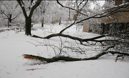
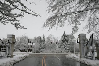
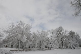
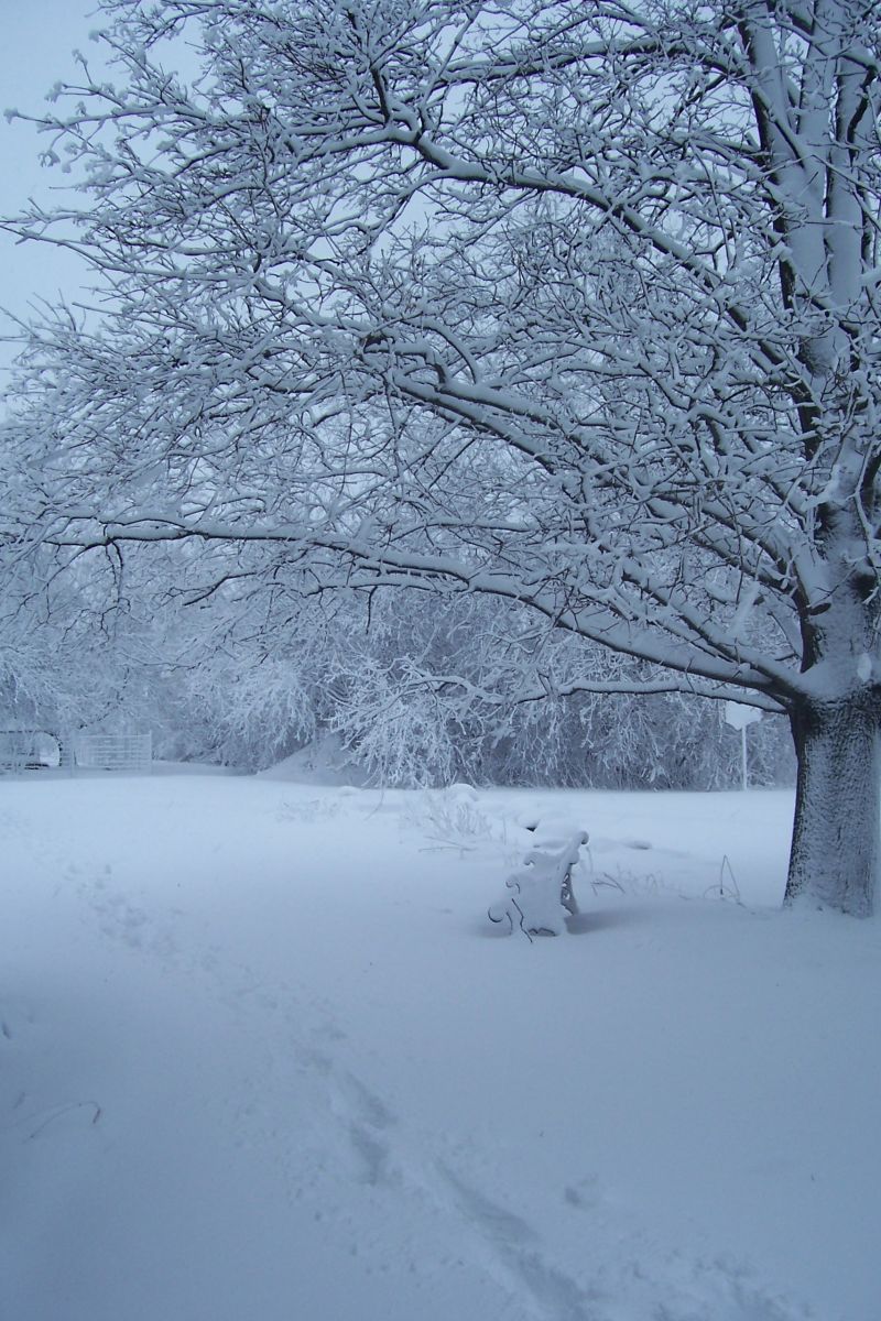
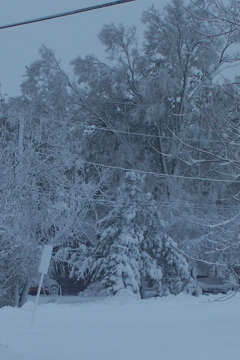
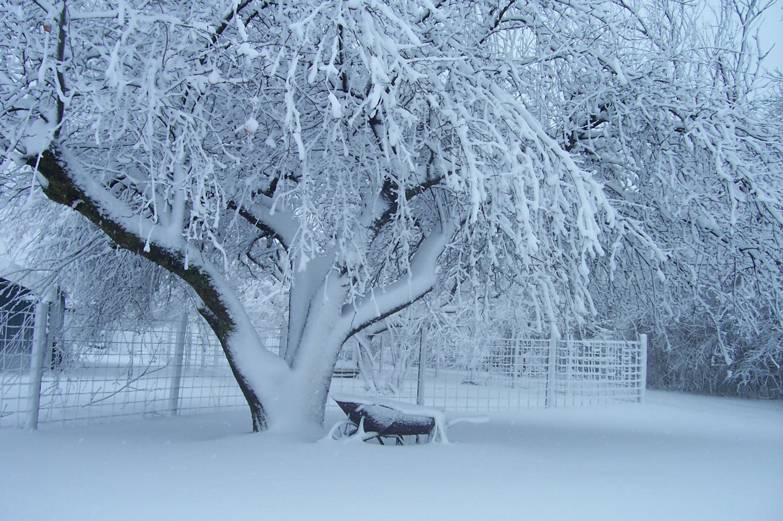
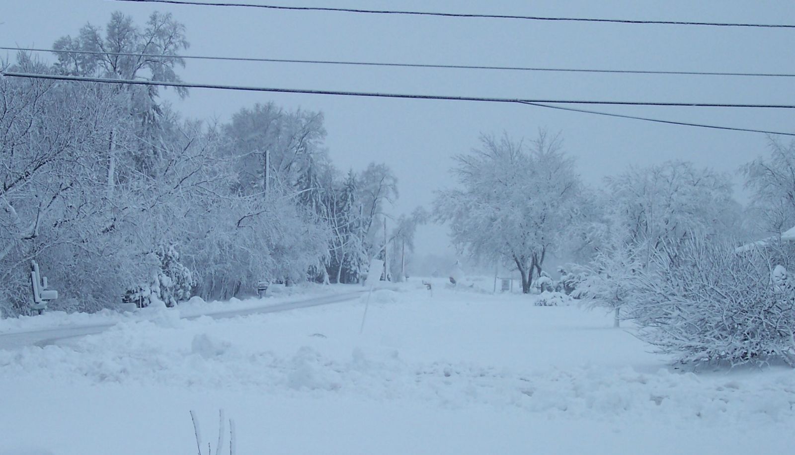
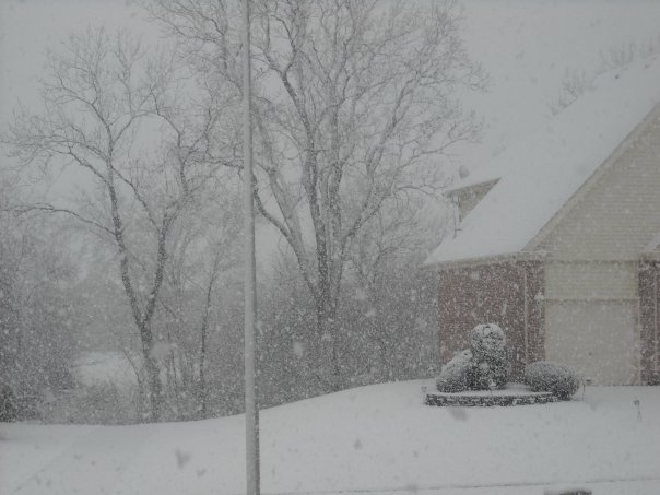
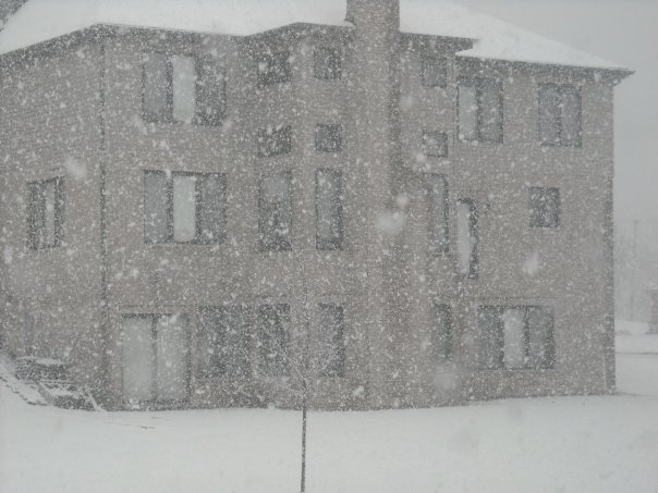
The snow that fell was heavy and wet causing it to stick to trees and powerlines. This created a very winter-like, photogenic looks to the area this morning. Here are some pictures that were taken during and following the late season snowstorm...
Here are a few taken in and around the Northern Illinois University Campus by Travis Carlson:
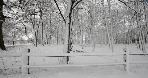
The following pictures are from Beach Park, IL and were sent to us by one of our CoCoRaHS observers, Penny Latona:
Finally, these pictures are from Andrei Evbuoma taken during the height of the snow in Hazel Crest, IL:
Strong onshore winds occurred near the Lake Saturday night with gusts between 40 and 50 mph common. Here are the peak gusts along the shore during the storm:
| Location |
Peak Wind Gust (mph) |
| Chicago Harrison-Dever Crib |
49 |
| Waukegan Harbor |
48 |
| Kenosha WI |
47 |
| Burns Harbor |
43 |
| Calumet Harbor |
39 |
|
|


 Follow us on YouTube