Ring-of-Fire Storms and Floods
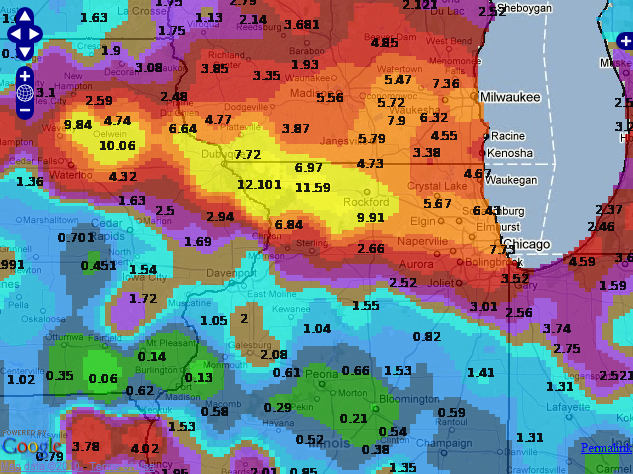
Map of 72 hour precipitation ending on July 25
Meteorological Setup:
A large sub-tropical ridge developed early in the week across Texas and drifted east towards the Southeastern United States. (Fig. 1) As the 500hPa ridge drifted east, a series of weak low pressure systems traversed the Central Plains northeast into the Upper Midwest. A by-product of the 500hPa positioning on 22Jul2010, was a steady feed of Gulf of Mexico moisture to the Northwest of the ridge. (Fig. 2)
Strong convective activity is commonly found when subtropical ridges occur, especially during the warm seasons. Galarneau and Bosart (2006) coined the term "ridge rollers" for convective systems
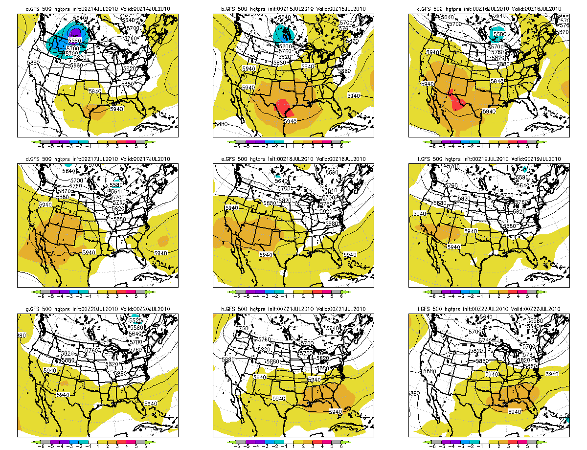
Figure 1. 500hPa-ridge across the Southwest United States becoming centered across the Southeast United States 22July 2010.
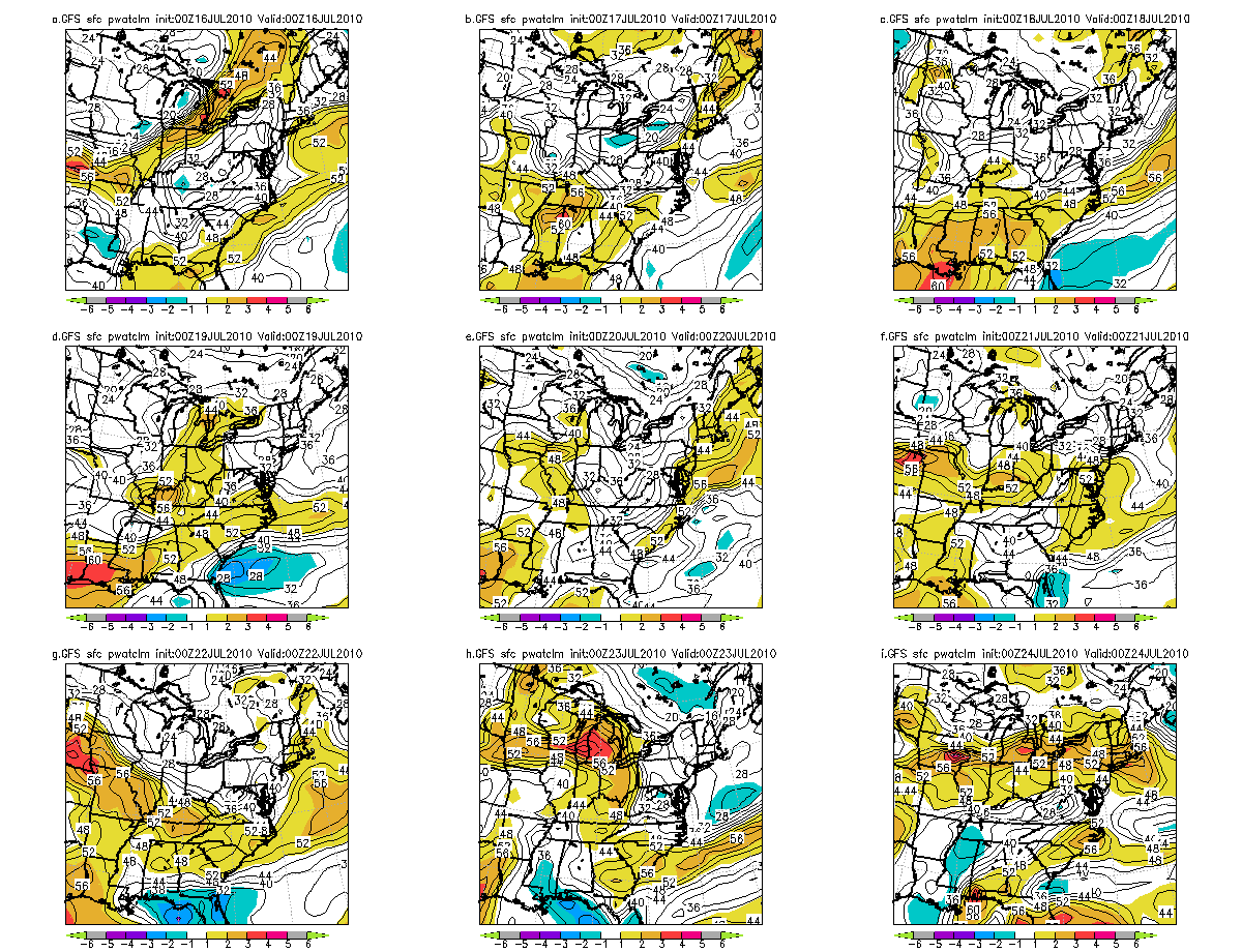
Figure 2. GFS Precipitable water anomalies.
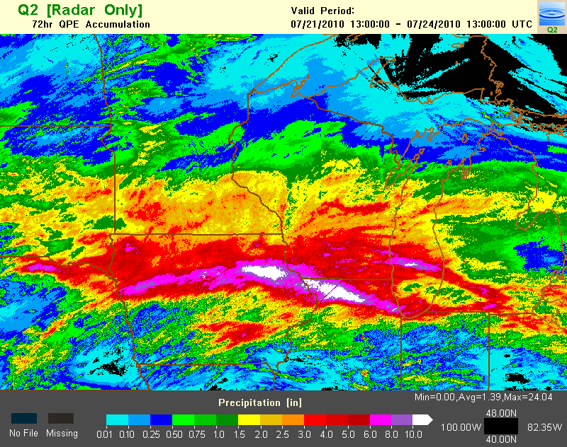
Figure 3. Multi-sensor estimated rainfall for the period of 21-24 July 2010.


 Follow us on YouTube