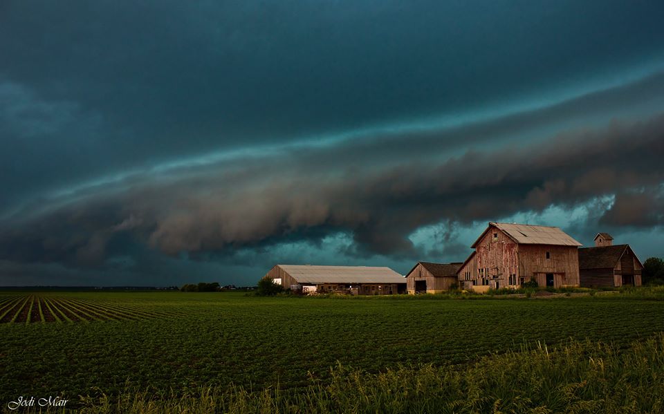
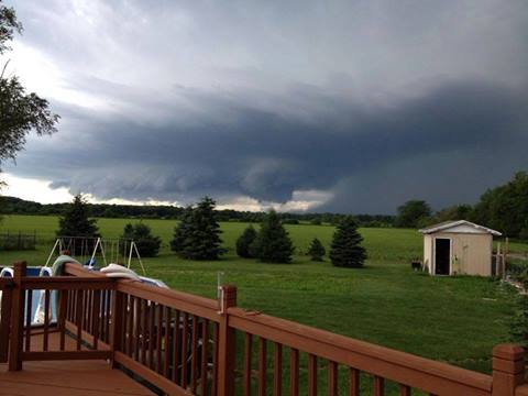
Above photo of a shelf cloud, indicative of strong winds, near Sugar Grove on June 21st. Courtesy of Jodi Mair.
Storm Reports | Science | Lake County | Iroquois County | Rainfall | Wind | Warnings | Other Links
|
|
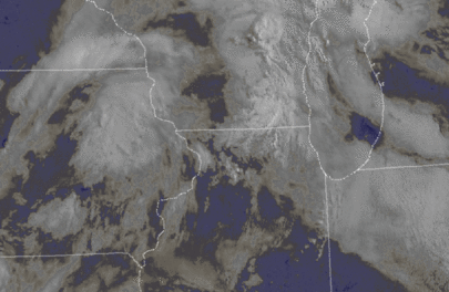
Saturday June 21st began with widespread stratus and fog across much of northeast Illinois and northwest Indiana. This would give way to breaks of sunshine by late morning. The warming combined with the muggy near-surface conditions led to quick destabilization. As an upper level disturbance rode atop this air mass it would help to spark thunderstorms. You may have noted the rapid building of deep cumulonimbus clouds across the sky early in the afternoon? Well, that was that process of storm initiation! The triggering upper disturbance was compact and strong due to convective-enhancement, in other words stronger because of earlier storms. Thanks to persistent storms that had occurred late Friday night into early Saturday morning across western Iowa, this aided the potency of the upper level disturbance. Such an upper level feature is often referred to as a mesoscale convective vortex (MCV). You can note this in the visible satellite loop below.
|
GOES Visible Satellite Loop: 8 am - 4 pm |
|
|
|
Click image to enlarge |
The MCV traversed east overriding the forecast area during peak heating. This served as an impetus for thunderstorms across northern Illinois, as well as leading to stronger deep layer and possibly even low-level shear. Organized storms were more supported in such an environment. Some of these storms had bowing segments, capable of very strong winds, and numerous were very efficient rain producers due to high moisture content in the atmosphere. These storms slowly evolved southeast of the area by 10 pm.
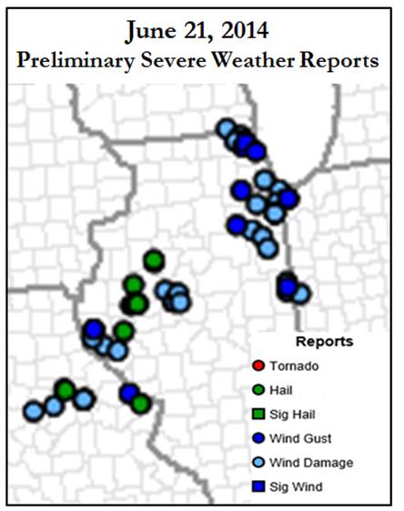
Two of the storms in the span of the event, one across Lake County, IL and the other Iroquois County, were well-defined supercells, each exhibiting deep rotation and for periods low-level rotation. Because of this, these prompted tornado warnings from the NWS. While no tornadoes were confirmed with these storms, they did bring damaging winds that downed trees as well as caused structural damage in Iroquois County.
|
Lake County, IL Storm: 4 pm - 5 pm |
|
|
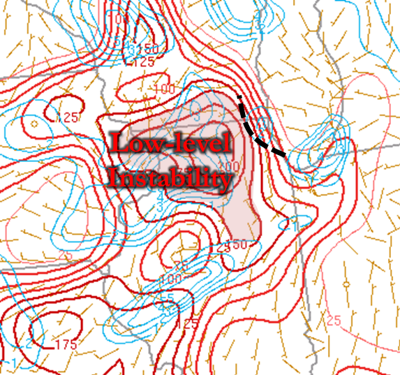
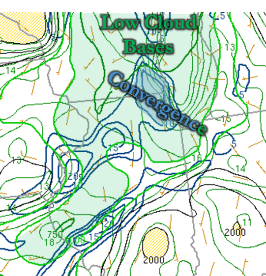
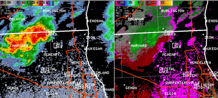
The storm across Lake County developed into a supercell storm and lasted as such for just over an hour from around 4 to 5 pm. It exhibited rotation which was also fairly shallow to the ground. A few parameters in place to help that were continued high moisture, thus helping low-level instability. There also was a lower cloud base to the storm, helped in part to the high dew points. A boundary was also analyzed as seen in the bottom image. Together these elements can be conducive for rotating updrafts to exist lower within the storm.
|
4 pm: 0-3km CAPE & Surface Winds & Vorticity |
4 pm: Low-level Moisture Convergence & Approximate Cloud Base Height (LCLs) |
 |
 |
|
High values of 0-3km CAPE (in excess of 150 J/kg) were bordering this boundary. Any pre-existing vorticity along such boundaries can more readily be stretched by a strong updraft, and some of that likely happened for visible rotation within the cloud base of the supercell that afternoon. |
This model analyzed image reflects what observations were indicating in the wind field, with convergence of the surface winds across western and central Lake County. In addition, low heights of condensation (green shade), or approximate cloud base height, can aid in rotation within the storm to more readily reach to the ground. |
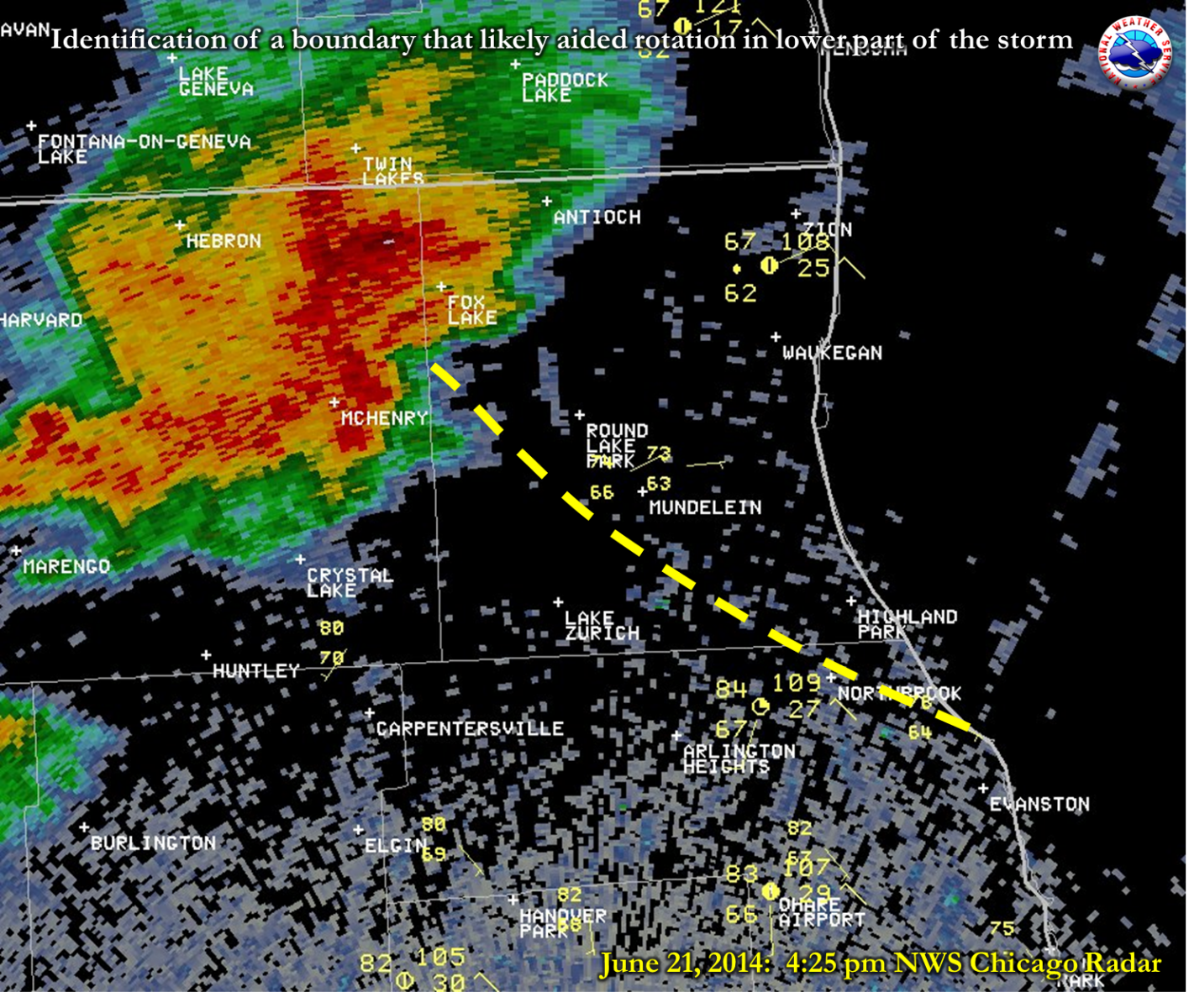
The storm also had an even more apparent signature of strong winds wrapping around its western and southern side. You will note this in the bowing structure on the radar loop in the radar section. The wind damage reports received at the NWS with this storm were all located near this wind area as opposed to under the low-level rotating part of the storm. Thus it is suspected that straight-line winds were the culprit behind the mainly tree damage that occurred there. To say why a tornado likely did not occur is challenging, although it may have had to do with lake-cooled air being drawn into the storm. Such lower temperature air as inflow has been shown to be far less conducive for a supercell storm to produce a tornado.
This supercell was nearly the same time as the Lake County one. This storm had severe structure capable of damaging winds, large hail, and several times brought low-level rotation as it cycled through its southeast path.
|
Iroquois County, IL Storm: 4 pm - 5:30 pm |
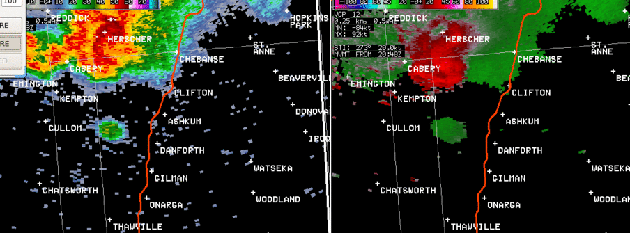 |
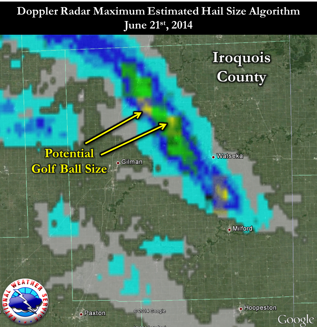
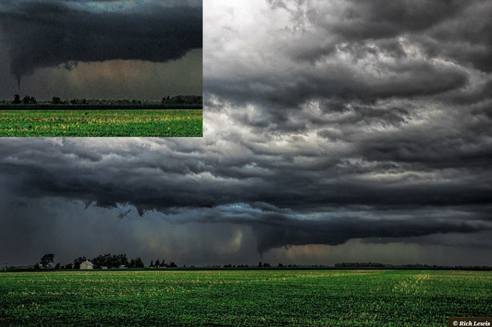
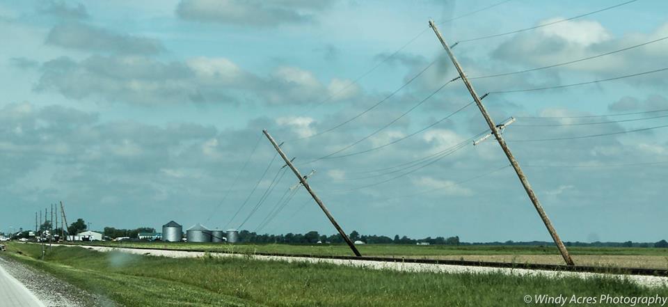
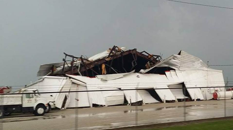
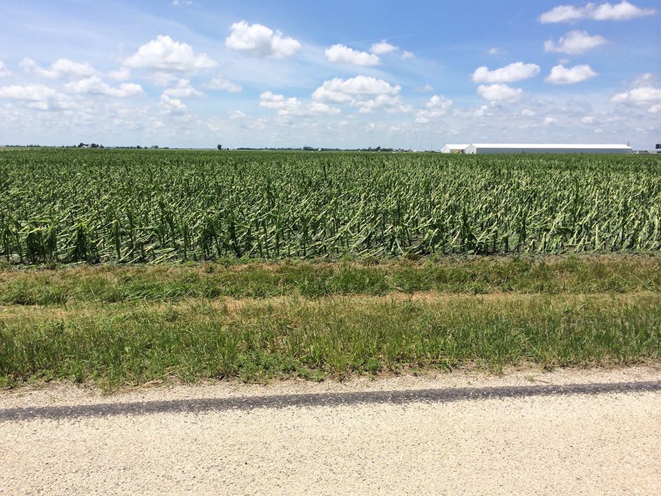
Photos from Iroquois County indicated the presence of a well-defined rain-free base, and at times a wall cloud. It appears there was at least a funnel cloud with this storm northeast of Crescent City based on a photo received (see below). Just as with the Lake County supercell, the reported damage appeared to be in the area of the storm most favored for straight-line winds. So as of June 23rd, it is likely no tornado occurred with this storm. However, the straight-line winds were very likely in excess of 80 mph based on some of the damage observed. In addition, hail likely to the size of golf balls, possibly coincident with the severe winds, caused extensive crop damage near Crescent City.
|
Taken 5 miles east of Clifton. Wall cloud (lowered rain-free base) and possibly a developing shelf cloud to its back left in this photo. |
Taken near Crescent City looking northeast. Apparent funnel cloud. |
|
|
|
|
Photo courtesy of Lynk McTaggart |
Photo courtesy of Rich Lewis |
|
Damage near Crescent City along U.S. Highway 24. |
Taken in Crescent City. |
|
|
|
|
Photo courtesy of Patrick Pahl |
Photo courtesy of Johnathan Martin |
|
Hail damage to crops near Crescent City |
|
|
|
Photo courtesy of Patrick Pahl |
A listing of rainfall totals from this event can be found here.
...HIGHEST OBSERVED WIND GUSTS ON SATURDAY...

THE FOLLOWING IS A LIST OF MAXIMUM OBSERVED WIND GUSTS AT
AUTOMATED SITES ACROSS NORTHERN ILLINOIS AND NORTHWEST INDIANA
ON SATURDAY JUNE 21ST. THESE GUSTS OCCURRED FROM STRONG
THUNDERSTORMS ACROSS THE REGION.

LOCATION                       SPEED     TIME/DATE
------------------------------------------------------
AURORA MUNICIPAL AIRPORT       48 MPH    0540 PM 06/21
CHICAGO EXECUTIVE AIRPORT      46 MPH    0514 PM 06/21
CHICAGO OHARE INTL AIRPORT     41 MPH    0522 PM 06/21
GARY                           40 MPH    0645 PM 06/21
PERU                           39 MPH    0535 PM 06/21
DE KALB                        39 MPH    0515 PM 06/21
CHICAGO MIDWAY AIRPORT         36 MPH    0556 PM 06/21
ROMEOVILLE                     36 MPH    0615 PM 06/21
ROCKFORD                       35 MPH    0430 PM 06/21

SOME HIGHER GUSTS WERE OBSERVED FROM TRAINED STORM SPOTTERS
ON SATURDAY...INCLUDING 70 TO 75 MPH GUSTS IN LAKE COUNTY
ILLINOIS.

$$

MTF
|
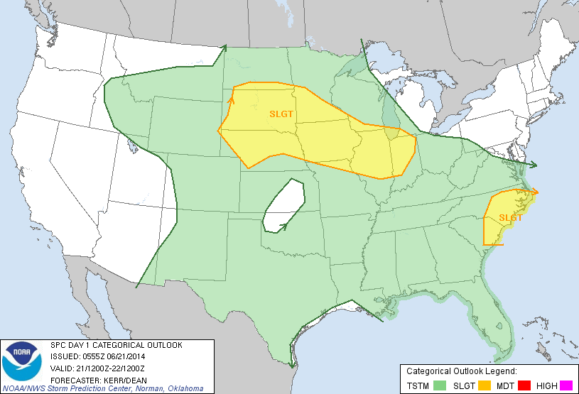
Severe Weather Outlook (Issued at 1 am) |
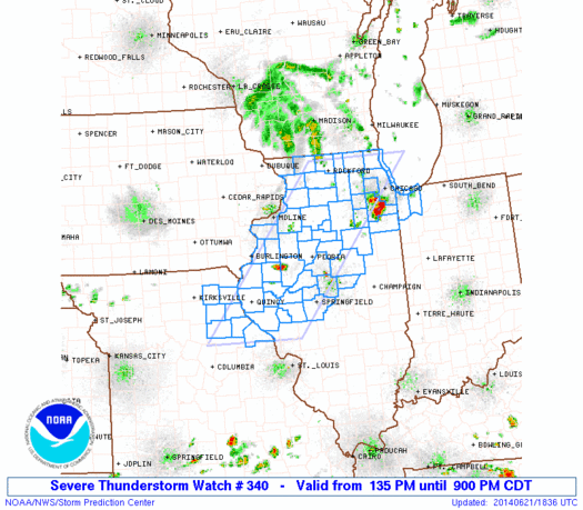
Severe Thunderstorm Watch (issued at 1:35 pm, and expanded southeast at 321 pm) |
|
|
|
|
|


 Follow us on YouTube