Last Map Update: Thu, Apr. 18, 2024 at 6:13:52 pm CDT
 Weather Events |
 Skywarn Program |
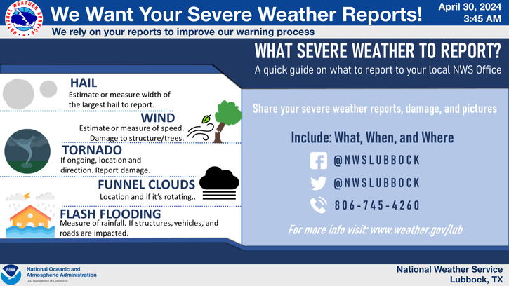
 Submit A Storm Report |
 West Texas Mesonet Data |
 Precipitation Reports |
 Winter Weather |
|
Local Weather History For April 18th...
|
|
1971: Late this night, five funnels reportedly roared over Muleshoe "like a great big train, then touched down
northeast of the city." The tornadoes were all from the same thunderstorm and spaced about two miles apart. They first hit about 3.5 miles northeast of Muleshoe and each tracked about four miles in length damaging a total of 25 farm homes. Two persons were injured and 38 electric and telephone poles uprooted. This same tornadic supercell was believed to have spawned additional tornadoes after midnight near the Hereford, Dawn and Umbarger areas causing over $3M in damage to a portion of Herefords industrial and residential sections. Some accounts speculate that these were perhaps the original tornadoes that developed near Muleshoe.' |


 Local Radar
 Weather Map
 Satellite
 Follow us on YouTube