National Weather Service United States Department of Commerce
Click a location below for detailed forecast.

Last Map Update: Tue, Apr. 23, 2024 at 2:19:49 am CDT
National Weather Service Pueblo, CONational Weather Service Amarillo, TXNational Weather Service Norman, OK
National Weather Service Albuquerque, NMZoom
Out

National Weather Service Fort Worth/Dallas, TX
National Weather Service El Paso, TXNational Weather Service Midland/OdessaNational Weather Service San Angelo, TX

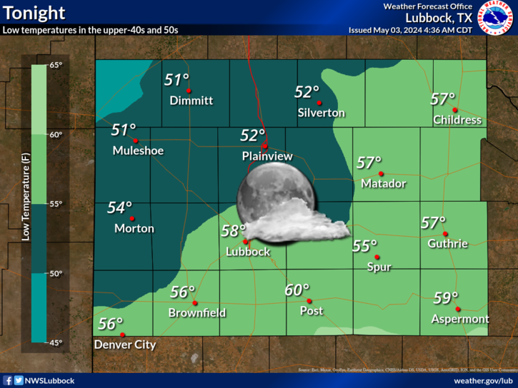
Breezy southerly winds beneath a nearly full moon will provide for a mild night. Temperatures will only drop into the lower to middle 50s for most locations.
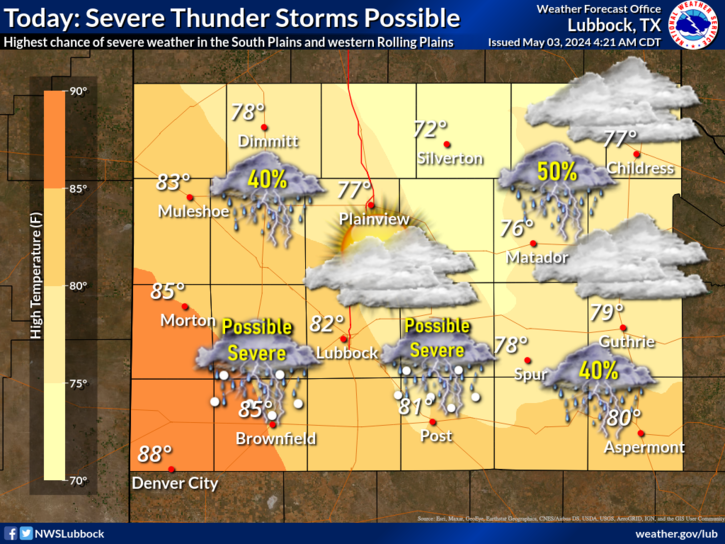
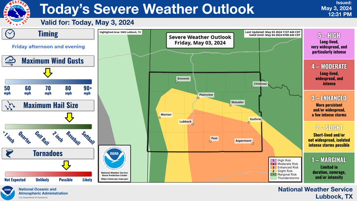
Temperatures will soar well into the 80s, with even a few lower 90s possible, Tuesday afternoon. A weak cold front will sag into the area from the northeast, and in combination with a dryline, could serve as a focus for isolated thunderstorm development during the mid-late afternoon. A storm or two could strength to severe levels, bringing with it the potential for large hail, damaging wind gusts, cloud to ground lightning and brief downpours. Overall storm coverage will be low, so most locations will remain dry.
As a cold front moves south into the area it may trigger the development of a thunderstorm or two Tuesday afternoon, which could become strong to severe. The greatest storm chances (around 20%) will be across the southeast Texas Panhandle and Rolling Plains after 4 pm. Large hail, damaging wind gusts, cloud to ground lightning and brief downpours will accompany the most intense activity, though coverage will be limited.
A dryline will sharpen near the I-27/US-87 corridor by Thursday afternoon. Instability along and ahead of the dryline should be sufficient for scattered strong to severe thunderstorms to develop and move to the northeast. Large hail and damaging wind gusts are the primary threats.
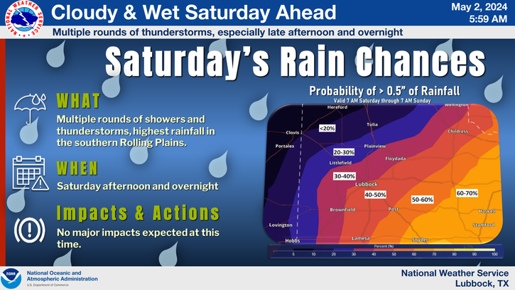
Warm temperatures will be the theme through the rest of the week and on into the weekend. Highs will generally be in the 80s the next five days, even flirting with 90 on Tuesday. In addition, there will be a few opportunities for thunderstorms in and near Lubbock, including Tuesday afternoon/evening, Thursday evening/night and Saturday afternoon/evening. Even better storm chances will exist farther east, off the Caprock, each of those days, along with a slim chance of storms on Wednesday too. It is spring, so if/where storms develop, there will be a chance of severe weather. Currently, Thursday and Saturday are favored for the best chance for scattered severe thunderstorms. Stay tuned!


Local Weather History For April 22nd...
2010: Part of a large tornado outbreak that extended into southeast Colorado, scattered thunderstorms developed over the
central and eastern South Plains region of West Texas late this afternoon and evening. These storms resulted in
significant severe weather, including strong tornadoes, as they impacted portions of the extreme southeastern Panhandle
and the Rolling Plains. Thunderstorms initiated over the central South Plains along and east of a dryline late in the day.
These storms, some exhibiting supercell characteristics, initially became severe and produced large hail and damaging
winds before 6 PM. By 6:20 PM, the first of three tornadoes, two of which were long-lived and significant, developed over
northeastern Motley County. The parent supercell thunderstorm produced two damaging and rain-wrapped tornadoes over
portions of Motley and Cottle Counties. The initial tornado south of Northfield crossed the Motley and Cottle County line
southwest of Cee Vee. This three-quarter mile wide EF2 tornado destroyed windmills and utility poles as it tracked through
rural ranchlands. The second tornado heavily damaged or destroyed three farmsteads south and southeast of Cee Vee and was
rated EF3. Winds were estimated at approximately 140 mph where one home was destroyed east of that community. No injuries
were reported. A second supercell thunderstorm developed south of the initial tornadic storm, and became tornadic near
Swearingen shortly after 9 PM. In addition to tornadoes, numerous reports of large hail up to the size of baseballs were
received. Another Cottle County home was heavily damaged by thunderstorm winds just north of Paducah as convection
organized into a linear complex late in the evening. Also, training thunderstorms repeatedly moved over the Tahoka area in
Lynn County. This resulted in areas of flooding and portions of two U.S. Highways were rendered impassable. In all,
property damages were estimated at $530,000. No injuries were reported.