November 2004 will go down in the record books as the wettest November on record for the area. So far this month Lubbock International Airport has received 5.80 inches. This is the greatest amount for November since records began in 1911. The previous record was 3.45 inches set in November 2001.
Click on the link below to view a Special Weather Statement issued by our office with rainfall totals from stations across the region.
250 pm November 17, 2002 Special Weather Statement
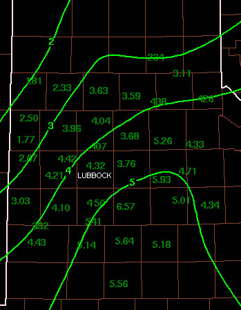
Below is an image of the 4-day rainfall totals in inches from across the area. Some of the area Coop and West Texas Mesonet observations are also plotted.
For the year, Lubbock now stands at 31.71 inches. This is the 3rd greatest yearly total. It is the greatest annual total since the all-time record was set in 1941. Other years with more rainfall include:
40.55 inches in 1941
31.88 inches in 1915 and
31.71 inches so far in 2004
Since the year still has over a month left, we will likely move into 2nd place. Breaking the 40.55 inches set in 1941 will be significantly more difficult.
For the 39 NWS cooperative stations in the area, the average rainfall so far this month is 5.35 inches. This value is 4.48 inches above normal (0.87 inches).
Two primary weather systems were responsible for the record amounts of precipitation this month. Early in the month, around Election Day, a winter storm produced a very wet rain-snow event across the area. Some areas east of the Caprock saw over 2 inches of rain. On the Caprock, heavy rain mixed with and then changed to snow, producing up to a foot of snow, heaviest in a band from Levelland across Lamb, Hale, Swisher, and Briscoe Counties. The second event, which was ended November 17th, was caused by another upper low which approached the area from the west and then stalled. Initially, on Saturday the 13th of November, it was cold enough for considerable snow to fall over areas mostly north and west of a Plainview to Littlefield line. Lubbock briefly had snow mixing with rain Saturday morning, but after that temperatures slowly warmed during the event. The event started Saturday and was slowly ended Wednesday November 17th as the upper low finally began moving east. During this event, the lowest amounts of moisture (including rain and melted snow) occurred over the northwest sections which had 2 to 3 inches. Almost all areas from southeast of a line from Turkey to Plainview, Levelland, and Brownfield had more than 4 inches of rain. Some areas received over 6 inches. South and west of the South Plains heavy rain with some flooding occurred, including over much of the remainder of West Texas and Southeast New Mexico. The Rio Grande in Big Bend still had some flooding November 18th.
As for the effects of such a record breaking precipitation event at this time of year across the South Plains area, many cotton and peanut farmers who haven't been able to harvest their crops will likely be impacted in a very negative manner. Since the rainfall was spread out over so many days, flash flooding was not much of a problem, but the event has produced one of the longest duration river flows into the headwaters of the Brazos in many years. Most flood events on the Brazos start and end within 24 to 30 hours.
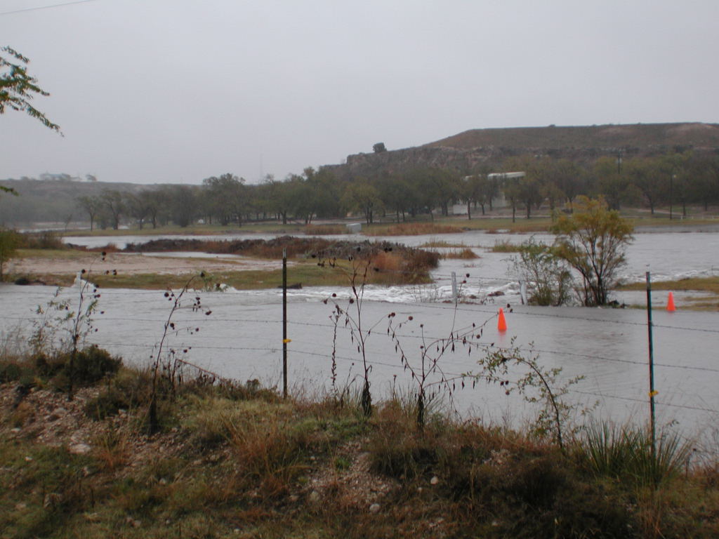
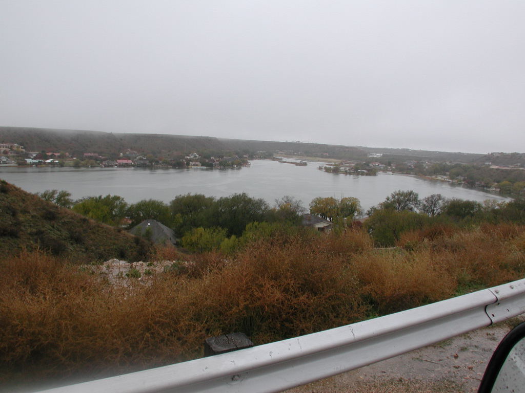
Runoff out of the city of Lubbock, which flows into the North Fork Double Mountain Fork of the Brazos and then through Buffalo Springs and Ransom Canyon, can be seen in the pictures below (click on the image for a larger version).
 |
 |
 |
 |
 |
 |
 |
 |
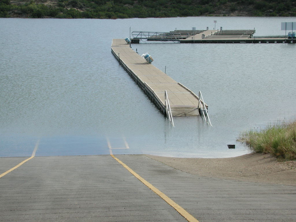
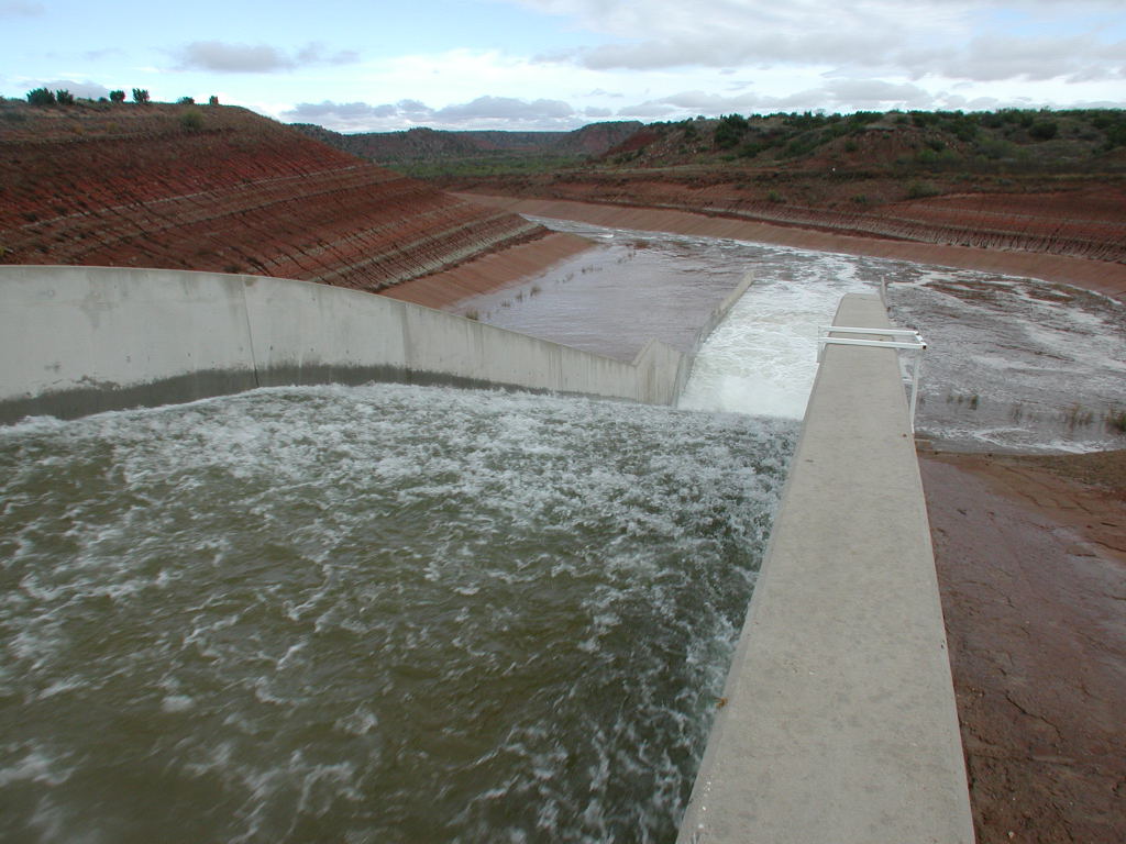
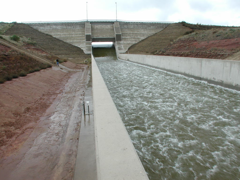
Elsewhere, Lake Alan Henry located southeast of Post now has 43.98 inches of rain so far this year. WOW! The 5 to 6 inches of rainfall over most of the drainage area west of the lake produced a very prolonged high flow into the lake lasting from Sunday through Tuesday. The lake was near conservation capacity at 99 percent or about 115,000 acre-feet of water before the event. By Tuesday the pool elevation had increased nearly 7 feet and was over 6 feet deep flowing over the spillway at the dam. The water stored in the lake peaked near 117 percent of conservation capacity, which was around 135,000 acre feet. This equated to just over 6.5 billion gallons (20,000 acre feet) of water during this event. That's a lot of water, especially compared to the average annual inflow to the lake which is around 18,000 acre-feet, but is sometime less than 6,000 acre feet as it was last year.
Below are some pictures of the Lake Alan Henry, it's Spillway and the flow beyond the dam (click on the images for larger versions).
 |
 |
 |
 |
 |
 |
 |
 |
Interestingly, the amount of water that accumulated in Lake Alan Henry over this past five day event was over 6.5 billion gallons. The recently added water would be sufficient to supply Lubbock with water for about 186 days (assuming average usage of 35 million gallons a day).


 Follow us on YouTube