|
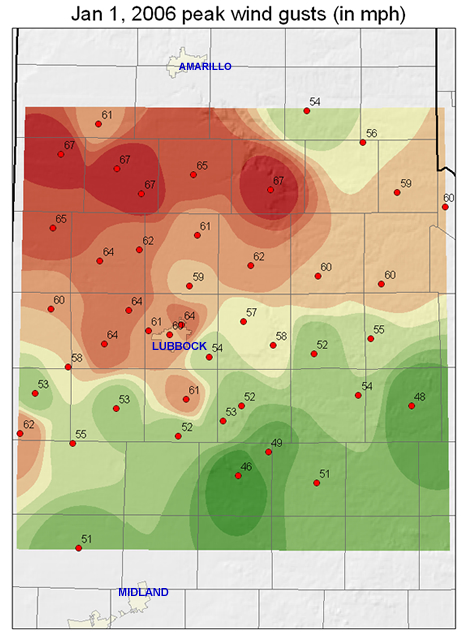
HIGH WINDS AND WILD FIRES RAKE WEST TEXAS ON NEW YEAR'S DAY Very strong winds swept across the Texas South Plains and northern Rolling Plains New Year's day as a very intense upper level storm system moved across the Texas Panhandle, and western Oklahoma. Strong winds began to increase around 9 am, first across the Texas/New Mexico border, and then spreading eastward. Sustained wind speeds increased to over 40 mph with gusts exceeding 65 mph at times. Areas of blowing dust developed with visibility between 3 and 5 miles early on, then the visibility quickly lowered to less than one-half mile and was reported to be only a few yards at times near open fields. The strongest winds occurred between 9 A.M. and 4 P.M. across the extreme southern Panhandle, South Plains and Rolling Plains. Sustained winds increased to 40 to 45 with gusts over 65 mph. The strongest wind gusts recorded by stations of the West Texas mesonet were 67 mph at Dimmitt, Hart, Silverton and Friona. There were many reports of wind gusts over 50 mph. The winds subsided late in the evening as the upper level storm system quickly moved toward the Mississippi Valley. Along I-27 near Hale Center, a semi tractor-trailer was blown over by a wind gust, with the driver receiving minor injuries. Below is a map of the wind gusts from data provided by the West Texas Mesonet (www.mesonet.ttu.edu) and from the National Weather Service stations at the Lubbock and Childress Airport. Please note that some of the data used to make this map is preliminary and may be subject to revision. To see the actual wind data used CLICK HERE. Also, to view a listing of the preliminary storm reports associated with this event CLICK HERE. |
 |
||
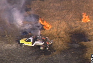
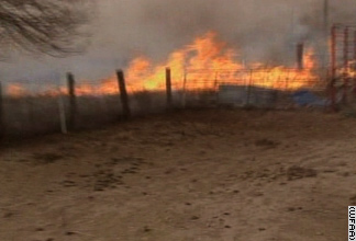
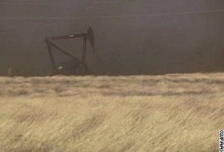
| With very dry conditions that persist across West Texas, several wild fires started and spread quickly in the extreme winds. Large fires were reported near the Lubbock Airport, near Levelland, and near Claytonville (about 10 miles east of Kress in Swisher County). The wildfire near the Lubbock Airport destroyed a horse stable and injured a fire fighter. Additionally, at least two mobile homes were destroyed by the fire near Levelland and two fire fighters received minor injuries. The pictures below show some scenes from the fires across the area. | |
 |
|
 |
|
 |
|
|
(Photos courtesy of CNN)
|
|
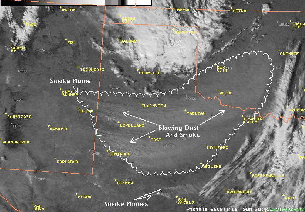
| The National Weather Service Office at Lubbock was able to track the strong winds and wildfires through a combination of data from satellite, radars, and surface reporting stations. The images shown below show some examples of displays we used on New Year's Day to provide the public along with state and local officials with current and forecast information for what turned out to be a very dangerous event. Click on each image for the full-size version (large files). | |
 |
|
|
Picture of the visible satellite image at 2:45 pm.
|
|
 |
|
|
The infrared satellite image around 4 pm. The darker the color in the image the warmer the temperature of the object.
|
|
 |
|
|
Image from the Lubbock Doppler Radar at 4:42 pm. The radar is able to detect the dust and smoke particles as they rise into the atmosphere above West Texas.
|
|


 Follow us on YouTube