 |
| A picture of the Lubbock National Weather Service office near the South Loop Thursday morning (Brian Lamarre). |
|
Winter Weather Returns to West Texas, |
|
A strong cold front swept through West Texas during the evening hours of the 29th. Behind the front, temperatures quickly dropped into the teens and 20s and the northerly winds howled at 30 to 40 mph. Meanwhile, an upper-level storm system moved out of the Rockies and crossed right over the South Plains and Rolling Plains. Bands of snow developed near the Texas-New Mexico border late Wednesday evening, and then expanded eastward across the region overnight. Isolated thunderstorms also accompanied the snowbands - and made for brief periods of heavy snow, which when coupled with the strong winds, produced near whiteout conditions at times. This was the strongest winter storm that much of the area has seen since November of 2004. You can read a summary of the storm produced by the Lubbock NWS Office HERE. A local storm report that includes details on the snow reports received by our office can be found HERE. Due to the strong winds with this storm, snowfall totals are hard to assess as blowing and drifting of the snow was widespread. Drifts up to 3 feet were reported across the region. |
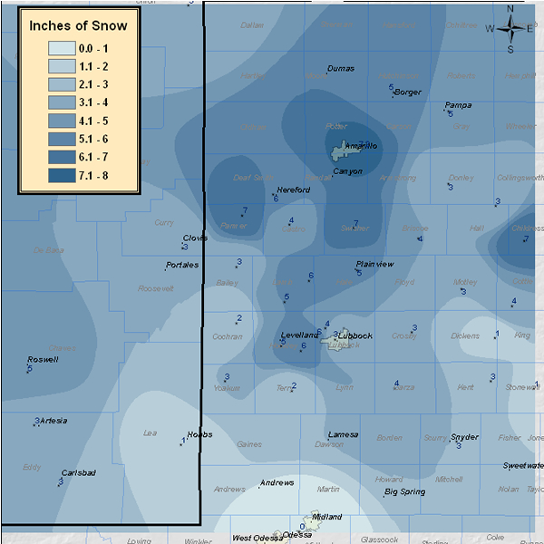 |
| Map of snowfall reports compiled by the Lubbock office as of Thursday evening the 30th. This data is preliminary. |
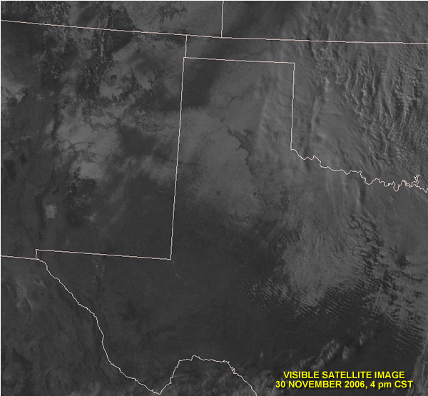
The satellite image below was taken around 4 pm on Thursday the 30th. In the picture, the pattern of snowfall can be seen stretching from the mountains of Southern Colorado and New Mexico into the Texas Panhandle and South Plains. The outline of the Caprock Escarpment is also visible along with several of the larger river valleys. At this time there were still clouds over the far eastern Panhandle and Rolling Plains with snow falling across most of Oklahoma. |
 |
|
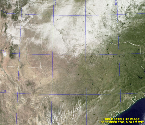
The next satellite image below shows how the snowpack looked on the morning of |
|
|
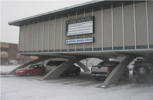
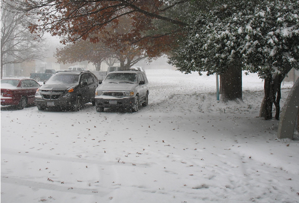
| Another photograph taken Thursday morning in the NWS parking lot (Brian Lamarre). |


 Follow us on YouTube