 |
| Above is an image displaying the approximate snowfall totals from Friday, January 19th through Saturday, January 20th (Jeff Vitale). For another image displaying some of the more exact snowfall amounts observed click HERE. |
|
Winter Storm Brings a Variety of |
|
A strong upper level storm system, with abundant moisture to work with, brought a combination of winter weather to the region between Friday morning (January 19th, 2007), and Saturday evening (January 20th, 2007). The majority of the precipitation across the southwest Texas Panhandle and northwest South Plains fell as snow. Farther south and east, where temperatures aloft were slightly warmer, many experienced a combination of freezing rain, sleet and snow, before changing over to all snow by early Saturday. In additional to the snowfall, locations across the central and southern South Plains and much of the Rolling Plains received considerable amounts of ice (1/4 inch plus). Even farther to the southeast, across the southern Rolling Plains, slightly warmer temperatures limited most of the precipitation to rain and freezing rain, with little in the way of snow. Although the extended period of rain, freezing rain and sleet limited the snowfall totals in many locations from the central South Plains south and east, the storm did result in widespread liquid water equivalent precipitation totals at or above one inch. A detailed report of preliminary snowfall totals received by the Lubbock NWS Office can be found HERE. Also, if you are interested in learning in more detail why less snow fell than predicted at some locations with the winter storm click HERE. |
| Below is visible satellite image taken around noon on 21 January 2007. The image nicely depicts the edge of the significant snow and ice accumulations from the winter storm, as well as other geographic features. Click HERE or on the image for a similar view without the text. |
 |
| Below is a regional visible satellite image taken around noon on 21 January 2007. As you can see, it can be quite difficult to distinguish between clouds and snow. Click HERE or on the image for a similar view without the text. |
 |
| Below is a picture taken from Muleshoe, TX, during the early afternoon Saturday, 20 January 2007. At the time approximately 8 inches of snow had fallen in the Muleshoe area. (Photo by Jack Rennels) |
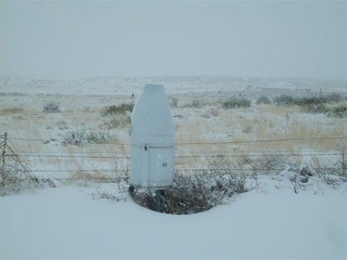 |
| Below is another image of snow that had fallen in Muleshoe, TX, on the afternoon of Saturday, 20 January 2007. The object in the center of the image is a Fisher/Porter gauge. The gauge measures precipitation by collecting it in a large metal bucket and weighing it. The gauge also punches holes in a paper tape every 15 minutes to create a precipitation record over time for the site. (Photo by Jack Rennels) |
 |
| Below is a picture of "ice daggers" (icicles) hanging from a building after the winter storm concluded. (Photo by Jeff Vitale) |
 |
| Below are a few pictures taken around Lubbock on the morning of Sunday the 21st. (Click on each image to enlarge) | |
 |
 |
 |
 |


 Follow us on YouTube