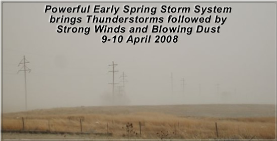
Picture of blowing dust taken from Muleshoe on 10 April 2008. Photo by Jack Rennels.
A strong upper-level storm system approached West Texas on Wednesday, April 9th. Although cold air had moved in near ground level across most of the region, warm and moist air moved northwest above the cold layer on a strong low-level jet ahead of the system. The result was the development of "elevated" thunderstorms Wednesday morning across the southern South Plains and Rolling Plains. As these storms raced northeast, they dropped brief heavy rain and some hail. Large hail fell from a storm near Tulia and also from several storms across Cottle, Dickens and King Counties. These stormed moved northeast of the area by midday. Most of the thunderstorm activity during the afternoon was confined to areas to our south; along the I-20 corridor. Severe thunderstorms produced several tornadoes near San Angelo and Abilene. Wednesday evening, additional thunderstorms formed from the south-central South Plains into the Rolling Plains. Again, several of these storms became severe and produced large hail. Hail up to the size of golfballs fell near Childress and the town of Lorenzo in Crosby County. In addition to the severe weather, the thunderstorms did bring some much-needed rainfall to mainly central and eastern portions of the area.


Visible satellite image from the afternoon of April 9th. At this time, not much thunderstorm activity was occurring across the South Plains and Rolling Plains. Strong thunderstorms were developing across portions of the eastern Permian basin south of the cold front. Click on the image for a larger view.
On Thursday the 10th, all the thunderstorm activity had moved off into central and eastern Texas and Oklahoma. As the upper-level storm system moved into the central plains, strong winds developed across West Texas. Sustained wind speeds in the 35-45 mph range with gusts into the 60s brought widespread blowing dust and some wind damage to the region.

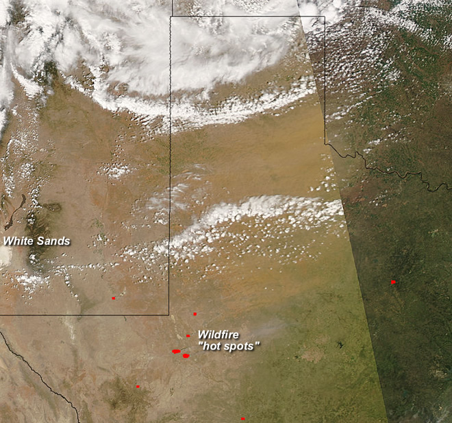
Satellite image from the afternoon of April 10, 2008 -showing blowing dust across West Texas. For a larger view click on the image.


 Follow us on YouTube