|
Three Days of Storms: 5-7 May 2008
|
||
 |
||
|
Photo of quarter to half-dollar sized hail that fell at Reese Center of the 6th. Click on the image for a larger picture. Courtesy Wes Burgett
|
||
|
Monday evening the 5th to early Tuesday morning the 6th Tuesday evening the 6th to Wednesday afternoon the 7th |
||
 |
||
|
Map of three-day total rainfall across the area May 5th through 7th. The data is courtesy of the West Texas Mesonet and the National Weather Service. Click on the image for a larger view.
|
||
 |
||
| Radar image of the squall line around midnight on the 5th/6th. At this time golf ball sized hail was falling from the severe thunderstorm moving through Hockley County. Click on the image for a larger picture. | ||
|
|
||
 |
||
|
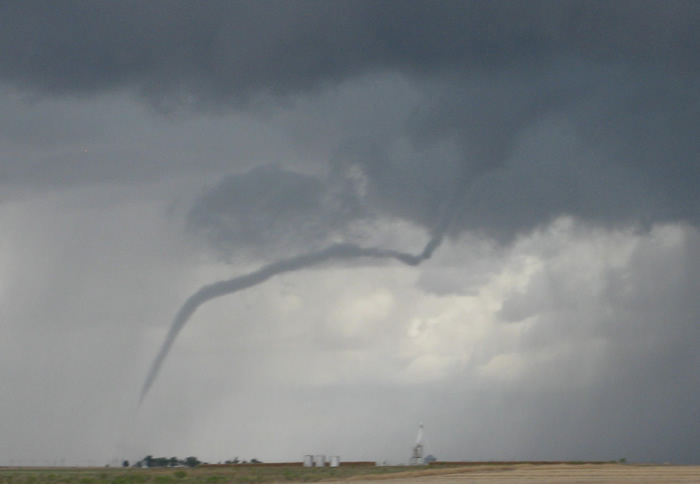
Photo of the landspout-type tornado 6 miles north-northwest of Smyer around 11:50 am. Please click on the image to view a larger picture. Photo courtesy Jonathan Sparks and KCBD.
|
||
 |
||
| 3-D radar image of the severe thunderstorm that spawned the tornado north of Smyer. This storm is just to the upper left of the center of the image. The other thunderstorm in southwest Lubbock County is also severe - producing large hail. For a larger view click on the image. | ||
Much of the data reported here was obtained from the West Texas Mesonet. Their summary of this event is located HERE.


 Follow us on YouTube