A dynamic storm system brought another round of wind, dust and wildfires to the region on Thursday, 9 April 2009. This was on the heels of a similar event just five days earlier, on Saturday the 4th. While damage reports across the South Plains were rather limited, the passing storm system did bring widespread wind gusts in the mid 50 to lower 60 mph range from mid-morning through the mid-afternoon hours, including a gust to 62 mph at the Lubbock Airport at 12:42 pm. For a list of severe wind gusts across the area CLICK HERE. The winds gradually diminished during the evening hours as the storm system moved off to the east and deep vertical mixing decreased with the loss of daylight.
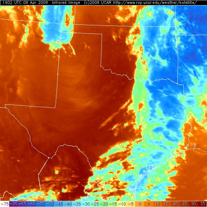
In addition to the strong winds, warm and very dry air contributed to the ignition and spread of number of wildfires, including one in Bailey county, another in Cochran county, and a third near Matador in Motley county. However, these fires were rather tame in comparison to a corridor of fires that ignited from North Texas into central Oklahoma. The above satellite image depicts numerous wildfires (scattered dark blocks from North Texas into central Oklahoma denote "hotspots" where wildfires were ongoing) Thursday afternoon. The Texas and Oklahoma wildfires consumed tens of thousands of areas, resulted in dozens of injuries and several deaths.
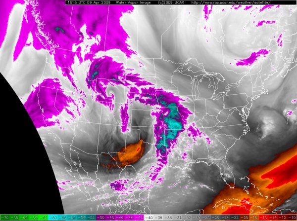
The above water vapor image shows the large scale view of the storm system as it evolved late Thursday morning. An area of dry sinking air (oranges and reds) can be seen on the southern side of the storm over much of the western half of Texas. In advance of the storm moisture (purples and blues), in the form of showers and thunderstorms, is being drawn northward.
|
||||||||||||||
|
|
||||||||||||||
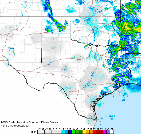
| Radar loop during the early afternoon hours on 9 April 2009. | ||||||||||||||
|
The above radar loop shows showers and thunderstorms advancing eastward into Missouri and Arkansas, with a narrow north-south oriented line moving through central Oklahoma and North Texas. To the west of the line, strong westerly winds and very dry air was advancing eastward. The west-southwest to east-northeast oriented plumes in western North Texas are areas of smoke being carried eastward from the numerous ongoing wildfires. An additional wildfire smoke plume can be seen advancing eastward out of east-central New Mexico. The arcing line moving southward from the Texas Panhandle into the northern South Plains is a cold front. Below, the visible satellite image nicely depicts the arching cold front, with a narrow line of cumulus clouds along it. The smoke plumes are less evident, but can be seen as light grey on the image.
|
||||||||||||||
|
|
||||||||||||||
| Visible satellite image early Thursday afternoon (9 April 2009). Click on the image for a larger view. | ||||||||||||||


 Follow us on YouTube