Severe Winds Impact the South Plains and Childress Area
- July 29, 2009 -

| Map depicting peak wind gusts for the event as recorded by the West Texas Mesonet and NWS automated observing system. |
Several clusters of thunderstorms developed across eastern New Mexico and the western Texas Panhandle during the afternoon on Wednesday, July 29. These thunderstorms formed into a large complex that moved east across the South Plains and Rolling plains during the late evening into the early morning hours Thursday. Several wind gusts in excess of 60 mph were recorded by the West Texas Mesonet (WTM). The strongest winds observed were near the Childress airport where the NWS Automated Surface Observing System (ASOS) recorded a wind gust of 102 mph. The WTM site 2 miles north of town recorded a peak gust of 80 mph. Several structures in the city of Childress were damaged due to the strong winds estimated to be between 80 and 90 mph for the most part. In and around Lubbock, severe wind gusts near 60 mph were observed with damage primarily to trees. In addition to the wind, a swath of hail about 2.5 miles wide destroyed several acres of crops in eastern Bailey county.
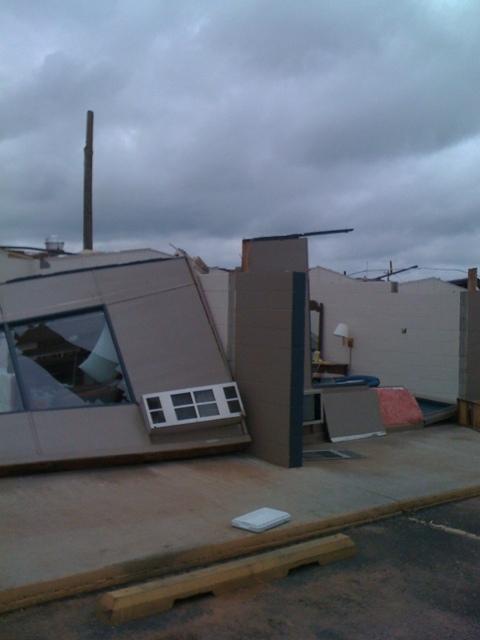
| This hotel along U.S. Highway 287 in Childress was heavily damaged by the strong winds. Several units lost their roof causing the walls to fall in. One person was injured by flying debris. |
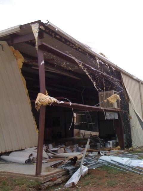
| Inward collapse of a metal building in Childress. |

| This mobile home was destroyed as strong cross winds hit the home causing it to roll. |
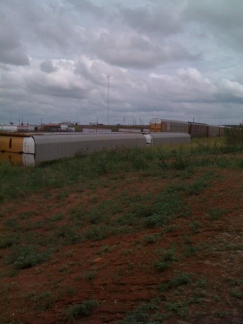
| These rail cars were blown over on the west side of Childress. |

| Strong winds blew out the wall of this building near the town square in Estelline. |
The following radar animations show the storm as it moved across the Childress area:
 |
| Radar reflectivity animation (lowest tilt) from the WSR-88D at Fredrick, Oklahoma showing the severe thunderstorm moving across Childress and northern Cottle Counties. The city of Childress is located at the intersection of the two roads (US 287 and US 83). The NWS reporting station at Childress Airport is located approximately 4 miles WNW of the town. The loop runs about one hour from 10-11 pm CDT. |
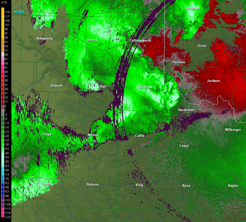 |
| Same as above, except for the base velocity. Green (cool) colors represent wind moving toward the radar, while red (hot) colors indicate wind moving away from the radar. |


 Follow us on YouTube