Snow and ice storm slams much of the area:
28 January, 2010
|
|
A strong winter storm brought a wide variety of weather including rain, thunderstorms, freezing rain, sleet and snow to West Texas on the 28th of January.
|
|
|
|
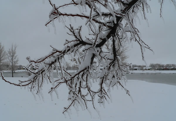
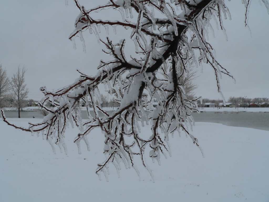
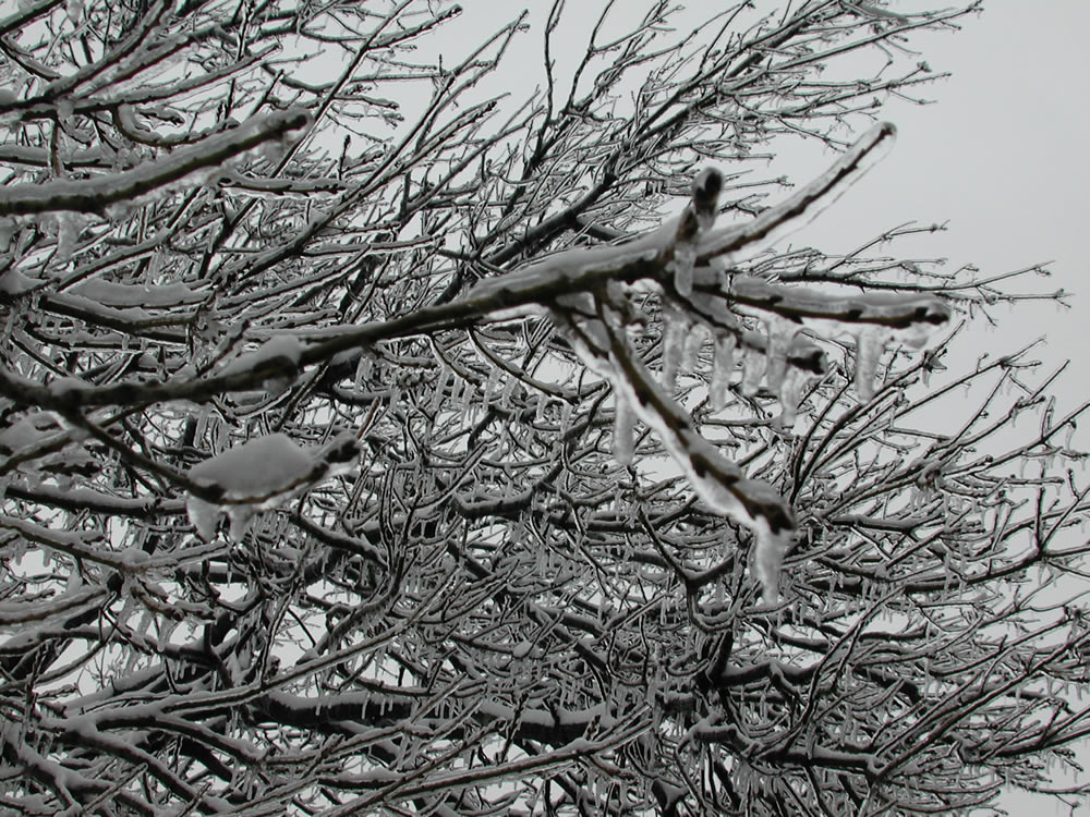
Picture taken of ice and snow in southwest Lubbock on January 28, 2010. The combination of ice, sleet and snow made travel difficult and also resulted in numerous power outages and downed tree limbs across the region. Click on the image for a larger view.
|
|
Precipitation first began during the early morning hours of Thursday, January 28, 2010. Initially, temperatures were warm enough for most locations to see a cold rain, with even a few embedded thunderstorms. However, a strong cold front passing southward through the region brought cooling temperatures on gusty northeasterly winds through the day. Temperatures began falling below the freezing mark, from north to south, during the morning hours. This caused to rain to change to freezing rain, as warmer air above ground level kept the precipitation falling in liquid form. Eventually, the warm air aloft cooled enough to switch the freezing rain to sleet and then snow for most locations on the Caprock by mid to late morning. Many locations off the Caprock remained warm enough aloft for freezing rain to be the primary mode through most of the event, though the southern Rolling Plains were just warm enough that they experienced mostly a cold rain, before finally cooling below freezing by late in the day.
|

|
|
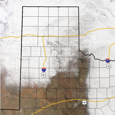
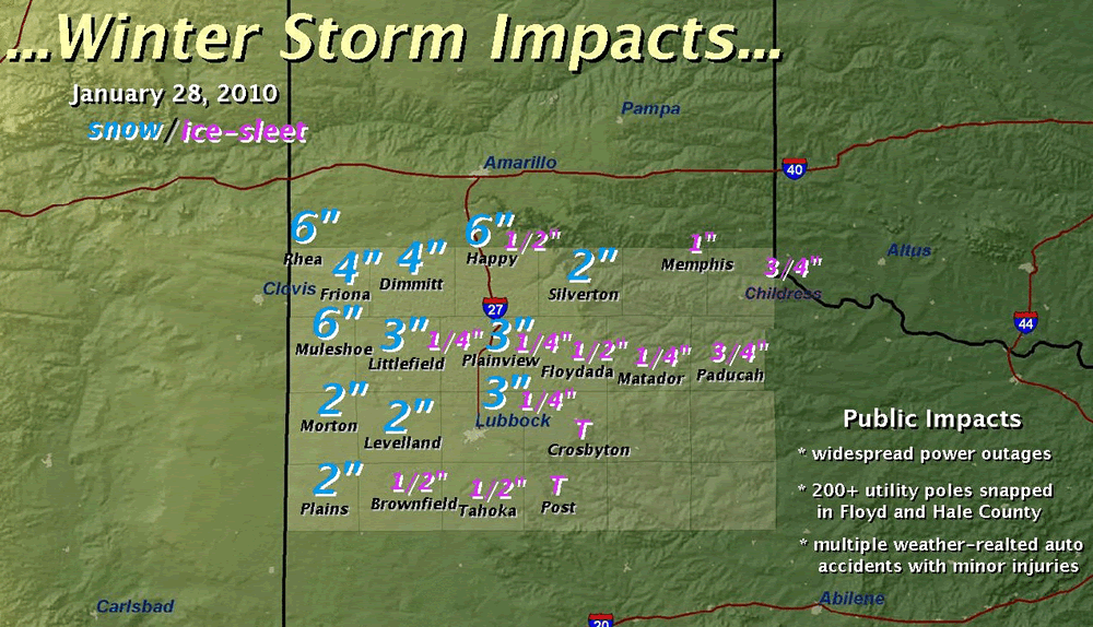
Map showing ice and snowfall totals from January 28, 2010. Click on the graphic for a larger view.
|
The above map shows the measured snow and ice accumulations from around the area on the 28th. Snowfall totals generally ranged from 2 to 6 inches across much of the Caprock, with locations across the southwest Texas Panhandle and northwest South Plains receiving the most snow. Additionally, much of the area saw significant ice accumulations, with the southeast Texas Panhandle and northern Rolling Plains recording the highest amounts, where a few locations approached an inch. Needless to say, the ice and snow created travel difficulties, and resulted in numerous power outages and downed tree limbs across the region. To view a summary of the local storm reports from the 28th please CLICK HERE. To view the Public Information Statement issued by the National Weather Service office please CLICK HERE. |
|
|
|
NASA MODIS satellite image on January 30, 2010. Click on the image to view a larger version.
|
|
A snapshot from space (above) was taken by the NASA MODIS satellite on the 30th, after the low clouds finally cleared the area. The satellite image shows that the ice and snow accumulations affected much of the region, though locations from the Permian Basin into the southern Rolling Plains didn't see the wintry precipitation to the extent that locations farther to the north and east did. In fact, the satellite image indicates a rather sharp north to south cutoff of the snow/ice accumulations from roughly a Denver City to O'Donnell to Post to Guthrie line, with a sharp west to east cutoff line farther east, into western North Texas.
|
|
|
|
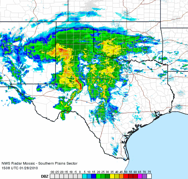
Radar animation around the height of the storm over Lubbock, from 9:08 am to 10:18 am on January 28, 2010.
|
|
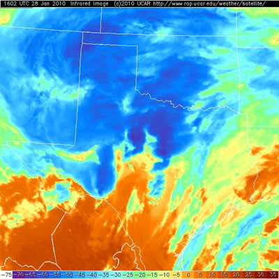
The radar animation (above) and infrared satellite image (below) show the storm system around its peak as it was affecting the South Plains region. The radar imagery indicates widespread moderate to heavy precipitation across much of the area, with the satellite image confirming that cold, tall clouds were present. The dynamic and moist storm system even supported a number of thunderstorms, which locally enhanced precipitation rates. Although the form of precipitation (freezing rain, sleet and snow) did create many problems, the storm system brought widespread beneficial moisture, with many locations recording an inch or more of total liquid equivalent.
|
|
|
|
Infrared satellite image of the storm at 10:02 am on January 28, 2010. The deep blues represent colder, taller clouds where heavy precipitation, and in some cases thunderstorms are occurring. Click on the image for a larger view.
|
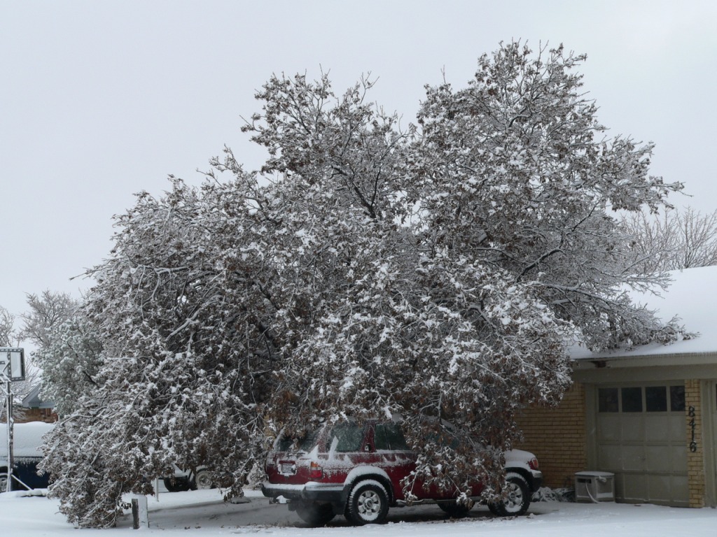
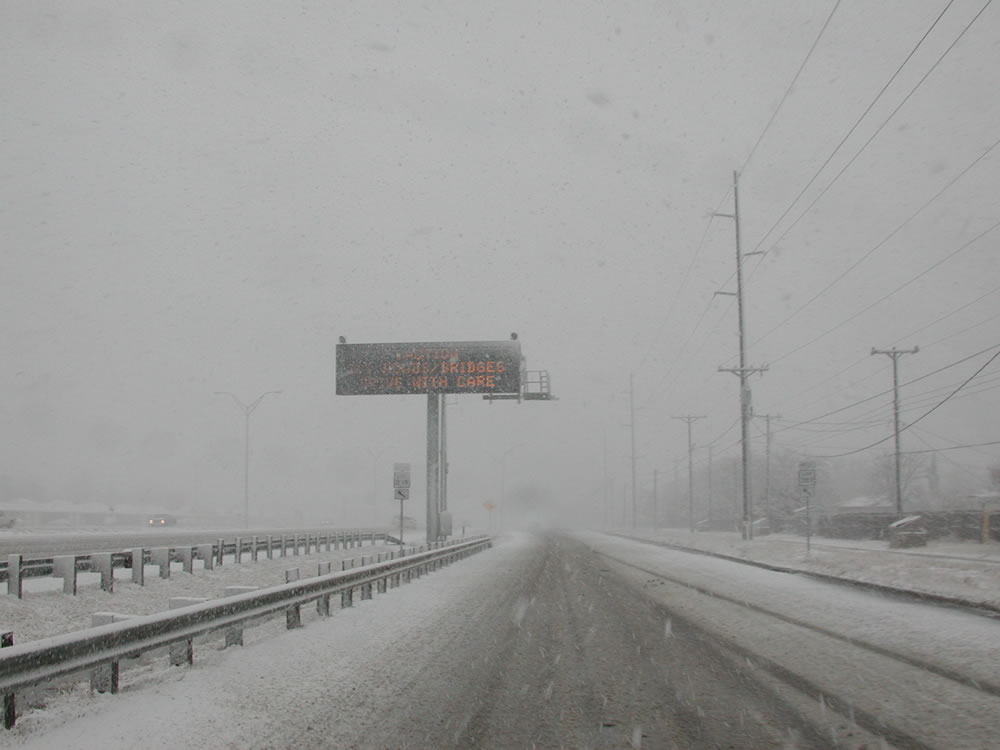
The pictures below show some of the wintery scenes around the Lubbock area. Click on any of the images to view a larger version. |
|
|
| |


 Follow us on YouTube