A Strong Microburst Strikes the Turkey, TX, Area
14 June 2010
|
|
|
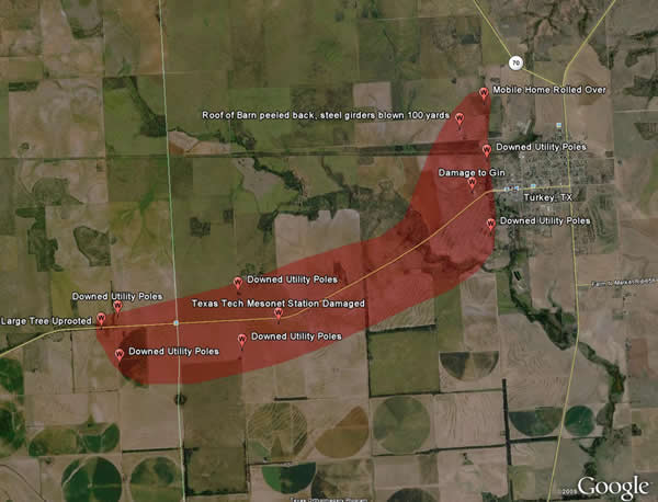
Approximate coverage (in red) of a macroburst that struck near Turkey, TX, around 12:30 am on June 14, 2010. Also noted are several areas of damage that occurred from the strong straight line winds. Picture of several of the damage points noted in the map can be found below. |
|
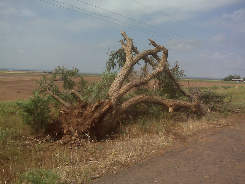
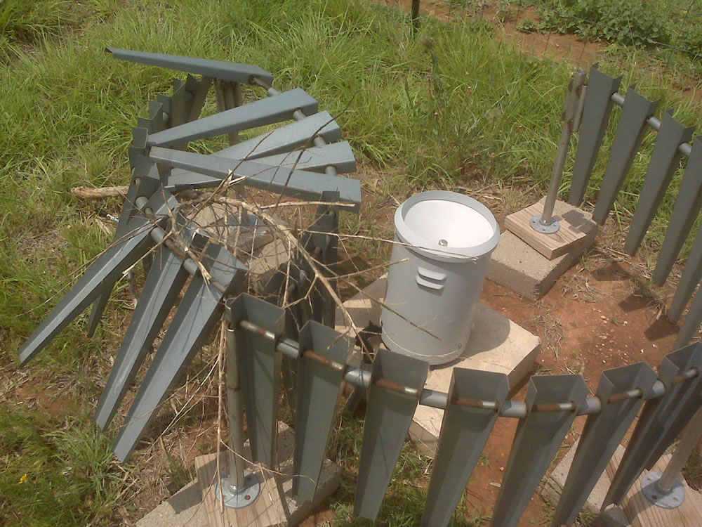
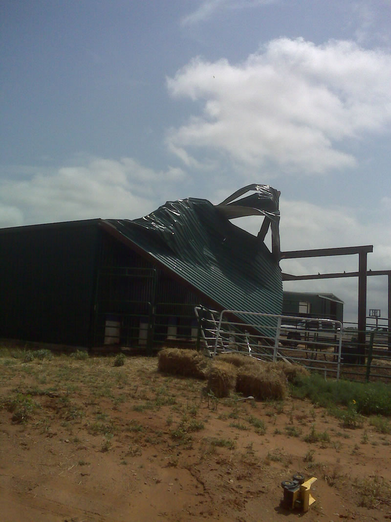
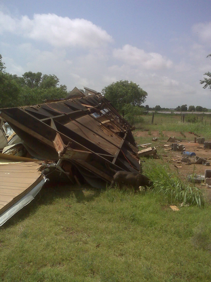
Below are pictures of damage from around the Turkey area. The images were taken by Wes Burgett, the manager of the Texas Tech West Texas Mesonet. |
||||||||
|
||||||||
|
Pictures of damage taken from the Turkey area after the early morning macroburst on 14 June 2010. The images are courtesy of Wes Burgett. Click on the pictures for a larger view. |
| The winds also knocked over several center pivot irrigation systems west of Turkey. Below are a couple of views of damaged pivots. | ||||||
|
||||||
| Center pivot irrigation systems knocked over by the strong winds early 14 June 2010. Pictures are courtesy of Cody Yates. Click on the images for a enlarged view. | ||||||
|
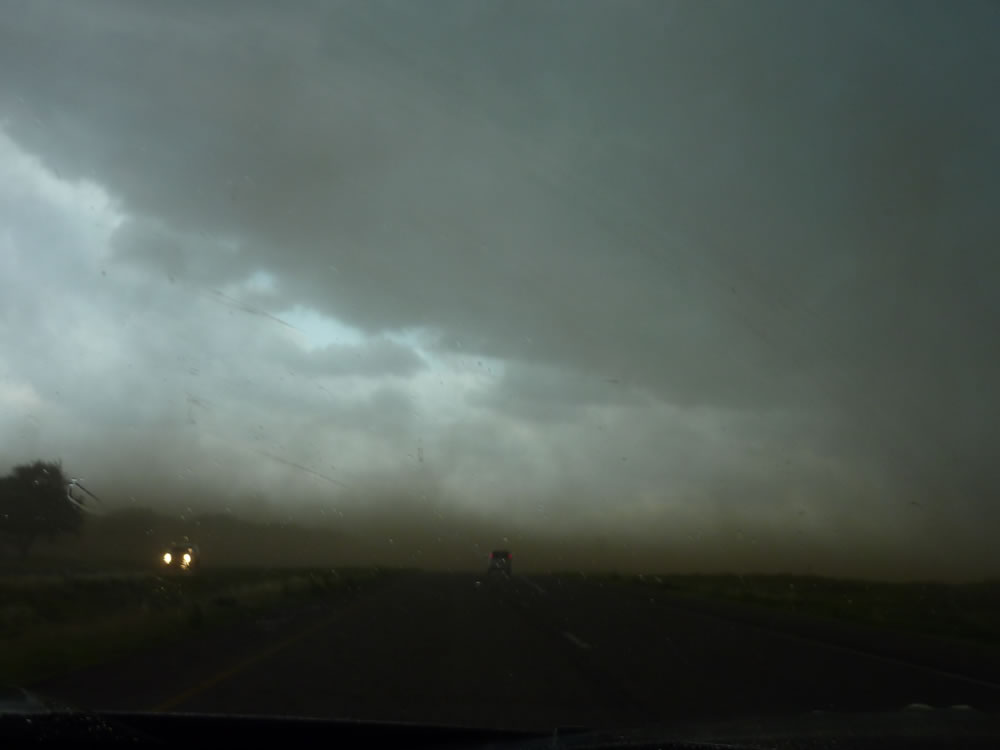
After a brief reprieve from the violent weather, severe thunderstorms redeveloped during the afternoon and evening hours of the 14th, with even a couple of strong and severe storms persisting into the early morning hours of the 15th. Many locations across the South Plains into the Rolling Plains experienced strong thunderstorm outflow winds and large hail, along with very heavy rain. The strongest wind recorded during the afternoon was a gust to 84 mph, observed 4 miles south-southwest of Wilson by a member of the VORTEX 2 project. Additionally, one brief tornado was observed just southwest of Wilson, though it did no known damage. |
||||||
|
||||||
| Above are pictures of a powerful storm that moved up across the Tahoka area with strong winds, hail and very heavy rain during the mid-afternoon on June 14, 2010. The pictures are courtesy of Erin Shaw. Click on the pictures for a larger view. | ||||||
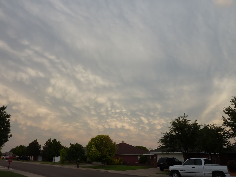
| Although the storms did cause some destruction, they also produced some beauty. Below are a couple of images of the evening sky on the 14th, as viewed from Lubbock. | ||||||
|
||||||
| Pictures of a colorful sky as viewed from Lubbock on the evening of June 14, 2010. The pictures are courtesy of Erin Shaw. Click on the pictures for a larger view. | ||||||
|
To view the preliminary local storm reports for the day CLICK HERE. To view a page composed on the event by the TTU West Texas Mesonet Click Here. |
||||||


 Follow us on YouTube