|
|
|
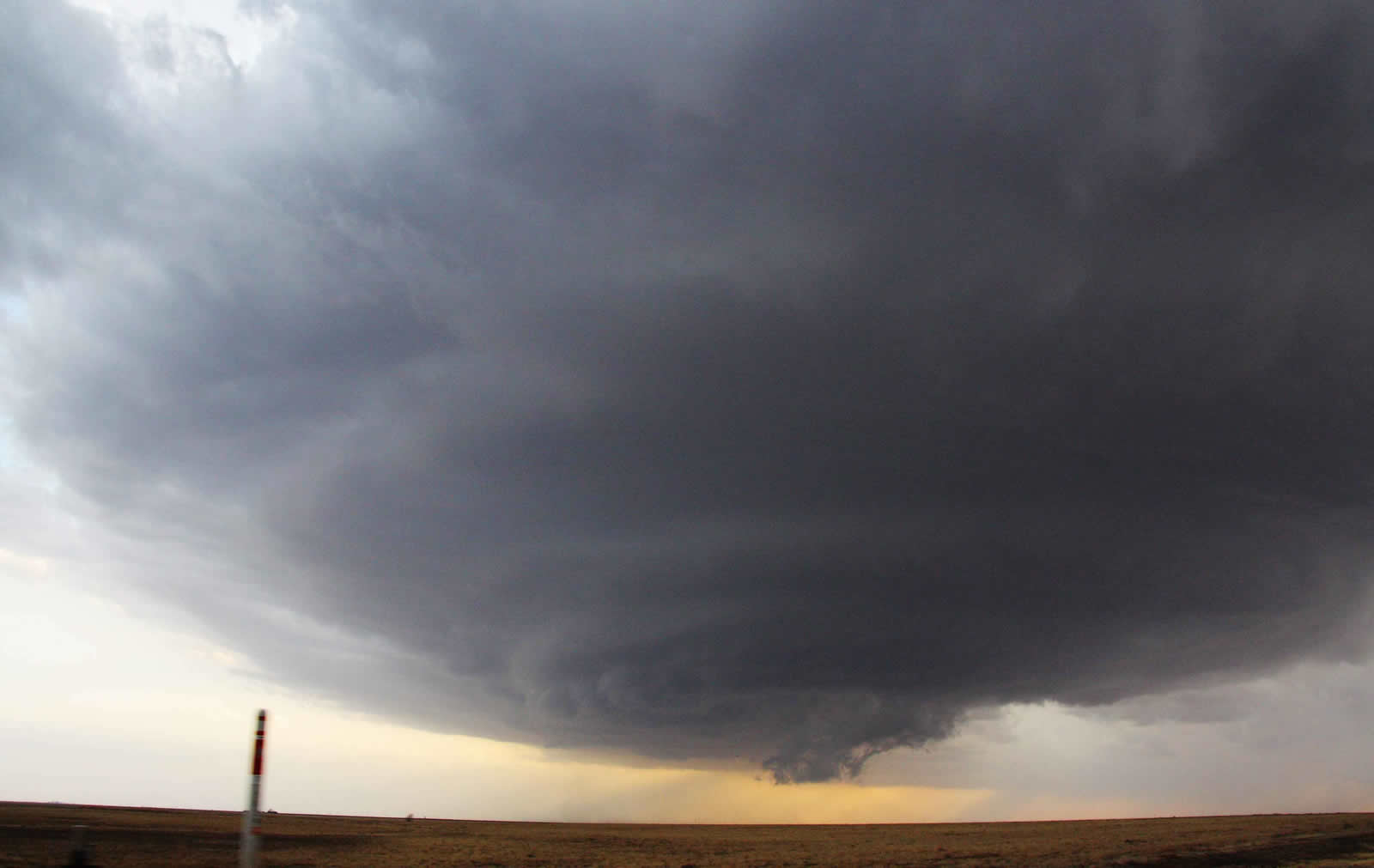
The mesocyclone and wall cloud of a supercell thunderstorm in southeast Hale County. Photo courtesy Joe Merchant. Click on the image to view a large version. |
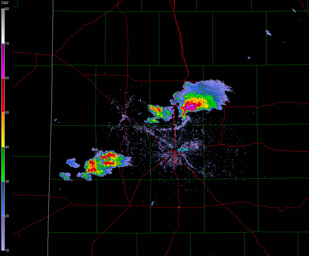
Scattered thunderstorms broke out late Saturday afternoon across the western and central South Plains on the nose of warm and unstable air moving north out of the Permian Basin. Though the development of thunderstorms was a little uncertain leading up to the severe weather event, once storms were able to develop, moderate instability and wind shear supported rapid intensification and the formation of a couple of supercell (rotating) thunderstorms. The strongest storms produced large hail, with even one very brief funnel cloud and tornado reported in rural areas northeast of Abernathy around 7 pm. No damage occurred with the brief tornado touchdown, but the large hail did cause problems for a few locations. The below map illustrates how the large hail (and tornado) reports were distributed across the South Plains.
To view a complete listing of the preliminary storm reports CLICK HERE.
|
|
|
Preliminary storm reports from the event. Click on the weather icons to view the full report.
|
Many locations across the South Plains, from central Hockley County through parts of Lubbock and Hale Counties and into southwest Floyd County saw hail. Initially, the strongest storm intensified in Hale County and moved eastward. The radar images below are taken near the storm's peak intensity, when it produced a well-documented wall cloud and perhaps a very brief tornado.
 |
 |
| Radar reflectivity images taken from the Lubbock WSR-88D radar at 7:01 pm (left) and 7:06 pm (right) CDT on March 19, 2011. Click on the radar images for a larger view. | |
The above images show a well-developed storm with high reflectivities (bright reds, purples and whites), representing the heavy rain and large hail falling from the storm. Additionally, a hook echo is seen extending from the southwest flank of the storm, a good indication the storm is rotating and could be capable of producing a tornado.
 |
|
| Radar velocity images taken from the Lubbock WSR-88D radar around 7:06 pm CDT on March 19, 2011. The left image is taken from the lowest scan angle, which is around 1,000 ft above the ground at the storm of interest in southeast Hale County. The right image is scanning the mid-level of the storm, around 10,000 ft above ground level. The green (red) represents air flowing toward (away from) the radar. Arrows are drawn on the right image to help visualize the mid-level circulation in the storm in southeast Hale County. Click on the radar images for a larger view. | |
The above images show the Doppler velocities, as seen from the Lubbock WSR-88D radar, around the time of the wall cloud and possible brief tornado touchdown. Implied rotation is not overly impressive at the lower levels (left image), but there is a strong circulation signature in the middle levels (right image) of the storm. Below is a sequence of images taken looking at this same storm around and shortly after 7 pm on Saturday, when the storm was near its peak.
 |
 |
 |
 |
 |
 |
 |
 |
 |
 |
 |
 |
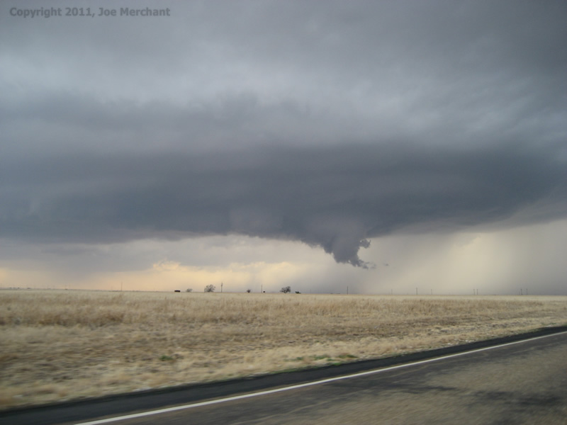
| Sequence of pictures of a severe thunderstorm located in southeast Hale County on March 19, 2011. The pictures increase in time (chronologically) from upper left to lower right, and are taken roughly between 6:57 pm and 7:04 pm CDT. View is looking west-southwestward. Photos are courtesy of Erin Shaw. Click on the images for a larger view. | |||
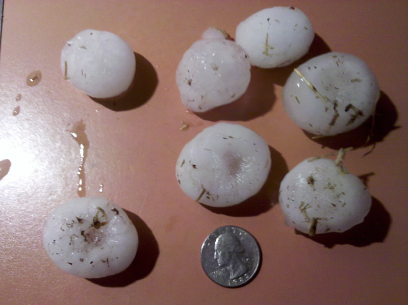
Another storm then formed and strengthened to severe levels further to the west. This thunderstorm brought baseball sized hail to parts of Shallowater, with golf ball sized hail reported in Levelland and near Smyer. Below are two pictures from near Levelland on the 19th. The left picture shows hail (in reference to a quarter) that fell in Levelland, while the right picture is what the storm looked like while it was dropping large hail over central Hockley County.
|
|
 |
| (Left) Hail that fell in Levelland on the evening of March 19, 2011. Photo courtesy Whitney Owens. (Right) Looking north at the supercell over central Hockley County. Photo courtesy Wes Burgett. Click on the images to view a large version. | |
|
|
| Radar reflectivity image taken from the Lubbock WSR-88D radar at 7:48 pm on March 19, 2011. Click on the radar image for a larger view. |
The strong and severe thunderstorms gradually diminished in intensity and coverage late Saturday evening as temperatures cooled and the atmosphere began to stabilize.


 Follow us on YouTube