|
Rain Visits West Texas |
|
|
|
|
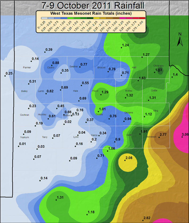
| Three day rainfall totals observed from Friday (7 October 2011) through Sunday (9 October 2011). The data is courtesy of the West Texas Mesonet and the National Weather Service. Click on the image for a larger view. | |
|
A strong upper level storm system interacted with abundant moisture to bring rainfall to much of the area over the early October weekend (7-9 October 2011). Unfortunately, though, the heaviest rainfall setup a little east of what was anticipated a couple days in advance and kept rainfall amounts on the Caprock on the light side. Still, many observations sites across the South Plains recorded between a tenth and a half of an inch, with localized amounts around an inch. Further to the east, in the Rolling Plains, rainfall tallies ranged from just shy of an inch to nearly 3 inches in and around Aspermont. |
|
|
|
|
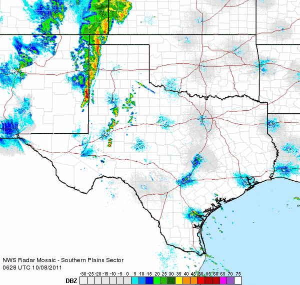
| Regional radar loop between 1:28 am and 2:38 am on 8 October 2011 (early Saturday morning). | |
| Thunderstorms initially developed on a retreating dryline Friday evening (7 October). This activity, some which was severe, was generally confined to the western Texas Panhandle and eastern New Mexico plains. However, by early Saturday morning (8 October) a cold front merged with the dryline and began to advance eastward across the South Plains. A line of thunderstorms developed along the front and advanced into the South Plains (see the above radar animation). This line, in one form or another, marched across parts of the South Plains and into the Rolling Plains early Saturday morning, while other new activity developed in advance of the line. In general, these thunderstorms were sub-severe, though one storm did produce a rogue gust to 58 mph near Memphis around 6 am. This early morning activity brought the majority of the rain that fell on the Caprock with this event. | |
|
|
|
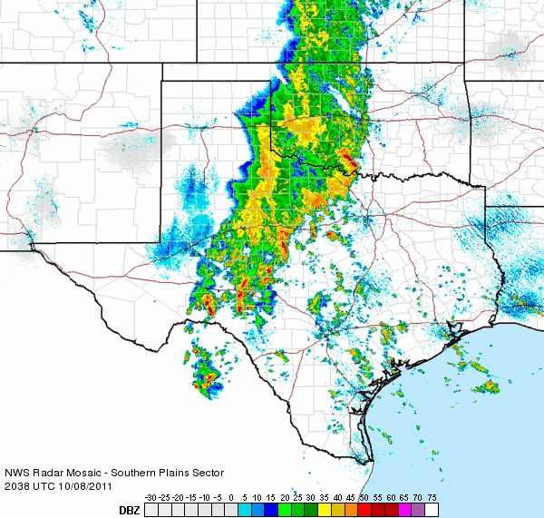
| Regional radar loop between 3:38 pm and 4:48 pm on 8 October 2011 (Saturday afternoon). | |
|
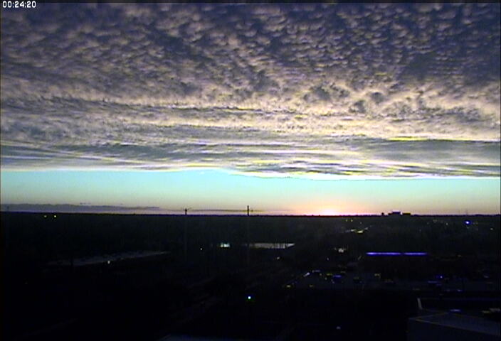
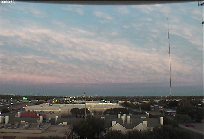
However, as the cold front slowed to a crawl and aligned with deep and moist southerly flow through much of the atmosphere, a large swath of precipitation setup from the Edwards Plateau into western Oklahoma during the day Saturday. The back edge of this band persisted across the eastern Rolling Plains and resulted in a prolonged period of light to moderate rainfall there. This boosted rainfall totals to around 3 inches across Stonewall County before the band eventually shifted east of the area by Saturday evening. Although locations further to the west remained dry Saturday afternoon and evening, the middle and high clouds emanating from the large band of rain did make for a beautiful sunset in Lubbock (see the below image). |
|
 |
|
| Image taken looking west around sunset from Lubbock on Saturday, 8 October 2011. For a view around the same time looking to the east CLICK HERE. | |
| Additional isolated to scattered showers did form across parts of the South Plains and Rolling Plains on Sunday (9 October), as a final upper level disturbance swung through the area and another weak cold front slipped in. Rainfall with this last round of activity was rather limited and on the light side, with most locations that did get a shower receiving a tenth of an inch or less. |


 Follow us on YouTube