After several months of very little precipitation across the South Plains, a return of Gulf of Mexico moisture and the approach of a slow-moving upper-level storm system from the west brought thunderstorm activity back into the area. Sunday afternoon, the dryline moved east of the Caprock and several severe thunderstorms developed in the Rolling Plains, producing up to golfball sized hail and damaging wind gusts in excess of 70 mph. Some wind damage was reported in town of Memphis, in Hall County. Then, Sunday night, the dryline retreated into the western South Plains and collided with an incoming cold front from the west. A line of storms developed along this boundary and brought more widespread rainfall as the line moved east through the South Plains and Rolling Plains during the overnight hours.
To view a complete listing of the preliminary storm reports CLICK HERE.
Below are some images and information from this event.
|
|
|||
|
Preliminary storm reports from the event. Click on the weather icons to view the full report. Rainfall reports are courtesy of the West Texas Mesonet. Hail size and mesocyclone tracks are derived from radar data.
|
|||
|
Toggle Storm Reports
|
Toggle Rainfall Reports
|
Toggle Hail Size
|
Toggle Mesocyclone Tracks
|
To download the KML (Google Earth) file of the preliminary storm reports CLICK HERE.
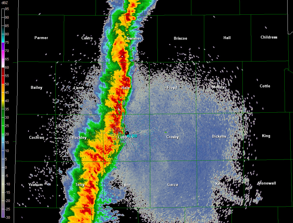 |
| Base (0.5 degrees) reflectivity data from the Lubbock WSR-88D showing the squall line around midnight on Sunday night. Click on the image to view a larger version. |
The squall-line produced several circulations on the leading edge which were detected by the National Weather Service WSR-88D Doppler radar. Bowing line segments and small circulations are not uncommon in squall lines. One circulation in the Permian Basin developed into a tornado which caused some damage and injuries in the community of Gardendale, in Ector County. You can read the report by the Midland National Weather Service Office here. Another pronounced cirulation develop near the Hockley/Lynn County line and moved northeast into western Lubbock County.
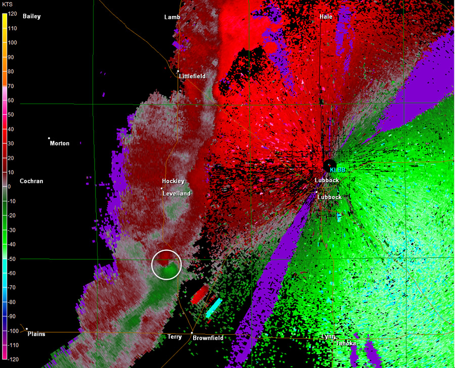
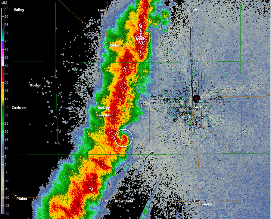
We have gathered a couple of radar images that highlight the circulation. Texas Tech University researchers were able to capture this event using their mobile Doppler radars and high-resolution surface stations (sticknets). This data may be able to confirm whether or not there was a ground-level tornadic circulation. You can view their report on this case here.
 |
 |
 |
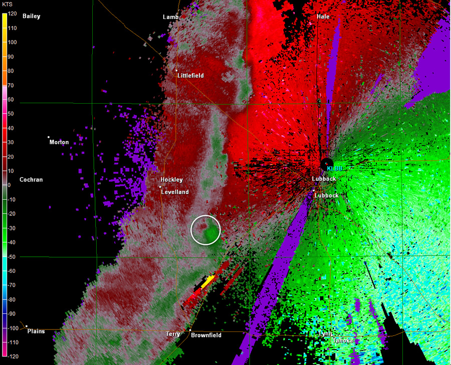 |
| Base (0.5 degrees) reflectivity (left) and storm-relative velocity (right) data from the Lubbock WSR-88D at 11:06 pm (top) and 11:23 pm (bottom). Click on each image to view a larger version. | |
| Below is a plot of the rainfall reports from the West Texas Mesonet (and the Lubbock and Childress ASOS): | |
 |
| West Texas Mesonet rainfall reports from the 17th through the 19th. Click on the image to view a larger version. |


 Follow us on YouTube