Significant wind and hail damage occurred Sunday evening in southern Lubbock County. There is evidence of damage from very large hail to hundreds of mobile homes, especially along FM 41 east of Ropesville to U.S. 87 south of Woodrow. Most of the damage along the western sections of the route was due to strong winds, in some cases in excess of 80 mph, along with hail damage. Farther east toward U.S. 87 the damage was indicative of very large hail, in some cases up to baseball size, with minimal damage from strong wind gusts. Rainfall amounts were heaviest across the region from near Levelland to just south of Lubbock, where totals ranged from 1.5 to near 2.0 inches. For rainfall amounts during this time period, see Temperature and Precipitation Summary from Monday morning, April 30th.
Below are some images and information from this event.
|
|
|||
|
Preliminary storm reports from the event. Click on the weather icons to view the full report. Rainfall reports are courtesy of the West Texas Mesonet. Hail size estimates are derived from radar data.
|
|||
|
Toggle Storm Reports from 4/29
|
Toggle Storm Reports from 4/30
|
Toggle Rainfall Reports from 4/28 - 5/2
|
Toggle Hail Size from 4/29
|
|
|
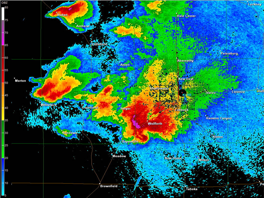
| Base Reflectivity (0.5 degrees) data from the Lubbock WSR-88D from 8:50 pm, April 29. Supercell over southern Lubbock County was responsible for wind and considerable hail damage. Click on the image for a larger view. |
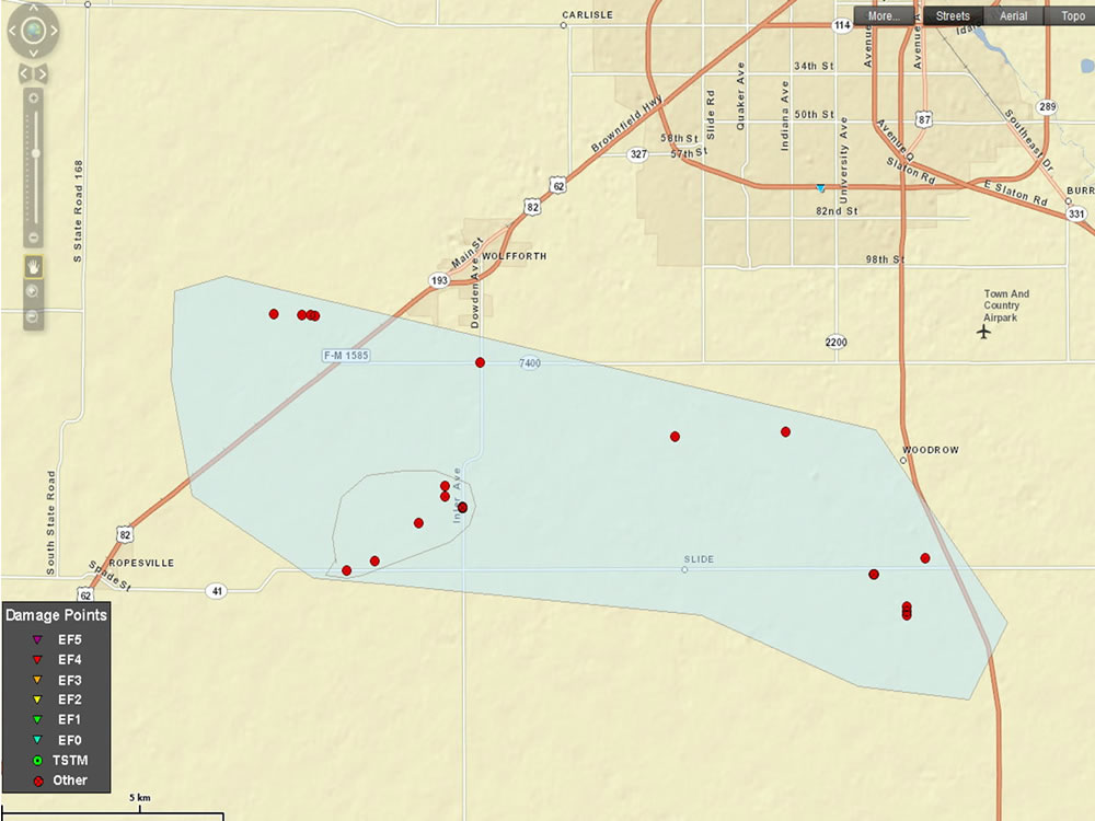 |
| Plot of Wind and Hail Reports from thunderstorms on Sunday, April 29, 2012. Hail damage is expected to result in millions of dollars of damage, with widespread damage to automobiles, roofs, and mobile homes. Click on the image for a larger view. To access the Damage Survey Interface (with clickable damage points with pictures), see THIS LINK. |
|
|
| Hail Damage to mobile home from thunderstorms on April 29th. Several mobile were damage along FM 1585 a few miles west of U.S. 62/82. Click on the picture for a bigger view. |
|
|
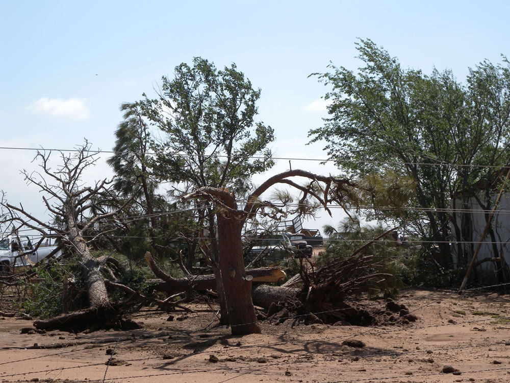
| Large tree limbs snapped off from winds estimated to be 80 to 85 mph. Photo taken approximately 1/2 north of FM 41 along FM 179. Click on the image for a larger view. |
|
|
| Collapsed Roof from winds estimated to be 80 to 85 mph. Photo taken approximately 1/2 north of FM 41 along FM 179. Click on the picture for a bigger view. |
|
|
| Hail damage to a vehicle from baseball sized hail. Location was near FM 41 and CR 2300. Click on the image for a larger view. |
 |
| Regional radar animation captured from 8:28 pm to 9:38 pm CDT on Saturday, April 29, 2012. The storm that dropped the very large hail and produced the damaging winds can be seen moving through southern Lubbock County. |
 |
| 7-day total rainfall, as estimated from radar (and bias corrected), ending at 7 am on May 2, 2012. The heavy swath of rainfall that fell April 29th is apparent to the south and west of Lubbock. Much of the rainfall observed in the Rolling Plains occurred on the 28th and the 30th of April. Click on the image for a larger view. |
| In addition to the severe storms that impacted the South Plains on Sunday, April 29th, additional severe weather affected the region the day before, as well as several of the following days. Below is a short description of some of this activity. | |||
 |
|||
| Regional radar animation captured from 7:58 pm to 9:08 pm CDT on Saturday, April 28, 2011. | |||
| Isolated severe thunderstorms developed along a quasi-stationary front across the southern Rolling Plains during the evening hours of Saturday, April 28th. This activity produced large hail to golf ball size in Swenson along with one brief tornado southwest of Aspermont. To view the preliminary storm reports of April 28th, CLICK HERE. | |||
 |
|||
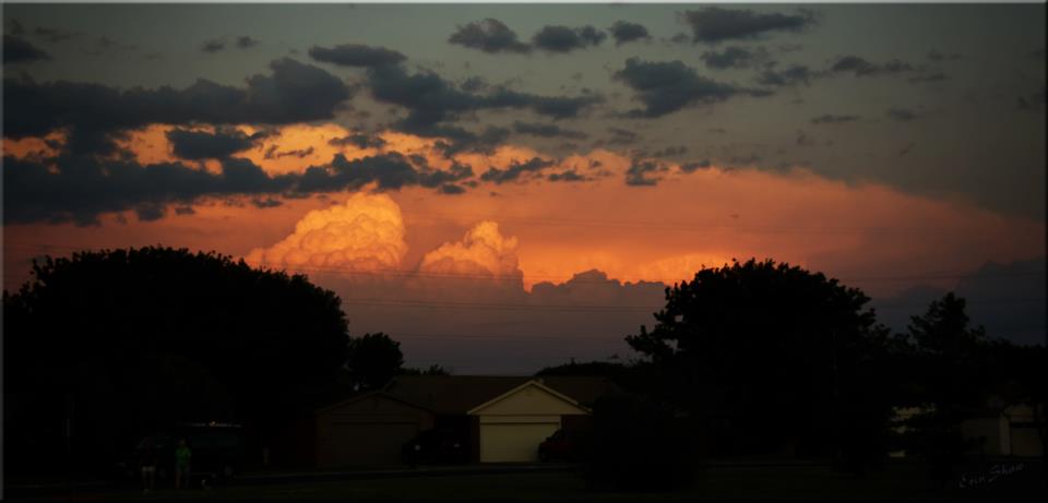
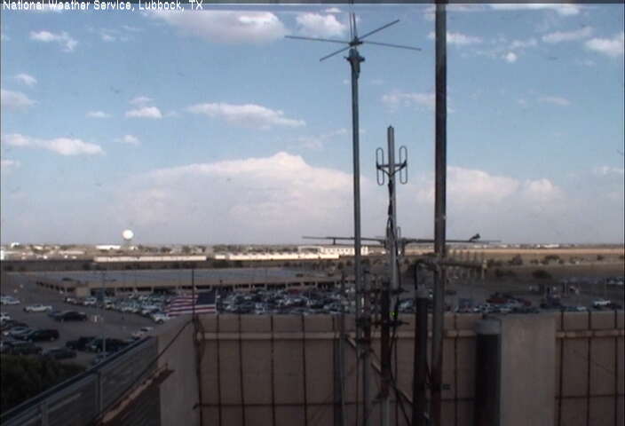
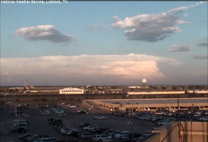
| View of the southern Rolling Plains thunderstorms, as seen from Lubbock, around sunset April 28th. Click on the picture for a larger view. Image is courtesy of Erin Shaw. | |||
|
After the robust activity on Sunday, April 29th (as detailed earlier in this article), another round of severe weather unfolded during the afternoon and evening hours of the Monday, April 30th. A cluster of thunderstorms took aim on the Rolling Plains late this afternoon and evening, producing hail to the size of baseballs just outside of Post and Dickens. To view the preliminary storm reports for April 30th CLICK HERE. A strong cap kept thunderstorms from developing on Tuesday, May 1st. However, isolated severe storms were able to develop along the dryline over portions of the southern Rolling Plains during the evening hours both Wednesday and Thursday, May 2nd and 3rd. |
|||
 |
 |
||
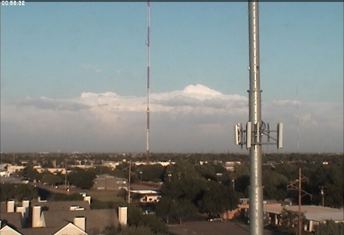
| Thunderstorms, as viewed from the Lubbock Airport (left) and south Lubbock (right) on the evening of May 2nd. These pictures are looking to the east-southeast. This activity produced golf ball size hail 5 miles west of Girard. Click on the pictures for a larger view. | |||
|
|||
| Although the periods of severe weather did cause damage in some locations, it also brought some welcome rains to parts of the area, as the rainfall map below demonstrates. | |||
|
|
|||
| 7-day total rainfall, as estimated from radar (and bias corrected), ending at 7 am on Friday, May 4, 2012. The heavy swath of rainfall that fell April 29th is apparent to the south and west of Lubbock. Much of the rainfall observed in the Rolling Plains occurred on the 28th and the 30th of April, with a few pockets of heavy rain also falling on May 2nd and 3rd. Click on the image for a larger view. | |||
| To view a story created for the severe weather on April 29th and 30th by the West Texas Mesonet CLICK HERE! . | |||


 Follow us on YouTube