|
Storms Bring Rain and Severe Weather |
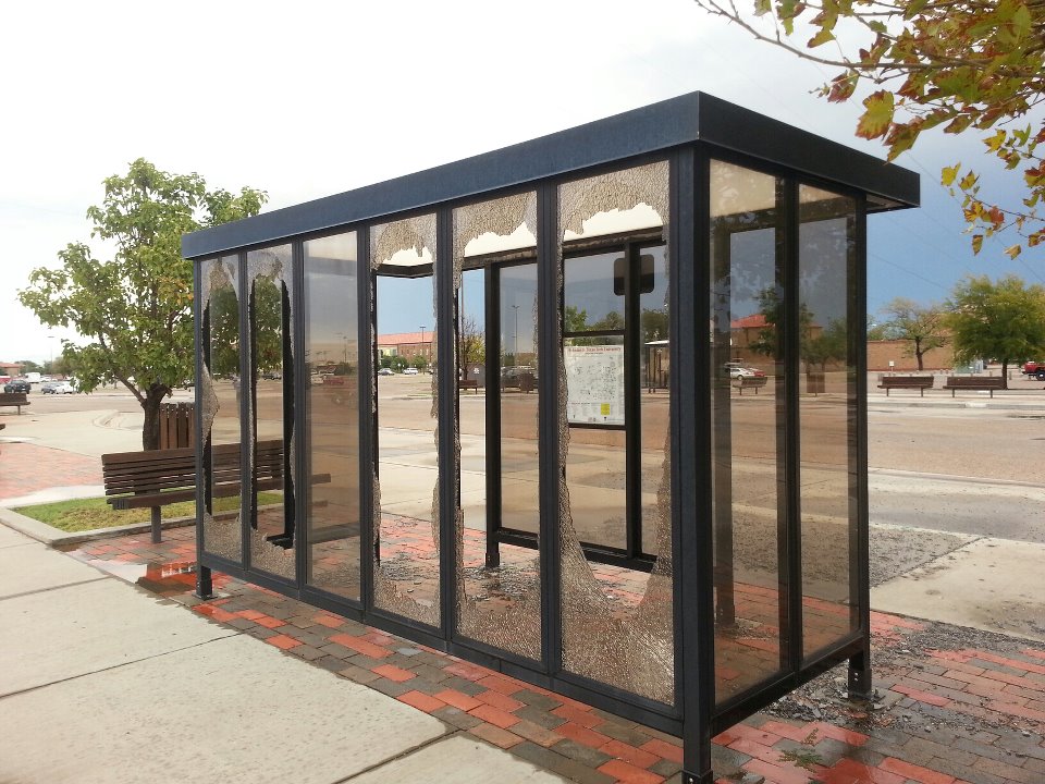 |
| Glass blown out at a bus stop on the Texas Tech University campus. Photo courtesy Jenn Daniel. |
| A line of thunderstorms swept across much of the South Plains and Rolling Plains Wednesday afternoon and evening. These storms brought heavy rain and strong wind gusts. As they moved through Lubbock, wind gusts in excess of 60 mph brought down some power lines, causing power outages. The strong winds also downed tree limbs, and flying debris knocked out windows in some vehicles and bus stops in central Lubbock. The winds also caused some havoc for the Panhandle-South Plains Fair at the Lubbock Fairgrounds. As the storms moves east into the Rolling Plains, they continued to generate strong winds. A 96 mph wind gust was recorded by the West Texas Mesonet 10 miles southwest of Paducah around 7:30 pm. A damage survey by the National Weather Service and West Texas Mesonet found only minor damage. |
|
|
| Wind damage to some vendor tents at the Lubbock fairgrounds. Photograph is courtesy Katya Kadavera. |
| Some of the storms also produced heavy rainfall. About one inch of rain fell in southern Lubbock, causing minor street flooding. Torrential rainfall hit Caprock Canyons State Park - dropping over 1.5" of rain in about a 30 minute period, which caused some more significant flooding. |
 |
| Washed out roadway at Caprock Canyons State Park. |
|
The graph or meteogram below highlights the 96 mph wind gust that occurred as a line of storms swept across the Rolling Plains Wednesday evening. |
|
|
| West Texas Mesonet graph of data from the severe wind gust at the station 10 miles southwest of Paducah (in Cottle County). Data courtesy Texas Tech University (www.mesonet.ttu.edu) |
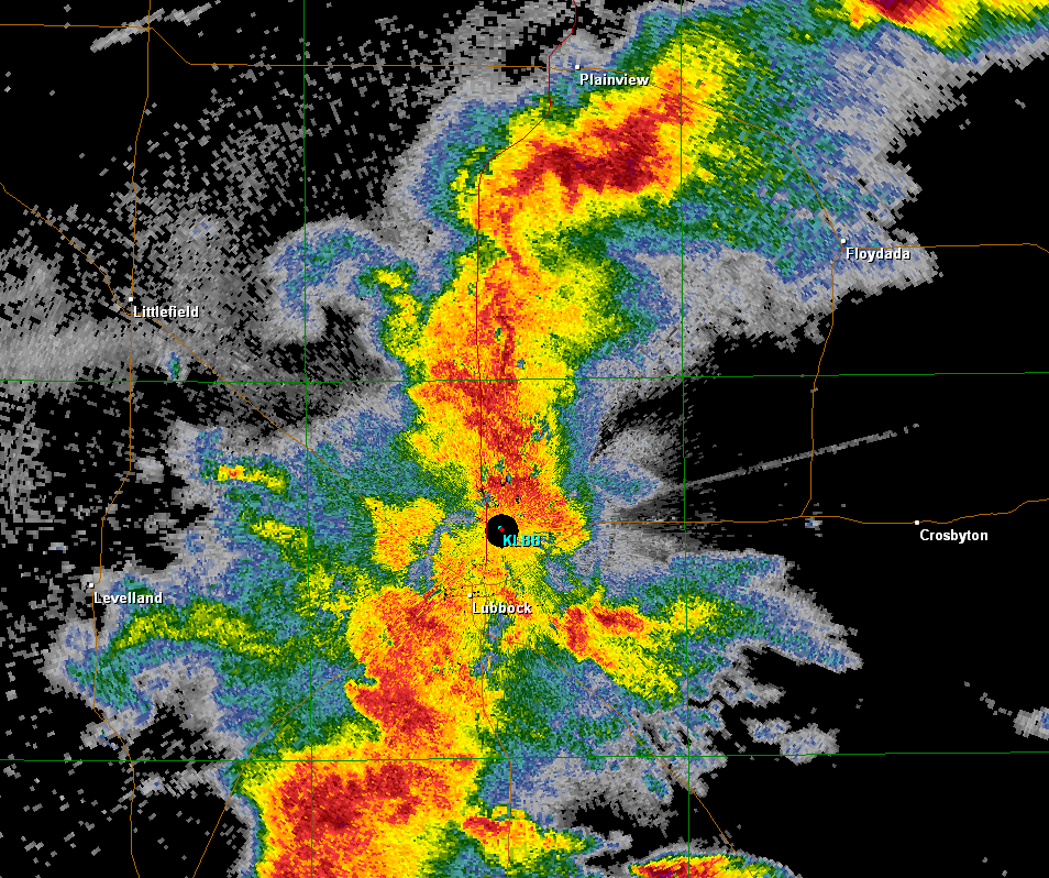
| The radar image below is a snapshot of the storms as they moved across the central South Plains late Wednesday afternoon. |
|
|
| Lubbock WSR-88D base reflectivity image for 5:30 pm. |
 |
|
Radar loop from 5:58 to 7:08 pm on 25 September 2012. The damaging winds in Lubbock occurred near 6 pm, with the 96 pm gust southwest of Paducah occurring at 7:30 pm. |
| An interactive graphical plot of severe storm reports and rainfall totals for this event can be found below. |
|
|
|||
|
Preliminary storm reports from the storms Wednesday (26 September 2012). Click on the weather icons to view the full report. Rainfall reports are courtesy of the West Texas Mesonet.
|
|||
|
Toggle Preliminary Storm Reports from 26 Sept 2012
|
Toggle 24 Hour Rainfall ending at 7:00 am on 28 September 2012
|
Toggle 48 Hour Rainfall ending at 7:00 am on 28 September 2012
|
|


 Follow us on YouTube