|
Scattered Severe Thunderstorms Rake the Region - updated 18 October 2012 - |
|||||
|
|
|||||
| Picture of lightning taken in eastern Hale County shortly after sunset on 12 October 2012. The picture is courtesy of Erin Shaw. Click on the image for a larger view. | |||||
| The combination of a strong upper level storm system approaching from the west and plentiful amounts of Gulf moisture carried on gusty southerly winds provided the right ingredients for scattered thunderstorms to develop Friday afternoon and evening (12 October 2012). Moderate instability and strong wind shear allowed several of these storms to quickly organize and become severe. The rotating storms produced very large hail, locally heavy rain, strong wind gusts and two tornadoes. These efficient hail producers dropped ice chunks as large as the size of baseballs in and near Hale Center around 7 pm. | |||||
 |
|||||
|
|||||
|
|
|||||
|
Picture showing the second of two EF0 tornadoes in east-central Hale County on 12 October 2012. The image was taken at 7:14 pm looking north from FM 400 just south of the community of Happy Union. Several observers documented a small debris cloud beneath the visible funnel. The picture is courtesy of Erin Shaw. |
|||||
| The most intense supercell thunderstorm of the evening moved northeastward through Hale County and northwest Floyd County before quickly weakening as it moved into southern Briscoe County. Early on, this storm produced a large rotating wall cloud just north of the intersection of Interstate 27 and FM Road 54 in south-central Hale County before moving northeast. Around 7:05 pm, this wall cloud produced a diffuse tornado over open land about 3 miles east of the I-27 Hale Center rest stop. The tornado quickly disorganized, but several minutes later the parent circulation aloft intensified and allowed the tornado to resume for a short time. This tornado occasionally displayed multiple vortices and grew to at least 200 yards wide at times. Fortunately, the tornado remained over farm land and created no known damage before dissipating around 7:11 pm. By 7:14 pm, the parent storm produced a second, but very brief tornado in open land just west of the community of Happy Union. Storm chasers observed a compact rotating debris cloud beneath the visible funnel shown in the picture above. | |||||
|
|
|||||
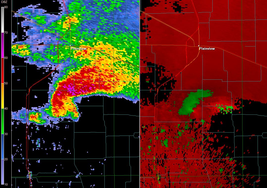
| 0.5 degree reflectivity (left) and velocity (right) captured from the Lubbock WSR-88D at 7:11 pm on 12 October 2012. Click on the image for a larger view. | |||||
|
The above image shows the thunderstorm presentation on radar around the time of the first tornado. The radar is sampling the storm about 1500 feet above ground level. A hook echo is noted in the reflectivity along with a strong velocity couplet to the south of Plainview. To view a preliminary summary of the storm reports for Friday evening CLICK HERE. |
|||||
|
|||||
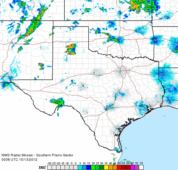
| The below radar animation shows how the storms evolved Friday evening. The thunderstorms were isolated to scattered from the South Plains into the southeastern plains of New Mexico. However, the storms were well organized, dominated by supercells (individual rotating storms) and multicells. | |||||
|
|
|||||
| Radar animation valid from 7:38 pm to 8:48 pm on 12 October 2012. | |||||
| The thunderstorms weren't all bad, as they brought nice views (below) and beneficial rains for some. The heavier rainfall was rather limited, but several spots did record from a half an inch to over one inch. | |||||
|
|
|||||
| Picture of a beautiful sky captured in central Hale County shortly before sunset on 12 October 2012. The image is courtesy of Erin Shaw. Click on the image for a larger view. | |||||
| Below is a plot of the preliminary storm reports for 12 October 2012. The 24-hour rainfall totals can also be plotted below by selecting the appropriate check box below this graphic. | |||||
|
|
|||
|
Preliminary storm reports from the event. Click on the weather icons to view the full report. Rainfall reports are courtesy of the West Texas Mesonet.
|
|||
|
Toggle Storm Reports from 10/12/2012
|
Toggle 24 Hour Reports ending at 1:30 pm on 10/13/2012
|
Maximum Estimated Size of Hail (MESH) from 10/12/2012
|
|


 Follow us on YouTube