|
Line of Severe Storms Lash the Region 14 December 2012 |
|
 |
|
|
Photo showing a line of severe thunderstorms overtaking south Lubbock. Widespread blowing dust seen here along the leading edge of these storms was replaced moments later by brief heavy rains and very strong winds. |
|
|
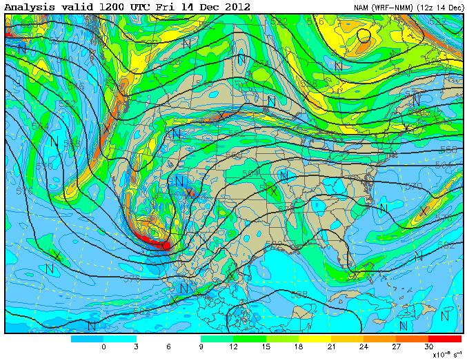
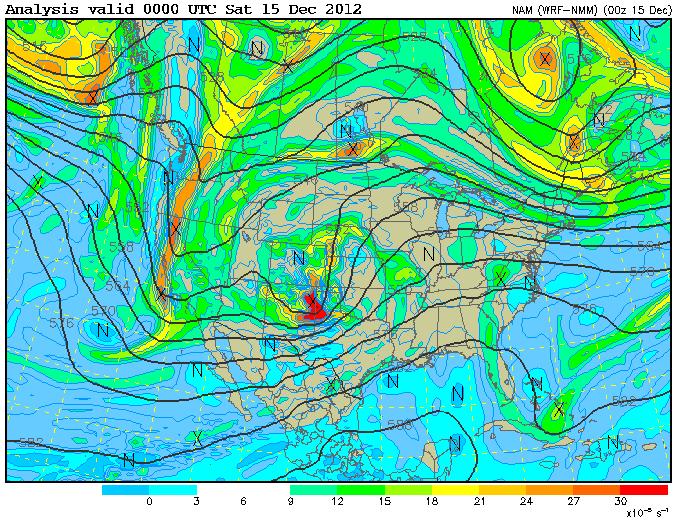
Rather uncommon for December, a powerful and fast-moving line of thunderstorms plowed across the South Plains ahead of a vigorous upper storm system. The day began with abundant low clouds and moisture from the Gulf of Mexico on stiff southerly winds. These clouds parted by late morning followed by even stronger southerly winds with frequent gusts over 40 mph, areas of blowing dust, and abundant sunshine that would further destabilize the atmosphere. As the upper trough (shown below) and a Pacific cold front began exiting eastern New Mexico shortly after 1 pm CST, showers expanded in coverage near the state line and rapidly intensified into thunderstorms as they encountered the increasingly moist and unstable airmass immediately to their east. These storms solidified into a narrow, but intense squall line that raced eastward at highway speeds for the next 4 hours accompanied by several severe wind gusts measured between 58 and 77 mph. Scattered wind damage was reported throughout the South Plains and in some instances power was disrupted to residents. Also, widespread blowing dust along the leading edge of this line of storms resulted in a period of "mudballs" before brief, but heavy rain yielded at least a tenth of an inch of precipitation over much of the region. |
|
|
|
|
| Evolution of the intense upper-level trough that provided the lift for the squall line to develop. | |
|
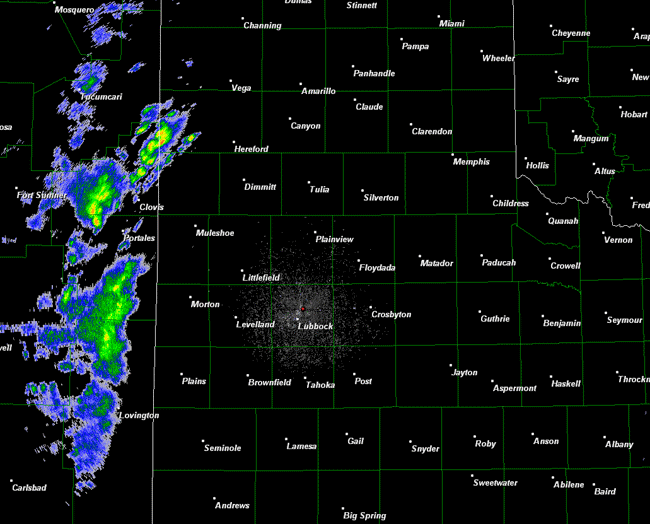
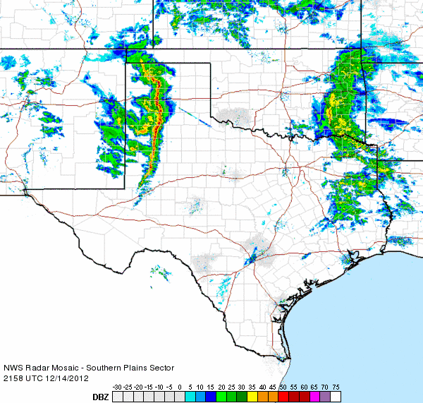
The radar animation below shows showers initially in eastern New Mexico early Friday afternoon quickly explode into thunderstorms and organize into a narrow, but intense squall line as they raced east at up to 60 mph. This intensification was the result of a very moist and unstable airmass residing over the Texas South Plains. By sunset, instability diminished and the once prolific squall line withered away into ordinary showers and storms. |
|
|
|
|
| Lubbock WSR-88D radar animation valid from 2:01 pm to 6:30 pm on 14 December 2012. | |
| A regional view of how the showers and thunderstorms evolved Friday afternoon can be found in the animation below. In addition to generating showers and thunderstorms, the upper level storm system brought snow to the mountains of northern New Mexico and southern Colorado. | |
|
|
|
| Regional radar animation valid from 3:58 pm to 5:08 pm on 14 December 2012. To view and earlier regional radar animation valid from 1:18 pm to 2:28 pm CLICK HERE. | |
|
Winds peaked in excess of 50 mph across the South Plains, southern Texas Panhandle and northern Rolling Plains Friday afternoon. The severe wind gusts, in excess of 58 mph, generally occurred as the line of the thunderstorms moved through during the middle to late afternoon hours. The below graphic shows how the strong and severe wind gusts were distributed across the area on 14 December 2012. To view the preliminary storm reports for the event CLICK HERE. |
|
|
|
|
| Plot of the maximum winds (mph) recorded on 14 December 2012. Data are courtesy of the West Texas Mesonet and the National Weather Service. Click on the map for a larger view. | |
 |
|
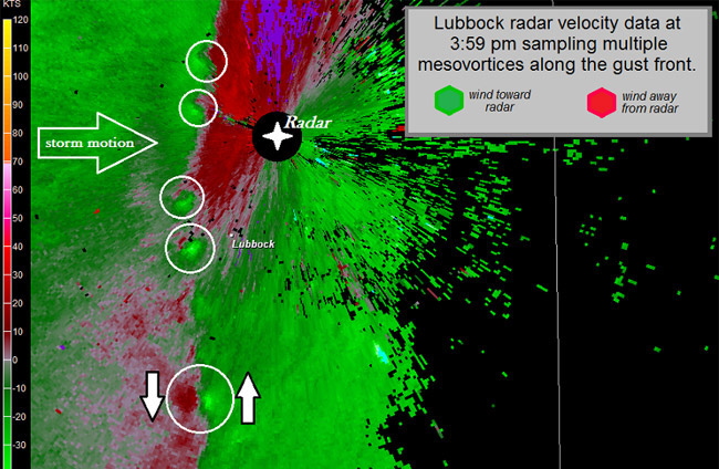
| Image of velocity data as measured by the NWS-Lubbock radar at 3:59 pm. The white circles highlight relatively small, low-level circulations along the thunderstorm gust front known as mesovortices. Mesovortices frequently enhance straight-line winds over localized areas. We monitor these features closely for intensification as they can occasionally produce brief tornadoes. | |
| The below map displays the preliminary storm reports and rainfall totals for 14 December 2012. Rainfall totals were on the light side, though at least all locations did pick up a little rain before the precipitation shifted quickly to the east. In addition, the storm system brought snow to the mountains of New Mexico and southern Colorado. | |
|
|
|||
|
Preliminary storm reports from the event. Click on the weather icons to view the full report. Rainfall reports are courtesy of the West Texas Mesonet. MODIS satellite image taken around 4 pm CST
|
|||
|
Toggle Storm Reports from 12/14/2012
|
Toggle Rainfall Reports for 12/14/2012
|
Toggle Afternoon Satellite Image
|
|
| Click HERE for a case study of this event from the West Texas Mesonet |
| Click HERE for a case study of this event from the National Weather Service office in Amarillo |


 Follow us on YouTube