|
Welcome Precipitation Falls on West Texas |
||||
 |
||||
|
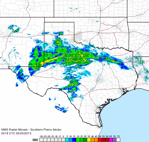
Radar animation valid from 10:18 to 11:28 pm on Tuesday, February 19th, 2013. Another radar animation valid from 1:48 to 2:58 am on Wednesday the 20th can be FOUND HERE. |
||||
|
The South Plains region experienced a couple of rounds of welcome precipitation between Tuesday and Thursday (19-21 February 2013). Initially, a very dry atmosphere was in place on Tuesday, but a strong upper-level disturbance drew in a large slug of Pacific moisture and produced a widespread band of light to moderate rain Tuesday evening and overnight (see the above radar animation). Rain totals of 1/10th to around 1/3rd of an inch were common with this initial round of chilly rain, except across the southwest Texas Panhandle, where they missed out on the rain. A few spots even saw a few rumbles of thunder. The steady rain came to an end early Wednesday morning, as the lead disturbance shifted off to the east. However, cloudy skies and moist easterly winds kept things cool, and foggy, with areas of drizzle too. |
||||
 |
||||
|
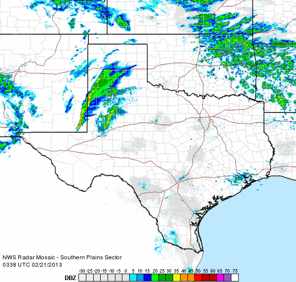
Radar animation valid from 9:38 to 10:48 pm on Wednesday, February 20th, 2013. Another radar animation valid from 10:48 to 11:58 pm on Wednesday can be FOUND HERE. |
||||
| An even stronger upper-level low then quickly approached from the west Wednesday evening into early Thursday. Increasing lift with the nearing system combined with sufficient moisture to produce another round of widespread showers and isolated to scattered thunderstorms. The stronger thunderstorms even produced small hail in spots. In addition, the cool temperatures, along with the strong lift and even colder air moving in with the storm system, allowed the rain to mix with or change completely over to sleet and snow in places. The heaviest wintry precipitation generally fell north of Lubbock, from Abernathy to Plainview, Tulia and Dimmitt, where 1/2 inch to over an inch of icy sleet/snow fell. | ||||
|
||||
|
|
||||
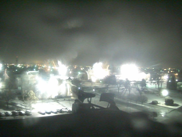
| The above images show a little bit of the wintry precipitation that fell in the region. Even heavier snow totals fell well to the north, in the Texas Panhandle. Eventually, by early Thursday morning, the mixture of precipitation tapered off and shifted north and east of the South and Rolling Plains. Rain totals from the two rounds of precipitation generally ranged from 1/3 to 1/2 of an inch, with locally heavier amounts. | ||||
|
|
||||
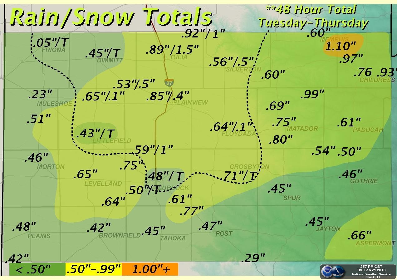
| Map of the observed rain and snow from the entire mid-February event (19-21 February 2013). Click on the map for a larger view. | ||||
|
A plot of the rain totals, as measured by the West Texas Mesonet, can be found below. Also, a plot of the low temperatures Thursday morning is available. Temperatures bottomed out plus or minus a few degrees of freezing, making for the interesting types of precipitation and also resulting in some slick spots on area roadways. |
||||
|
Toggle Precipitation Totals from 2/19-21/2013
|
Toggle Low Temperatures on 2/21/2013
|


 Follow us on YouTube