|
Overnight severe winds produced by a wake low and heat burst |
 |
| Lubbock WSR-88D radar reflectivity animation from 12 am to 7 am on 3 June 2013. Click on the animation for a larger view. |
| A weakening complex of showers and thunderstorms dropped rain and produced strong and severe wind gusts early on June 3rd (Monday). The heaviest rain fell around and shortly after midnight across the western South Plains. One storm in Yoakum County even briefly became severe, producing a wind gust to 62 mph and likely dropped small hail. The thunderstorms then weakened, but as they did so they rapidly formed an area of low pressure on the northern flank of the decaying showers. This strong pressure gradient caused winds to quickly accelerate and many spots across the southwest and south-central Texas Panhandle into the far northern South Plains saw a prolonged period of winds gusts between 60 and 70 mph. |
 |
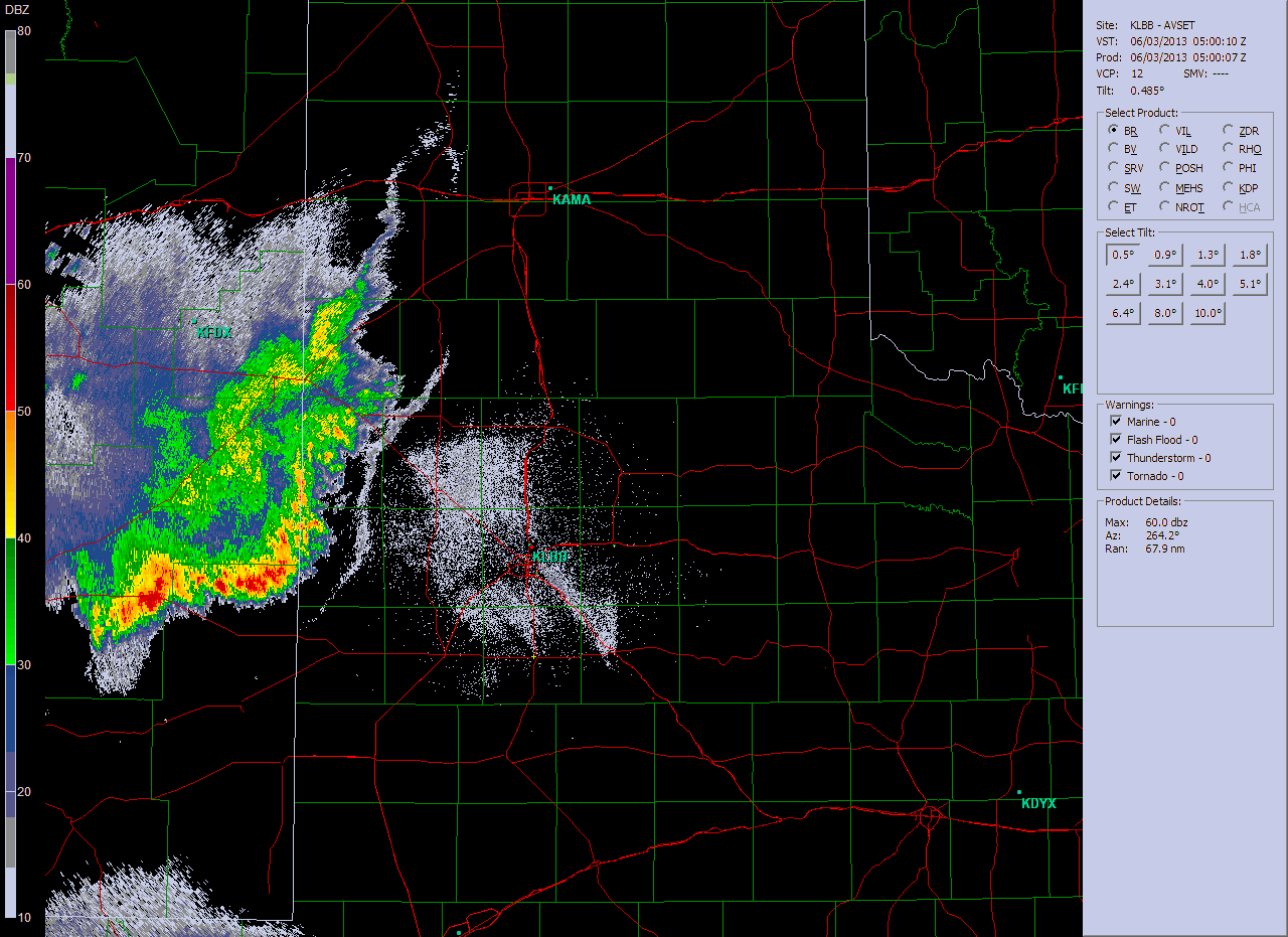
| Lubbock radar reflectivity (left) and velocity (right) at 3:41 am on 3 June 2013. The West Texas Mesonet station near Hart recorded a wind gust to 68 mph at 3:40 am. |
|
The above panels show what the radar looked like around the time of the strongest winds in Hart. Although little to no rain was making it to the ground, evaporating as it fell into a dry sub-cloud layer, the radar does show strong outbound velocities (bright reds) corresponding to the strong winds. In addition to the widespread severe wind gusts resulting from the wake low, more localized strong to severe winds occurred over Lubbock around 6 am. These winds were a result of a heat burst, with a collapsing shower aloft producing a strong downdraft which penetrated to the ground and caused the temperature to rapidly rise from the middle 60s to the lower and middle 80s during the early morning hours. Unfortunately, aside from the Denver City area, the locations that experienced the strongest winds saw little to no rainfall, as is typical with wake lows and heat bursts. |
 |
| Lubbock radar reflectivity (left) and velocity (right) at 5:51 am on 3 June 2013. This is around the time Lubbock experienced 50-60 mph in a heat burst. Temperatures jumped 10-20 degrees with the winds. The circle shows where the weak shower is producing strong winds moving toward the radar. |
| The below plot displays the severe wind reports that were received from around the area early on June 3rd. In addition, the maximum winds speeds and total rainfall measured by the West Texas Mesonet stations from this event can be viewed in the map below. For a listing of the preliminary storm reports for this event CLICK HERE. |
|
|
|||
|
Toggle Preliminary Storm Reports
|
Toggle Maximum Wind Speed (mph)
|
Toggle 24 hr rainfall ending at 8 am on June 4th
|
|


 Follow us on YouTube