Extensive roof damage to a motel in the northern part of Lubbock.
During the mid to late afternoon hours on Wednesday, June 5th, an area of thunderstorms developed as a result of upslope flow across the higher terrain of New Mexico. These storms then morphed into a well-organized squall line into the late afternoon and evening. This line raced southeast into the far southwest Texas panhandle and much of the South Plains, producing wind gusts in excess of 90 mph and hail up to the size of baseballs. Numerous reports of damage were received, including downed trees and power lines as well as demolished structures and broken windshields. A second area of showers and thunderstorms developed across the southern Rolling Plains into the Big Country, but no damage reports were received from this activity. The squall line continued moving east and southeast through the early morning hours on Thursday, bringing widespread rainfall of one to two inches across that area.
Timeline (in CST)
5:00 to 8:00 pm:
Thunderstorms develop in eastern New Mexico. Storms approach the state line and produce a 69 mph wind gust at Cannon Air Force Base and penny-sized hail at Texico
8:00 to 9:00 pm:
A supercell thunderstorm moves across Parmer County producing hail up to the size of baseballs and 60 to 70 mph wind gusts.
Radar image at 8:30 pm (base reflectivity from the Lubbock radar). Click on the image for a larger view.
9:00 to 10:00 pm:
Thunderstorms form a organized complex which moves southeast across mainly Lamb, Cochran, Bailey and Yoakum Counties. After two-inch hail falls near Springlake in Lamb County, the main threat shifts to high winds. The West Texas Mesonet station at Morton records a 72 mph wind gust.
Radar image at 9:30 pm (base reflectivity from the Lubbock radar). Click on the image for a larger view.
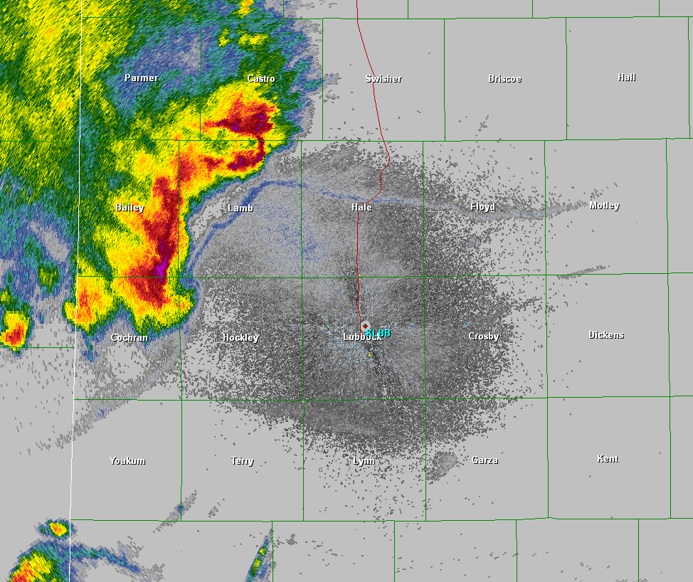
10:00 to 11:00 pm:
The storm complex is moving more easterly now and moves across Hockley County into Hale, Lubbock and Terry Counties. Widespread wind damage is reported across the Lubbock area with measured wind gusts of 84 mph at Wolfforth and 82 mph in Slaton.
Radar image at 10:30 pm (base reflectivity from the Lubbock radar). Click on the image for a larger view.
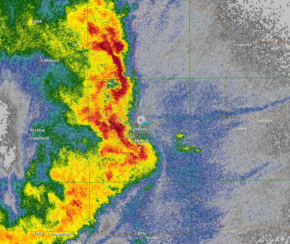
11:00 to 12:00 am:
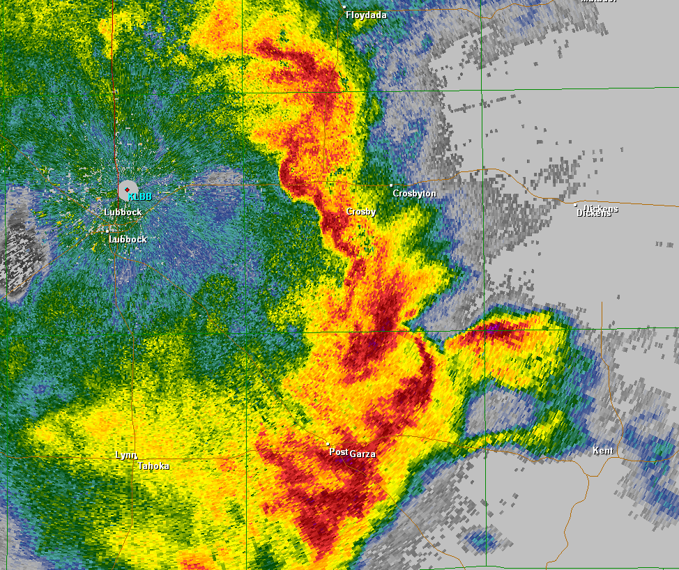
The storm complex moves east into Floyd, Crosby and Lynn Counties. Numerous wind gusts of 60-70 mph are reported and quarter-sized hail falls at White River Lake.
Radar image at 11:30 pm (base reflectivity from the Lubbock radar). Click on the image for a larger view.
12:00 to 3:00 am:
Although the storm complex has lost some intensity, it continues to move east across the Rolling Plains and finally into north Texas. The storms produce widespread moderate to heavy rain and 40 to 50 mph wind gusts.
Radar image at 1:00 am (base reflectivity from the Lubbock radar). Click on the image for a larger view.
Damage Survey
The Lubbock office sent two teams out on Thursday to survey some of damage reports across Lubbock County. The teams concentrated on Reese Center, north Lubbock and the Marsha Sharp Freeway, Ransom Canyon and Slaton. The teams found damage consistent with 80 to 90 mph winds in the majority of the more severe damage. More information and photos will be posted soon.
Uprooted tree on a vehicle in Slaton.
Rail car damage in Slaton showing box cars on top of tanker cars.
Map of the damage across Lubbock County as surveyed by the NWS. Click on each damage indicator to view images & details.
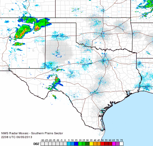
Radar Analysis
The animated image below shows a broad overview of the storms from about 10 to 11 pm. More radar loops are available through the links below the image.
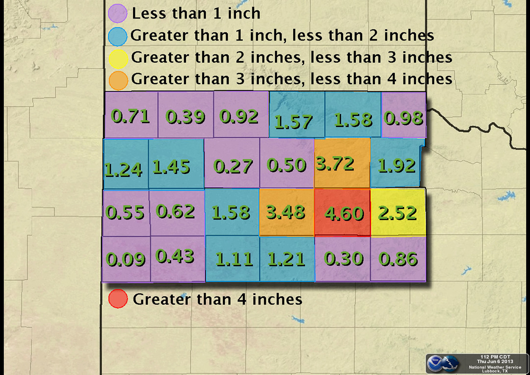
Fortunately, along with the severe winds and hail came some much needed rainfall for much of the far southern panhandle, South Plains, and Rolling Plains. Amounts were generally between half an inch to 1.50 inches north and east of a Muleshoe to Brownfield line, with localized areas receiving upwards of 2.50 to 3 inches. Locations in the southwest South Plains did not fair so well, with rainfall totals generally between a couple hundredths of an inch up to a tenth of an inch.
Map of the highest rainfall totals received from each county based on West Texas Mesonet and Co-op reports.
Click on the image to view a larger version.
The below map shows all of the preliminary storm reports that were received by the National Weather Service in Lubbock during and shortly after the storms. In addition, the maximum wind gusts and total rainfall recorded by the West Texas Mesonet stations can be displayed below. To view a listing of the preliminary storm reports in a text format CLICK HERE.
Toggle Preliminary Storm Reports
Toggle Maximum Wind Gusts (mph)
Toggle 24 Hour Rain Totals (inches)
ending at 8 am on June 6th


 Follow us on YouTube