 |
||||
 |
||||
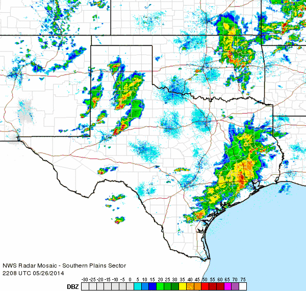
| Regional radar loop valid from 5:38 to 6:48 pm on 21 May 2014. | ||||
|
A slow moving upper level storm system combined with plentiful amounts of moisture to bring rounds of showers and thunderstorms to West Texas in late May of 2014. Although the heavy rainfall did cause some generally minor flooding issues, and a few of the thunderstorms turned severe, the overall outcome was very positive with the entire region receiving desperately needed rainfall at a critical time of year.
|
||||
|
||||
| Damage caused by strong downburst winds in Tulia on 21 May 2014. The pictures are courtesy of Chad Miller. | ||||
|
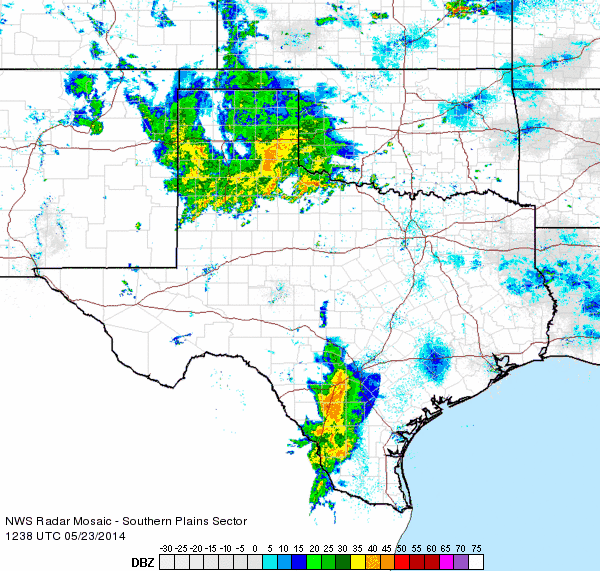
The active late May kicked off with a round of thunderstorms Wednesday afternoon (May 21st) across the western South Plains, as the radar animation at the top of the page illustrates. Low-level moisture was still somewhat limited initially, and these "dry" conditions help contribute to strong downburst winds and plenty of blowing dust during the afternoon and evening hours. A few storms even became strong to severe and produced hail and damaging winds. The most intense winds, measured as high as 64 mph at the West Texas Mesonet Station 3 miles north of Hart, impacted Olton, Hart and Tulia. The downburst winds downed power lines, lofted dust, and caused localized property damage, as the above and below images illustrate. In addition, rainfall totals of up to a couple tenths of an inch were fairly common across the southwest Texas Panhandle and western South Plains, with Hart being the big winner, picking up 1.03 inches. A list of the preliminary storm reports for Wednesday, May 21th, can be FOUND HERE. |
||||
|
||||
| The storms on 21 May 2014 produced strong downburst winds, as visualized by the blowing dust in the above left picture. The left picture was taken west of Ropesville by Erin Shaw. The right picture is of a free standing grain elevator that was blown against a grain tank in Hart during the evening of the 21st. The picture from Hart is courtesy of Randy Griffitt. | ||||
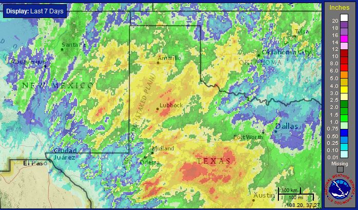
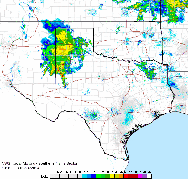
| The low-level moisture did increase by late week and remained in place through the long holiday weekend. This deep moisture supported several rounds of showers and thunderstorms from late Thursday (22 May 2014) through Memorial day (26 May 2014). The abundant moisture allowed for very efficient rainfall rates, leading to rain totals that quickly eclipsed the year-to-date rain totals up to this point at many locations. Over the course of 6 days, most spots accumulated from 2 to over 6 inches, as the below graphic shows. | ||||
 |
||||
|
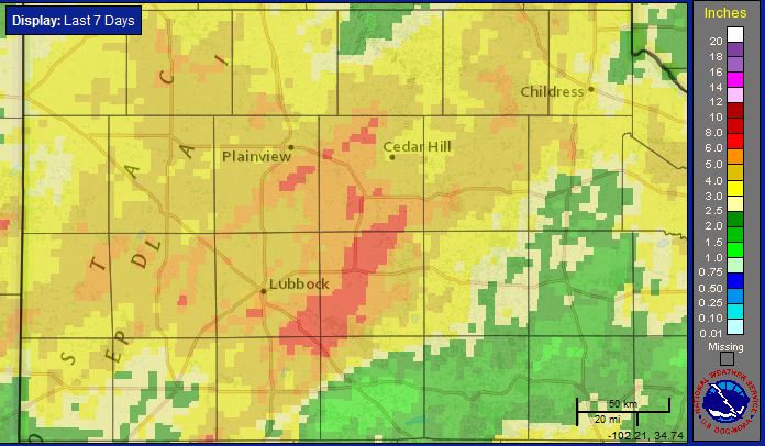
Radar-estimated 7-day rainfall totals ending the morning of Tuesday, 27 May 2014. A regional view of the 7-day radar-estimated rainfall totals can also be VIEWED HERE.
|
||||
You can compare the radar estimates above to actual observations from our Co-op observers and automated stations of the West Texas Mesonet and the National Weather Service in the image below. The same swath of heavy rain across the central South Plains is apparent in both analyses. |
||||
 |
||||
|
Rainfall reports from May 21 through May 26th gathered from the National Weather Service Co-op and ASOS data, and West Texas Mesonet data (www.mesonet.ttu.edu). Click on the image to view the full-size map. |
||||
| The heavy rainfall did cause some problems, mostly in the form of flooded streets and swelling playa lakes (some which just days before were bone dry). The below pictures depict flooding experienced around the Lubbock area. | ||||
|
||||
| The heavy rain caused flooding around the region. The left picture, courtesy of Aaron Hill, shows water inundating the intersection of FM 114 and Frankford Avenue, in Lubbock County, Sunday morning (25 May 2014). The right image shows a flooded car near 98th and Indiana, in Lubbock, on Memorial Day afternoon (Monday, 26 May 2014). The right image is courtesy of Cortney (@cenorty) via Twitter. | ||||
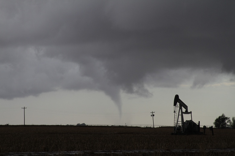
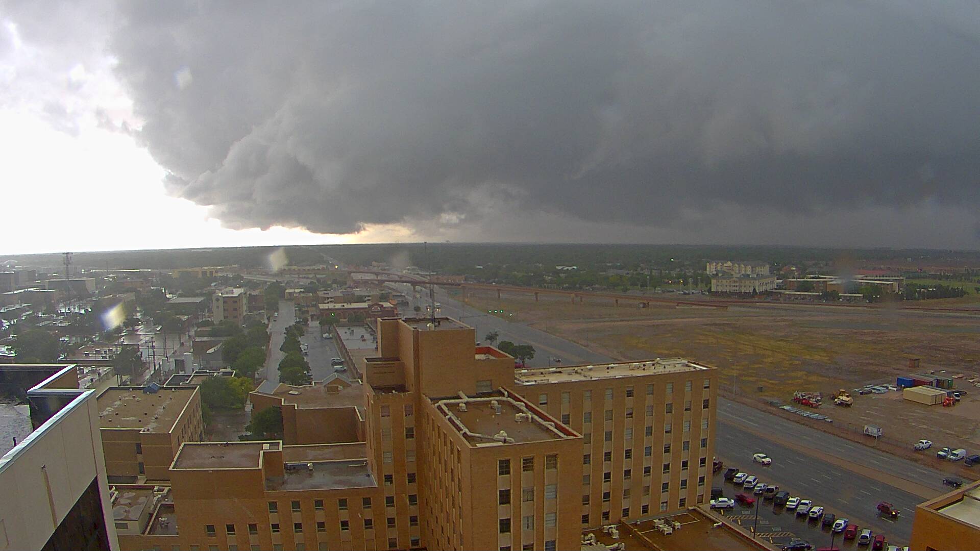
| A few of the thunderstorms that brought the heavy rain also become strong to severe, with the strongest storms experienced in the South Plains region on Wednesday the 21st (discussed above) and then again on Monday the 26th. One thunderstorm on Memorial day even produced a brief tornado in Hockley county during the early evening hours. All of the moisture also meant that storm cloud bases were low to the ground, making for an ominous sight, as the below images depict. | ||||
|
||||
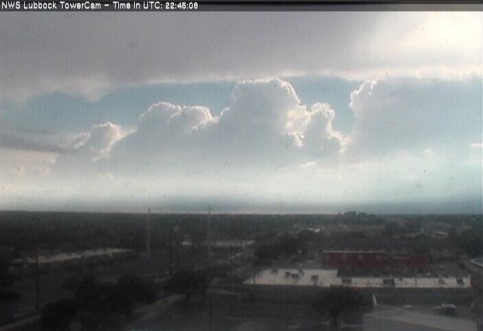
| Pictures of storm clouds around the South Plains on the Memorial Day (26 May 2014). The upper left picture, courtesy of Bruce Haynie, is of a brief tornado that occurred in Hockley County during the early evening hours. The upper right picture, courtesy of KAMC, shows a rain shaft and wall cloud on the west side of Lubbock during the late afternoon. The lower left picture shows a developing line of thunderstorms to the west of the Lubbock. The lower right picture, courtesy of Zach Long, shows what it looked like under that line of thunderstorms, with a well-defined shelf cloud. | ||||
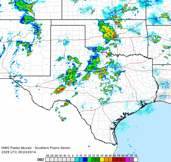
| The below radar animation shows how the thunderstorms evolved through early evening on the 26th. The most intense storms were located along the I-20 corridor, but a few rounds of strong to severe storms moved across the South Plains and Rolling Plains. | ||||
 |
||||
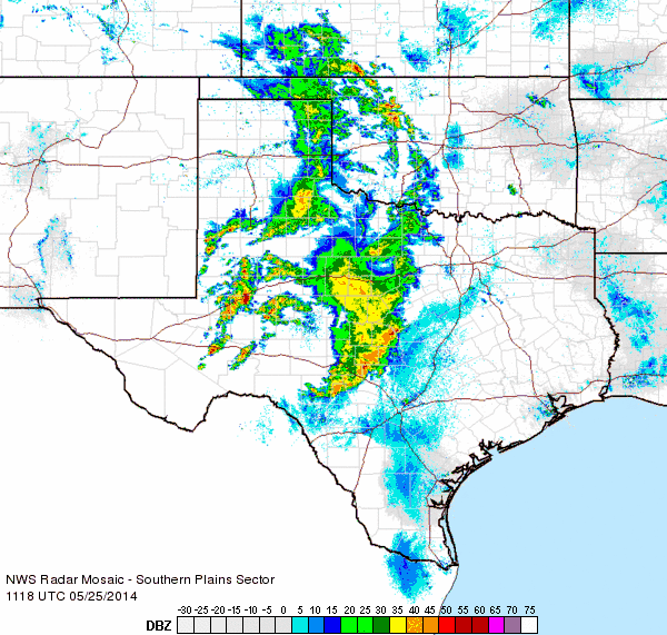
| Regional radar loop valid from 5:08 to 6:18 pm on 26 May 2014.Additional regional radar animations from the this long duration rain event can be found at: 23 May from 5:18 to 6:28 am ; 23 May from 7:38 to 8:48 am ; 23 May from 2:28 to 3:38 pm ; 24 May from 8:18 to 9:28 am ; 24 May from 12:48 to 1:58 pm ; 24 May from 6:28 to 7:38 pm ; and 25 May from 6:18 to 7:28 am. | ||||
|
Thankfully, the severe thunderstorms were relatively isolated and short-lived, which limited the damage. Still, several trees and power lines were knocked down in and around Lubbock on Memorial Day. A list of the preliminary storm reports collect from Saturday, May 24th, through Monday, May 26th, can be FOUND HERE. |
||||
 |
||||
| Graph of the accumulated rainfall at the Lubbock International Airport for 2014, through May 26th (green line). Also displayed are the normal rainfall (brown) and the driest year on record (red - 2011). | ||||
| All of the rain did put a welcome and long-awaited dent in the ongoing drought. The above graph shows the rainfall recorded at the Lubbock International Airport this year. The relative dearth in precipitation through early May is quite obvious, with Lubbock officially tallying a paltry 0.90 inches through May 21st. In fact, through mid-May Lubbock was actually below the record dry year of 2011, and ranked behind only 1996 (0.65") and 1984 (0.88") for driest starts to the year (through May 21st). This quickly came to an end as 5.23 inches fell over the course of five days, from May 22nd through the 26th. This included daily rainfall records of 1.22 inches on the 25th and 1.60 inches on the 26th. May 23rd also recorded 1.89 inches, though this did not break a daily record. Amazingly, this wet stretch carried Lubbock from threatening to be the driest May on record to the 10th wettest. In addition, the yearly rainfall tally at Lubbock catapulted above the yearly average, if only by a few tenths of an inch. | ||||
 |
||||
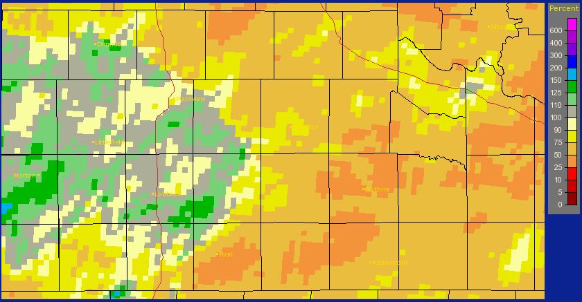
| Radar-estimated year-to-date rainfall, as a percent of normal, ending on 26 May 2014. To view the same information as a departure from normal CLICK HERE. | ||||
| The above map shows the impacts of the heavy rainfall across the entire South Plains region. Many locations on the Caprock jumped to near and even slightly above average for the year. Spots across the Rolling Plains and southeast Texas Panhandle also saw significant improvements, though their yearly rain totals remain short of average. | ||||
 |
||||
| Graph of the accumulated rainfall at the Lubbock International Airport since November of 2010, ending on May 26th of 2014 (green line). Also displayed is the normal rainfall (brown) for this 3.5+ year stretch. | ||||
| Obviously, the heavy rain has helped squash the short-term drought by replenishing the soil moisture and refilling many playa lakes and holding ponds. However, the drought has been ongoing since late 2010, and large rainfall deficits remain from the past few years, as the above graph for Lubbock illustrates. These longer-term droughts have significant impacts on water supply. Most area lakes/reservoirs did see some improvement over the past week, but they remain well below capacity. White River Lake rose about 3 feet, but still remained at 0% capacity. Mackenzie Lake, Lake Alan Henry, and Lake Meredith saw only minor rises under a foot. Much more frequent heavy rainfalls, similar to this past extended weekend of rain, will be needed to make a more significant dent in the long-term drought. | ||||
|
|
|||
|
Toggle Preliminary Storm Reports on May 21, 2014
|
Toggle 24-hr Rainfall (inches) ending at 7 am on May 22, 2014
|
Toggle 5-day Rainfall (inches) ending at 9 am on May 25, 2014
|
Toggle 5-day Rainfall (inches) ending at 9 am on May 27, 2014
|


 Follow us on YouTube