 |
||
 |
||
| Storm rolling into Lubbock Thursday morning (11 September 2014). | ||
| After a brief warm and dry stretch for the beginning of the second week of September, rain and cooler conditions returned to West Texas to close out the week, keeping the weather roller coaster ride going this month. These wide swings in temperatures along with periodic rainfall are not uncommon for fall, as shortening days and lower sun angles combine with stronger cold fronts that begin to make their way more regularly through the South Plains. This was certainly the case from September 5-7th, with an encore performance on September 11th and 12th. The rainfall coverage and intensity with each event were also enhanced by plentiful amounts of moisture streaming out of the Gulf of Mexico as well as the eastern Pacific. | ||
 |
||
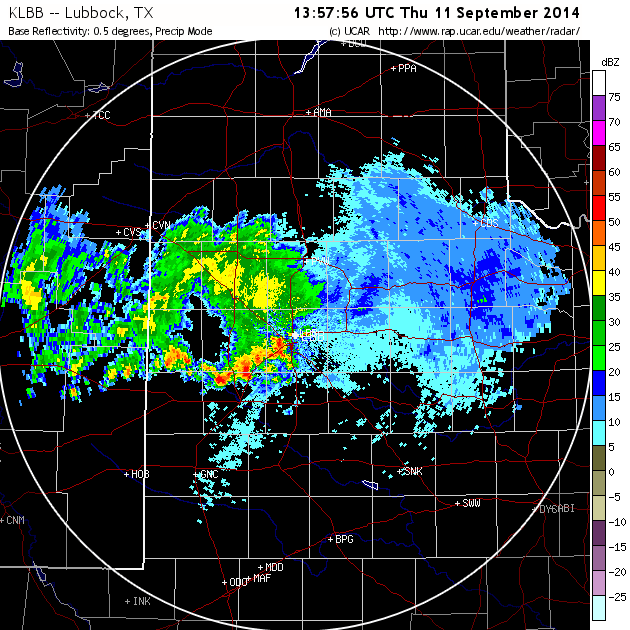
| Snapshot of the Lubbock radar at 8:58 am on 11 September 2014 (Thursday). | ||
| An initial cold front moved through the region on Wednesday into early Thursday (10-11 September). The frontal passage was dry, but it did bring modest cooling to the region. Lift well behind the front did eventually trigger a small complex of showers and thunderstorms that moved across the South Plains Thursday morning (see the above radar image). This activity dropped locally heavy rainfall in spots, with an inch or more recorded from parts of Lubbock westward through Levelland to south of Morton. This did create some minor flooding issues as the rain came down at a robust rate for a short time. The rain gradually tapered off early Thursday afternoon as the complex moved into the Rolling Plains and diminished, but the rainfall, cloud cover and easterly winds kept highs down in the 70s. | ||
 |
||
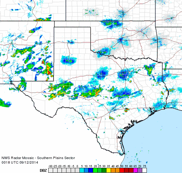
| Regional radar animation valid from 6:18 to 7:28 am on 12 September 2014 (Friday). An additional radar animations can be viewed at: Regional radar animation valid from 7:18 to 8:28 pm on 11 September. | ||
| After a lull during the afternoon and early evening, another round of showers and thunderstorms moved northeastward into the region from eastern New Mexico and the Permian Basin Thursday night and persisted into Friday. This rain was further enhanced by a secondary cold front that brought chilly mid-September air southward on gusty northerly winds. The heaviest rain with this round of activity was focused from southeast New Mexico into the northern Permian Basin, though areas of moderate to heavy rain also affected the South Plains and Rolling Plains. In addition, temperatures fell from the 60s early in the day into the 40s and 50s behind the cold front by Friday afternoon. The gusty winds and cool, cloudy, and moist conditions made for a raw fall day. The rain gradually diminished Friday night, though a few light showers and areas of drizzle did linger into Saturday morning. | ||
 |
||
| Two-day radar-estimated rainfall totals ending at 8 pm on Friday, 12 September 2014. | ||
|
The above map shows that the heaviest rain for the event generally fell along and south of Sudan to Lubbock to Guthrie line, where totals of 1 to 2+ inches were common. Much lighter amounts were recorded further north, with little to no rainfall in parts of the Texas Panhandle. The below maps shows precipitation totals and temperatures as recorded by the West Texas Mesonet. |
||
|
|
||
|
Toggle 24-hour rain totals ending
at 8:30 pm on 9/11/2014 (Thursday) |
Toggle 48-hour rain totals ending
at 9 pm on 9/12/2014 (Friday) |
Toggle temperatures observed around midday on Friday 9/12/2014
|


 Follow us on YouTube