 |
 |
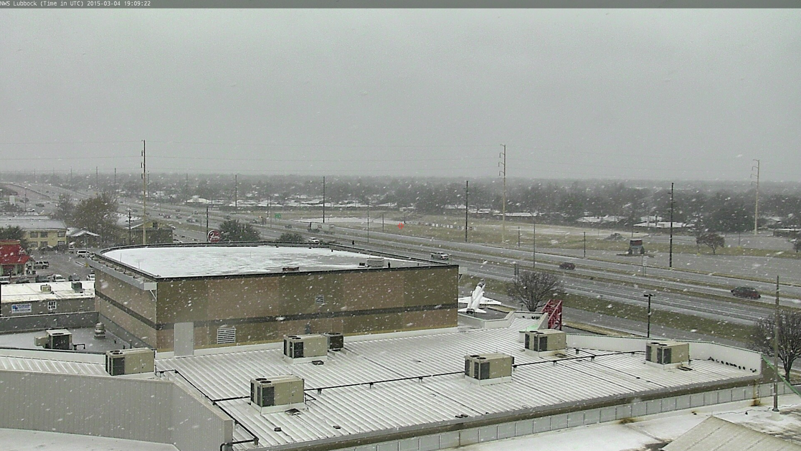
| Moderate to heavy snow affecting Lubbock during the early afternoon on Wednesday, March 4th. The image was captured from Covenant Hospital and is courtesy of KAMC. |
| |
| After a one day reprieve from winter on Tuesday (March 3rd), the colder air and frozen precipitation quickly returned on Wednesday. The day actually started on the mild side, with most locations above freezing. However, this quickly changed as a strong cold front brought frigid air in on gusty northeasterly winds through the morning and afternoon hours. Temperatures by late afternoon were only in the lower to middle 20s. To complicate things, an approaching upper level disturbance brought widespread precipitation to the region. Initially, the precipitation started as light to moderate rain, but as the temperatures cooled, the rain changed to freezing rain through the morning. |
| |
 |
| Ice accumulates on a car in South Lubbock around noon on March 4, 2015. |
| |
| The freezing rain first coated exposed objects like trees, grass and cars, but it eventually cooled enough for ice to form on some roadways too. Then, as the cold air deepened, the freezing rain mixed with and changed to sleet and eventually snow. A particularly intense band of snow spread northeastward over much of the South Plains through the early to mid-afternoon hours (see the below radar animation). The heaviest sleet and snow gradually shifted eastward across the Rolling Plains during the late afternoon and evening hours before diminishing late in the evening. |
| |
 |
| Regional radar animation valid from 11:48 am to 12:58 pm on March 4, 2015. |
| |
| By the time all was said and done, most spots recorded 1 to 2 inches of sleet and snow, with a few locations seeing 3 or more inches. The biggest winner was Turkey, who recorded 4.5 inches of snow, though Hart, Memphis, Paducah and Tulia did all measure 3 inches. A complete report of the measured rain and snow totals can be FOUND HERE. The wintry mix created plenty of travel problems and contributed to numerous accidents, but it also brought more welcome moisture to the region. Liquid equivalents of a tenth to three tenths of an inch were fairly common for this event. Even though road conditions did briefly improve in spots during the early evening hours, they degraded again thereafter as moisture refroze as temperatures dropped overnight. Where skies cleared early, across the southern Texas Panhandle, temperatures tumbled into the single digits in many spots. The Silverton West Texas Mesonet recorded the lowest temperatures, bottoming out at 4 degrees. |
| |
|
|
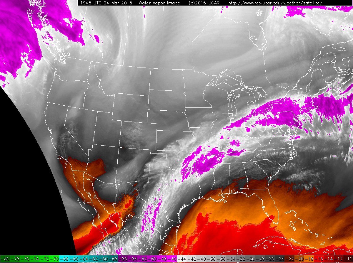
| Water vapor satellite image (left) taken at 1:45 pm and a visible satellite image (right) snapped at 1:15 pm on March 4, 2015. |
| |
| The storm system that dropped the rain, freezing rain, sleet and snow had a nice tap of middle and upper level moisture off of the eastern Pacific, as the above water vapor image shows. This sub-tropical moisture tap was then lifted over the cold air moving in near ground level to produce the widespread cloud cover and variety of precipitation types. |
| |
 |
 |
| What it looked like in Plainview (left) and Whiteface (right) during the early afternoon of March 4, 2015. The images are courtesy of KAMC and Whiteface ISD, respectively. |
| |
| The above pictures showed what it looked like in Plainview and Whiteface while the snow was moving through during the early afternoon of March 4th. Additional images of the heavy snow, and giant snowflakes, falling in Lubbock can be viewed below. |
| |
|
|
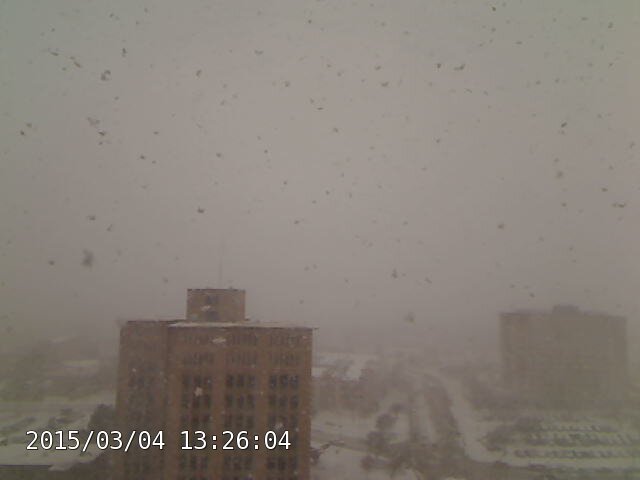
| Freezing rain and sleet transitioning to snow in south Lubbock (left) shortly after 1 pm on March 4th. Shortly after this, large flakes of heavy snow were seen falling on the Texas Tech campus (right) at 1:26 pm. |
| |
| The satellite image below, taken the day after all of the winter weather, illustrates how widespread the sleet and snow was. Aside from the coastal regions of Texas, Mexico and southeast New Mexico, all the lighter/whiter regions are locations of sleet and snow blanketing the ground. |
| |
 |
| Visible satellite image captured at 10:15 am on March 5, 2015. |
| |
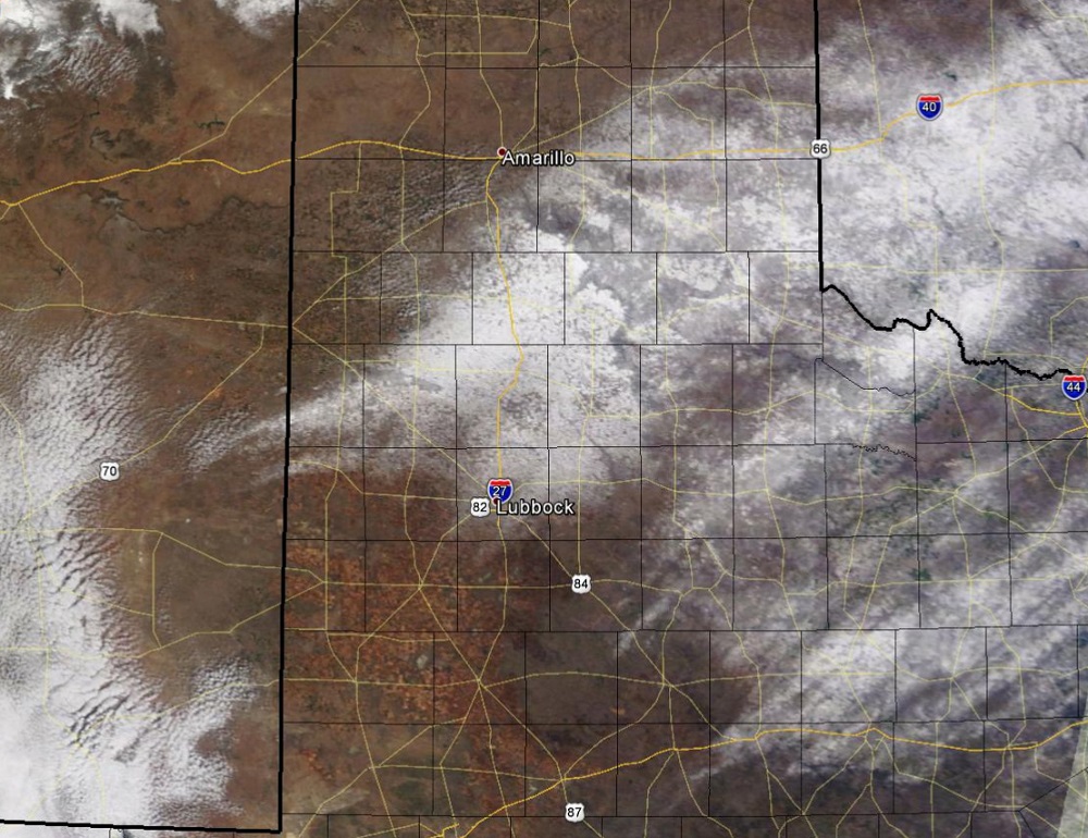
| The satellite images below show the progression of the snow melt on Wednesday. The image on the left was taken early in the afternoon, and the image on the right was taken late in the afternoon. The edge of the Caprock is easily seen as strong northeast winds produced higher snow totals on the south and west sides of the canyons along the escarpement. |
| |
 |
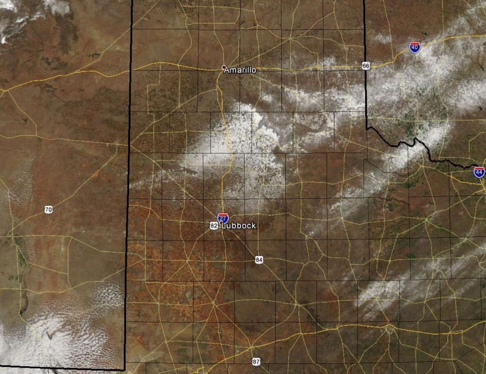 |
| Images from the NASA polar orbiting Terra (left) and Aqua (right) satellites Wednesday afternoon on March 5, 2015. |


 Follow us on YouTube