 |
||
 |
||
| Photograph of an electrically charged storm near Paducah early Saturday afternoon. | ||
|
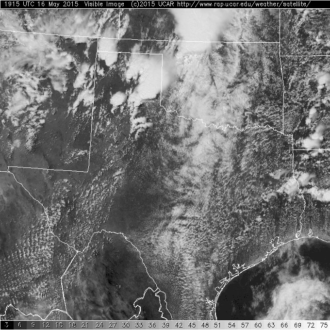
Scattered thunderstorms developed relatively early in the day on Saturday, May 16th, as a strong upper-level storm system passed over West Texas. The initial storms formed before noon, growing in coverage and intensity after midday. The most widespread activity affected the Texas Panhandle into the Rolling Plains, though isolated showers and storms did roam the South Plains as well. |
||
 |
||
| Visible satellite image captured at 2:15 pm on Saturday, 16 May 2015. | ||
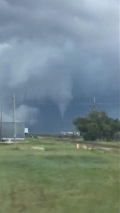
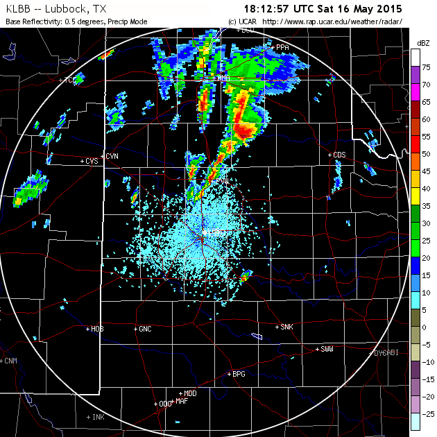
| One better organized storm even produced a brief tornado northeast of Silverton shortly after 1 pm (see the images below). | ||
 |
||
| Picture of a funnel cloud (and possible tornado) about 10 miles north-northeast of Silverton. The image was captured by an off duty fireman around 1:12 pm on 16 May 2015. | ||
 |
||
| Another photograph of the Silverton tornado taken by Mile Palmer around 1:17 pm on 16 May 2015. | ||
|
||
| Lubbock WSR 88-D reflectivity (left) and velocity (right) imagery sampled at 1:13 pm on 16 May 2015. This is around the time of the tornado report northeast of Silverton. | ||
| Besides the brief tornado, the storms did produce isolated reports of large hail and damaging wind gusts. A list of the preliminary storm reports for May 16th can be FOUND HERE. | ||
| Several of the thunderstorms which developed across the Rolling Plains moved into southwest Oklahoma late in the afternoon and produced several tornadoes on the north side of the Red River as well as tennis-ball sized hail in Quanah. | ||
| The map below shows tracks of storm rotation and hail size estimated by National Weather Service Doppler Radar. The map can be used to follow the strength and path of thunderstorm cells. |
|
|
|
|
Toggle radar-indicated maximum hail size
|
Toggle radar-indicated rotation tracks
|


 Follow us on YouTube