 |
||||
 |
||||
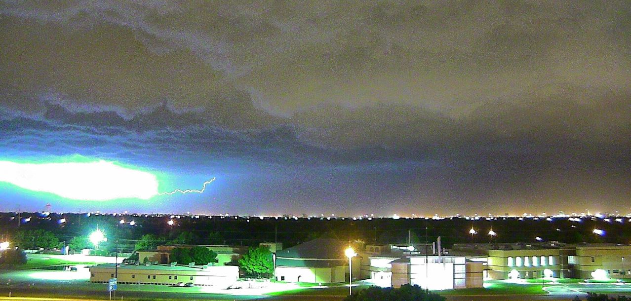
| Thunderstorm rolling into Lubbock late Friday evening, 29 May 2015. | ||||
| Late May of 2015 brought active weather to the Lone Star State. Although the worst impacts were felt down state, West Texas received numerous rounds of severe weather and heavy rainfall. Abundant amounts of moisture and instability lingered over the region through late May, setting the stage for this volatile stretch of weather. Then, whenever any disturbances approached, showers and thunderstorms erupted and produced severe weather and heavy rain. To complete the recipe for the wild weather, a prolonged period of unsettled southwest flow aloft brought numerous disturbances across the region. | ||||
 |
||||
| Regional radar animation valid from 3:58 to 5:08 pm on Saturday, 23 May 2015. | ||||
| A couple upper level disturbances approached on Saturday, May 23rd. This caused several clusters of storms to develop over West Texas. One complex formed in the predawn hours and tracked from eastern New Mexico into the Texas Panhandle dropping very heavy rain. Rhea recorded over 3 inches in a couple of hours, causing widespread street flooding there. This heavy rain eventually clipped the Memphis and Childress areas during the afternoon after producing widespread flooding in and around Amarillo. The tail end of this system can be seen just exiting the Childress area in the above radar animation. Additional thunderstorms then formed to the southwest of Lubbock and moved northeastward, bringing gusty winds, small hail and brief heavy rain to portions of the southern South and Rolling Plains Saturday evening. A wind gust to 65 mph was measured by the West Texas Mesonet site near O'Donnell as this activity blew through. | ||||
|
||||
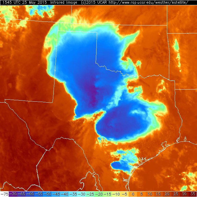
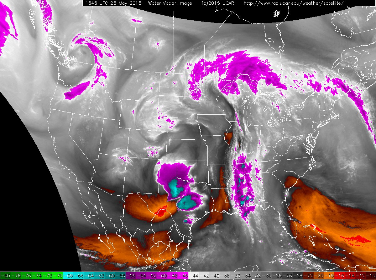
| Infrared (left) and visible (right) satellite images captured from space at 10:45 am on Monday, 25 May 2015. A water vapor image valid at the same time can be VIEWED HERE. A regional radar animation valid from 9:18 to 10:28 am can be FOUND HERE. | ||||
| The following day provided relatively quiet weather as the dryline remained largely capped Sunday afternoon. However, a small but potent upper level low raced in from the Desert Southwest early Monday morning, triggering a large complex of thunderstorms to develop over western Texas early in the day (see the above satellite images). This prompted a relatively rare early morning severe thunderstorm watch for portions of the South and Rolling Plains and points south. The most severe weather stayed south and east of the area, but a light to moderate rain and plenty of thunder greeted many that Monday morning. | ||||
 |
||||
| Large hail that fell in Hale Center during the evening of Wednesday, 27 May 2015. The image is courtesy of Mark Shackelford. | ||||
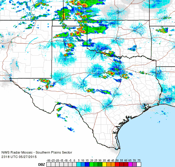
| The dryline pushed off to the east on Tuesday, providing a quiet day locally and keeping all the severe thunderstorms into western Oklahoma and western North Texas. This reprieve didn't last long though as the moisture surged back westward and provided fuel for the next round of thunderstorms Wednesday afternoon and evening (May 27th). The amount of instability and wind shear allowed most storms that formed to quickly strengthen and begin to rotate. These supercell thunderstorms generated giant hail, as demonstrated in the pictures above and below. | ||||
 |
||||
| Regional radar animation valid from 9:38 to 10:48 pm on Wednesday, 27 May 2015. An additional radar animation valid from 6:18 to 7:28 pm on the 27th can be VIEWED HERE. | ||||
| Several spots, including near Anton, Hale Center, Cotton Center and northwest of Silverton reported hail from tennis ball to baseball size and bigger. One report of softball sized hail was received 10 miles north of Abernathy. In addition to the huge hail, the rotating storms moved very slowly or not at all, creating flooding problems where they sat for hours. | ||||
|
||||
| Pictures of large hail that fell in Cotton Center (left) and Hale Center (center) on Wednesday, 27 May 2015. The two pictures are courtesy of KCBD. The right picture shows a developing storm and wall cloud, viewed from south Lubbock (looking northwest), Wednesday evening. | ||||
| One particularly intense and persistent thunderstorm developed over Hale County and moved very little through much of the evening. This storm dumped copious amounts of rain squarely in Hale County, as the below map shows. Radar estimates suggest as much as 8 or more inches fell in a few hours. All of this rain in such a short time did create flooding problems, including on I-27 south of Hale Center where both north and south bound lanes were covered in water. Heavy rain, on the order of 2 to 4 inches, also fell in the Memphis area flooding streets and a number of businesses. | ||||
 |
||||
| Storm total precipitation, as estimated from radar, from Wednesday afternoon through Thursday morning (27-28 May 2015). | ||||
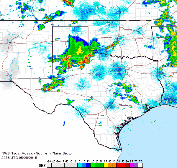
| The main action then shifted a little farther south the next day. Thunderstorms started early on Thursday (May 28th), with the first severe hail of the day reported before noon in Whiteface. A number of locations received quarter to ping pong ball sized hail through the afternoon, but the biggest story was the heavy rain the thunderstorms dropped. Slow moving storms tracked slowly and repeatedly across the central South Plains (see the below radar animation), with the torrential rain causing flooding in many spots, including Shallowater and parts of Lubbock. | ||||
|
||||
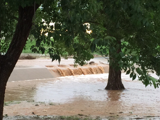
| Images of flooding (left, center) from around Lubbock on Thursday, 28 May 2015. The right image shows hail that fell near the Lubbock Airport on Thursday. The pictures are courtesy of KCBD. | ||||
| Two to four inches of rain fell in a short period of time, with locally higher amounts. The Lubbock Airport officially measured 3.21 inches during the day. Even more impressive, 6.93 inches of rain was measured in Shallowater, most of which fell in a couple of hours. | ||||
 |
||||
| Regional radar animation valid from 1:18 to 2:28 pm on Thursday, 28 May 2015. An additional radar animation valid from 3:38 to 4:48 pm on the 28th can be VIEWED HERE. | ||||
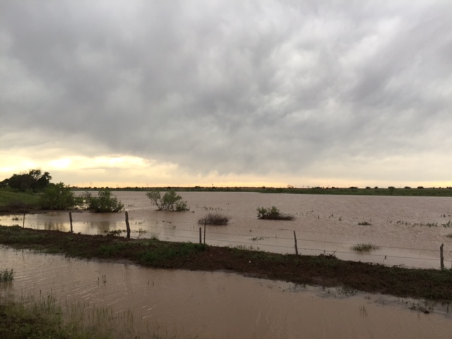
| The amount and rate of the rain, coupled with the already saturated soils, led to rapid runoff and numerous flooding problems. Below are several pictures of the flooding that occurred around the area on May 28th. | ||||
|
||||
| (left) Flooding in Shallowater, courtesy of KCBD. (center) "Lake Shallowater" and (right) the low water crossing at Berl Huffman, on the northwest side of Lubbock. All pictures were taken on Thursday, 28 May 2015. The center and right images are courtesy of Bruce Haynie. | ||||
| The storms eventually organized into a large squall line that brought unwanted heavy rain to much of the remainder of the state late Thursday night while West Texas began to dry out. The dry period didn't last very long though as one final batch of storms that developed across the higher elevations of New Mexico organized into a line and swept southeastward through the South Plains late Friday evening (May 29th). This line of storms was mostly non-severe, though it did produce a 60 mph wind gust as it blew through Dimmitt. In addition, one stronger storm briefly produced quarter size hail on the west side of Lubbock. The storms moved fast enough to keep rainfall totals down, though portions of the southern Texas Panhandle into the northern South Plains, from Dimmitt to Plainview, did record a quick 1 to 2 inches of rain. | ||||
 |
||||
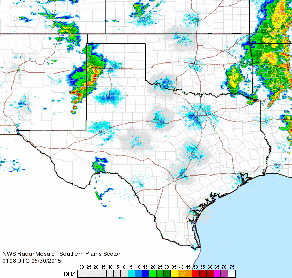
| Regional radar animation valid from 10:48 to 11:58 pm on Friday, 29 May 2015. An additional radar animation valid from 8:08 to 9:18 pm on the 29th can be VIEWED HERE. | ||||
|
Drier weather finally built into the region for the final weekend of May. The below map shows the one week rain totals, as estimated by radar, for the active stretch of late May weather. The most widespread heavy rain hit the central and eastern parts of the state as well as much of Oklahoma, where extreme flash flooding resulted in a number of fatalities. Although the rain totals in West Texas were lower than further east, they were still sizeable and added to the already wet month. |
||||
 |
||||
| Radar-estimated and bias-corrected 7-day rain total ending at 4 pm on Saturday, 30 May 2015. A close up of the South Plains region can be viewed by clicking on the above map or CLICKING HERE. | ||||
|
Lubbock officially ended May 2015 with 12.12 inches of rain, which made it the second wettest May on record, and third wettest month on record. The only wetter months include May 1941 when 12.69 inches fell, and September 1936 when 13.93 inches fell. Not to be outdone, the 13.21 inches that fell in Childress in May made it the wettest month ever on record, outpacing the previous record of 12.05 inches set in June 1941. In addition to bringing the drought to an end, the heavy rains also put much needed water in the reservoirs. Lake Alan Henry filled back to capacity and White River Lake rose to over 35% of capacity for the first in over a decade. To read a more detailed story about the uncharacteristically wet May CLICK HERE. In addition, all of the moisture and clouds kept temperatures cool. Both Lubbock and Childress stayed below 90 degrees through the entire month of May. This has happened only two other times at Childress (1954 and 1957) and three other times in Lubbock (1920, 1957 and 2007). Preliminary storm reports for the active late May weather can be viewed below or read in text format at the following links: May 23rd; May 27th; and May 28th. The rainfall data displayed below is courtesy of the West Texas Mesonet. |
||||
|
|
||
|
Toggle Preliminary Storm Reports for Wednesday, May 27, 2015
|
Toggle Preliminary Storm Reports for Thursday, May 28, 2015
|
Toggle the 5-day Rain Totals ending at 1:43 pm on Friday, May 29, 2015
|


 Follow us on YouTube