| Strong Thunderstorms Drop Heavy Rains 8-9 July 2015 |
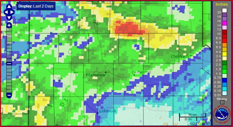 |
| Radar-estimated and bias-adjusted 2-day rainfall ending at 9 pm on Friday, 10 July 2015. The swath of heavy rain north and northwest of Childress fell late Wednesday night into early Thursday morning (8-9 July). Much of the other rain fell the following evening and overnight. |
| A slow moving complex of thunderstorms tracked repeated across the southern Texas Panhandle late Wednesday night into early Thursday morning (July 8th and 9th). A few of these storms were strong to severe early on, but they quickly transitioned to heavy rain during the overnight hours. As the above map shows, a large swath of 3+ inches of rain fell from near Canyon to north of Childress. A large portion of southern Armstrong County was hit hardest, recording 6+ inches. |
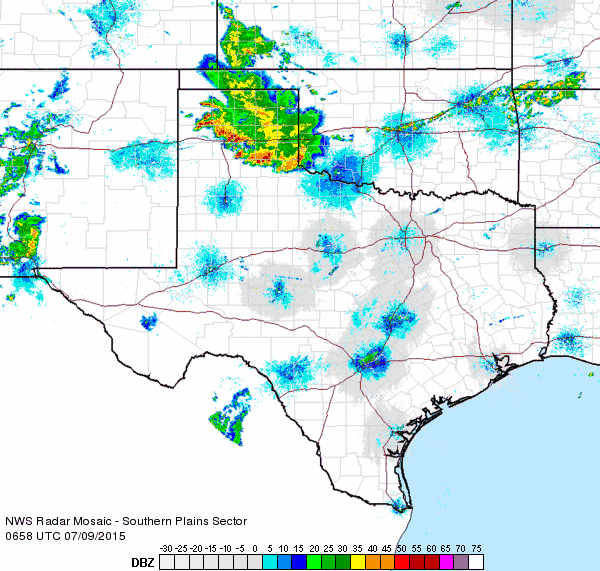 |
| Regional radar animation valid 1:58 to 3:08 am on Thursday (9 July 2015). |
| The heavy rains led to flooding problems from Palo Duro Canyon through Memphis and Childress. Extensive flooding forced the closure of all the trails in Palo Duro Canyon State Park for a couple of days. The heavy rain fell up and down the Prairie Dog Town Fork of the Red River, which resulted in a significant surge of water down the river. |
 |
| Plot of the level on the Prairie Dog Town Fork of the Red River located 10 miles north of Childress in early July 2015. |
| As the above graph illustrates, the water level quickly rose along the Red River, peaking at 11.63 feet north of Childress, over a foot and a half of flood stage. This resulted in the 6th highest flood stage ever recorded, and the first time the river rose above 11 feet since 1995. Just upstream, the river gauge located 6 miles southwest of Brice peaked at 11.29 feet, which was only about a foot below the record and 4th highest all-time. As is typical, the river level crested and fell nearly as quickly as it rose. Thankfully, only minor flooding was reported as the large flood plain swelled with water. |


 Follow us on YouTube