No Fooling: Snow Falls on Parts of the Caprock
1 April 2016 |
 |
| A light accumulation of snow on the grass in Littlefield on 1 April 2016. The picture is courtesy of KCBD and Destiny Reed. |
| |
| April Fools' Day didn't hold true to its name. Instead of threatening and not delivering, April 1st did indeed provide much of the South Plains with a late season taste of winter. Temperatures for the first day of the month started on the mild side, in the 40s and lower 50s. However, over time the temperatures gradually dipped down into the middle 30s for many locations on the Caprock, spurred on by the bands of heavier precipitation. |
| |
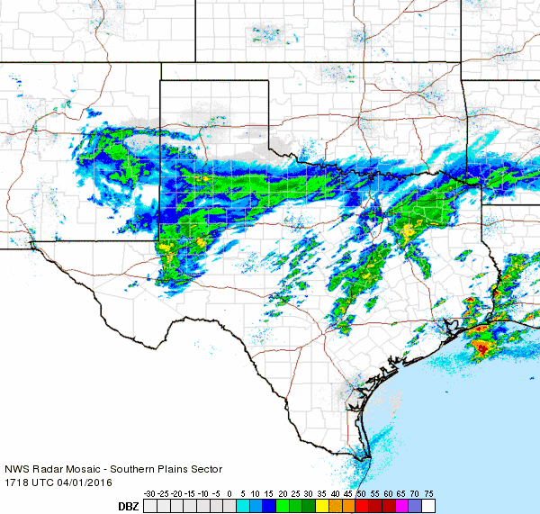
 |
| Regional radar animation valid from 8:48 am to 10:08 am on 1 April 2016. |
| |
| Initially, the precipitation started as a cold rain, but as temperatures fell the rain mixed with and in some places completely changed over to snow. One particularly heavy band, seen in the above animation, setup directly over Amherst mid-morning. A very heavy and wet snow fell for a half hour to hour before the band weakened and shifted southward. Upwards of 2 inches of snow quickly piled up in Amherst, covering the grass and even briefly building up on roadways. However, as soon as the intense snow ended the snow began to melt, and it was completely gone by mid-afternoon. |
| |
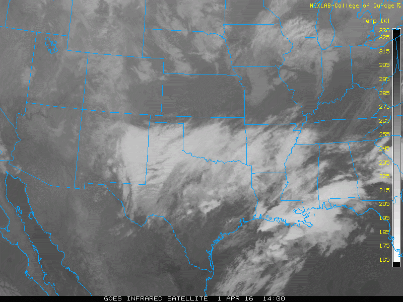 |
| Regional infrared satellite loop valid from 9 am to 3:30 pm on 1 April 2016. |
| |
| The primary driver of the rain and snow was a compact but fairly intense upper level storm system (visualized in the above satellite animation) that approached slowly through southeastern New Mexico. Widespread lift and sufficient moisture caused the precipitation to blossom over the South Plains region, though much drier low-level air blowing in from the northeast did keep the southern Texas Panhandle and northern Rolling Plains dry. |
| |
 |
| Regional radar animation valid from 12:18 pm to 1:28 pm on 1 April 2016. |
| |
| The most intense band gradually shifted southward across Lubbock where many spots saw a brief burst of snow, though little to no accumulation. Thankfully, with the relatively warm and wet ground and the fact that the temperature never actually fell below freezing, most roadways remained wet and did not have big impacts on travel. |
| |
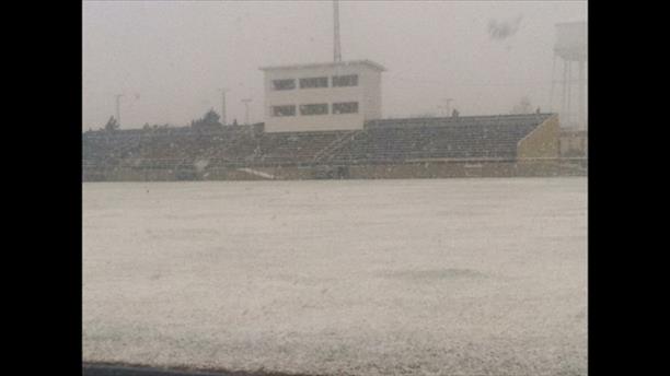 |
| Heavy snow falling in Morton on 1 April 2016. The picture is courtesy of KCBD, Pete Christy and Jimmy Randolph. |
| |
| The above and below pictures show a few different views of the snow around the South Plains on Friday, April 1st. In most places the snow disappeared nearly as quickly as it came down. |
| |
|
|
| A couple of more pictures of the snow in Littlefield (left) and near Sundown (right). The images are courtesy of KCBD. |
| |
| Further east, off the Caprock, temperatures remained several degrees warmer, mostly in the lower 40s. The few extra degrees of warmth kept it mild enough for the precipitation to remain a cold rain throughout the day. Even on the Caprock, when the precipitation rates decreased, many spots would warm a couple of degrees and the snow would change back to a light rain. |
| |
 |
| The wintry scene in Amherst at 10:48 am on 1 April 2016. |
| |
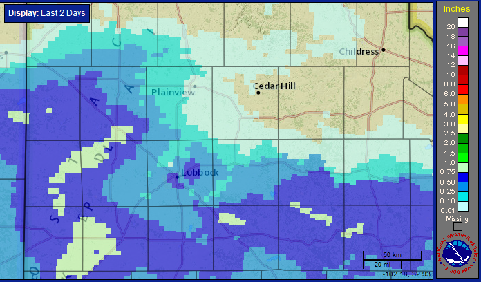
| Although not a big precipitation maker, most of the western and southern South Plains and southern Rolling Plains did record modest totals. Liquid equivalents of a quarter to half inch were fairly common, with portions of the western South Plains even picking up a little more than that. Unfortunately, north and east of Lubbock the precipitation cutoff very quickly. Officially, the Lubbock Airport only recorded 0.08 inches of liquid and a trace of snow. |
| |
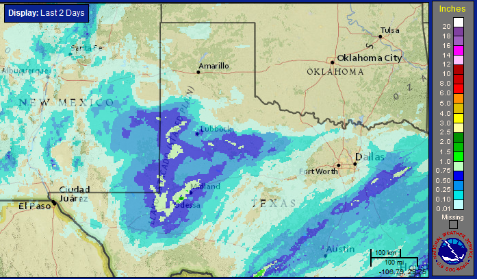 |
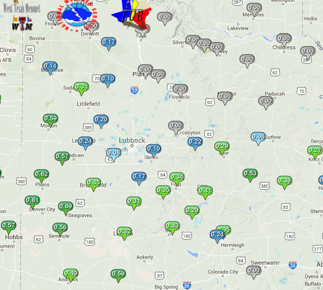
| Two-day radar-estimated and bias-corrected rainfall ending at 9 am on 2 April 2016. A close-up view of the South Plains and Rolling Plains can be obtained by clicking on the above image. In addition, a map with the West Texas Mesonet rainfall totals for the event can be FOUND HERE. |
| |


 Follow us on YouTube