| August 2016 Ends on a Wet Note |
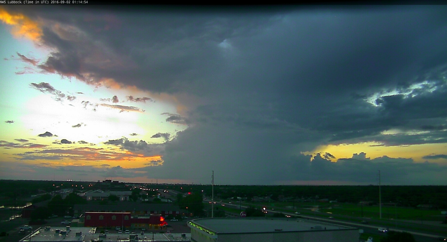 |
| A storm off to the Lubbock on the evening of Thursday, September 1st, 2016. |
| |
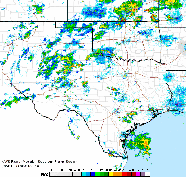
| A stagnant weather pattern featuring abundant moisture and the occasional passing disturbance yielded a wet and cool end to August for the South Plains region. The wet stretch kicked off in earnest during the evening of Sunday, August 28th. A slow moving complex of showers and thunderstorms developed across southeast New Mexico into the southwestern South Plains. Hobbs and Seminole were particularly hard hit picking up 3 to 5+ inches of rain in a matter of a couple hours. The heavy rain produced extensive runoff and flooding. Rain totals were lower further north, though Denver City and Plains did record a few inches through the next day. |
| |
 |
| Regional radar animation valid from 10:18 pm to 11:28 pm on Sunday, 28 August 2016. An additional radar animation from 5:18 pm to 6:28 pm on the 28th can be VIEWED HERE. |
| |
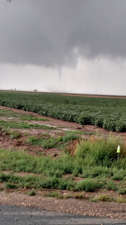
| The following day (Monday, 29 August) brought another round of showers and thunderstorms, with slow moving storms producing more heavy downpours. One storm over Briscoe County even produced a brief landspout-type tornado over open country during the afternoon. Much of the activity moved just quickly enough that only nuisance flooding occurred in spots. |
|
|
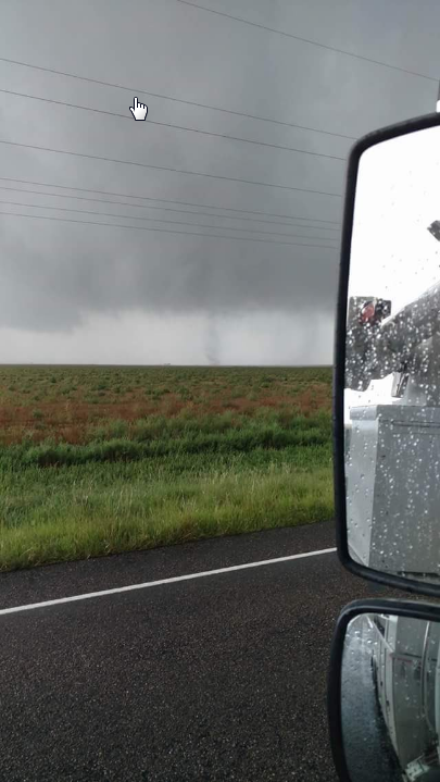
| A brief landspout-type tornado captured near Silverton during the afternoon of Monday, 29 August 2016. The pictures are courtesy of Dustin Bach, relayed via KAMR. |
| |
| The greatest coverage of the rain was across the Caprock on Sunday and Monday, though even locations further east did experience locally heavy downpours. |
| |
 |
| Regional radar animation valid from 3:38 pm to 4:48 pm on Monday, 29 August 2016. |
| |
| More rounds of heavy rain followed on Tuesday and Wednesday as just enough warming during the days sparked heavy afternoon and evening storms. Portions of Lubbock was impacted by heavy rain both days, creating areas of flooding across the city. The extensive cloud cover and rounds of rain also kept temperatures down, with many spots on the Caprock not making it out of the 70s the final three days of August. |
| |
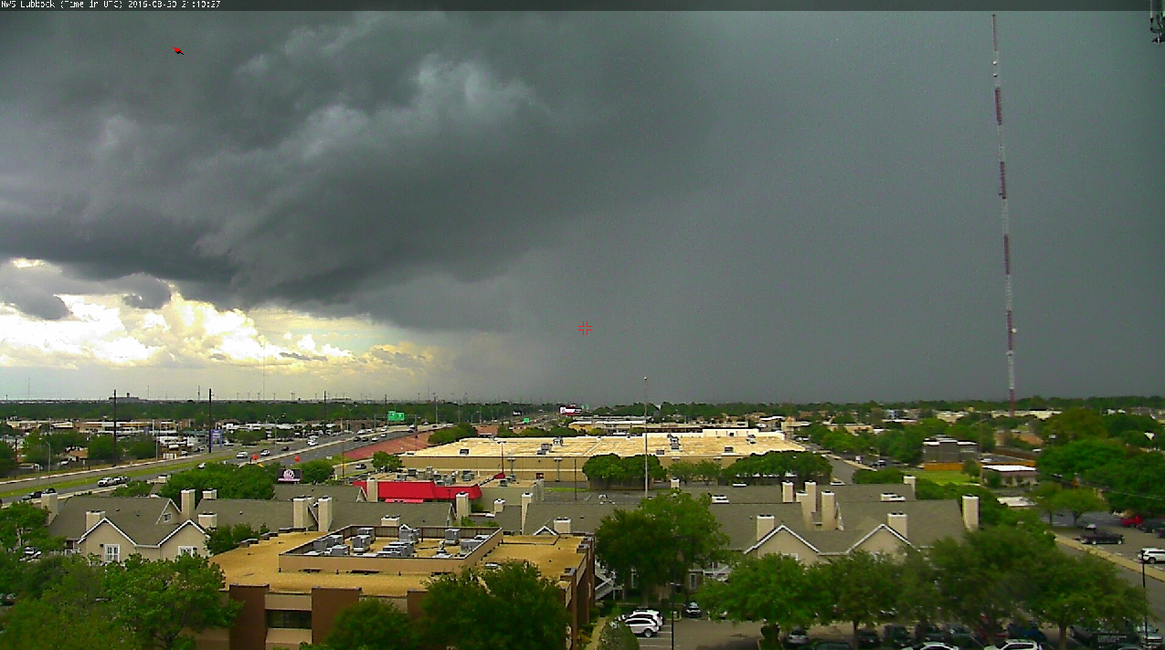 |
| Heavy rain shower approaching south Lubbock from the east during the late afternoon of Tuesday, 30 August 2016. |
| |
| The heaviest rain affected the Highway 84 corridor from Littlefield through Lubbock to near Post on Tuesday evening. The Slaton West Texas Mesonet recorded over 4 inches of rain during the evening, much of which fell in a two hour period. |
| |
|
|
| Regional radar animations valid from 7:58 pm to 9:08 pm on Tuesday, 30 August 2016 (left) and 3:18 pm to 4:28 pm on Wednesday, 31 August 2016 (right). |
| |
| Another nearly stationary thunderstorm developed over the central and western part of Lubbock during the late afternoon on Wednesday. This storm dumped a quick 1 to 3 inches, causing extensive street flooding around town. |
| |
|
|
| Pictures of flooding at Texas Tech University during the afternoon of Wednesday, 31 August 2016. The left image is courtesy of Brock Burghardt and the right image is courtesy of the Daily Toreador. |
| |
| The shower and thunderstorm coverage gradually waned through the rest of the week as upper level moisture thinned, though a few more isolated heavy downpours still visited the region. By the time the week was done much of West Texas had recorded significant amounts of rain. The western South Plains were hit hardest with 2 to 5+ inches common. Rain totals were generally lighter with eastern extent though everyone saw at least a little rain. |
| |
 |
| Seven-day radar-estimated and bias-corrected rain totals ending at 7 am on Friday, 2 September 2016. A regional view of the above image can be FOUND HERE. |
| |
| The recent rain did pull the yearly rain total at Lubbock upward to around 10 inches, which is still a few inches below average through August. However, many other locations in Lubbock County have seen more rain and are near and even a little above average for the year. The rain also helped to temper drought conditions that were gradually expanding across a good chunk of the South Plains through the late summer. |
| |
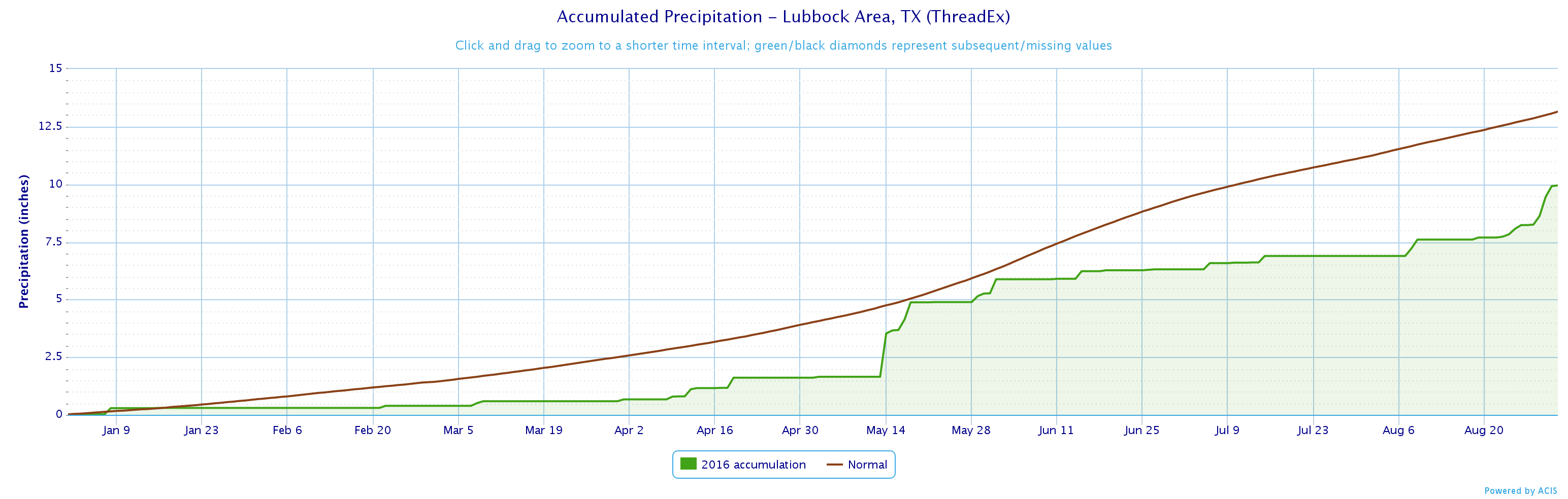 |
| Accumulated precipitation (green line) at the Lubbock International Airport through August 2016. |
| |


 Follow us on YouTube