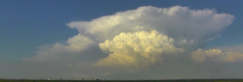
On Tuesday, March 28, 2017, West Texas experienced the first widespread severe thunderstorm event of the year as a strong upper-level storm system sparked thunderstorm development along a dryline. The thunderstorms began to develop late in the morning across the central South Plains, then spread east into the Rolling Plains through the afternoon and evening hours. A few of the storms were severe with large hail and tornadoes. For the most part, the tornadoes were short-lived, small circulations that did little damage. However, one tornado caused damage at a ranch in the Rolling Plains and was rated an EF-1 (see further details on this tornado in the damage survey section). The image below shows some of the tornado damage at the Pitchfork Ranch. Click on the image to enlarge it.

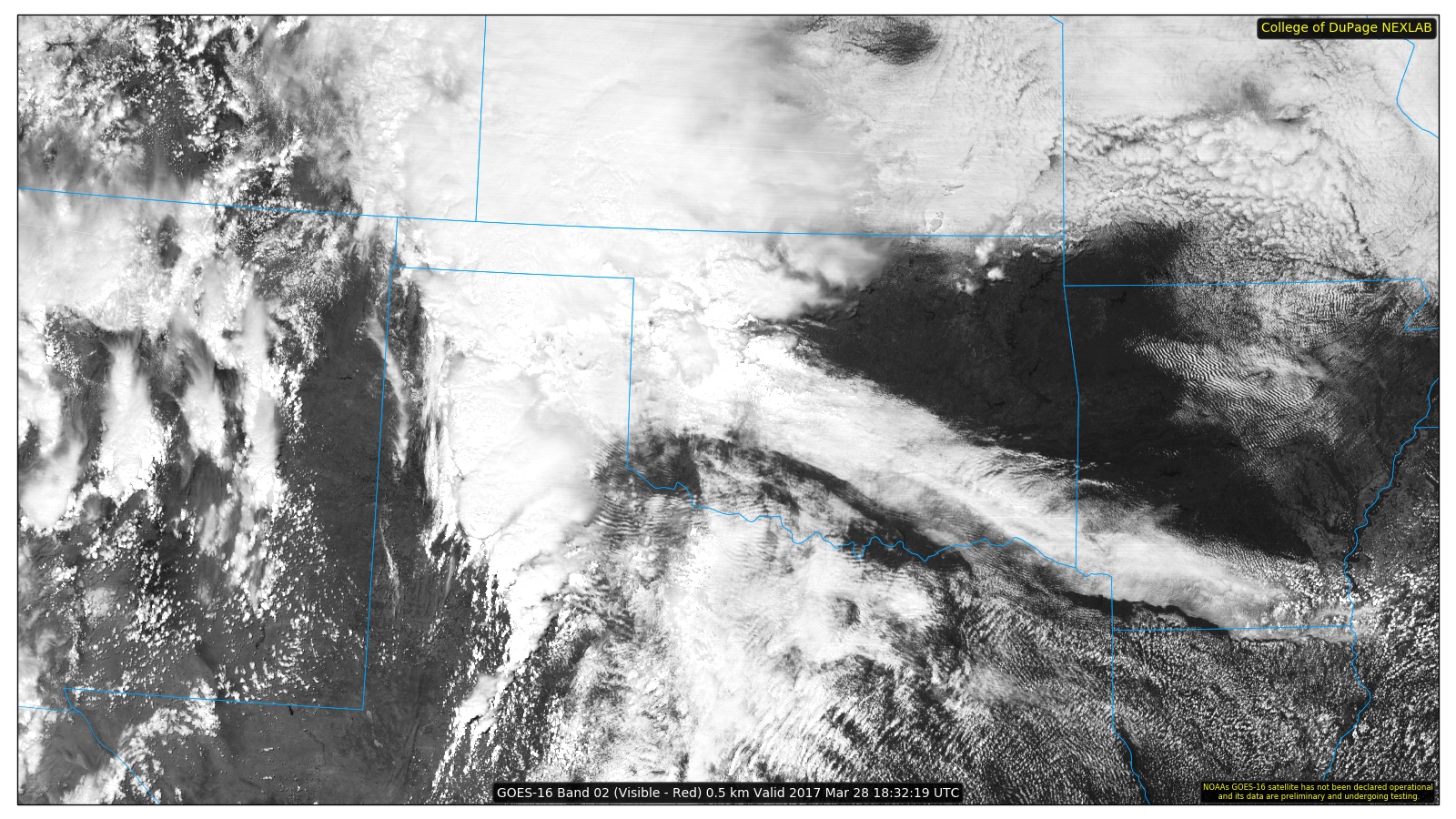
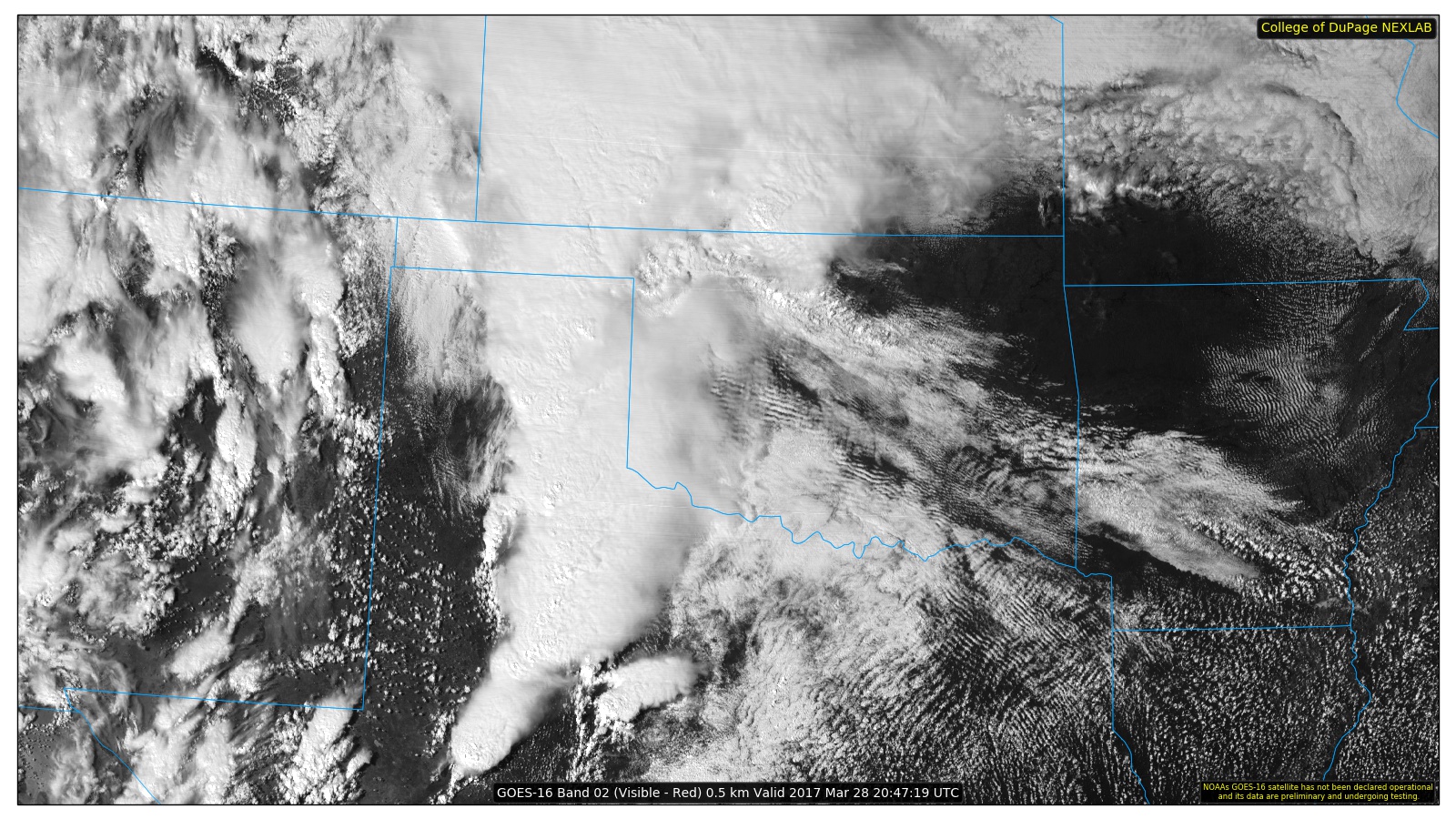
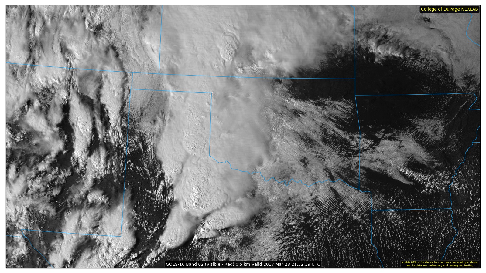
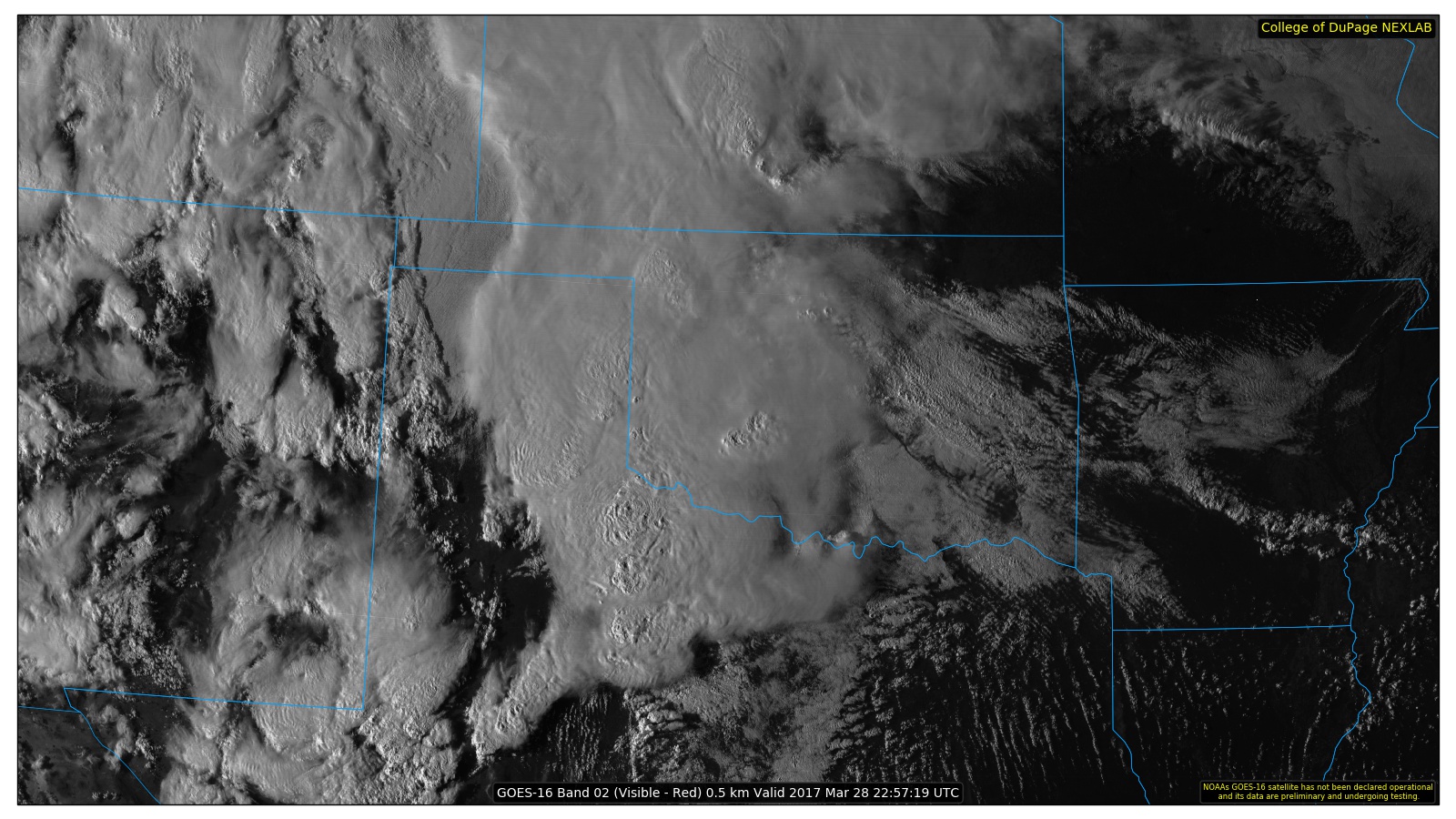
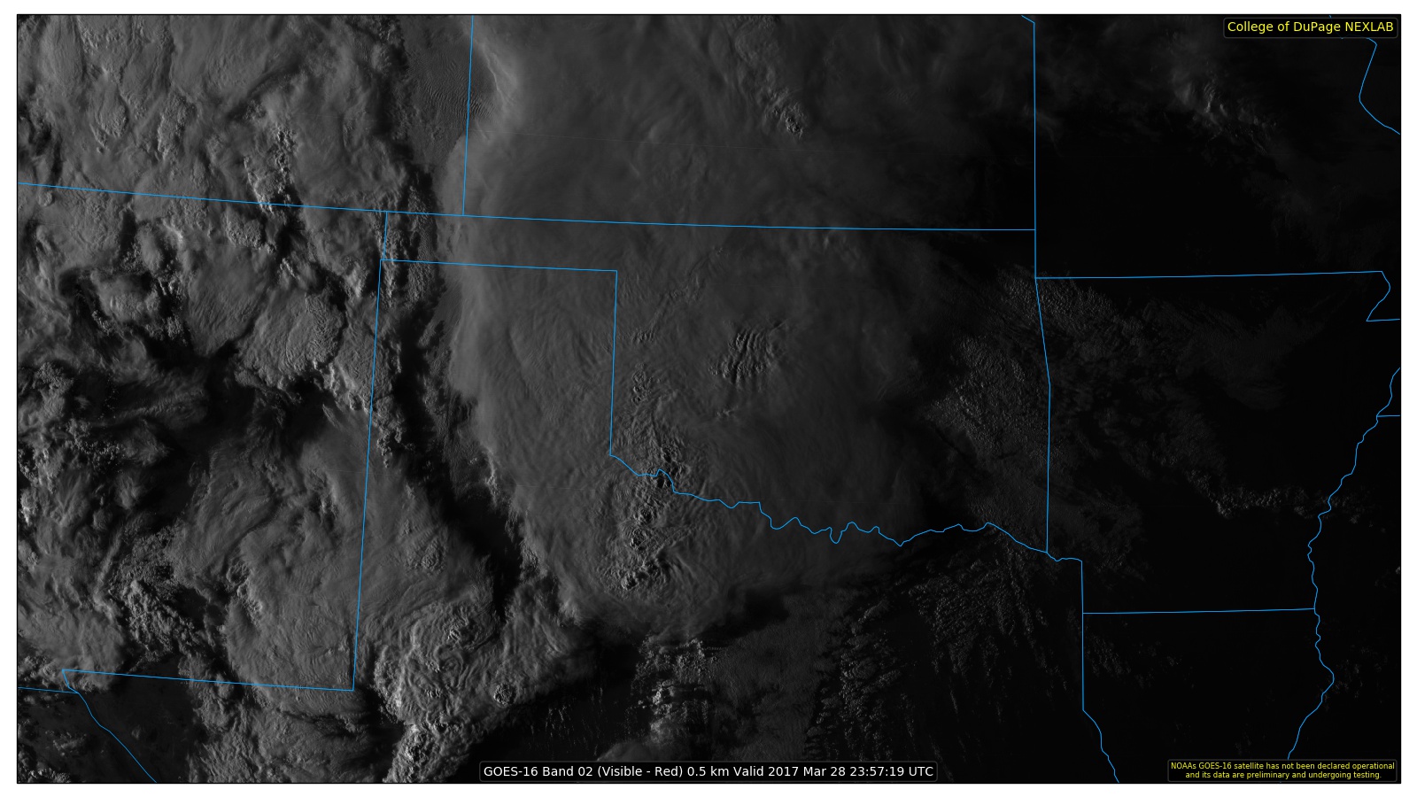
Below is a sequence of satellite images during the event. These images were taken by the new GOES-16 satellite which has a higher resolution than the GOES-East and GOES-West. These images are courtesy of the College of DuPage (weather.cod.edu). The GOES-16 data posted on this page are preliminary, non-operational data.
The storms also brought some locally heavy rainfall across the area. The map below shows the West Texas Mesonet rainfall totals for the 24 hours from 6 am Tuesday morning to 6 am Thursday morning. The station near Ralls recorded 3.34 inches of rain. The southwest South Plains received the least rainfall. The image below shows 48-hour precipitation totals from the West Texas Mesonet. Click on the image to enlarge it. Data is courtesy of Texas Tech University, www.mesonet.ttu.edu

Here are two examples of the severe weather across the area. The image on the left shows hail covering the roadway along highway 70 east of Floydada, and the image on the right shows a tornado to the southeast of Crosbyton. Click on the images to view a larger version. Both images are courtesy of Matt Zeibell.
 |
 |
Above are two examples of the severe weather across the area. The image on the left shows hail covering the roadway along highway 70 east of Floydada, and the image on the right shows a tornado to the southeast of Crosbyton. Click on the images to view a larger version. Both images are courtesy of Matt Zeibell. The below images are damage that occurred at Pitchfork Ranch in eastern Dickens County. The pictures are courtesy of John Lipe.
 |
 |
...NWS Damage Survey for the March 28, 2017 Pitchfork Ranch
Tornado in far eastern Dickens County, TX...

Rating: EF-1
Estimated Peak Wind: 100 MPH

Path length: 3/4 Mile
Path width: 50 Yards
Fatalities: 0
Injuries: 0

Start date: March 28
Start time: 434 PM CDT
Start lat/lon: 33.599, -100.536

End date: March 28
End time: 435 PM CDT
End lat/lon: 33.607, -100.529

Meteorologists with NWS Lubbock and the Texas Tech University
West Texas Mesonet conducted a storm damage survey in far east-
central Dickens County during the morning of March 29. This team
surveyed damage at the Pitchfork Ranch located about 11 miles west
of Guthrie, TX along U.S. Highway 82.

The most significant damage observed at the Pitchfork Ranch
consisted of about 300 square feet of metal roofing removed from a
well-constructed building. Many of the underlying support trusses
to the roof were also separated from the building. Various trees
were blown over and strewn about. A large, twin gravity box was
also toppled. The damage to the roof was consistent with maximum
winds of around 100 miles per hour.

Available damage indicators surrounding the Pitchfork Ranch were
very sparse and an accurate assessment of the total duration and
path of this EF-1 tornado was not possible.

EF Scale:  The Enhanced Fujita Scale Classifies Tornadoes into
the following categories.

EF0...Weak......65 to 85 MPH
EF1...Weak......86 to 110 MPH
EF2...Strong....111 to 135 MPH
EF3...Strong....136 to 165 MPH
EF4...Violent...166 To 200 MPH
EF5...Violent...>200 MPH

Note:
The information in this statement is preliminary and subject to
change pending final review of the events and publication in NWS
Storm Data.
 |
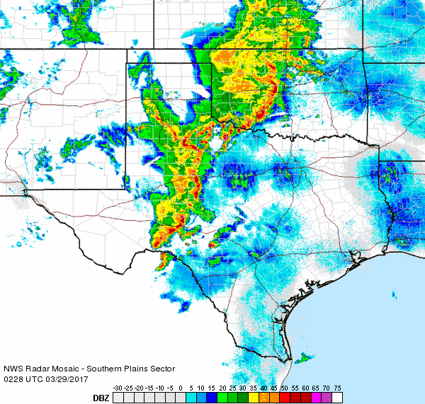 |
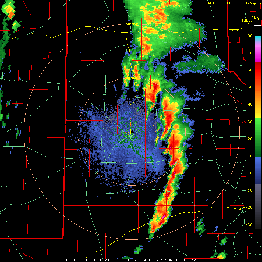
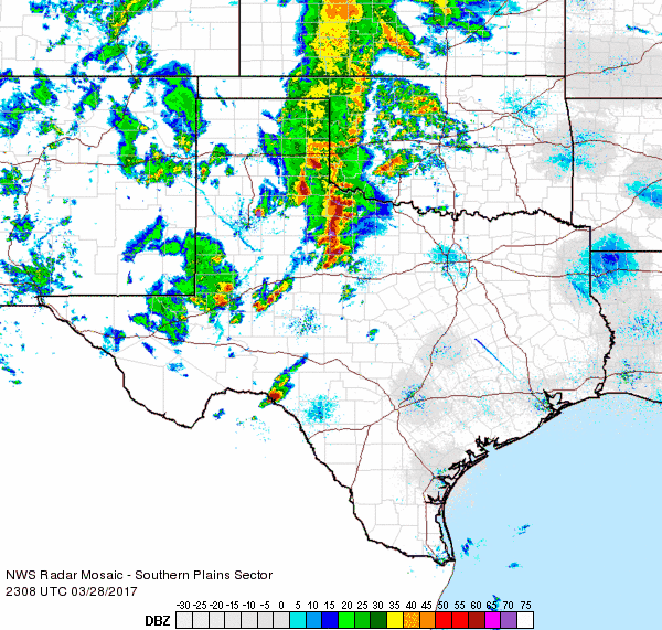
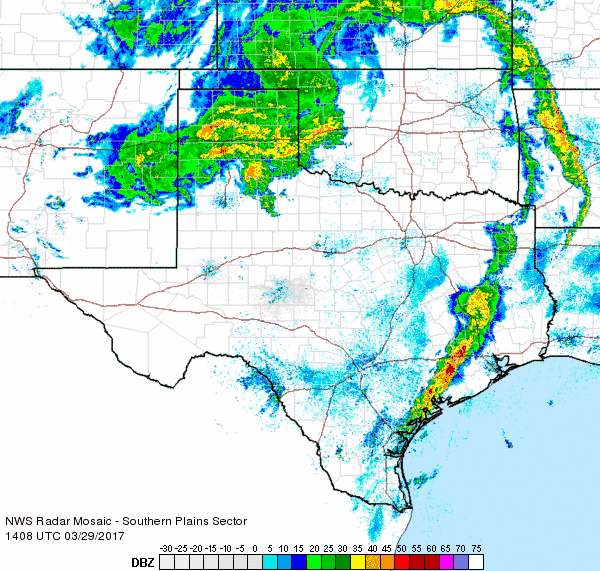
| A couple of radar animations captured on Tuesday, 28 March 2017 can be found above. The left animation is valid from 2:37 pm to 3:18 pm. The right loop is valid from 9:28 pm to 10:38 pm. Additional regional animations can be viewed at: 6:08 pm to 7:18 pm on 28 March 2017; and 9:08 am to 10:18 am on 29 March 2017. | |


 Follow us on YouTube