|
Strong Winds, Light Dust and Isolated Thunderstorms |
|
 |
|
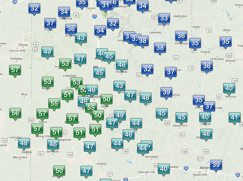
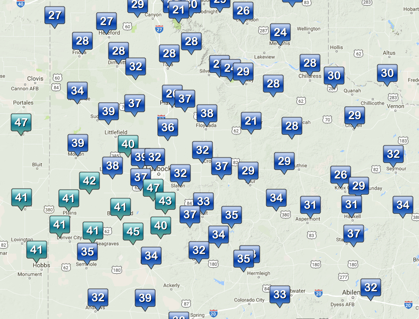
| Maximum wind gusts (mph) observed by the West Texas Mesonet on Tuesday, 4 April 2017. The maximum sustained wind speeds for the day can be VIEWED HERE. | |
| A compact but intense storm system that emerged from the southern Rockies brought strong winds to the region on Tuesday (4 April 2017). Westerly winds peaked at 50 to 57 mph over much of the central and western South Plains. The winds did loft some blowing dust too, though in general the dust wasn't very thick. Much cooler air then spilled southward through the South and Rolling Plains on gusty north winds behind a cold front during the late afternoon and evening hours. | |
 |
|
| Regional radar animation valid from 4:18 pm to 5:28 pm on 4 April 2017. | |
| The passing storm system also generated scattered showers and even a couple of thunderstorms that raced from west to east during the afternoon. One stronger storm even covered Caprock Canyons State Park in peas-sized hail during the late afternoon. | |
 |
|
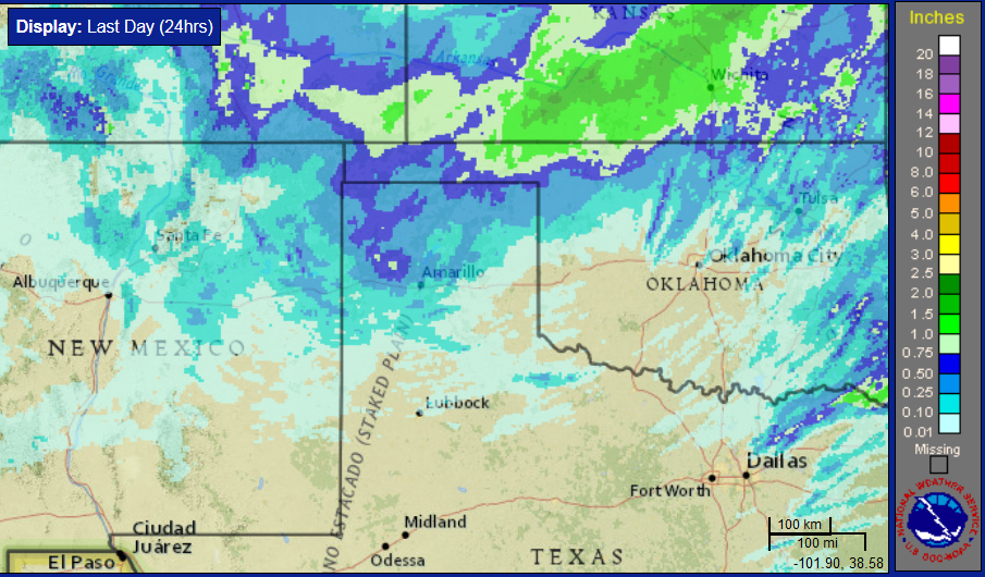
| Radar-estimated and bias-correct 24-hour rain totals ending at 4 am on 5 April 2017. | |
| Where rain did fall on the southern Texas Panhandle into the South and Rolling Plains totals were on the light side, from a trace to a tenth or two. However, further north, where the precipitation was more widespread and intense it also cooled just enough to switch the rain to snow. This included a swath of heavy snow that spread out of northeast New Mexico into the western Oklahoma and extreme northwestern Texas Panhandles. Locations from near Boise City down to Texline recorded a quick 4 to 6+ inches of wet snow, with even higher totals over the higher terrain of northern New Mexico and southern Colorado. | |
 |
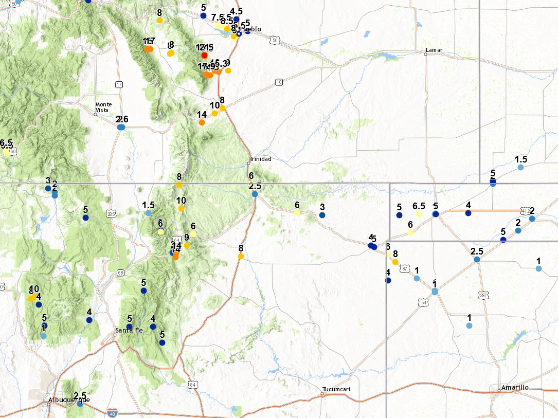 |
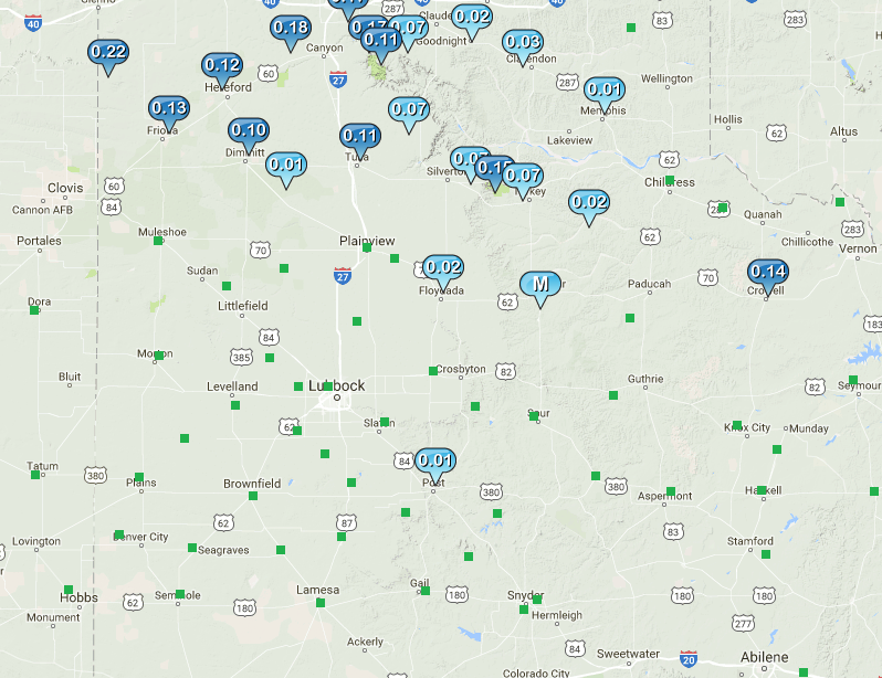
| (Left) 24-hour rain totals measured by the West Texas Mesonet ending at 9 pm on 4 April 2017. (Right) Snow totals reported across parts of New Mexico, Colorado, Oklahoma and Texas on 4 April 2017. | |


 Follow us on YouTube