| Mid-April brings rounds of wind, dust and wildfires 12-14 April 2018 |
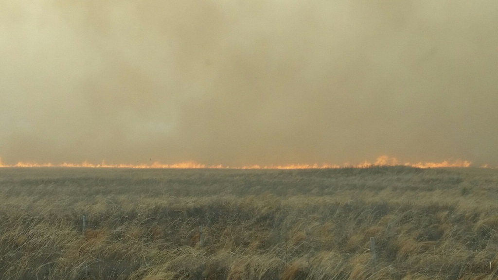 |
| Large wildfire that moved into western Cochran County out of eastern New Mexico on Thursday, 12 April 2018. The picture is courtesy of the Texas Forest Service. |
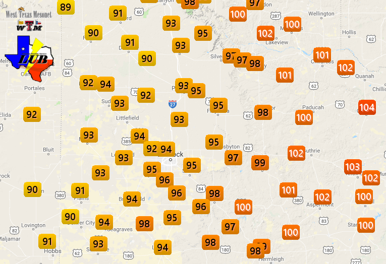
| The middle part of April brought strong and dry winds to West Texas as a powerful and slow-moving upper level storm system moved by to the north. In advance of the system, increasing southwesterly winds fueled warm to hot temperatures Wednesday into Thursday (11-12 April). Temperatures peaked on Thursday when highs in the 90s were common, with triple digits off the Caprock. Childress officially tied their daily record high, topping out at 102 degrees, while Lubbock came up just one degree short, reaching 95 degrees. |
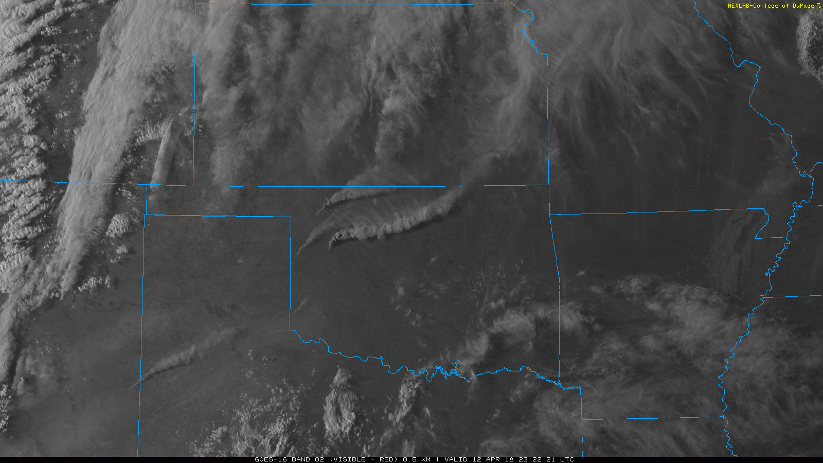 |
 5-minute visible satellite animation valid from 6:27 pm to 7:07 pm on 12 April 2018. The imagery is courtesy of the College of DuPage. 5-minute visible satellite animation valid from 6:27 pm to 7:07 pm on 12 April 2018. The imagery is courtesy of the College of DuPage. |
| The near-record to record heat combined with the strong winds and very dry conditions to create extreme fire weather. Unfortunately, several fires did ignite across the region, and they quickly grew into large wildfires. The largest fires occurred over western Oklahoma, but one large fire that started in southeast New Mexico crossed over into Cochran County, burning a couple of thousand acres in Texas before finally being halted. The above visible satellite animation shows several smoke plumes originating in western Oklahoma as well as one near the Texas/New Mexico border. |
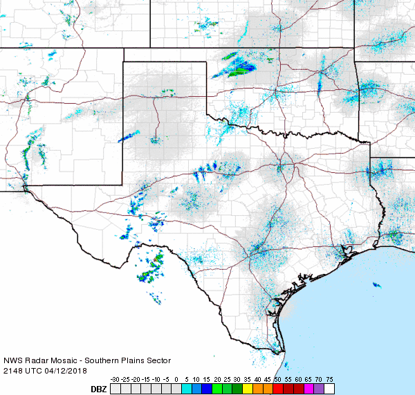 |
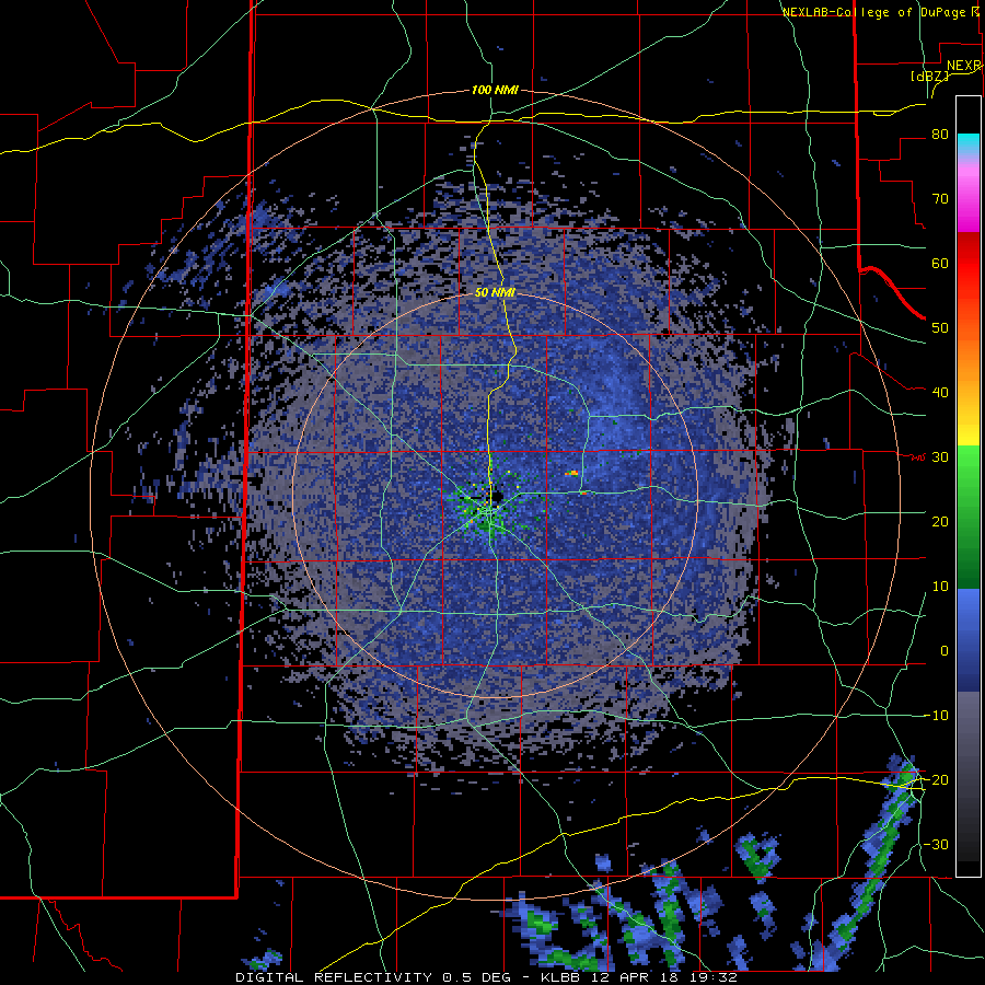
| Regional radar animation valid from 4:48 pm to 5:58 pm on 12 April 2018. An animation of the Lubbock WSR-88D valid from 2:32 pm to 4:20 pm on 12 April can be VIEWED HERE. |
| Instead of sampling precipitation, regional radars also detected the large smoke plumes (more specifically debris within the smoke plume). The above animation shows several large reflectivity plumes emanating from fires in northwest Oklahoma, with another plume spilling out of southeast New Mexico. |
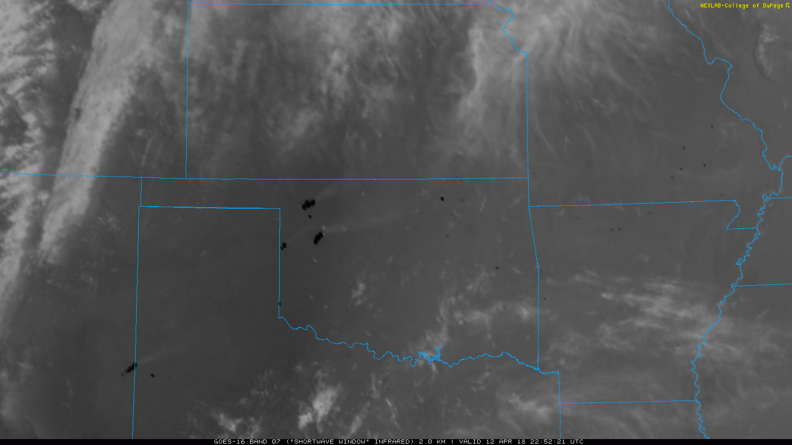 |
| 5-minute infrared satellite animation valid from 5:52 pm to 6:37 pm on 12 April 2018. The imagery is courtesy of the College of DuPage. |
| The infrared channel on the satellite is also very useful at detecting "hot spots" where wildfires are ongoing. The above imagery shows several large hot spots (darker pixels) where large wildfires are ongoing the evening of the 12th. |
 |
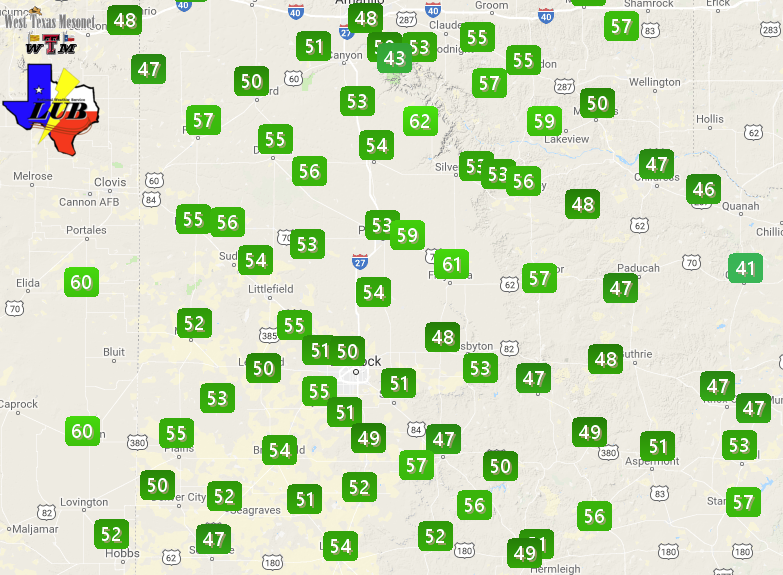
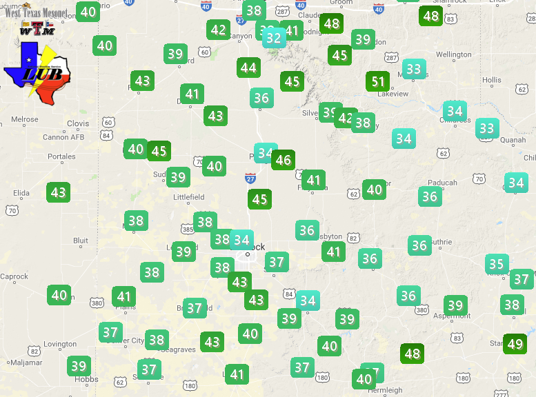
| Maximum wind gusts recorded by the West Texas Mesonet of 12 April 2018. The maximum sustained wind speeds for the 12th can be FOUND HERE. A plot of the high temperatures for the 12th can be VIEWED HERE. |
| The large fires were fanned by southwesterly winds of 30 to 40 mph, with gusts in excess of 50 mph in spots Thursday afternoon and evening. Winds decreased enough late Thursday night to allow conditions to improve somewhat for a period, and firefighters were able to gain control of some of the wildfires. |
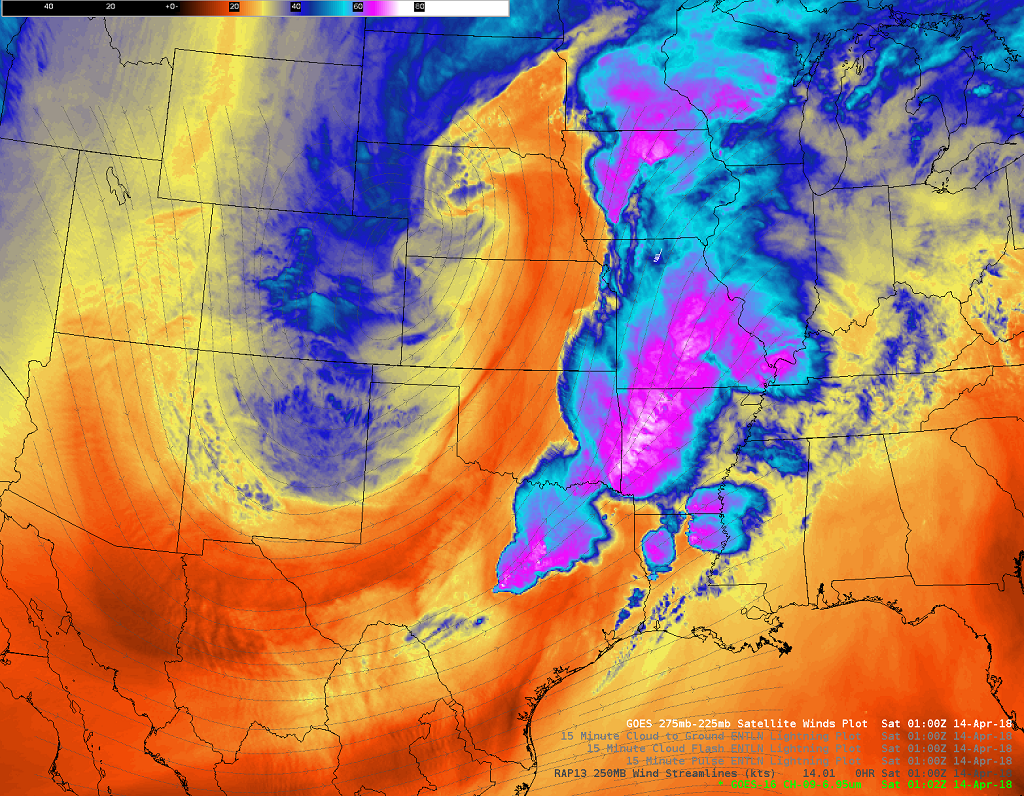 |
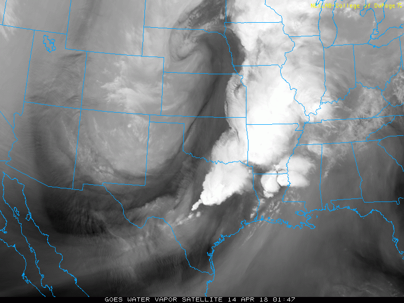
| Water vapor image captured at 8:02 pm on Friday, 13 April 2018. A water vapor animation valid that same evening can be WATCHED HERE. |
| Cooler air then spread across the South Plains region Friday as the upper level storm system emerged over the High Plains. Although temperatures were knocked back toward average, some 25 to 30 degrees cooler than the previous day, the cooling came with intense westerly winds. These dry winds lofted plenty of blowing dust and pushed lingering fires and rapidly spread additional new fire starts. Where the wind energy encountered better moisture, severe thunderstorms erupted over the eastern parts of Texas and points north and east from there, as can be visualized in the above imagery. |
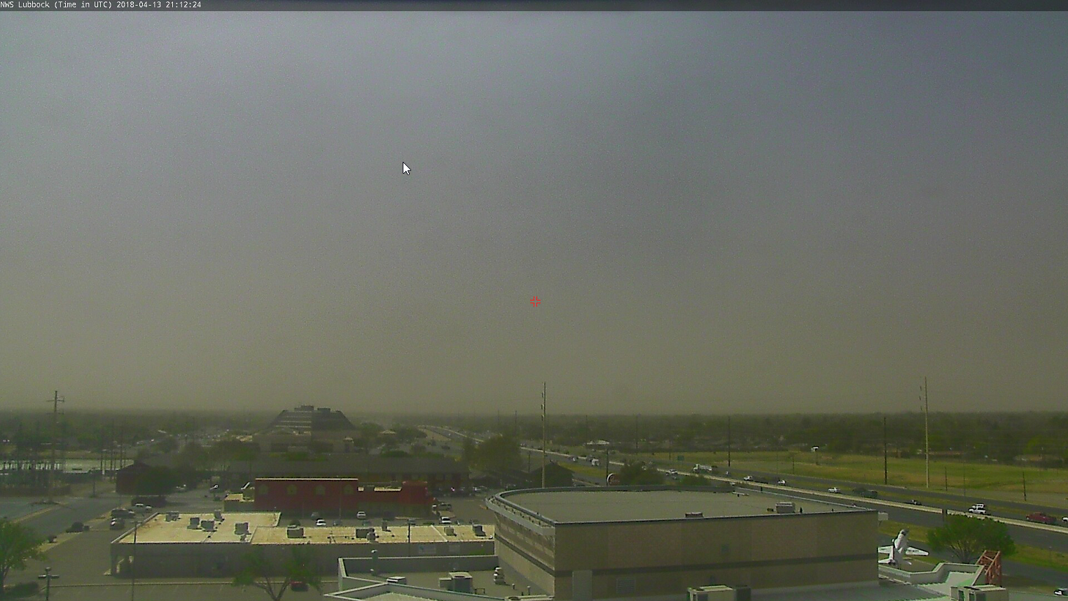 |
| Dusty sky in Lubbock late Friday afternoon, 13 April 2018. |
| One new fire ignited near Afton, in northern Dickens County, late Friday afternoon and quickly grew. This fire, seen spewing a small plume in the below radar imagery, burned through much of the evening before being controlled. The fire consumed around 3,100 acres of land before being suppressed. |
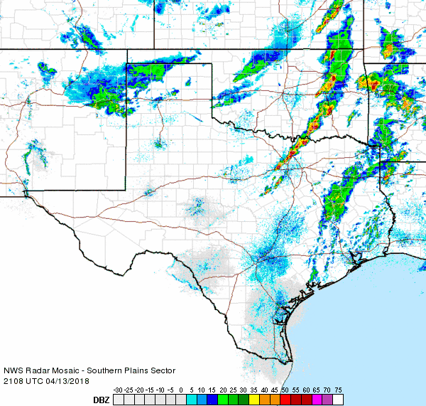 |
| Regional radar animation valid from 4:08 pm to 5:18 pm on 13 April 2018. |
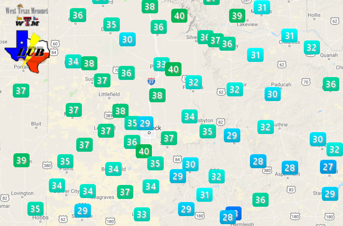
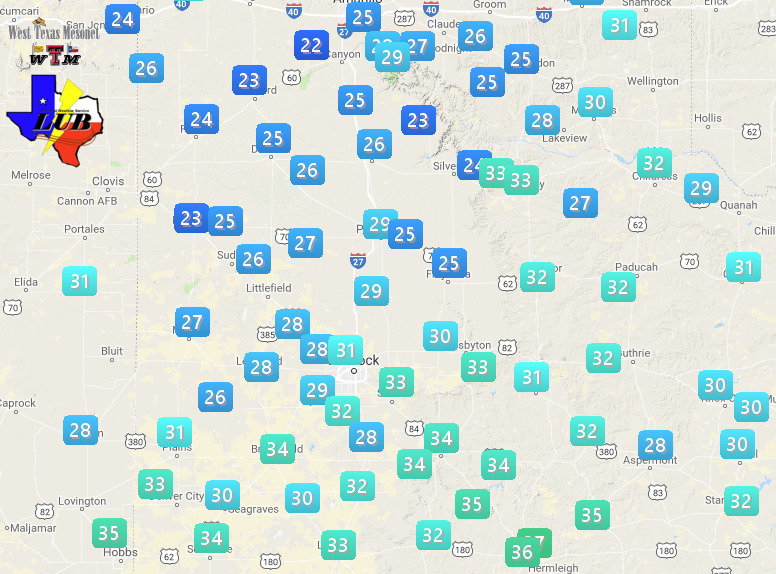
| Wind gusts of 50 to 60 mph were widespread on the 13th, with sustained speeds of 35 to 45 mph common. These westerly winds turned more northerly during the evening as another cold front moved through. Winds remained stout behind the front, before slowly weakening during the late evening hours. The wind shift did further complicate ongoing firefighting operations. |
 |
| Maximum wind gusts recorded by the West Texas Mesonet of 13 April 2018. The maximum sustained wind speeds for the 13th can be FOUND HERE. |
| In addition to the strong winds, lift and cooling from the emerging upper level storm system combined with just enough moisture behind the cold front to generate scattered showers and isolated thunderstorms late Friday afternoon and evening. This activity affected the southwest Texas Panhandle and northern South Plains before diminishing. Temperatures cooled into the 30s during the precipitation and several reports of a wintry mix of snow and sleet were received. |
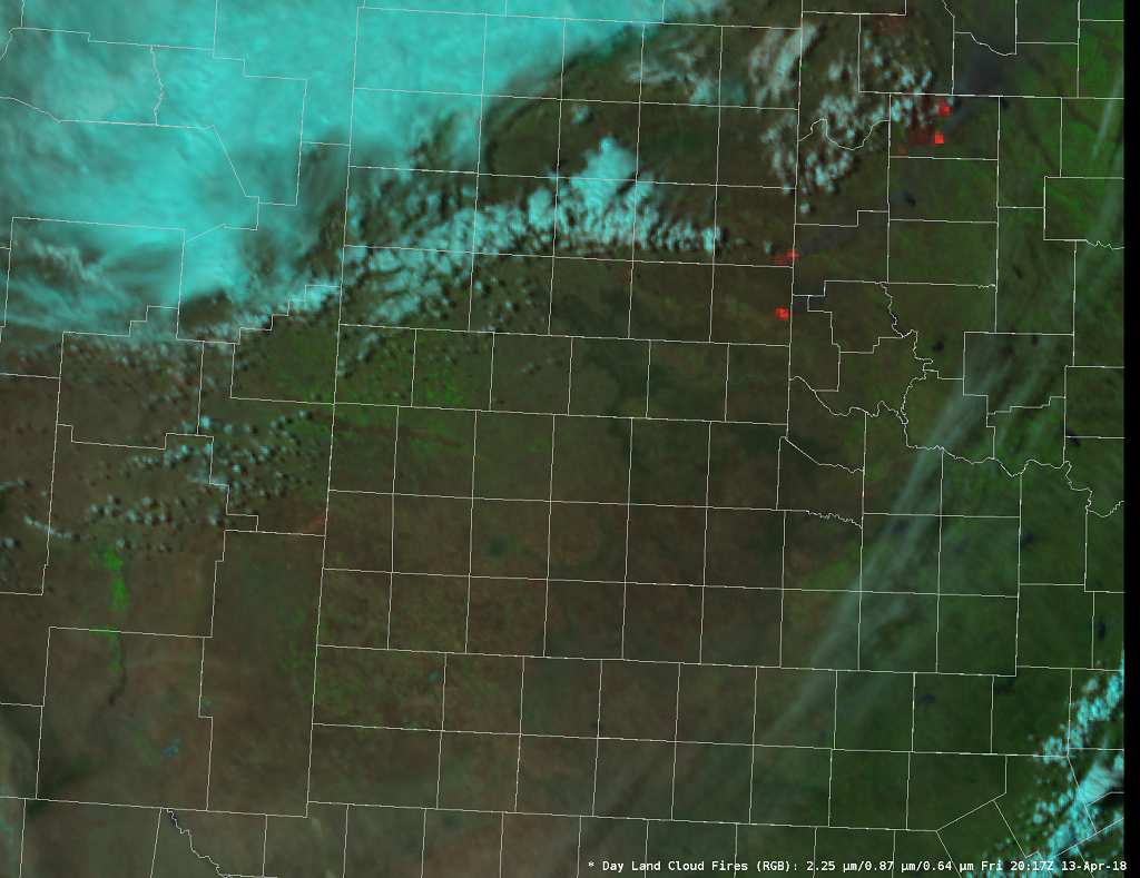 |
| RGB satellite combo image captured at 3:17 pm on 13 April 2018. The orange areas represent locations of detected fires. This image was taken before the fire developed in Dickens County. |
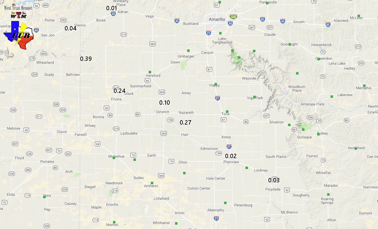
| As the below image shows, the precipitation fell in a fairly narrow swath. Totals in excess of a quarter inch were recorded in Friona (0.31") and at the Bootleg 11WNW West Texas Mesonet site (0.39"), with lighter totals found with southeast extent. As the showers were drying up they also enhanced the wind, producing a severe wind gust of 61 mph near Floydada, and a gust to 57 mph at Roaring Springs. |
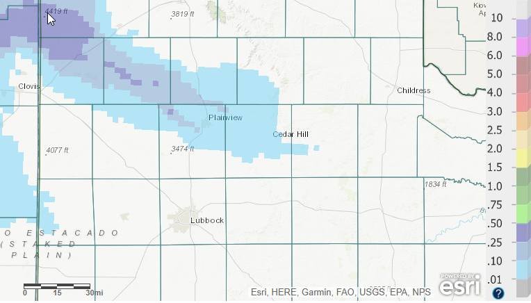 |
| Radar-estimated and bias-corrected 24 precipitation ending at 7 am on 14 April 2018. A plot of measured precipitation from the West Texas Mesonet can be FOUND HERE. |
| Even as the storm system was finally pulling away from the region toward the Midwest, it still managed to provide one final day of gusty and cool northwesterly winds Saturday (14 April). The winds on the 14th weren't quite as intense as the previous day, but gusts of 40 to 50 mph were widespread from Lubbock north and eastward. This made for a brisk day as temperatures only peaked in the upper 50s and lower 60s. |
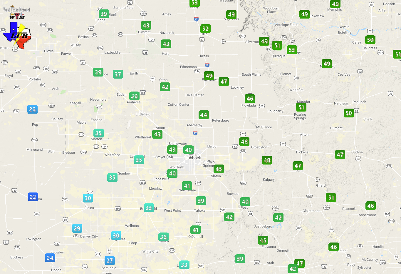 |
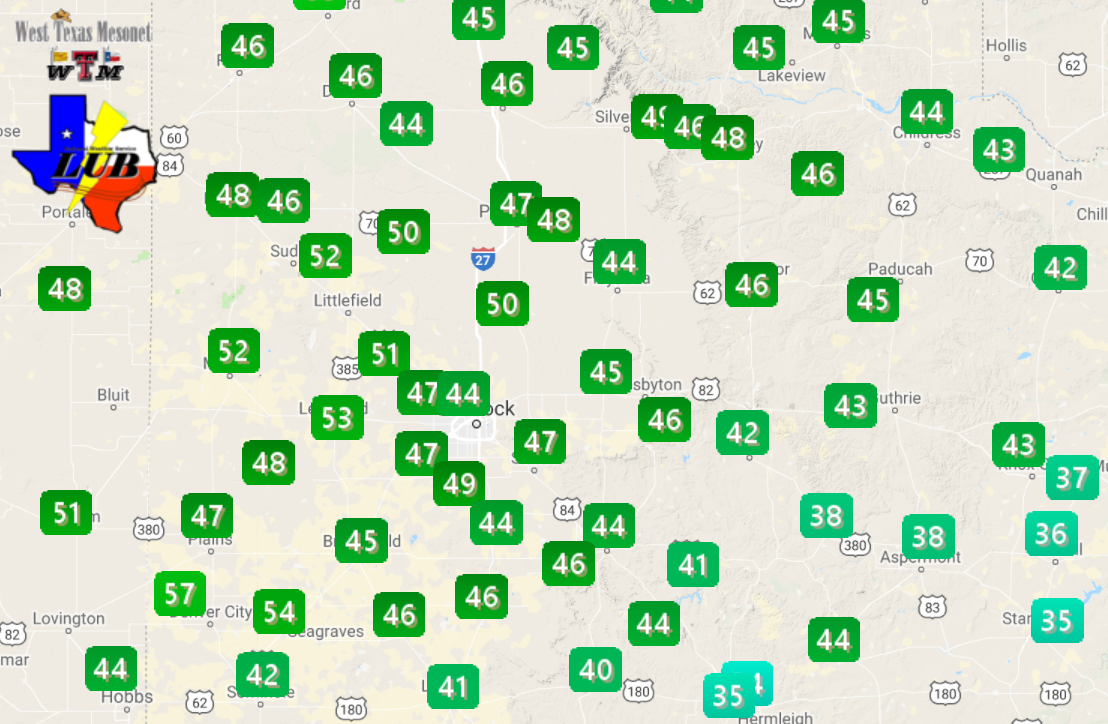
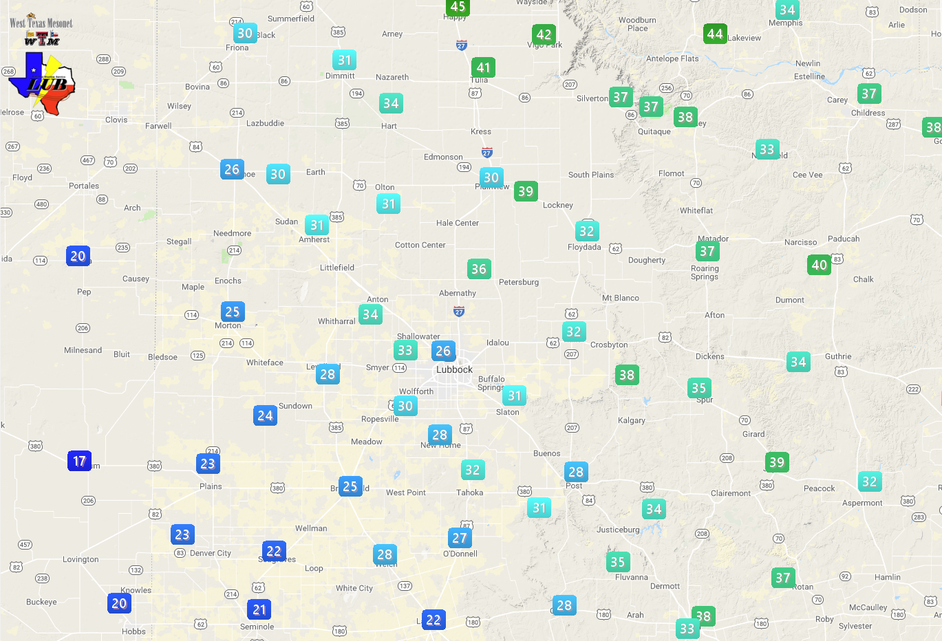
| Maximum wind gusts recorded by the West Texas Mesonet of 14 April 2018. The maximum sustained wind speeds for the 14th can be FOUND HERE. |
| Winds associated with this slow-moving storm system finally diminished for good Saturday evening. The light winds and clear skies did allow temperatures to tumble to and below the freezing mark for many spots in the South Plains region early Sunday morning (to view the lows Sunday morning CLICK HERE). A much-deserved light wind day followed Sunday, with afternoon highs in the upper 60s and lower 70s. |


 Follow us on YouTube