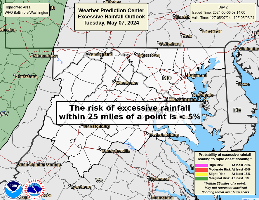
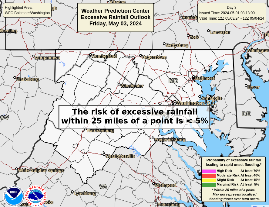
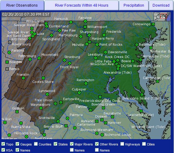
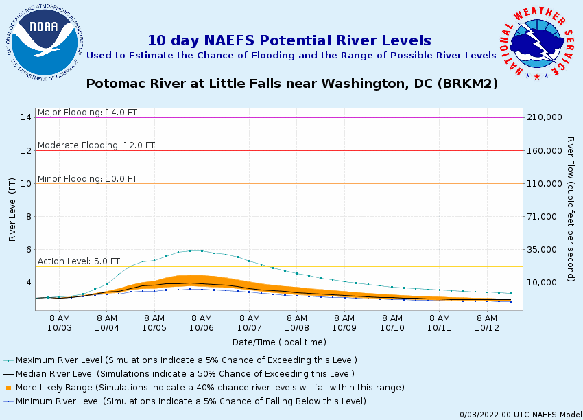
|
Mon/Fri Morning EM Weather Briefing
This briefing is only updated around 10:45am Monday & Friday. Consult the latest forecast for updates.
For latest Mon/Fri West Virginia state briefings
[courtesy NWS Charleston]
click here
|
Severe Weather Briefing Page
Hurricane-Tropical Briefing Page
Excessive Heat-Cold Briefing Page
Local Forecast Graphics
All links are the same, just click on any of the images to go directly to the page.
The weather elements along the left-hand column.
Just mouse over the image to get that forecast graphic.
|
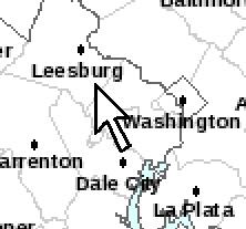
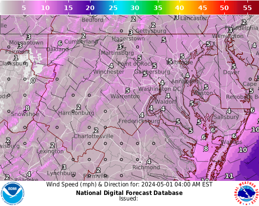
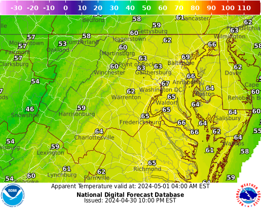
CURRENT HAZARDS - LOCAL FORECAST
"POINT" FORECAST
FOR A DETAILED 7-DAY POINT FORECAST: Click on a specific location on the map above.
|
WEATHER FORECAST TABLE
FOR A GRAPH OF WEATHER CONDITIONS FOR A POINT LOCATION: Click on "Hourly Weather Graph" under the "Additional Forecasts & Information" section at the bottom right of the screen, AFTER you have already clicked on a specific point on the map above.

|
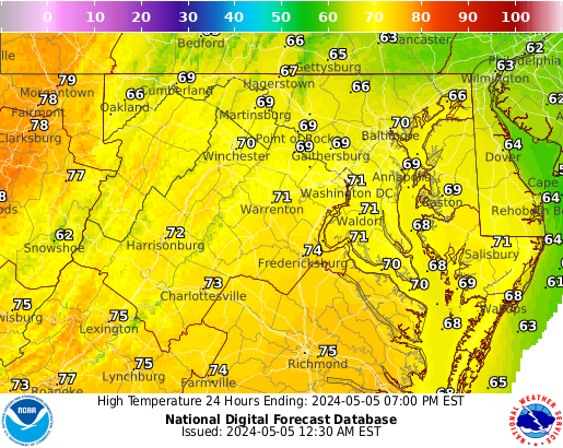
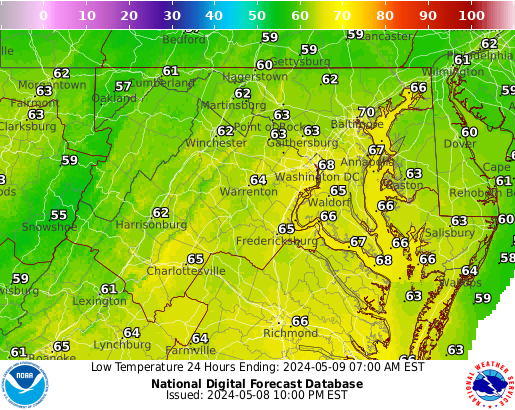
GRAPHICAL FORECAST
|
|
|
|


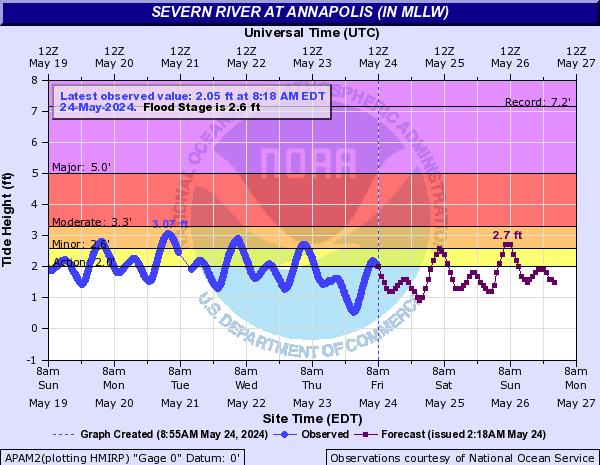
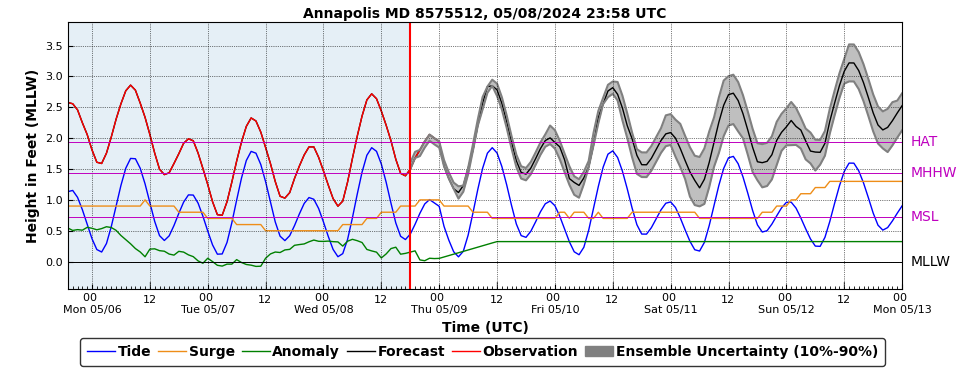


 Coastal Flood
 FAQ
FAQ Follow us on YouTube